Category:Topographic maps made in 18th century
Jump to navigation
Jump to search
Media in category "Topographic maps made in 18th century"
The following 6 files are in this category, out of 6 total.
-
 Abriss der Haupt-Schlacht, welche den 11ten Sept. 1709 von 7 Uhr... - CBT 6625874.jpg 5,910 × 4,749; 12.11 MB
-

-
 Grundriss der glorieusen Action welche in der Gegend Pultawa in d'Ucraine... - CBT 6625784.jpg 6,026 × 4,749; 13.29 MB
-
 Plan de Constantinople de son port canal et environ = Grundriss... - CBT 5883928.jpg 5,325 × 4,714; 10.69 MB
-
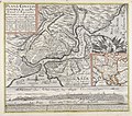
 Plan de la Ville du Chateau et der deux Palanques ou... - CBT 6626175.jpg 4,714 × 6,015; 13.11 MB
-
 Plan de la ville et de la citadelle de Lille, assiegée... - CBT 6625652.jpg 4,474 × 6,653; 17.03 MB


