Category:Topographic maps of Crater Lake National Park
Jump to navigation
Jump to search
United States national parks: Acadia · Arches · Badlands · Big Bend · Biscayne · Black Canyon of the Gunnison · Bryce Canyon · Canyonlands · Capitol Reef · Channel Islands · Congaree · Crater Lake · Death Valley · Denali · Dry Tortugas · Glacier · Glacier Bay · Grand Canyon · Grand Teton · Great Basin · Great Smoky Mountains · Guadalupe Mountains · Haleakalā · Hot Springs · Isle Royale · Joshua Tree · Kenai Fjords · Kings Canyon · Lake Clark · Lassen Volcanic · Mammoth Cave · Mesa Verde · Mount Rainier · North Cascades · Olympic · Petrified Forest · Pinnacles · Redwood · Rocky Mountain · Saguaro · Sequoia · Shenandoah · Virgin Islands · White Sands · Wrangell-St. Elias · Yellowstone · Yosemite · Zion
Media in category "Topographic maps of Crater Lake National Park"
The following 10 files are in this category, out of 10 total.
-
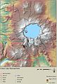
 Crater Lake National Park SW corner map.jpg 1,129 × 779; 318 KB
-
 Crater Lake National Park, OR 2006 (6539577583).jpg 451 × 600; 129 KB
-
 NPS crater-lake-depth-map.gif 606 × 544; 189 KB
-
 NPS crater-lake-east-topo-map.jpg 2,850 × 3,785; 2.71 MB
-
 NPS crater-lake-east-topo-map.pdf 3,052 × 4,054; 5.43 MB
-
 NPS crater-lake-elevation-map.jpg 955 × 1,408; 280 KB
-
 NPS crater-lake-hazards-map.jpg 2,565 × 3,814; 2.34 MB
-
 NPS crater-lake-illustrated-map.jpg 3,192 × 4,247; 1.75 MB
-
 NPS crater-lake-west-topo-map.jpg 2,853 × 3,788; 2.55 MB
-
 NPS crater-lake-west-topo-map.pdf 3,056 × 4,058; 4.68 MB

.jpg)


