Category:Topographic maps of Nestier
Jump to navigation
Jump to search
Media in category "Topographic maps of Nestier"
The following 3 files are in this category, out of 3 total.
-
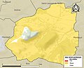 65327-Nestier-argile.jpg 3,057 × 2,480; 431 KB
-
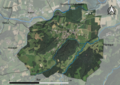 65327-Nestier-Orthophoto.png 7,015 × 4,960; 4.39 MB
-
 65327-Nestier-Relief-PlanIgn.png 7,015 × 4,960; 10.67 MB


