Category:Topographic maps of Région Bretagne
Jump to navigation
Jump to search
Administrative regions and territorial collectivity of Metropolitan France (‡ since start of 2016):
Auvergne-Rhône-Alpes‡ · Bourgogne-Franche-Comté‡ · Brittany · Centre-Val de Loire · Corsica · Grand Est‡ · Hauts-de-France‡ · Île-de-France · Normandy‡ · Nouvelle-Aquitaine‡ · Occitania‡ · Pays de la Loire · Provence-Alpes-Côte d'Azur
Former administrative regions of Metropolitan France (until end of 2015):
Alsace · Aquitaine · Auvergne · Burgundy · Champagne-Ardenne · Franche-Comté · Languedoc-Roussillon · Limousin · Lorraine · Midi-Pyrénées · Nord-Pas-de-Calais · Lower Normandy · Upper Normandy · Picardy · Rhône-Alpes
Overseas departments and regions: Guadeloupe · Martinique · French Guiana · Réunion · Mayotte
Overseas collectivities: Saint Barthélemy · Saint-Martin · Saint Pierre and Miquelon · French Polynesia · Wallis and Futuna
Sui generis territories: New Caledonia
Subcategories
This category has the following 3 subcategories, out of 3 total.
Media in category "Topographic maps of Région Bretagne"
The following 10 files are in this category, out of 10 total.
-
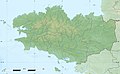 Bretagne region relief location map.jpg 1,615 × 1,001; 348 KB
-
 Bretagne topographic blank map.jpg 552 × 405; 89 KB
-
 Landunvez 29 Topo.png 577 × 623; 23 KB
-
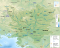
 Oust River Drainage Basin map-fr.svg 1,954 × 1,573; 817 KB
-
 Reliefkarte Bretagne 2018.png 4,120 × 2,239; 8.75 MB
-
 Reliefkarte Bretagne.png 3,239 × 1,633; 5.12 MB
-
 Saint-Pabu 29 Topo.png 713 × 643; 26 KB
-
 Vilaine River Drainage Basin map-br.svg 1,954 × 1,573; 805 KB
-
 Vilaine River Drainage Basin map-fr.svg 1,954 × 1,573; 799 KB
-
 Vilaine River Drainage Basin map-mk.svg 1,954 × 1,573; 1.1 MB


