Category:Topographischer Atlas der Schweiz
Jump to navigation
Jump to search
previous official map series of Switzerland | |||||
| Upload media | |||||
| Instance of |
| ||||
|---|---|---|---|---|---|
| Depicts | Switzerland | ||||
| Replaced by |
| ||||
| |||||
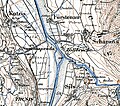
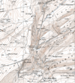
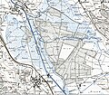
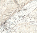
English: Topographic Atlas of Switzerland (Siegfried Map): first published between 1870 bis 1926, new editions until 1949. Scale: 1:25,000, except Alps (1:50,000).
Deutsch: Topographischer Atlas der Schweiz (Siegfriedkarte)
Français : Atlas topographique de la Suisse (carte Siegfried)
Media in category "Topographischer Atlas der Schweiz"
The following 68 files are in this category, out of 68 total.
-
Aare Saane Topographischer Atlas.jpg 2,334 × 2,262; 2.91 MB
-
Aegelsee Karte 1926.png 1,729 × 931; 3.03 MB
-
Albulamündung Topographischer Atlas der Schweiz.jpg 2,306 × 2,046; 2.45 MB
-
Armary Allaman - Genfersee 1895.jpg 849 × 725; 164 KB
-
Baden 1874.jpg 1,600 × 1,600; 830 KB
-
Bahnhof Herisau Karte.png 800 × 600; 1.08 MB
-
Bernese Alps, map 1900, 1.jpg 1,540 × 1,185; 2.37 MB
-
Bernese Alps, map 1900, 2.jpg 1,596 × 1,182; 2.41 MB
-
Berninapass 1877 Siegfriedkarte.jpg 1,591 × 1,119; 1.45 MB
-
Bifurcation Chrennen.jpg 959 × 480; 361 KB
-
Bremgarten Siegfriedkarte.jpg 1,500 × 1,125; 600 KB
-
Brugg Siegfriedkarte.jpg 1,500 × 1,125; 595 KB
-
Delta de l’Aubonne Chanivaz, vers 1920.jpg 1,976 × 1,828; 939 KB
-
Dorfbach Schliffitobel Horgen 1887.jpg 1,338 × 718; 282 KB
-
Egelmoos Taumoos Torfmoos Bösimoos Reuss TopogrAtlas.jpg 1,768 × 1,988; 1.79 MB
-
Flusslandschaft Villnachern-Brugg um 1900.jpg 3,110 × 2,248; 3.2 MB
-
Fribourg Siegfriedkarte 1874.jpg 1,500 × 1,125; 533 KB
-
Grimselpass Topographischer Atlas um 1910.jpg 1,852 × 2,168; 1.88 MB
-
Heilibach Seegarten Horgen 1887.jpg 1,328 × 688; 255 KB
-
JCF-Kraftwerk Wildegg 1896.jpg 1,251 × 603; 422 KB
-
Lac de Luchet 1933.png 1,813 × 1,031; 4.79 MB
-
Le Pichoux, Petit-Val, vers 1900.jpg 2,458 × 1,750; 1.91 MB
-
Les Convers NE 1950.png 2,034 × 2,238; 9.47 MB
-
Limmatspitz Siegfriedkarte.jpg 2,230 × 2,220; 1.86 MB
-
Mala-Armary Montherod - Aubonne 1895.jpg 1,734 × 663; 308 KB
-
Maules Les Gurles um 1910 Karte.png 2,162 × 1,800; 7.57 MB
-
Montreux Ancien Lac de Jaman.png 2,508 × 1,994; 11.85 MB
-
Morteratschgletscher, Siegfriedkarte 1875.jpg 1,596 × 1,197; 1.3 MB
-
Oberglatterallmend-Glattkanal.jpg 2,412 × 2,106; 2.95 MB
-
Paluegletscher 1877 Siegfriedkarte.jpg 1,449 × 1,206; 1.41 MB
-
Pardiala Siegfriedkarte.tiff 932 × 523; 1.52 MB
-
Piz Medel Siegfriedkarte.png 1,118 × 758; 520 KB
-
Prada Siegfriedkarte.jpeg 2,655 × 1,651; 1.85 MB
-
Rapperswil-Jona 1882.jpg 1,500 × 1,125; 408 KB
-
Reuss bei Eggenwil Topographischer Atlas.jpg 3,332 × 2,202; 3.19 MB
-
Roseg- und Tschiervagletscher, Siegfriedkarte 1877.jpg 1,602 × 1,202; 1.22 MB
-
Rueun Siegfriedkarte.tiff 922 × 570; 1.51 MB
-
Schindellegi Landeskarte 1922.jpg 992 × 763; 187 KB
-
Seegarten Horgen 1897.jpg 1,319 × 702; 271 KB
-
Seegarten Horgen 1907.jpg 1,322 × 706; 290 KB
-
Septimerpass Siegfriedkarte 1906.jpg 1,100 × 676; 141 KB
-
Siegfried 190.jpg 1,200 × 1,200; 839 KB
-
Siegfried aletsch.jpg 788 × 631; 400 KB
-
Siegfried eiger.jpg 375 × 294; 56 KB
-
Siegfried Matterhorn.jpg 863 × 657; 449 KB
-
Siegfriedkarte 1881-Berg.jpg 958 × 600; 183 KB
-
Siegfriedkarte 1881.jpg 1,338 × 905; 294 KB
-
Siegfriedkarte 529 Orsières 1878.png 605 × 433; 667 KB
-
Siegfriedkarte Biel 1876.jpg 1,203 × 1,077; 896 KB
-
Siegfriedkarte TA 541 1891 detail.jpg 400 × 400; 59 KB
-
Siegfriedkarte Äppelhausen.png 2,016 × 1,168; 4.72 MB
-
Sood Siegfriedkarte 1880.jpg 548 × 564; 119 KB
-
St. Moritz Siegfriedkarte.tiff 1,142 × 1,114; 3.15 MB
-
Sécheron-carte Siegfried 1898-1915.png 883 × 683; 1.24 MB
-
Sécheron-carte Siegfried 1898-1915.svg 883 × 683; 1.67 MB
-
Topographischer Atlas Döttingen-Felsenau.jpg 2,246 × 2,362; 2.73 MB
-
Unterer Thurlauf um 1860.png 2,964 × 1,106; 6.36 MB
-
Valbella Siegfriedkarte.tiff 495 × 539; 697 KB
-
Wauwilermoos um 1900.png 3,121 × 1,457; 7.53 MB
-
Weiach Siegfriedkarte.jpg 1,500 × 1,125; 556 KB
-
Winterthur Neuwiesen 1881 Siegfriedkarte.jpg 357 × 314; 69 KB
-
Wohlen Siegfriedatlas 1881.jpg 1,600 × 1,600; 768 KB
-
Zofingen 1884.jpg 1,000 × 1,067; 293 KB
-
Zuerich Siegfriedkarte 1881.jpg 1,500 × 1,125; 629 KB


