Category:Totland
Jump to navigation
Jump to search
village, civil parish and electoral ward at the western tip of the Isle of Wight, in England, UK  | |||||
| Upload media | |||||
| Instance of | |||||
|---|---|---|---|---|---|
| Location | Isle of Wight, South East England, England | ||||
 | |||||
Subcategories
This category has the following 14 subcategories, out of 14 total.
A
C
- Colwell Bay (15 F)
H
- The Highdown Inn, Totland (5 F)
K
- Kingdom Hall, Totland (3 F)
S
T
- Tennyson's monument (49 F)
W
- West High Down (38 F)
- Weston Manor Chapel, Totland (3 F)
Media in category "Totland"
The following 200 files are in this category, out of 459 total.
(previous page) (next page)-

-
 A stroll along the prom - geograph.org.uk - 3112156.jpg 4,510 × 2,934; 4.5 MB
-
 A3054, Colwell Common - geograph.org.uk - 5130631.jpg 640 × 480; 118 KB
-
 Access road to Tennyson Down - geograph.org.uk - 6259496.jpg 1,024 × 576; 439 KB
-
 Across the island - geograph.org.uk - 5201790.jpg 640 × 427; 89 KB
-
 Agrimony (Agrimonia eupatoria) - geograph.org.uk - 4079315.jpg 298 × 640; 248 KB
-
 Along High Down Cliffs - geograph.org.uk - 5201870.jpg 640 × 427; 85 KB
-
 Alum Bay - geograph.org.uk - 6244871.jpg 6,275 × 4,183; 7.14 MB
-
 Alum Bay - geograph.org.uk - 6244877.jpg 6,752 × 4,502; 5.34 MB
-
 Alum Bay - geograph.org.uk - 6244878.jpg 5,660 × 3,773; 3.39 MB
-
 Alum Bay - geograph.org.uk - 6244881.jpg 7,079 × 4,720; 5.98 MB
-
 Alum Bay - geograph.org.uk - 6259485.jpg 1,024 × 576; 315 KB
-
 Alum Bay and the white cliffs of West High Down - geograph.org.uk - 5382080.jpg 3,456 × 2,592; 3.52 MB
-
 Alum Bay cliffs - geograph.org.uk - 6259491.jpg 1,024 × 576; 374 KB
-
 Alum Bay New Road - geograph.org.uk - 5130640.jpg 640 × 480; 89 KB
-
 Alum Bay, Needles Park - geograph.org.uk - 3355838.jpg 1,024 × 768; 146 KB
-

-
 Arriving at The Needles Park - geograph.org.uk - 4192680.jpg 640 × 480; 58 KB
-
 Arts and Crafts House - geograph.org.uk - 17716.jpg 627 × 640; 133 KB
-
 Back up to the top^ - geograph.org.uk - 6228034.jpg 640 × 480; 63 KB
-
 Barton Clay - geograph.org.uk - 4086158.jpg 427 × 640; 377 KB
-
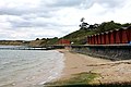
 Beach at Totland, Isle of Wight, England.jpg 2,226 × 1,642; 1.5 MB
-
 Beach Boulders - geograph.org.uk - 4086188.jpg 424 × 640; 429 KB
-
 Beach huts on Colwell Bay - geograph.org.uk - 1918950.jpg 1,500 × 1,000; 155 KB
-
 Beach huts on the coastal path at Colwell Chine - geograph.org.uk - 3071069.jpg 1,000 × 750; 536 KB
-
 Beach huts on The Promenade - geograph.org.uk - 3667848.jpg 640 × 480; 72 KB
-
 Becton Sand - geograph.org.uk - 4086170.jpg 640 × 427; 379 KB
-
 Beside the prom - geograph.org.uk - 3112221.jpg 4,592 × 3,056; 6.09 MB
-
 Betony (Stachys officinalis) - geograph.org.uk - 4078999.jpg 640 × 571; 549 KB
-
 Black Bryony (Tamus communis) - geograph.org.uk - 4086338.jpg 640 × 359; 285 KB
-

-
 Borough of South Wight.JPG 2,296 × 1,528; 1.95 MB
-
 Boscombe Sand - geograph.org.uk - 4086131.jpg 427 × 640; 389 KB
-
 Boscombe Sand - geograph.org.uk - 4086151.jpg 427 × 640; 417 KB
-
 Branksome Sand - geograph.org.uk - 4084871.jpg 427 × 640; 455 KB
-
 Brickwork logo on The Promenade - geograph.org.uk - 3667844.jpg 640 × 480; 74 KB
-
 Broadway Garage in Totland.JPG 3,072 × 2,304; 2.39 MB
-
 Broadway Inn in Totland.JPG 3,072 × 2,304; 2.25 MB
-
 Broadway Totland from A3055 - geograph.org.uk - 1869766.jpg 640 × 480; 72 KB
-
 Broadway, Totland - geograph.org.uk - 943856.jpg 640 × 468; 260 KB
-
 Burnet Moth (Zygaena sp) Chrysalis - geograph.org.uk - 4079359.jpg 640 × 351; 231 KB
-
 Bus Turning Circle, Needles Park - geograph.org.uk - 3565471.jpg 640 × 480; 294 KB
-
 Can you tell the direction of the prevailing wind^ - geograph.org.uk - 5381940.jpg 3,456 × 2,592; 4.39 MB
-
 Canoes on the path near the pier - geograph.org.uk - 3667828.jpg 640 × 480; 64 KB
-
 Canons in the Old Battery - geograph.org.uk - 5213904.jpg 640 × 427; 91 KB
-
 Cape Finisterre 649 miles - geograph.org.uk - 1926891.jpg 3,008 × 2,000; 1.6 MB
-
 Car boot sale on Colwell Common - geograph.org.uk - 6228162.jpg 640 × 480; 69 KB
-
 Car park at The Needles Park - geograph.org.uk - 4192673.jpg 640 × 480; 44 KB
-
 Car park near Tennyson Down - geograph.org.uk - 2141904.jpg 480 × 640; 283 KB
-
 Carline Thistle (Carlina vulgaris) - geograph.org.uk - 4078942.jpg 506 × 640; 523 KB
-
 Chair lift at Alum Bay - geograph.org.uk - 6400115.jpg 1,797 × 1,198; 480 KB
-
 Chair lift to beach, Alum Bay - geograph.org.uk - 5130657.jpg 640 × 480; 123 KB
-
 Chairlift at Alum Bay Chine - geograph.org.uk - 5618996.jpg 2,848 × 2,144; 1.5 MB
-
 Chairlift at Alum Bay Chine from the beach - geograph.org.uk - 5619624.jpg 2,848 × 2,144; 1.53 MB
-
 Chairlift pylon - geograph.org.uk - 5215380.jpg 427 × 640; 119 KB
-
 Chalk cliffs - geograph.org.uk - 5201785.jpg 640 × 427; 110 KB
-
 Chalk cliffs - geograph.org.uk - 5215476.jpg 427 × 640; 127 KB
-
 Chalk cliffs and the sea - geograph.org.uk - 5201896.jpg 427 × 640; 105 KB
-
 Chalky cliffs on High Down - geograph.org.uk - 5201887.jpg 427 × 640; 100 KB
-
 Chicken on the Beach - geograph.org.uk - 4079547.jpg 640 × 427; 390 KB
-
 Church Hall in Totland - geograph.org.uk - 264336.jpg 640 × 480; 66 KB
-

-
 Cleaning the slip at Colwell Bay - geograph.org.uk - 4355619.jpg 1,600 × 1,064; 312 KB
-
 Cliff face at Sun Corner - geograph.org.uk - 5382727.jpg 3,456 × 2,592; 3.72 MB
-
 Cliff Path towards The Needles - geograph.org.uk - 3565496.jpg 640 × 481; 267 KB
-
 Cliff top walk to the Needles, Isle of Wight - geograph.org.uk - 1727133.jpg 1,024 × 681; 271 KB
-
 Cliff top, West High Down - geograph.org.uk - 5130742.jpg 640 × 480; 146 KB
-
 Cliffs above Colwell Bay - geograph.org.uk - 4031581.jpg 1,024 × 680; 341 KB
-

-
 Cliffs at Tennyson Down from Shippard's Chine - geograph.org.uk - 1919006.jpg 1,500 × 990; 116 KB
-
 Cliffs next to the Old Battery - geograph.org.uk - 5211873.jpg 640 × 427; 77 KB
-
 Clifftop Flowers and Alum Bay, Isle of Wight - geograph.org.uk - 5778807.jpg 5,312 × 2,988; 6.24 MB
-
 Clifton House B-B Lodging - geograph.org.uk - 1009668.jpg 640 × 480; 87 KB
-
 Coastal path - geograph.org.uk - 5202256.jpg 640 × 427; 84 KB
-
 Coastal path at Highdown Cliffs - geograph.org.uk - 4626435.jpg 1,600 × 1,065; 507 KB
-
 Coastal path to Warden Point - geograph.org.uk - 2056363.jpg 1,500 × 991; 182 KB
-
 Coloured cliffs at Alum Bay - geograph.org.uk - 5215466.jpg 640 × 427; 110 KB
-
 Coloured Cliffs of Alum Bay - geograph.org.uk - 5556464.jpg 640 × 480; 74 KB
-
 Coloured Sands - geograph.org.uk - 2595137.jpg 2,880 × 1,920; 2.31 MB
-
 Colwell - geograph.org.uk - 3759164.jpg 640 × 480; 278 KB
-
 Colwell Chine Road, Freshwater - geograph.org.uk - 4626553.jpg 1,600 × 1,065; 486 KB
-
 Colwell Common - geograph.org.uk - 3759162.jpg 640 × 480; 273 KB
-
 Colwell Common - geograph.org.uk - 4281356.jpg 1,600 × 884; 263 KB
-
 Colwell Common - geograph.org.uk - 6259503.jpg 1,024 × 576; 439 KB
-
 Common Centaury (Centaurium erythraea) - geograph.org.uk - 4078959.jpg 346 × 640; 324 KB
-
 Common Toadflax (Linaria vulgaris) - geograph.org.uk - 4079322.jpg 229 × 640; 196 KB
-
 Cottage Garden - geograph.org.uk - 4079369.jpg 640 × 427; 464 KB
-
 Crumbling Cliffs - geograph.org.uk - 264362.jpg 640 × 480; 102 KB
-
 Damaged coastal defences in Totland Bay - geograph.org.uk - 5163923.jpg 3,648 × 2,048; 2.3 MB
-
 Derelict building on The Promenade - geograph.org.uk - 3667854.jpg 640 × 480; 61 KB
-
 Differential Erosion - geograph.org.uk - 4084815.jpg 427 × 640; 355 KB
-
 Dilapidated beach hut, Totland, Isle of Wight, England.jpg 3,850 × 2,734; 4.36 MB
-
 Donate a gate, Frederick Arthur Gwynn - geograph.org.uk - 4626457.jpg 1,600 × 1,065; 607 KB
-
 Donate a gate, Frederick Arthur Gwynn - geograph.org.uk - 4626463.jpg 1,600 × 1,065; 577 KB
-
 Donate a gate, Jonathan Kipling - geograph.org.uk - 4626497.jpg 1,600 × 1,065; 683 KB
-
 Donate a gate, Jonathan Kipling - geograph.org.uk - 4626500.jpg 1,600 × 1,065; 499 KB
-
 Dusk at Tennyson Down - geograph.org.uk - 6423551.jpg 1,799 × 1,199; 249 KB
-
 Edge of the cliffs - geograph.org.uk - 5201895.jpg 640 × 427; 92 KB
-
 Empty tables at The Needles Park - geograph.org.uk - 4193092.jpg 640 × 480; 58 KB
-
 End of the beach - geograph.org.uk - 5215470.jpg 427 × 640; 122 KB
-
 End of the beach - geograph.org.uk - 5215480.jpg 427 × 640; 126 KB
-
 End of the sands - geograph.org.uk - 5215412.jpg 640 × 427; 107 KB
-
 English Stonecrop (Sedum anglicum) - geograph.org.uk - 4079120.jpg 640 × 445; 412 KB
-
 Enjoying the beach - geograph.org.uk - 5215454.jpg 640 × 427; 112 KB
-

-
 Entrance to Stotts Farm Camping site, Totland - geograph.org.uk - 4283263.jpg 1,024 × 533; 118 KB
-
 Fallen Cliff - geograph.org.uk - 4079332.jpg 420 × 640; 402 KB
-
 Farm track - geograph.org.uk - 6259493.jpg 1,024 × 576; 345 KB
-
 Farmland at Middleton - geograph.org.uk - 1379398.jpg 640 × 426; 182 KB
-
 Farmland at Middleton - geograph.org.uk - 1379426.jpg 640 × 425; 181 KB
-
 Farmland near Nodewell Farm - geograph.org.uk - 943460.jpg 640 × 479; 303 KB
-
 Farmland on Headon Hill - geograph.org.uk - 6259494.jpg 1,024 × 576; 340 KB
-
 Farmland west of Middleton - geograph.org.uk - 1379407.jpg 640 × 427; 176 KB
-
 Fault in the Cliff - geograph.org.uk - 4079334.jpg 416 × 640; 398 KB
-
 Fence on High Down - geograph.org.uk - 4078994.jpg 640 × 427; 351 KB
-
 Fence on High Down - geograph.org.uk - 5201891.jpg 640 × 427; 92 KB
-
 Fishing at Dusk - geograph.org.uk - 3114594.jpg 4,241 × 2,693; 2.38 MB
-
 Footpath around Warden Point - geograph.org.uk - 3071085.jpg 1,000 × 750; 590 KB
-
 Footpath to the Needles Lighthouse - geograph.org.uk - 5257573.jpg 3,456 × 4,608; 3.44 MB
-
 Footpath to Totland - geograph.org.uk - 1918926.jpg 1,500 × 1,000; 161 KB
-
 Formerly the Broadway Inn, Totland - geograph.org.uk - 5133505.jpg 640 × 480; 106 KB
-
 Fossiliferous Limestone - geograph.org.uk - 4086195.jpg 640 × 427; 442 KB
-
 Fossiliferous Sandstone - geograph.org.uk - 4086201.jpg 640 × 427; 495 KB
-

-

-
 From the Old Battery towards Alum Bay - geograph.org.uk - 1378242.jpg 640 × 427; 125 KB
-
 Granville Court, The Broadway - geograph.org.uk - 3759159.jpg 640 × 480; 350 KB
-
 Groynes below Widdick Chine - geograph.org.uk - 3071100.jpg 1,000 × 750; 540 KB
-
 Groynes on the beach at Totland - geograph.org.uk - 5555281.jpg 1,500 × 1,119; 226 KB
-
 Gulls on The Needles - geograph.org.uk - 5382062.jpg 3,456 × 2,592; 3.8 MB
-
 Gunsite slipping seaward in coastal landslip - geograph.org.uk - 5163919.jpg 3,648 × 2,048; 2.98 MB
-
 Hatherwood Point - geograph.org.uk - 4086208.jpg 640 × 422; 391 KB
-
 Hatherwood Point - geograph.org.uk - 962726.jpg 7,198 × 4,742; 4.8 MB
-
 Headon Hill Formation - geograph.org.uk - 4086220.jpg 640 × 427; 407 KB
-
 Headon Hill near Alum Bay - geograph.org.uk - 4285197.jpg 1,600 × 1,200; 444 KB
-
 Headon Lea Burial Ground - geograph.org.uk - 4775886.jpg 640 × 480; 63 KB
-
 Heatherwood Point - geograph.org.uk - 6259488.jpg 1,024 × 576; 270 KB
-
 High Down - geograph.org.uk - 4078977.jpg 640 × 416; 337 KB
-
 High Down control room - geograph.org.uk - 5209786.jpg 640 × 427; 97 KB
-
 High Down footpath - geograph.org.uk - 4360742.jpg 1,600 × 1,064; 391 KB
-
 High Down Rocket Test Site - geograph.org.uk - 4547250.jpg 4,896 × 3,672; 6.21 MB
-
 High Down rocket testing site - geograph.org.uk - 6015759.jpg 4,000 × 3,000; 2.95 MB
-
 High Down Test Site - geograph.org.uk - 5204753.jpg 640 × 427; 82 KB
-
 Highdown Cliffs - geograph.org.uk - 4028252.jpg 1,024 × 680; 256 KB
-
 Highdown Cliffs - geograph.org.uk - 4078970.jpg 640 × 427; 421 KB
-
 Highdown Cliffs - geograph.org.uk - 4079098.jpg 411 × 640; 448 KB
-
 Highdown Cliffs, Isle of Wight - geograph.org.uk - 4281397.jpg 1,024 × 426; 80 KB
-
 Holiday flats on The Promenade - geograph.org.uk - 3667825.jpg 640 × 480; 53 KB
-
 House on York Lane, Freshwater - geograph.org.uk - 4626538.jpg 1,600 × 1,065; 506 KB
-
 Houses in Colwell Common Road - geograph.org.uk - 6228172.jpg 640 × 480; 59 KB
-
 Hurst Castle and Hatherwood Point - geograph.org.uk - 2715955.jpg 1,738 × 1,077; 1.96 MB
-
 Hurst Castle and Spit - geograph.org.uk - 4425730.jpg 1,920 × 1,080; 456 KB
-
 Hurst Point Road, Freshwater - geograph.org.uk - 6259501.jpg 1,024 × 576; 382 KB
-
 Hurst Point View - geograph.org.uk - 702727.jpg 640 × 480; 101 KB
-
 Incoming tide near Warden Point - geograph.org.uk - 6268750.jpg 3,952 × 2,964; 2.58 MB
-
 Isle of Wight from Mudeford Spit - geograph.org.uk - 2499034.jpg 2,272 × 1,704; 1.11 MB
-
 Isle of Wight public footpath T32.JPG 4,000 × 3,000; 4.83 MB
-
 Jetty and chairlift - geograph.org.uk - 5215419.jpg 640 × 427; 101 KB
-
 Landslip Damaging Path - geograph.org.uk - 4086261.jpg 640 × 427; 447 KB
-
 Landslip, Headon Warren, Isle of Wight - geograph.org.uk - 6166914.jpg 1,024 × 683; 584 KB
-
 Livestock Pens - geograph.org.uk - 4086327.jpg 640 × 427; 461 KB
-
 Locksley , Middleton Road - geograph.org.uk - 2887543.jpg 4,288 × 2,848; 6.91 MB
-
 Locksley , Priory House - geograph.org.uk - 2887545.jpg 4,066 × 2,462; 3.91 MB
-
 Loco, Totland Bay - geograph.org.uk - 5133484.jpg 640 × 428; 89 KB
-
 London Clay - geograph.org.uk - 4079514.jpg 427 × 640; 445 KB
-

-

-

-

-

-

-

-

-
 Looking towards West High Down - geograph.org.uk - 5381927.jpg 3,456 × 2,592; 3.92 MB
-
 Looking west on the Tennyson Trail - geograph.org.uk - 4703688.jpg 800 × 600; 105 KB
-
 Marsh Farm Formation - geograph.org.uk - 4084837.jpg 427 × 640; 426 KB
-
 Marsh Farm Formation - geograph.org.uk - 4084842.jpg 427 × 640; 422 KB
-
 Marsh Thistle (Cirsium palustre) - geograph.org.uk - 4086290.jpg 640 × 547; 444 KB
-
 Marsh Thistle (Cirsium palustre) - geograph.org.uk - 4086305.jpg 417 × 640; 396 KB
-
 Marsh Thistle (Cirsium palustre) - geograph.org.uk - 4086310.jpg 619 × 640; 482 KB
-
 Meadow Brown Butterfly (Maniola jurtina) - geograph.org.uk - 4079318.jpg 640 × 603; 386 KB
-
 Milestone on West High Down - geograph.org.uk - 5382015.jpg 3,456 × 2,592; 5.68 MB
-
 Model of Prospero - geograph.org.uk - 5209794.jpg 640 × 427; 93 KB
-
 Monument on Tennyson Down - geograph.org.uk - 6412880.jpg 1,800 × 1,200; 352 KB
-
 Nearing Radio Mast - geograph.org.uk - 1050602.jpg 640 × 425; 55 KB
-
 Needles Battery - geograph.org.uk - 5382059.jpg 3,456 × 2,592; 4.08 MB
-
 Needles Battery - geograph.org.uk - 5382072.jpg 3,456 × 2,592; 4.41 MB
-
 Needles Battery - geograph.org.uk - 5382079.jpg 3,456 × 2,592; 3.42 MB
-
 Needles Battery - geograph.org.uk - 5382729.jpg 3,456 × 2,592; 3.98 MB
-
 Needles Coastguard Cottages - geograph.org.uk - 6259489.jpg 1,024 × 576; 335 KB
-
 Needles Country Park - geograph.org.uk - 866731.jpg 640 × 492; 90 KB
-
 Needles Old Battery - geograph.org.uk - 5211874.jpg 640 × 427; 103 KB
-
 Needles Old Battery - geograph.org.uk - 5215358.jpg 640 × 427; 99 KB
-
 Needles Park Bus Turning Circle - geograph.org.uk - 3565720.jpg 640 × 480; 286 KB
-
 Needles Pleasure Park - geograph.org.uk - 3565476.jpg 640 × 481; 275 KB
-
 Needles View Pitch and Putt - geograph.org.uk - 2056366.jpg 1,500 × 972; 224 KB
-
 No access to SZ3284 - geograph.org.uk - 1377564.jpg 640 × 426; 183 KB
-
 Nodes Beacon replica - geograph.org.uk - 2606649.jpg 640 × 480; 86 KB
-
 Nodewell Farm - geograph.org.uk - 5130770.jpg 640 × 428; 140 KB
-


_-_geograph.org.uk_-_4079315.jpg)


_-_geograph.org.uk_-_4078999.jpg)
_-_geograph.org.uk_-_4086338.jpg)
_-_geograph.org.uk_-_6228032.jpg)


_Chrysalis_-_geograph.org.uk_-_4079359.jpg)


_-_geograph.org.uk_-_4078942.jpg)


_-_geograph.org.uk_-_4086242.jpg)


_-_geograph.org.uk_-_4078959.jpg)


_-_geograph.org.uk_-_4079120.jpg)


_-_geograph.org.uk_-_4086290.jpg)
_-_geograph.org.uk_-_4086305.jpg)
_-_geograph.org.uk_-_4086310.jpg)
_-_geograph.org.uk_-_4079318.jpg)


_-_geograph.org.uk_-_4079322.jpg)