Category:Town hall in Gardelegen
Jump to navigation
Jump to search
| Object location | | View all coordinates using: OpenStreetMap |
|---|
 | |||||
| Upload media | |||||
| Pronunciation audio | |||||
|---|---|---|---|---|---|
| Instance of | |||||
| Location | Gardelegen, Altmarkkreis Salzwedel, Saxony-Anhalt, Germany | ||||
| Heritage designation | |||||
 | |||||
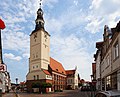
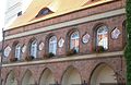
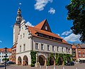
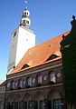
This is the category of the Saxony-Anhalt Kulturdenkmal (cultural heritage monument) with the ID 09485805 (Wikidata)
|
Media in category "Town hall in Gardelegen"
The following 21 files are in this category, out of 21 total.
-
 22 Гарделеген.jpg 3,366 × 2,717; 5.48 MB
-

-
 Rathaus Gardelegen Wappen Detail.jpg 2,008 × 1,299; 359 KB
-
 Rathaus Gardelegen.jpg 2,048 × 1,536; 1.61 MB
-
 Gardelegen Rathaus 040.jpg 3,245 × 4,868; 9.81 MB
-
 Gardelegen Rathaus 10.jpg 4,025 × 3,091; 8.3 MB
-
 Gardelegen Rathaus 11.jpg 4,492 × 3,626; 9.76 MB
-
 Gardelegen Rathaus 12.jpg 4,804 × 3,503; 8.76 MB
-
 Gardelegen Rathaus 13.jpg 4,609 × 3,319; 7.88 MB
-
 Gardelegen Rathaus 15.jpg 2,847 × 4,202; 6.86 MB
-
 Gardelegen Rathaus 17.jpg 5,472 × 3,648; 10.35 MB
-
 Gardelegen Rathaus Hoehenfestpunkt.jpg 4,000 × 3,000; 2.66 MB
-
 Gardelegen Rathaus Seitenansicht mit Wappen.jpg 1,396 × 2,000; 249 KB
-
 L1040750 Rathaus Gardelegen.JPG 3,000 × 4,000; 4.76 MB
-
 L1040751 Rathaus Gardelegen.JPG 3,000 × 4,000; 5.07 MB
-
 L1040752 Rathaus Gardelegen.JPG 3,000 × 4,000; 4.92 MB
-
 L1040753 Roland Gardelegen.JPG 3,000 × 4,000; 4.98 MB
-
 Rathaus Roland Gardelegen.jpg 6,016 × 4,000; 1.51 MB
-
 Rathaus von Gardelegen auf dem dreieckigen Marktplatz.jpg 3,648 × 2,736; 1.87 MB
-
 Roland Rathaus Gardelegen.jpg 6,016 × 4,000; 1.69 MB
-
 Roland Rathaus Seite Gardelegen.jpg 6,016 × 4,000; 1.92 MB


