Category:Town hall of Gurcy-le-Châtel
Jump to navigation
Jump to search
| Object location | | View all coordinates using: OpenStreetMap |
|---|
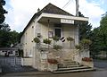
town hall located in Seine-et-Marne department, France  | |||||
| Upload media | |||||
| Instance of |
| ||||
|---|---|---|---|---|---|
| Location | Gurcy-le-Châtel, Seine-et-Marne, Île-de-France, Metropolitan France, France | ||||
| Street address |
| ||||
| Has use | |||||
| Owned by | |||||
| Operator | |||||
 | |||||
Media in category "Town hall of Gurcy-le-Châtel"
This category contains only the following file.
-
 Gurcy-le-Châtel mairie.jpg 2,495 × 1,793; 1.24 MB