Category:Town hall of Montégut-Savès
Jump to navigation
Jump to search
| Object location | | View all coordinates using: OpenStreetMap |
|---|
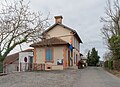
town hall located in Gers department, France .jpg) | |||||
| Upload media | |||||
| Instance of |
| ||||
|---|---|---|---|---|---|
| Location | Montégut-Savès, canton of Lombez | ||||
| Street address |
| ||||
| Has use | |||||
| Owned by | |||||
| Operator | |||||
 | |||||
Media in category "Town hall of Montégut-Savès"
The following 3 files are in this category, out of 3 total.
-
 Town hall of Montegut-Saves (1).jpg 5,394 × 3,923; 15.52 MB
-
 Town hall of Montegut-Saves (2).jpg 3,785 × 5,224; 10.46 MB
-
 Town hall of Montegut-Saves (3).jpg 4,730 × 3,838; 9.94 MB
.jpg)
.jpg)