Category:Traffic calming
Jump to navigation
Jump to search
methods to slow or reduce some types or all vehicle traffic  | |||||
| Upload media | |||||
| Instance of | |||||
|---|---|---|---|---|---|
| Subclass of | |||||
| |||||
Deutsch: Verkehrsberuhigung
Français : Ralentisseurs
Subcategories
This category has the following 30 subcategories, out of 30 total.
A
B
C
- Curb extensions (48 F)
D
- Directional closures (2 F)
- Diverters (5 F)
G
- Gateway treatments (11 F)
L
M
P
R
- Reduced radius (1 F)
S
- Silent cops (8 F)
V
Media in category "Traffic calming"
The following 67 files are in this category, out of 67 total.
-

-
 20020615 17 Traffic Calming Zone, Toronto, ON (8413203182).jpg 1,799 × 1,201; 347 KB
-
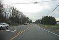
 2006 11 21 - 115@Lisa - EB 01.JPG 2,589 × 1,529; 835 KB
-
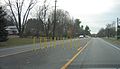
 2006 11 21 - 115@Lisa - EB 02.JPG 2,589 × 1,769; 918 KB
-
 2006 11 21 - 115@Lisa - EB 03.JPG 2,585 × 1,489; 788 KB
-
 2006 11 21 - 115@Lisa - EB 04.JPG 2,592 × 1,944; 1.83 MB
-
 2006 11 21 - 115@Lisa - WB 01.JPG 2,589 × 1,561; 818 KB
-
 2006 11 21 - 115@Lisa - WB 02.JPG 2,589 × 1,541; 894 KB
-
 2007 04 26 - 115@Lisa - EB 01.JPG 2,589 × 1,657; 815 KB
-
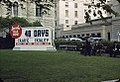 40 days Lincoln, Nebraska.jpg 963 × 660; 141 KB
-
 Azyl-dla-pieszych-01.jpg 1,632 × 1,224; 230 KB
-
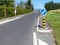
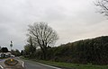
 B4461 heading east. (geograph 3457587).jpg 640 × 480; 69 KB
-
 B4461 heading east. (geograph 3457699).jpg 640 × 480; 95 KB
-
 Barrmill - traffic calming.JPG 1,958 × 1,506; 1.44 MB
-
 Cara Panneau suisse 2.35.jpg 4,000 × 3,000; 4.88 MB
-
 Cerdanyola del Vallès, Julio 2020 14 11 05 998000.jpeg 3,024 × 4,032; 4.82 MB
-
 Chantry Road - Waterton Road - geograph.org.uk - 1400043.jpg 640 × 548; 227 KB
-
 Drosselweg.JPG 2,848 × 2,136; 1.45 MB
-
 Hale Village sign on Town Lane.jpg 5,008 × 3,288; 9.66 MB
-
 Home zone in Wonford.jpg 800 × 600; 423 KB
-
 IMAG4107-berkeley-etna-and-dwight.jpg 2,595 × 1,520; 1.72 MB
-
 Island on the B4461, Elberton (geograph 6414893).jpg 1,872 × 1,204; 943 KB
-
 Lossy balises J11 ralentisseur en écluse.jpg 4,000 × 3,000; 4.81 MB
-
 Map of a Berlin superblock 1.png 1,040 × 720; 526 KB
-
 Modalfilter eines Superblocks in Favoriten (Wien 2023).jpg 3,730 × 2,262; 1.06 MB
-
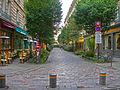 ParisPedestrianStreetCul-de-sac.jpg 3,072 × 2,304; 1.23 MB
-
 Postbox, Rustwick - geograph.org.uk - 1608035.jpg 640 × 430; 150 KB
-
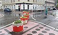
 Praha 10 ulice Ruska 08 cykloboxy.JPG 3,776 × 2,520; 5.08 MB
-
 Praha 10 ulice Ruska 09 prechod s ostruvkem.JPG 3,536 × 2,148; 4.09 MB
-
 Praha 10 ulice Ruska 10 prechod s ostruvkem.JPG 3,968 × 2,232; 4.59 MB
-
 Praha 10 ulice Ruska 11 prechod s ostruvkem.JPG 3,968 × 2,232; 4.72 MB
-
 Praha 10 ulice Ruska 12 prechod s ostruvkem.JPG 3,836 × 2,140; 4.2 MB
-
 Praha 10 ulice Ruska 13 prechod s ostruvkem.JPG 3,968 × 2,232; 4.82 MB
-
 Praha 10 ulice Ruska x Estonska 09 krtčí uši.JPG 3,776 × 2,520; 4.98 MB
-
 Praha 10 ulice Ruska x Finska 02 krtčí uši.JPG 3,776 × 2,520; 5.25 MB
-
 Praha 10 ulice Ruska x Finska 03 krtčí uši.JPG 3,776 × 2,520; 4.78 MB
-
 Praha 10 ulice Ruska x Finska 04 krtčí uši.JPG 3,776 × 2,520; 3.9 MB
-
 Praha 10 ulice Ruska x Moskevska 01.JPG 3,776 × 2,520; 5.14 MB
-
 Raised Pedestrian Crossing Lviv Ukraine 1.jpg 4,160 × 3,120; 5.07 MB
-
 Redhill Road towards Thornbury (geograph 2724013).jpg 800 × 600; 221 KB
-
 Schemaskizze Aufpflasterung.jpg 1,907 × 1,589; 356 KB
-
 Seaview Duver Road traffic calming measures.JPG 4,000 × 3,000; 4.48 MB
-
 Seaview Duver Road traffic calming.JPG 3,712 × 2,088; 3.26 MB
-
 Sett traffic calming.jpg 7,296 × 5,472; 11.44 MB
-
 Slow Down Please - geograph.org.uk - 2670775.jpg 640 × 520; 209 KB
-
 Speed Limit 20 - Lyndale Avenue South (24578844830).jpg 5,458 × 3,512; 9.44 MB
-

-
 Supergrätzl-Schulzone, Favoriten (Wien) 2023.jpg 3,917 × 2,268; 2.58 MB
-
 Traffic Calming (26221764570).jpg 4,630 × 3,087; 13.9 MB
-
 Traffic Calming (26468688276).jpg 4,501 × 3,001; 10.98 MB
-
 Traffic calming - geograph.org.uk - 1004361.jpg 640 × 480; 114 KB
-
 Traffic calming chicane Jersey.jpg 4,000 × 3,000; 4.34 MB
-
 Traffic Calming June 2011.jpg 1,045 × 789; 324 KB
-
 Traffic calming measures Eastgate - geograph.org.uk - 841306.jpg 640 × 480; 143 KB
-
 Traffic calming measures on the B4411 at Rhoslan - geograph.org.uk - 1763582.jpg 1,024 × 687; 190 KB
-
 Traffic calming, Hall's Hole Rd - geograph.org.uk - 4199028.jpg 640 × 430; 83 KB
-

-
 Traffic Calming, Stanbury - geograph.org.uk - 2531750.jpg 640 × 480; 172 KB
-
 Traffic island in the B4461, Elberton (geograph 2742376).jpg 640 × 578; 92 KB
-

-
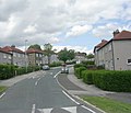
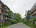
 Traffic-calmed neighbourhood.jpg 1,000 × 800; 217 KB
-
 Traffic-calming in Divinity Road - geograph.org.uk - 1219512.jpg 640 × 480; 68 KB
-
 Tylney Road, Oldhall - geograph.org.uk - 1188980.jpg 640 × 480; 119 KB
-
 Vauban housing courts.jpg 2,262 × 1,779; 809 KB
-
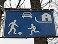
 Vehicle activated sign (VAS) speed limit enforcement.jpg 485 × 608; 252 KB
-
 Õueala liiklusmärk.jpg 3,264 × 2,448; 1.13 MB
-
 Львів, вул. Садова, підняте перехрестя, 2017 р.jpg 2,000 × 1,500; 1.5 MB
.jpg)
.jpg)


.jpg)
.jpg)


.jpg)


.jpg)


.jpg)


.jpg)

_2023.jpg)
.jpg)
.jpg)


.jpg)


_speed_limit_enforcement.jpg)

