Category:Tramsingel, Breda
Jump to navigation
Jump to search
| Object location | | View all coordinates using: OpenStreetMap |
|---|
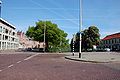
Nederlands: Afbeeldingen van de Tramsingel, een lange straat langs de singel in de wijk Schorsmolen in Breda in de provincie Noord-Brabant in het zuiden van Nederland. Gelegen nabij het centrum van Breda. De Tramsingel is een verlengde van de straat de Academiesingel na de Koning Willem Alexanderbrug Breda en gaat ook nog verder na de kruising met de Lunetstraat (bron ([1];[2])
street in Breda, the Netherlands | |||||
| Upload media | |||||
| Instance of | |||||
|---|---|---|---|---|---|
| Named after | |||||
| Location | Breda, North Brabant, Netherlands | ||||
| Street address |
| ||||
 | |||||
Subcategories
This category has the following 2 subcategories, out of 2 total.
B
- Brandweer Kazerne Breda (26 F)
L
Media in category "Tramsingel, Breda"
The following 32 files are in this category, out of 32 total.
-
 2010-05-22-breda-by-RalfR-06.jpg 3,008 × 2,000; 2.63 MB
-
 Michielsen Snooker- en biljartcentrum DSCF4154copy.jpg 4,000 × 3,000; 1.81 MB
-
 Nijverheidssingel, Breda P1530978.jpg 4,000 × 2,672; 5.46 MB
-
 P1000953copyMark.jpg 3,264 × 2,448; 2.74 MB
-
 P1030153De Lunet.JPG 3,264 × 2,448; 3.2 MB
-
 P1030156Tramsingel.JPG 3,264 × 2,448; 3.7 MB
-
 Schorsmolenstraat, Breda DSCF4148.jpg 4,000 × 3,000; 4.49 MB
-
 Tramsingel Breda P1130367.jpg 4,000 × 2,672; 6.23 MB
-
 Tramsingel Breda P1460338.jpg 4,000 × 2,672; 6.26 MB
-
 Tramsingel P1070517.jpg 4,000 × 2,672; 5.77 MB
-
 Tramsingel P1130366.jpg 4,000 × 2,672; 6 MB
-
 Tramsingel, Breda DSCF4152copy.jpg 4,000 × 3,000; 3.14 MB
-
 Tramsingel, Breda DSCF4153.jpg 4,000 × 3,000; 4.86 MB
-
 Tramsingel, Breda DSCF4189copy.jpg 4,000 × 3,000; 2.74 MB
-
 Tramsingel, Breda DSCF4719.jpg 4,000 × 3,000; 4.54 MB
-
 Tramsingel, Breda DSCF4724.jpg 4,000 × 3,000; 4.62 MB
-
 Tramsingel, Breda P1070512.jpg 4,000 × 2,672; 5.77 MB
-
 Tramsingel, Breda P1480986.jpg 4,000 × 2,672; 6.2 MB
-
 Tramsingel, Breda P1480988.jpg 4,000 × 2,672; 5.92 MB
-
 Tramsingel, Breda P1530966 copy.jpg 2,846 × 1,902; 1.69 MB
-
 Tramsingel, Breda P1530966.jpg 4,000 × 2,672; 5.51 MB
-
 Tramsingel, Breda P1530967 copy.jpg 4,000 × 2,672; 4.36 MB
-
 Tramsingel, Breda P1530968 copy.jpg 3,208 × 2,143; 2.17 MB
-
 Tramsingel, Breda P1530969 copy1.jpg 4,000 × 2,672; 3.53 MB
-
 Tramsingel, Breda P1530972 copy.jpg 4,000 × 2,672; 4.1 MB
-
 Tramsingel, Breda P1530973 copy.jpg 2,716 × 1,815; 1.71 MB
-
 Tramsingel, Breda P1530975.jpg 4,000 × 2,672; 5.18 MB
-
 Tramsingel, Breda P1530977.jpg 4,000 × 2,672; 5.52 MB
-
 Tramsingel, Breda P1530981.jpg 4,000 × 2,672; 5.24 MB
-
 Tramsingel, Breda P1530988.jpg 4,000 × 2,672; 4.97 MB
-
 Tramsingel, Breda P1530990.jpg 4,000 × 2,672; 5.52 MB
-
 Voetpad P1530985.jpg 4,000 × 2,672; 5.58 MB


