Category:Transport in Truro
Jump to navigation
Jump to search
Subcategories
This category has the following 12 subcategories, out of 12 total.
B
C
- Coosebean Greenway (3 F)
G
H
- Truro harbour (21 F)
M
N
- Newham Branch Line (Truro) (3 F)
P
- Park and Ride in Truro (17 F)
S
- Sparnick Tunnel (3 F)
T
V
Media in category "Transport in Truro"
The following 76 files are in this category, out of 76 total.
-
 3440 City of Truro outside Truro Cathedral 25-27 May 1992.jpg 984 × 1,455; 232 KB
-
 A sad and sorry paddler - geograph.org.uk - 965786.jpg 640 × 360; 162 KB
-
 A sorry paddler - geograph.org.uk - 630942.jpg 640 × 428; 77 KB
-

-
 A39 Arch Hill - geograph.org.uk - 4688636.jpg 424 × 640; 59 KB
-
 A39 Arch Hill Truro - geograph.org.uk - 765815.jpg 640 × 480; 80 KB
-

-
 A39 road entering Truro - geograph.org.uk - 3611634.jpg 1,024 × 768; 139 KB
-
 A39 south of Tolgarrick roundabout - geograph.org.uk - 4039233.jpg 640 × 446; 101 KB
-
 A390 Truro by-pass - geograph.org.uk - 3321164.jpg 1,024 × 512; 359 KB
-

-
 Arch Hill Roundabout - geograph.org.uk - 2010156.jpg 800 × 600; 244 KB
-
 Coach near Truro Station - geograph.org.uk - 5149063.jpg 640 × 426; 46 KB
-
 Cornwall , The A39 - geograph.org.uk - 4611912.jpg 4,223 × 2,805; 7.14 MB
-
 Cornwall Farmers premises, Truro - geograph.org.uk - 4703737.jpg 800 × 758; 168 KB
-
 Dalvenie roundabout on the A390, Truro, Cornwall - April 2024.jpg 3,969 × 2,609; 1.71 MB
-
 Dennis van Royal Mail replica (4584684319).jpg 918 × 1,398; 234 KB
-
 Disused railway overbridge over A39 - geograph.org.uk - 4037714.jpg 640 × 441; 87 KB
-
 Footbridge at Truro railway station - geograph.org.uk - 4040609.jpg 521 × 640; 61 KB
-
 Footbridge over the railway at Truro - geograph.org.uk - 5748672.jpg 1,024 × 768; 203 KB
-

-
 Green Lane (A390) Approaching Arch Hill - geograph.org.uk - 2010153.jpg 800 × 600; 274 KB
-
 High and Dry (25984694700).jpg 4,000 × 2,400; 8.27 MB
-
 Level crossing at Truro Station - geograph.org.uk - 5894827.jpg 1,024 × 681; 122 KB
-
 Level crossing by Truro Station - geograph.org.uk - 6021666.jpg 1,024 × 681; 143 KB
-
 Penwithers - FGW 150265 heading for Truro.jpg 1,024 × 768; 616 KB
-
 Penwithers 153361.jpg 1,024 × 768; 531 KB
-
 Penwithers 43092.jpg 1,024 × 768; 499 KB
-
 Penwithers Junction - FGW 150265 going to Falmouth.jpg 1,024 × 1,024; 914 KB
-
 Railway Bridge - geograph.org.uk - 229131.jpg 640 × 427; 115 KB
-
 Roundabout by Sainsbury's store - geograph.org.uk - 4040611.jpg 640 × 480; 140 KB
-
 Roundabout on the A39 in Truro - geograph.org.uk - 2871188.jpg 640 × 480; 80 KB
-
 The A39 - geograph.org.uk - 4197642.jpg 4,000 × 2,664; 4.94 MB
-
 The A39 - geograph.org.uk - 4197646.jpg 4,000 × 2,664; 4.85 MB
-
 The A39 - geograph.org.uk - 4197660.jpg 4,000 × 2,664; 3.79 MB
-
 The A39 - geograph.org.uk - 4197666.jpg 4,000 × 2,664; 4.31 MB
-
 The A39 - geograph.org.uk - 4197670.jpg 4,000 × 2,664; 4.08 MB
-
 The A390 - geograph.org.uk - 4197651.jpg 4,000 × 2,664; 4.7 MB
-
 The Falmouth Branch Line - geograph.org.uk - 161361.jpg 640 × 427; 159 KB
-
 The Falmouth Branch Line - geograph.org.uk - 229184.jpg 640 × 427; 129 KB
-
 Tregolis Road (the A39) - geograph.org.uk - 3386540.jpg 1,024 × 767; 101 KB
-
 Tregolls Road (A39) - geograph.org.uk - 2009695.jpg 800 × 600; 273 KB
-
 Tregolls Road, Truro - geograph.org.uk - 4055297.jpg 3,872 × 2,592; 4.73 MB
-
 Tregolls Road, Truro, Cornwall - August 2023.jpg 3,923 × 2,496; 1.99 MB
-
 Tregurra Lane, Truro - geograph.org.uk - 2536444.jpg 640 × 480; 90 KB
-
 Treliske roundabout ahead - geograph.org.uk - 4039796.jpg 640 × 490; 68 KB
-
 Treliske roundabout on the A390, Truro, Cornwall - April 2024.jpg 4,032 × 2,306; 1.9 MB
-
 Tresawles Road near the school - geograph.org.uk - 4039786.jpg 640 × 420; 57 KB
-
 Trevithick Road junction with A390 - geograph.org.uk - 4037698.jpg 640 × 384; 60 KB
-
 Truro , Arch Hill A39 - geograph.org.uk - 4611914.jpg 4,288 × 2,848; 6.94 MB
-
 Truro , Arch Hill A39 - geograph.org.uk - 4611916.jpg 4,089 × 2,716; 5.58 MB
-
 Truro , Newquay Road A39 - geograph.org.uk - 4612116.jpg 4,288 × 2,848; 5.44 MB
-
 Truro , The A39 - geograph.org.uk - 4612100.jpg 4,288 × 2,848; 5.39 MB
-
 Truro , The A39 - geograph.org.uk - 4612101.jpg 4,288 × 2,848; 7.51 MB
-
 Truro , The A39 - geograph.org.uk - 4612107.jpg 4,288 × 2,848; 4.99 MB
-
 Truro , The A39 Newquay Road - geograph.org.uk - 2817562.jpg 4,288 × 2,848; 5.14 MB
-
 Truro , The A39 Newquay Road roadside - geograph.org.uk - 2817597.jpg 4,288 × 2,848; 4.62 MB
-
 Truro , The A39 Newquay Road roadside - geograph.org.uk - 2817598.jpg 4,288 × 2,848; 3.53 MB
-
 Truro , The A39 Newquay Road roadside - geograph.org.uk - 2817599.jpg 4,288 × 2,848; 3.9 MB
-
 Truro , The A39 Roundabout - geograph.org.uk - 2817600.jpg 4,288 × 2,848; 4.49 MB
-
 Truro , Treffy Road - geograph.org.uk - 5385779.jpg 5,666 × 3,778; 5.23 MB
-
 Truro , Tregolls Road A39 - geograph.org.uk - 2817595.jpg 4,288 × 2,848; 5.11 MB
-
 Truro , Tregolls Road A39 - geograph.org.uk - 2817596.jpg 4,288 × 2,848; 4.31 MB
-
 Truro 1859.gif 359 × 351; 14 KB
-
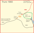 Truro 1860.gif 359 × 351; 14 KB
-
 Truro 1863.gif 359 × 351; 16 KB
-

-
 Truro City Council Parks Department WL59NNV.jpg 4,592 × 3,056; 3.23 MB
-
 Truro road 1852 - 1863 mark 2.gif 359 × 351; 16 KB
-
 Truro road 1852 - 1863.gif 359 × 351; 16 KB
-
 Truro Taxis.jpg 2,592 × 3,872; 5.3 MB
-
 Unimog type vehicle, Malabar Road, Truro, Cornwall - May 2023.jpg 4,032 × 2,382; 2.09 MB
-
 Waste collection in Truro VX05FTC-1 300713 CPS (11715089404).jpg 4,592 × 3,056; 2.71 MB
-
 The Road To Newquay - geograph.org.uk - 281973.jpg 640 × 427; 91 KB
-
 The Road to Truro - geograph.org.uk - 273058.jpg 640 × 427; 78 KB
-
 The Truro to Falmouth Road - geograph.org.uk - 229575.jpg 640 × 427; 100 KB


.jpg)


_Approaching_Arch_Hill_-_geograph.org.uk_-_2010153.jpg)
.jpg)


_-_geograph.org.uk_-_3386540.jpg)
_-_geograph.org.uk_-_2009695.jpg)


.jpg)


