Category:Transport maps of Cantal
Jump to navigation
Jump to search
Subcategories
This category has the following 2 subcategories, out of 2 total.
R
- Road maps of Cantal (1 F)
Media in category "Transport maps of Cantal"
The following 3 files are in this category, out of 3 total.
-
 15-RéseauRN.png 3,507 × 2,480; 1,019 KB
-
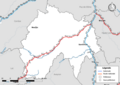
 Railway map of France - 15 - animated - fr.gif 1,566 × 2,166; 4.7 MB
-
 Transport map of France - 15.svg 815 × 956; 6.14 MB

