Category:Transport maps of Hautes-Pyrénées
Jump to navigation
Jump to search
Subcategories
This category has the following 5 subcategories, out of 5 total.
R
T
- Transport maps of Lannemezan (11 F)
Media in category "Transport maps of Hautes-Pyrénées"
The following 2 files are in this category, out of 2 total.
-
 Railway map of France - 65 - animated - fr.gif 1,252 × 2,227; 4.8 MB
-
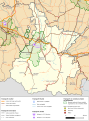 Transport map of France - 65.svg 709 × 956; 4.71 MB
