Category:Transport maps of Texas
Jump to navigation
Jump to search
States of the United States: Alabama · Alaska · Arizona · Arkansas · California · Colorado · Connecticut · Delaware · Florida · Georgia · Illinois · Kansas · Louisiana · Maryland · Massachusetts · Michigan · Mississippi · Montana · Nevada · New Jersey · New York · North Carolina · Ohio · Oklahoma · Oregon · Pennsylvania · South Carolina · Tennessee · Texas · Washington · Wyoming – Washington, D.C.
Puerto Rico
Puerto Rico
Subcategories
This category has the following 3 subcategories, out of 3 total.
P
R
Media in category "Transport maps of Texas"
The following 11 files are in this category, out of 11 total.
-
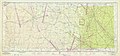
 Austin 1945 Edition - NARA - 84786184.jpg 20,075 × 9,376; 41.4 MB
-
 Austin 1946 Edition - NARA - 84786186.jpg 20,079 × 9,344; 32.79 MB
-
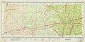 Dallas 1941 Edition - NARA - 84786178.jpg 19,462 × 9,664; 31.58 MB
-
 Dallas 1943 Edition - NARA - 84786182.jpg 19,475 × 9,632; 33.76 MB
-
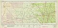
 Dallas 1944 Edition - NARA - 84786176.jpg 19,621 × 9,792; 44.68 MB
-
 Dallas 1945 Edition - NARA - 84786174.jpg 19,664 × 9,472; 24.33 MB
-
 Dallas 1946 Edition - NARA - 84786180.jpg 19,633 × 9,312; 37.62 MB
-
 El Paso 1944 Edition - NARA - 84785552.jpg 19,868 × 9,792; 26.67 MB
-
 El Paso 1945 Edition - NARA - 84785548.jpg 19,900 × 9,408; 26.38 MB
-
 El Paso 1946 Edition - NARA - 84785546.jpg 20,056 × 9,440; 26.74 MB
-
 El Paso 1947 Edition - NARA - 84785550.jpg 20,032 × 9,408; 25.12 MB


