Category:Transport maps of Yugoslavia
Jump to navigation
Jump to search
Countries of Europe: Albania · Andorra · Armenia‡ · Austria · Azerbaijan‡ · Belarus · Belgium · Bosnia and Herzegovina · Bulgaria · Croatia · Cyprus‡ · Czech Republic · Denmark · Estonia · Finland · France‡ · Georgia‡ · Germany · Greece · Hungary · Iceland · Republic of Ireland · Italy · Kazakhstan‡ · Latvia · Liechtenstein · Lithuania · Luxembourg · Malta · Moldova · Monaco · Montenegro · Netherlands‡ · North Macedonia · Norway · Poland · Portugal‡ · Romania · Russia‡ · San Marino · Serbia · Slovakia · Slovenia · Spain‡ · Sweden · Switzerland · Turkey‡ · Ukraine · United Kingdom · Vatican City
Specific status: Faroe Islands – Limited recognition: Kosovo
‡: partly located in Europe
Specific status: Faroe Islands – Limited recognition: Kosovo
‡: partly located in Europe
Subcategories
This category has the following 2 subcategories, out of 2 total.
R
- Road maps of Yugoslavia (105 F)
Media in category "Transport maps of Yugoslavia"
The following 5 files are in this category, out of 5 total.
-

-
-
 Highway network of Europe 1933 (Auto-Karta Kratjevine Jugoslavije).jpg 2,224 × 1,824; 706 KB
-
 Motorways in the former Yugoslavia.svg 753 × 551; 939 KB
-
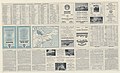
 Yugoslavia Railroads - DPLA - d05b596972175aa133404ddda3c281da.jpg 7,152 × 6,885; 6.64 MB
.jpg)
.jpg)
.jpg)

