Category:Travel maps in Japanese
Jump to navigation
Jump to search
Subcategories
This category has only the following subcategory.
S
- SVG travel maps in Japanese (1 F)
Media in category "Travel maps in Japanese"
The following 34 files are in this category, out of 34 total.
-
 Atlantic regions (ja).png 710 × 1,014; 203 KB
-
 Bali regions map (ja).png 3,044 × 1,730; 1.28 MB
-
 Belarus provinces (ja).png 850 × 733; 275 KB
-
 Benelux-map (ja).png 1,367 × 1,769; 293 KB
-
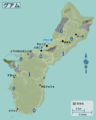 Guam regions map (ja).png 8,381 × 10,429; 9.27 MB
-
 Hawaii regions map (ja).png 1,184 × 757; 241 KB
-
 Hong Kong districts map (ja).png 1,600 × 1,083; 413 KB
-
 Indonesia regions map (ja).png 1,890 × 1,086; 463 KB
-
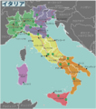 Italy regions (ja).png 1,211 × 1,367; 489 KB
-
 Japan chubu Map (ja).png 2,576 × 2,802; 1.16 MB
-
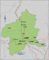 Japan Gunma Pref Map (ja).png 1,010 × 1,244; 294 KB
-
 Japan Hokkaido Map-ja.png 2,782 × 2,817; 2.57 MB
-
 Japan Islands of Tokyo Map (ja).png 2,189 × 2,955; 1.75 MB
-
 Japan Kansai Map (ja).png 3,003 × 3,003; 2.93 MB
-
 Japan Kyushu Map (ja).png 2,838 × 3,005; 2.88 MB
-
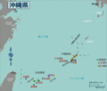 Japan Okinawa Map (ja).png 3,528 × 3,001; 3.01 MB
-
 Japan regions map(ja).png 1,500 × 1,851; 869 KB
-
 Japan Tohoku Map (ja).png 3,007 × 3,007; 2.59 MB
-
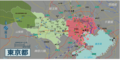 Japan Tokyo Pref Map (ja).png 3,017 × 1,510; 1.93 MB
-
 Keijō tourist map in late 1920s.jpg 3,422 × 1,494; 7.16 MB
-
 Map of Afghanistan (ja).png 1,173 × 938; 188 KB
-
 Map of Asia (jp).png 2,738 × 2,240; 890 KB
-
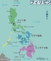 Map of Philippines (ja).png 1,950 × 2,324; 399 KB
-
 Map of South America (ja).png 1,131 × 1,376; 214 KB
-
 Map-Africa-Regions (ja).png 1,273 × 1,324; 517 KB
-
 Map-USA-Regions01(ja).png 1,500 × 1,246; 598 KB
-
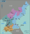 North Korea Regions Map-ja.png 790 × 877; 296 KB
-
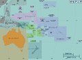 Oceania regions map (ja).png 3,584 × 2,628; 2.34 MB
-
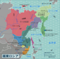 Russian Far East regions map2 (ja).png 952 × 929; 418 KB
-
 Slovakia Regions map (ja).png 1,294 × 752; 420 KB
-
 South Korea regions map (ja).png 1,559 × 1,673; 1.06 MB
-
 Taiwan Regions Map (ja).png 1,097 × 1,546; 520 KB
-
 Thailand regions map (ja).png 1,487 × 2,170; 1.35 MB
-
 Ukraine regions map (ja).png 949 × 644; 426 KB
.png)
.png)
.png)
.png)
.png)
.png)
.png)
.png)
.png)
.png)
.png)

.png)
.png)
.png)
.png)
.png)
.png)
.png)

.png)
.png)
.png)
.png)
.png)
.png)

.png)
.png)
.png)
.png)
.png)
.png)
.png)