Category:Travel maps of Central America
Jump to navigation
Jump to search
Subcategories
This category has the following 7 subcategories, out of 7 total.
B
C
E
G
H
N
P
Media in category "Travel maps of Central America"
The following 16 files are in this category, out of 16 total.
-
 Central America Flight Routes to the Americas.gif 540 × 540; 31 KB
-
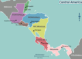
 Central America Regions (cs).png 795 × 567; 99 KB
-
 El Salvador Flight Routes.gif 540 × 540; 26 KB
-
 Guatemalan international air routes in the Americas.gif 540 × 540; 26 KB
-
 International flight routes within Central America.gif 720 × 360; 24 KB
-
 Map of Central America (eo 2).png 848 × 605; 98 KB
-
 Map of Central America (eo).png 848 × 605; 113 KB
-
 Map of Central America (fr).png 848 × 605; 108 KB
-
 Map of Central America (nl).png 848 × 605; 110 KB
-
 Map of Central America flights to Europe.gif 720 × 360; 27 KB
-
 Map of Central America flights.gif 540 × 540; 38 KB
-
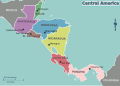
 Map of Central America.png 848 × 605; 110 KB
-
 Map of Central America.svg 412 × 294; 2.27 MB
-
 Mexico-Guatemala Air Routes.gif 720 × 360; 56 KB
-
 Rutas aéreas del Aeropuerto de Comayagua.gif 540 × 540; 16 KB
-
 Volaris Costa Rica Routes.gif 540 × 540; 16 KB

.png)


.png)
.png)
.png)
.png)


