Category:Treorchy
Jump to navigation
Jump to search
village in Rhondda Cynon Taf, Wales, UK  | |||||
| Upload media | |||||
| Pronunciation audio | |||||
|---|---|---|---|---|---|
| Instance of | |||||
| Location | Rhondda Cynon Taf, Wales | ||||
| official website | |||||
 | |||||
Cymraeg: Mae Treorci yn dref a chymuned yng Nghwm Rhondda, yn Rhondda Cynon Taf, de Cymru. Mae'n enwog am ei gôr meibion, Côr Meibion Treorci. Roedd na lot o waith glo yn y cwm ar un amser ond cawsant ei gyd eu cau yn y 1980au ar ôl y Streic Mawr.
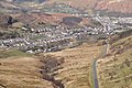
English: Treorchy is a village, although it used to be and still has characteristics of a town, in the county borough of Rhondda Cynon Taf, Wales, lying in the Rhondda Fawr valley. Treorchy is also one of the 16 communities of the Rhondda, taking in the near villages of Cwmparc and Ynyswen.
Subcategories
This category has the following 4 subcategories, out of 4 total.
Media in category "Treorchy"
The following 200 files are in this category, out of 501 total.
(previous page) (next page)-
 2010 Wales Rhondda Cynon Taf Community Treorchy map.svg 512 × 737; 416 KB
-
 2024 Wales Rhondda Cynon Taf Community Treorchy map.svg 512 × 737; 369 KB
-

-
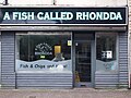 A Fish Called Rhondda - geograph.org.uk - 5400042.jpg 1,600 × 1,200; 382 KB
-
 A4107 Port Talbot to Treorchy road - geograph.org.uk - 5757870.jpg 3,264 × 2,448; 2.29 MB
-
 Abergorki Hall, Bute Street, Treorchy - geograph.org.uk - 5737926.jpg 800 × 699; 121 KB
-
 Abergorki Hall, Treorchy - geograph.org.uk - 2790210.jpg 640 × 494; 79 KB
-
 Access path to Treorchy railway station - geograph.org.uk - 4077096.jpg 800 × 663; 201 KB
-
 Access road to Alison House, Cwmparc - geograph.org.uk - 4071911.jpg 800 × 660; 180 KB
-
 Alison House, Cwmparc - geograph.org.uk - 4071894.jpg 800 × 639; 220 KB
-

-
 Anemometer on Cawrnant y Fforch - geograph.org.uk - 693630.jpg 480 × 640; 36 KB
-

-
 Approach to Ynyswen railway station - geograph.org.uk - 2786284.jpg 640 × 549; 103 KB
-
 Approaching the junction of the A4107 with the A4061 - geograph.org.uk - 3049126.jpg 4,320 × 3,240; 2.8 MB
-
 Autumn grasslands - geograph.org.uk - 5584313.jpg 3,264 × 2,448; 2.18 MB
-
 Back lane in Treorchy - geograph.org.uk - 5737784.jpg 800 × 682; 117 KB
-
 Baglan Street houses, Ynyswen - geograph.org.uk - 5606801.jpg 800 × 711; 125 KB
-
 Barclays Bank, Treorchy - geograph.org.uk - 2790665.jpg 640 × 491; 68 KB
-
 Barrett Street, Cwmparc - geograph.org.uk - 4102314.jpg 800 × 555; 101 KB
-
 Basic urinal, Park Road, Cwmparc - geograph.org.uk - 3924285.jpg 800 × 599; 154 KB
-
 Baz Bikes, Treorchy - geograph.org.uk - 5737944.jpg 738 × 800; 200 KB
-

-
 Bethlehem Chapel, Treorchy - geograph.org.uk - 5584499.jpg 2,448 × 3,264; 1.84 MB
-
 Blue Sky in Ynyswen - geograph.org.uk - 5606107.jpg 800 × 712; 128 KB
-

-
 Boarding the train at Ynyswen - geograph.org.uk - 5523019.jpg 1,024 × 768; 167 KB
-
-
 Bouchard ^ Jones Ltd, Ynyswen - geograph.org.uk - 2790105.jpg 640 × 473; 67 KB
-
-
 Brick urinal, Ynyswen Road, Ynyswen - geograph.org.uk - 5606122.jpg 800 × 696; 158 KB
-
 Bridge, A4061 - geograph.org.uk - 4435820.jpg 640 × 480; 89 KB
-
 Bridge, A4061 - geograph.org.uk - 4435826.jpg 640 × 480; 99 KB
-
 Bridgend District , Bwlchy-y-Clawdd Road - geograph.org.uk - 3903186.jpg 2,848 × 4,288; 6.64 MB
-
 Bridgend District , Countryside Scenery - geograph.org.uk - 3903080.jpg 4,166 × 2,652; 4.33 MB
-
 Bridgend District , Countryside Scenery - geograph.org.uk - 3903131.jpg 4,174 × 2,664; 3.12 MB
-
 Bridgend District , Countryside Scenery - geograph.org.uk - 3903135.jpg 4,230 × 2,758; 3.02 MB
-
 Bridgend District , Countryside Scenery - geograph.org.uk - 3903151.jpg 4,246 × 2,784; 3.89 MB
-
 Bridgend District , Countryside Scenery - geograph.org.uk - 3903209.jpg 4,288 × 2,848; 6.38 MB
-
 Bridgend District , The A4061 - geograph.org.uk - 3903204.jpg 4,288 × 2,848; 6.7 MB
-
 Bridgend District , The A4107 - geograph.org.uk - 3903154.jpg 4,288 × 2,848; 5.34 MB
-
 Bridgend District , The A4107 - geograph.org.uk - 3903170.jpg 4,288 × 2,848; 4.76 MB
-
 Bridgend District , The A4107 - geograph.org.uk - 3903214.jpg 4,288 × 2,848; 6.19 MB
-
 Bridgend District , Treorchy Scenery - geograph.org.uk - 3903175.jpg 4,288 × 2,848; 6.35 MB
-
 Bridgend District , Treorchy Scenery - geograph.org.uk - 3903184.jpg 4,250 × 2,790; 4.62 MB
-
 Brynhyfryd Street, Ynyswen - geograph.org.uk - 2785645.jpg 640 × 480; 73 KB
-
 Bute Street houses, Treorchy - geograph.org.uk - 5733384.jpg 800 × 739; 98 KB
-
 Bute Street In The Snow - geograph.org.uk - 2485153.jpg 640 × 480; 69 KB
-
 Bwlch y Clawdd (geograph 4030977).jpg 640 × 480; 91 KB
-
 Bwlch y Clawdd - geograph.org.uk - 3049132.jpg 4,320 × 3,240; 2.81 MB
-
 Bwlch y Clawdd - geograph.org.uk - 4028387.jpg 640 × 480; 103 KB
-
 Bwlch y Clawdd view point - geograph.org.uk - 3008256.jpg 4,000 × 3,000; 3.28 MB
-
 Cardiff Arms Cafe, Bute Street, Treorchy - geograph.org.uk - 5733430.jpg 800 × 585; 109 KB
-
 Cardiff Arms, Treorchy - geograph.org.uk - 4347781.jpg 2,592 × 1,456; 1.22 MB
-
-
 Cardiff Street, Treorchy - geograph.org.uk - 5733397.jpg 800 × 772; 101 KB
-

-
 Castle Street, Cwmparc - geograph.org.uk - 4076998.jpg 800 × 607; 121 KB
-
 Chepstow Road houses in Cwmparc - geograph.org.uk - 4064522.jpg 800 × 652; 132 KB
-
 Chepstow Road, Cwmparc - geograph.org.uk - 3924296.jpg 800 × 597; 130 KB
-
 Children's playground in Cwmparc - geograph.org.uk - 4121277.jpg 800 × 522; 116 KB
-
 Church Street, Cwmparc - geograph.org.uk - 4071603.jpg 800 × 616; 110 KB
-
 Clare Road, Cwmparc - geograph.org.uk - 4064426.jpg 800 × 622; 128 KB
-
 Clifton Street, Cwmparc - geograph.org.uk - 4077015.jpg 800 × 764; 140 KB
-
 Conway Road, Cwmparc - geograph.org.uk - 4077007.jpg 800 × 511; 101 KB
-
 Conway Road, Cwmparc - geograph.org.uk - 4077013.jpg 800 × 528; 129 KB
-

-
 Craig yr Aber - geograph.org.uk - 4028432.jpg 640 × 480; 100 KB
-
 Craig yr Aber - geograph.org.uk - 4028440.jpg 640 × 480; 71 KB
-
 Crichton Street, Treorchy - geograph.org.uk - 5733356.jpg 800 × 695; 105 KB
-
 Crown Garage, Ynyswen - geograph.org.uk - 2790046.jpg 640 × 480; 67 KB
-
 Crown Hotel, Ynyswen - geograph.org.uk - 2790059.jpg 640 × 441; 61 KB
-
 Crug-Yr-Afan Cairn - geograph.org.uk - 4159231.jpg 640 × 480; 71 KB
-
 Culvert on the A4061 - geograph.org.uk - 4435695.jpg 480 × 640; 115 KB
-
 Culvert, A4061 - geograph.org.uk - 4435709.jpg 480 × 640; 105 KB
-
 Culvert, A4061 - geograph.org.uk - 4435719.jpg 640 × 480; 97 KB
-
 Culvert, A4061 - geograph.org.uk - 4435823.jpg 640 × 480; 135 KB
-
 Culvert, A4107 - geograph.org.uk - 4159191.jpg 480 × 640; 108 KB
-
 Cwm Dar from Bwlch y Clawdd - geograph.org.uk - 3008251.jpg 4,000 × 3,000; 3.68 MB
-
 Cwm Dâr and Cwmparc - geograph.org.uk - 1188283.jpg 640 × 617; 121 KB
-
 Cwm Orci - geograph.org.uk - 6161194.jpg 3,264 × 2,448; 2.84 MB
-
 Cwm Orci - geograph.org.uk - 6162141.jpg 7,090 × 3,034; 7.16 MB
-
 Cwm Parc - geograph.org.uk - 5757850.jpg 3,264 × 2,448; 2.46 MB
-

-
 Cwmparc and Treorchy - geograph.org.uk - 2125034.jpg 640 × 480; 67 KB
-
-
 Cwmparc boundary sign, Treorchy - geograph.org.uk - 3923382.jpg 800 × 716; 211 KB
-
 Cwmparc Community Centre - geograph.org.uk - 4101694.jpg 800 × 474; 95 KB
-
 Cwmparc Community Centre mural - geograph.org.uk - 4101697.jpg 657 × 800; 291 KB
-
 Cwmparc Convenience Store, Cwmparc - geograph.org.uk - 3924272.jpg 800 × 594; 113 KB
-
 Cwmparc electricity substation - geograph.org.uk - 4071677.jpg 800 × 610; 156 KB
-
 Cwmparc from a lay-by on the A4061 - geograph.org.uk - 3136784.jpg 640 × 480; 138 KB
-
 Cwmparc from Mynydd Maendy - geograph.org.uk - 4298991.jpg 4,000 × 2,792; 3.16 MB
-
 Cwmparc from the A4061 - geograph.org.uk - 3136780.jpg 640 × 480; 145 KB
-
 Cwmparc from the A4061 lay-by - geograph.org.uk - 3136788.jpg 640 × 480; 128 KB
-
 Cwmparc Post Office - geograph.org.uk - 4064575.jpg 800 × 595; 112 KB
-
 Cwmparc, Treorchy - geograph.org.uk - 5584272.jpg 3,264 × 2,448; 2.07 MB
-
 Cwmparc, zigzag on the A4061 - geograph.org.uk - 444747.jpg 419 × 640; 86 KB
-
 Cwmparc. And Pen y Fan. - geograph.org.uk - 2125009.jpg 640 × 480; 78 KB
-
 Cylchoedd a Dolenau - geograph.org.uk - 5584292.jpg 2,281 × 3,041; 1.82 MB
-
 Danish Bacon Deli and Cafe, Treorchy - geograph.org.uk - 2790500.jpg 629 × 640; 93 KB
-
-
 David Street, Cwmparc - geograph.org.uk - 4102332.jpg 800 × 600; 151 KB
-
 Derelict corner in Cwmparc - geograph.org.uk - 4071409.jpg 800 × 606; 131 KB
-
-

-

-
-

-
 Doorless red phonebox in Cwmparc - geograph.org.uk - 4071614.jpg 800 × 540; 142 KB
-

-
 Down Crichton Street, Treorchy - geograph.org.uk - 5737939.jpg 800 × 580; 92 KB
-
 Down Jones Street, Ynyswen - geograph.org.uk - 5606948.jpg 800 × 633; 87 KB
-
 Down Park Road towards Treorchy, Cwmparc - geograph.org.uk - 4101691.jpg 800 × 700; 137 KB
-
 Down Woodland Terrace, Cwmparc - geograph.org.uk - 4121412.jpg 800 × 530; 126 KB
-

-
-
-
 Dumfries Street, Treorchy - geograph.org.uk - 2790379.jpg 640 × 483; 65 KB
-
 East along Barrett Street, Cwmparc - geograph.org.uk - 4102319.jpg 800 × 589; 99 KB
-
 East side of St George's Church, Cwmparc - geograph.org.uk - 4125256.jpg 800 × 733; 181 KB
-

-

-
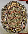
 Eisteddfod yr Urdd, Treorchy, 1947 (7344345406).jpg 628 × 406; 68 KB
-

-
 End of the road and bus route in Cwmparc - geograph.org.uk - 4119694.jpg 800 × 658; 141 KB
-

-
-
 Entrance to Ynyswen Clinic - geograph.org.uk - 2785692.jpg 640 × 480; 87 KB
-
 Fenced grassland - geograph.org.uk - 6161191.jpg 2,048 × 1,536; 1.23 MB
-
 Fenced-off corner of Treorchy - geograph.org.uk - 5733488.jpg 800 × 537; 84 KB
-
 Fenced-off waste ground in Cwmparc - geograph.org.uk - 4064474.jpg 800 × 600; 127 KB
-
 Former Crown Hotel pub, Ynyswen - geograph.org.uk - 5736779.jpg 800 × 676; 127 KB
-
 Former Crown Hotel, Ynyswen - geograph.org.uk - 5736784.jpg 800 × 600; 136 KB
-
-
-
 Former Pencelli Hotel for sale, Cwmparc - geograph.org.uk - 3915861.jpg 800 × 558; 121 KB
-
 Former Royal Oak pub, Ynyswen - geograph.org.uk - 5606807.jpg 800 × 657; 101 KB
-

-

-

-

-
 From the top you can get a nice ice cream - panoramio.jpg 2,048 × 1,536; 1.23 MB
-
 From Ynyswen towards Treorchy - geograph.org.uk - 5609721.jpg 800 × 594; 115 KB
-

-

-
 Glyncoli Road, Treorchy - geograph.org.uk - 2790513.jpg 640 × 412; 67 KB
-
 Glynrhondda Street, Treorchy - geograph.org.uk - 5737807.jpg 800 × 732; 110 KB
-
 Gorsedd Stones, Treorchy.JPG 2,033 × 1,025; 1.02 MB
-
 Gosen Christian Centre, Treorchy - geograph.org.uk - 2790236.jpg 640 × 514; 75 KB
-
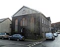
 Gospel Hall, Treorchy (geograph 7278993).jpg 4,032 × 3,024; 5.45 MB
-

-

-
 Graig Fach - geograph.org.uk - 3285487.jpg 640 × 480; 81 KB
-
 Graig Fach - geograph.org.uk - 5757858.jpg 6,524 × 3,086; 6.25 MB
-
 Graig Fach and Graig Fawr - geograph.org.uk - 3285474.jpg 640 × 480; 93 KB
-
 Graig Fach from the A4061 - geograph.org.uk - 2767196.jpg 640 × 480; 196 KB
-
 Graig Fawr - geograph.org.uk - 4026623.jpg 640 × 480; 97 KB
-
 Graig Fawr - geograph.org.uk - 4026653.jpg 640 × 480; 89 KB
-

-
 Herbert Street, Treorchy (geograph 7279615).jpg 2,430 × 3,240; 2.98 MB
-
 High Street, Treorchy - geograph.org.uk - 5584493.jpg 3,264 × 2,448; 2.21 MB
-

-
 Hill view from Cwmparc - geograph.org.uk - 4119787.jpg 800 × 498; 128 KB
-

-

-
-
-

-

-
-

-

-

-
 HSBC Treorchy - geograph.org.uk - 2790752.jpg 640 × 605; 88 KB
-
 Individualistic house in Cwmparc - geograph.org.uk - 4119697.jpg 800 × 512; 121 KB
-

-
 Information board - geograph.org.uk - 6324689.jpg 5,570 × 2,817; 1.53 MB
-

-
-

-
 Iron Maidens in Treorchy - geograph.org.uk - 5732763.jpg 800 × 778; 144 KB
-
 Jobcentre Plus in Treorchy - geograph.org.uk - 5737916.jpg 800 × 671; 87 KB
-
 Jones Street, Ynyswen - geograph.org.uk - 5606866.jpg 800 × 629; 106 KB
-

-

-

-
 Kenry Street, Ynyswen - geograph.org.uk - 2785643.jpg 640 × 522; 78 KB
-

-
 Kissing gate, gate and notice, Cwmparc - geograph.org.uk - 4119705.jpg 800 × 477; 126 KB
-

-
 Large Concrete Block - geograph.org.uk - 4159203.jpg 480 × 640; 96 KB
-
 Leaning Culvert, A4107 - geograph.org.uk - 4159181.jpg 640 × 480; 105 KB
-
 Lion Inn, Treorchy - geograph.org.uk - 2790655.jpg 640 × 480; 63 KB
-
 Llewelyn Street, Ynyswen - geograph.org.uk - 5606796.jpg 738 × 800; 125 KB
-

-
-
 Lockup garages in Cwmparc - geograph.org.uk - 4125188.jpg 800 × 467; 109 KB
-

-
 Long row of houses, Conway Road, Cwmparc - geograph.org.uk - 4077022.jpg 800 × 600; 135 KB


.jpg)


.jpg)


.jpg)
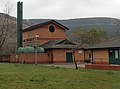
_listed_Park_and_Dare_Workmen%27s_Institute,_Treorchy_-_geograph.org.uk_-_2790814.jpg)


.jpg)


