Category:Treuddyn
Jump to navigation
Jump to search
village and community in Flintshire, Wales, UK  Canol y pentref  | |||||
| Upload media | |||||
| Instance of | |||||
|---|---|---|---|---|---|
| Location | Flintshire, Wales | ||||
 | |||||
Cymraeg: Pentref a chymuned yn Sir y Fflint yw Treuddyn. Saif fymryn oddi ar ar y briffordd A5104 i'r de o'r Wyddgrug. Cyfeirnod OS: SJ252583.
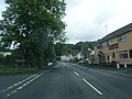
English: Treuddyn is a small village and community in Flintshire, Wales, located just off the A5104 road, around 4 miles south-east of Mold and 3 miles north-west of Caergwrle. The community includes the nearby village of Coed Talon to the east. The community's population was 1,567 during the 2001 Census.
Subcategories
This category has only the following subcategory.
T
Media in category "Treuddyn"
The following 121 files are in this category, out of 121 total.
-
 2010 Wales Flintshire Community Treuddyn map.svg 512 × 568; 494 KB
-
 2024 Wales Flintshire Community Treuddyn map.svg 512 × 568; 394 KB
-
 A small area of high ground - geograph.org.uk - 5010645.jpg 4,000 × 3,000; 4.73 MB
-
 A5104 at Rhydatlog crossroads - geograph.org.uk - 3001026.jpg 640 × 481; 65 KB
-
 A5104 at Rhydtalog village boundary - geograph.org.uk - 3001005.jpg 640 × 480; 63 KB
-
 A5104 heading south - geograph.org.uk - 6247244.jpg 1,600 × 1,200; 591 KB
-
 A5104 west of Treuddyn - geograph.org.uk - 3000982.jpg 640 × 481; 65 KB
-
 A5104-Ffordd Llanarmon junction - geograph.org.uk - 3000997.jpg 640 × 481; 54 KB
-
 Across grazing land to Tryddyn-fechan Farm - geograph.org.uk - 3849747.jpg 3,264 × 2,448; 5.17 MB
-
 Baptist Chapel at Treuddyn - geograph.org.uk - 1964810.jpg 1,500 × 778; 1.23 MB
-
 Cae Hic farmhouse - geograph.org.uk - 5007339.jpg 4,000 × 3,000; 4.65 MB
-
 Capel Berea, Treuddyn, now a dwelling - geograph.org.uk - 5877172.jpg 4,320 × 3,240; 2.68 MB
-
 Cattle in field beside Frank Farm - geograph.org.uk - 4632751.jpg 3,264 × 2,448; 4.43 MB
-
 Celyn farm - geograph.org.uk - 233382.jpg 640 × 480; 98 KB
-
 Corwen Road at Coed Talon boundary - geograph.org.uk - 2999678.jpg 640 × 480; 70 KB
-

-

-
 Cottages on the A5104 - geograph.org.uk - 3390895.jpg 3,810 × 2,546; 1.91 MB
-
 Dismantled railway - geograph.org.uk - 6321124.jpg 5,184 × 3,888; 7.26 MB
-

-
 Farmland - geograph.org.uk - 233406.jpg 640 × 480; 75 KB
-

-
 Farmland east of Rhyd y Ceirw - geograph.org.uk - 6247279.jpg 1,600 × 1,200; 608 KB
-
 Ffordd Blaenau (Blaenau Road) - geograph.org.uk - 5007350.jpg 4,000 × 3,000; 4.73 MB
-

-
 Ffordd Nercwys junction - geograph.org.uk - 4353258.jpg 640 × 480; 77 KB
-
 Ffordd Nercwys nears Terrig Bridge - geograph.org.uk - 4353262.jpg 640 × 480; 104 KB
-
 Ffordd Y Blaenau lane junction - geograph.org.uk - 4353235.jpg 640 × 480; 64 KB
-
 Ffordd yr Odyn lane junction - geograph.org.uk - 4353255.jpg 640 × 480; 38 KB
-
 Field and woodland near Plas-ym-Mhowys Farm - geograph.org.uk - 4632761.jpg 3,264 × 2,448; 3.96 MB
-

-
 Footbridge over the Afon Terrig - geograph.org.uk - 3849698.jpg 3,264 × 2,448; 6.26 MB
-
 Footpath through rough grazing land - geograph.org.uk - 3849764.jpg 3,264 × 2,448; 5.4 MB
-
 House at Treuddyn - geograph.org.uk - 3390879.jpg 4,283 × 2,972; 2.66 MB
-
 Houses in Treuddyn - geograph.org.uk - 208128.jpg 640 × 480; 80 KB
-
 Houses on the A5104 at Treuddyn - geograph.org.uk - 5877177.jpg 4,320 × 3,240; 2.75 MB
-
 Junction at Black Mountain, Treuddyn - geograph.org.uk - 4857738.jpg 640 × 480; 51 KB
-
 Land surrounding Ffrith Farm buildings with a view - geograph.org.uk - 4828936.jpg 1,600 × 1,200; 530 KB
-
 Lane junction near Cae Hic Bach - geograph.org.uk - 4353230.jpg 640 × 480; 81 KB
-
 Liver Inn - geograph.org.uk - 5112566.jpg 4,992 × 2,668; 1.94 MB
-
 Liver Inn, Rhydtalog - geograph.org.uk - 4857754.jpg 640 × 480; 67 KB
-
 Liver Inn, Rhydtalog - geograph.org.uk - 662579.jpg 640 × 480; 50 KB
-
 Making hay while the sun shines - geograph.org.uk - 1512154.jpg 640 × 480; 121 KB
-
 Mini waterfall on the River Cegidog - geograph.org.uk - 4828973.jpg 3,264 × 2,448; 6.25 MB
-
 Mynwent y Rhos, Treuddyn - geograph.org.uk - 1512164.jpg 640 × 480; 78 KB
-
 Pant-terfyn Fferm - geograph.org.uk - 5005828.jpg 3,264 × 2,448; 3.65 MB
-
 Pen-y-Bryn Fferm - geograph.org.uk - 5010610.jpg 3,663 × 2,617; 3.36 MB
-
 Pont Terrig and Ffordd y Pentre - geograph.org.uk - 4988104.jpg 4,000 × 3,000; 3.95 MB
-
 Pont Terrig, Afon Terrig and Ffordd y Pentre - geograph.org.uk - 4988028.jpg 4,000 × 3,000; 3.99 MB
-
 Pwll Farm, Treuddyn - geograph.org.uk - 4857732.jpg 640 × 465; 47 KB
-
 Pylons, Tryddyn Cottage - geograph.org.uk - 1512153.jpg 480 × 640; 56 KB
-
 Railway Inn, Coed-talon - geograph.org.uk - 6321117.jpg 5,184 × 3,888; 3.7 MB
-
 Railway Inn, Coedtalon - geograph.org.uk - 4857717.jpg 640 × 470; 50 KB
-
 Railway track at Coed Talon - geograph.org.uk - 557230.jpg 640 × 480; 171 KB
-
 Rivet bench mark on Pont Terrig - geograph.org.uk - 4988016.jpg 4,000 × 3,000; 3.98 MB
-
 Road junction - B5430 - geograph.org.uk - 201132.jpg 640 × 480; 113 KB
-
 Ruin near the bridleway - geograph.org.uk - 3849782.jpg 1,024 × 768; 430 KB
-
 Sheepfield, east of Rhyd y Ceirw - geograph.org.uk - 6247263.jpg 1,600 × 1,200; 492 KB
-
 Sign for completely overgrown footpath - geograph.org.uk - 4632780.jpg 3,264 × 2,448; 5.45 MB
-
 Some stiles are not easy to negotiate^ - geograph.org.uk - 3849720.jpg 3,264 × 2,448; 5.96 MB
-
 St Mary's Church, Treuddyn, Flintshire, Wales - Eglwys y Santes Fair 08.jpg 4,570 × 3,111; 2.33 MB
-
 Stile for footpath through grazing field heading for B5101 - geograph.org.uk - 4828917.jpg 3,264 × 2,448; 4.63 MB
-
 Stile on footpath beside Plas-ym-Mhowys Farm - geograph.org.uk - 4632768.jpg 3,264 × 2,448; 4.84 MB
-

-
 Stone stile and gate for footpaths - geograph.org.uk - 3849672.jpg 2,592 × 1,944; 3.48 MB
-
 Swan Farm Shop - geograph.org.uk - 1512158.jpg 640 × 480; 54 KB
-
 Swan's farm shop, Treuddyn - geograph.org.uk - 207684.jpg 640 × 480; 89 KB
-
 The A5104 cuts through a snowy landscape - geograph.org.uk - 3390978.jpg 4,335 × 2,891; 2.27 MB
-
 The A5104 near Rhydtalog - geograph.org.uk - 3390964.jpg 3,203 × 1,697; 1.17 MB
-
 The Buildings at Ffrainc - geograph.org.uk - 5010619.jpg 4,000 × 3,000; 5.11 MB
-
 The Dingle - geograph.org.uk - 5112565.jpg 5,043 × 2,971; 1.92 MB
-
 The Dingle, at Rhydtalog - geograph.org.uk - 201112.jpg 640 × 480; 60 KB
-
 The Farmer's Arms, Treuddyn - geograph.org.uk - 1512161.jpg 640 × 480; 53 KB
-
 The Farmer's Arms, Treuddyn - geograph.org.uk - 207694.jpg 640 × 480; 80 KB
-
 The Railway Inn - geograph.org.uk - 3390838.jpg 3,713 × 2,401; 1.86 MB
-
 The Railway Inn and other buildings - geograph.org.uk - 3182045.jpg 1,500 × 1,125; 1.28 MB
-
 The road to Nant y Ffrith - geograph.org.uk - 333870.jpg 640 × 426; 105 KB
-
 Three intensive livestock houses - geograph.org.uk - 5007318.jpg 4,000 × 3,000; 4.85 MB
-
 Tree on a field boundary near Rhyd y Ceirw Farm - geograph.org.uk - 6247271.jpg 1,946 × 1,460; 1.06 MB
-
 Treuddyn petrol station - geograph.org.uk - 3390871.jpg 3,232 × 2,538; 1.56 MB
-
 Which is the naughty one, then^ - geograph.org.uk - 1512167.jpg 640 × 480; 82 KB
-
 Woodland in a field corner, east of Rhyd y Ceirw - geograph.org.uk - 6247249.jpg 1,654 × 1,240; 745 KB
-
 Young black and white cattle grazing - geograph.org.uk - 5010681.jpg 3,264 × 2,448; 3.58 MB
-
 Ysgol Terrig, Treuddyn - geograph.org.uk - 1512160.jpg 640 × 480; 59 KB
-
 Aber Tairnant - geograph.org.uk - 201109.jpg 640 × 480; 68 KB
-
 Afon Terrig - geograph.org.uk - 1512168.jpg 640 × 480; 154 KB
-
 Barn near Rhydtalog - geograph.org.uk - 196374.jpg 640 × 480; 83 KB
-
 Bedlwyn Farm - geograph.org.uk - 1512152.jpg 640 × 480; 72 KB
-
 Bridleway to Llyn Cyfynwy - geograph.org.uk - 1511235.jpg 480 × 640; 161 KB
-
 Capel Berea - geograph.org.uk - 1512159.jpg 640 × 480; 53 KB
-
 Capel Ebeneser, Treuddyn - geograph.org.uk - 1512162.jpg 640 × 480; 55 KB
-

-
 Coed-Talon Works - geograph.org.uk - 430955.jpg 426 × 640; 62 KB
-
 Coed-Talon Works. - geograph.org.uk - 431033.jpg 640 × 285; 46 KB
-
 Farm Buildings - geograph.org.uk - 201128.jpg 640 × 480; 87 KB
-
 Farmland by the A5104 - geograph.org.uk - 228798.jpg 640 × 480; 96 KB
-
 Farmland near the Afon Terrig - geograph.org.uk - 228782.jpg 640 × 480; 89 KB
-
 Farmland near Tryddyn Cottage - geograph.org.uk - 228791.jpg 640 × 480; 67 KB
-
 Footpath - geograph.org.uk - 201122.jpg 640 × 480; 82 KB
-
 Gwernto Farm - geograph.org.uk - 333874.jpg 640 × 426; 90 KB
-
 Gwernto Farmyard - geograph.org.uk - 336065.jpg 640 × 426; 73 KB
-
 Horse jumps at Cae Hic Bach - geograph.org.uk - 228795.jpg 640 × 480; 68 KB
-
 Lead Mines Chimney above Rhydtalog - geograph.org.uk - 351320.jpg 480 × 640; 137 KB
-
 Leeswood Farm - geograph.org.uk - 233380.jpg 640 × 480; 100 KB
-

-
 Moorland south of Rhydtalog - geograph.org.uk - 662679.jpg 640 × 480; 59 KB
-
 Mount Farm - geograph.org.uk - 233409.jpg 640 × 480; 73 KB
-
 Nant Brook - geograph.org.uk - 692208.jpg 480 × 640; 116 KB
-
 Old railway track - geograph.org.uk - 557239.jpg 480 × 640; 173 KB
-
 Pant-y-ffordd cottage - geograph.org.uk - 228789.jpg 640 × 480; 91 KB
-
 Pontybodkin Lower Pumping Station - geograph.org.uk - 691621.jpg 480 × 640; 138 KB
-
 Pwll Farm - geograph.org.uk - 228780.jpg 640 × 480; 85 KB
-
 Stile near Waen y Llyn Country Park - geograph.org.uk - 557221.jpg 640 × 480; 131 KB
-
 The lane to Bryn Common - geograph.org.uk - 233408.jpg 640 × 480; 108 KB
-
 The Railway Inn, Coed-talon - geograph.org.uk - 207696.jpg 640 × 480; 76 KB
-
 Track Junction near Llyn Cyfynwy - geograph.org.uk - 350319.jpg 640 × 480; 195 KB
-
 Travellers Farm, Rhydtalog. - geograph.org.uk - 107483.jpg 640 × 480; 102 KB
-
 True Grit - geograph.org.uk - 333871.jpg 640 × 426; 125 KB
-
 Twmpath farm - geograph.org.uk - 233388.jpg 640 × 480; 91 KB
-
 Walled garden - geograph.org.uk - 336051.jpg 640 × 426; 98 KB
-
 Waste land, Leeswood - geograph.org.uk - 691616.jpg 640 × 480; 69 KB


_-_geograph.org.uk_-_5007350.jpg)


