Category:Trig points in the East Riding of Yorkshire
Jump to navigation
Jump to search
Ceremonial counties of England: Bedfordshire · Berkshire · Buckinghamshire · Cambridgeshire · Cheshire · Cornwall · Cumbria · Derbyshire · Devon · Dorset · Durham · East Riding of Yorkshire · East Sussex · Essex · Gloucestershire · Greater London · Greater Manchester · Hampshire · Herefordshire · Hertfordshire · Kent · Lancashire · Leicestershire · Lincolnshire · Merseyside · Norfolk · North Yorkshire · Northamptonshire · Northumberland · Nottinghamshire · Oxfordshire · Rutland · Shropshire · Somerset · South Yorkshire · Staffordshire · Suffolk · Surrey · Tyne and Wear · Warwickshire · West Midlands · West Sussex · West Yorkshire · Wiltshire · Worcestershire
City-counties:
Former historic counties:
Other former counties:
City-counties:
Former historic counties:
Other former counties:
Subcategories
This category has only the following subcategory.
P
Media in category "Trig points in the East Riding of Yorkshire"
The following 57 files are in this category, out of 57 total.
-
 A Wolds way Trig Point - geograph.org.uk - 930940.jpg 480 × 640; 127 KB
-
 A Wolds' Trigpoint - geograph.org.uk - 926594.jpg 480 × 640; 128 KB
-
 Barff Hill Farm and Trig Pillar - geograph.org.uk - 46014.jpg 640 × 480; 135 KB
-
 Buckton Cliff Triangulation Pillar - geograph.org.uk - 249825.jpg 640 × 492; 136 KB
-
 Burnby Wold Trig Point - geograph.org.uk - 448042.jpg 640 × 480; 156 KB
-
 Chalk Lighthouse at Flamborough Head - geograph.org.uk - 507488.jpg 640 × 480; 41 KB
-
 Chalk Tower Flamborough Head 058031.jpg 1,200 × 1,600; 306 KB
-
 Collingwood Trig Point - geograph.org.uk - 448047.jpg 360 × 480; 35 KB
-
 Fimberfields Trig pillar (geograph 6834165).jpg 1,024 × 768; 292 KB
-
 Flamborough Light House (Old) - geograph.org.uk - 1047.jpg 437 × 640; 46 KB
-
-
 Garrowby hill trig point - geograph.org.uk - 1636215.jpg 480 × 640; 65 KB
-
 Great Wold Trig point - geograph.org.uk - 1451944.jpg 640 × 480; 85 KB
-
 Hedge and Field view from Windmill Triangulation Pillar (geograph 4777115).jpg 4,000 × 3,000; 2.79 MB
-

-
 High Hunsley trig - geograph.org.uk - 100575.jpg 640 × 427; 136 KB
-
 Houseclose Plantation, Holmpton - geograph.org.uk - 281744.jpg 480 × 640; 102 KB
-
 Humber Side Lane Triangulation Pillar - geograph.org.uk - 305279.jpg 640 × 476; 88 KB
-

-
 Lane from Fordon to Wold Newton at North Cotes Triangulation Pillar (geograph 5751030).jpg 4,000 × 3,000; 2.36 MB
-
 Moor Farm Trig Point - geograph.org.uk - 447440.jpg 640 × 480; 71 KB
-
 Newcoat Fields Trig point - geograph.org.uk - 447394.jpg 640 × 480; 117 KB
-
 Newcote trig point - geograph.org.uk - 1636119.jpg 640 × 480; 81 KB
-
 North Cotes Trig Pillar (geograph 6090646).jpg 1,024 × 768; 140 KB
-
 O.S. Trig Point - geograph.org.uk - 1210894.jpg 640 × 480; 91 KB
-
 O.S. Trig. Point, Buckton Cliffs - geograph.org.uk - 770236.jpg 480 × 640; 223 KB
-

-

-
 OS Triangulation Pillar Blakehowe - geograph.org.uk - 249821.jpg 640 × 486; 131 KB
-
 South Field, Patrington - geograph.org.uk - 323849.jpg 640 × 478; 79 KB
-
 Southwest of Weeton - geograph.org.uk - 321761.jpg 640 × 478; 116 KB
-
 Sutton Park Golf Club - geograph.org.uk - 303558.jpg 465 × 640; 153 KB
-
 The Fair View Triangulation Pillar - geograph.org.uk - 294488.jpg 474 × 640; 167 KB
-
 The Humber Bank, Cherry Cobb Sands - geograph.org.uk - 769053.jpg 640 × 410; 94 KB
-
 The old tower and trig pillar - geograph.org.uk - 1451777.jpg 640 × 480; 52 KB
-
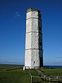
 The Tower Trig Point, Flamborough - geograph.org.uk - 835896.jpg 452 × 640; 49 KB
-
 Triangulation Pillar - geograph.org.uk - 1283169.jpg 640 × 480; 91 KB
-
 Triangulation Pillar - geograph.org.uk - 285435.jpg 640 × 480; 118 KB
-
 Triangulation Pillar No 10637.jpg 640 × 480; 149 KB
-
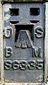
 Triangulation Pillar No. S6335 - geograph.org.uk - 149647.jpg 640 × 480; 106 KB
-
 Triangulation Pillar S6371 - geograph.org.uk - 133579.jpg 480 × 640; 140 KB
-

-

-
 Trig pillar near Haltemprice Farm - geograph.org.uk - 1451805.jpg 640 × 480; 89 KB
-
 Trig Pillar on Newbald Wold - geograph.org.uk - 1451913.jpg 640 × 480; 99 KB
-
 Trig Pillar, Beacon Hill - geograph.org.uk - 1451692.jpg 640 × 480; 135 KB
-
 Trig Pillar, South Field, Patrington - geograph.org.uk - 1451677.jpg 640 × 480; 70 KB
-
 Trig Point at 105.66m - geograph.org.uk - 802275.jpg 444 × 640; 244 KB
-
 Trig Point at Easington Clays - geograph.org.uk - 21767.jpg 480 × 640; 88 KB
-
-
 Trig point No.S6335 to the south of Fordon (geograph 2318031).jpg 800 × 600; 220 KB
-
 Trig Point on Newbald Wold - geograph.org.uk - 1069164.jpg 640 × 480; 94 KB
-
 Trig point on Nine Dikes Road - geograph.org.uk - 1293123.jpg 640 × 427; 264 KB
-
 Trig Point OS BM S2563 near Willerby, East Yorkshire (geograph 3741694).jpg 681 × 1,024; 321 KB
-
 View from the Triangulation Pillar at Houseclose Plantation (geograph 4777000).jpg 4,000 × 3,000; 3.5 MB
-
 Warmer Lane, Dimlington - geograph.org.uk - 290191.jpg 480 × 640; 105 KB
-
 Withernsea Golf Club - geograph.org.uk - 294440.jpg 640 × 460; 93 KB


.jpg)
_-_geograph.org.uk_-_1047.jpg)
.jpg)


.jpg)
.jpg)


.jpg)


.jpg)


.jpg)
.jpg)


.jpg)


.jpg)
.jpg)

