Category:Trinitatiskirche (Ostrhauderfehn)
Jump to navigation
Jump to search
| Object location | | View all coordinates using: OpenStreetMap |
|---|
| Upload media | |||||
| Instance of | |||||
|---|---|---|---|---|---|
| Location | Lower Saxony, Germany | ||||
 | |||||
Subcategories
This category has only the following subcategory.
Media in category "Trinitatiskirche (Ostrhauderfehn)"
The following 7 files are in this category, out of 7 total.
-
 ChurchLangholtEv.jpg 2,048 × 3,072; 3.71 MB
-
 Ostrhauderfehn - Dorfstraße - Trinitatiskirche + 42Pfarrhaus 01 ies.jpg 5,616 × 3,744; 23.78 MB
-
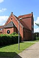
 Ostrhauderfehn - Dorfstraße - Trinitatiskirche 01 ies.jpg 5,616 × 3,743; 20.51 MB
-
 Ostrhauderfehn - Dorfstraße - Trinitatiskirche 02 ies.jpg 5,616 × 3,744; 17.86 MB
-
 Ostrhauderfehn - Dorfstraße - Trinitatiskirche 03 ies.jpg 3,744 × 5,616; 17.45 MB
-
 Ostrhauderfehn - Dorfstraße - Trinitatiskirche 04 ies.jpg 3,744 × 5,616; 18.97 MB
-
 Ostrhauderfehn - Dorfstraße - Trinitatiskirche 05 ies.jpg 3,745 × 5,616; 20.33 MB


