Category:Trolleybus maps of Italy
Jump to navigation
Jump to search
Subcategories
This category has the following 16 subcategories, out of 16 total.
A
- Trolleybus maps of Ancona (6 F)
- Trolleybus maps of Avellino (4 F)
B
- Trolleybus maps of Bologna (8 F)
C
- Trolleybus maps of Cagliari (5 F)
- Trolleybus maps of Chieti (3 F)
- Trolleybus maps of Cremona (2 F)
F
- Trolleybus maps of Florence (2 F)
G
- Trolleybus maps of Genoa (3 F)
L
- Trolleybus maps of Lecce (5 F)
M
- Trolleybus maps of Milan (24 F)
- Trolleybus maps of Modena (11 F)
N
- Trolleybus maps of Naples (3 F)
P
- Trolleybus maps of Parma (12 F)
R
- Trolleybus maps of Rimini (5 F)
- Trolleybus maps of Rome (4 F)
T
- Trolleybus maps of Turin (4 F)
Media in category "Trolleybus maps of Italy"
The following 16 files are in this category, out of 16 total.
-
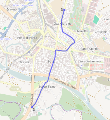
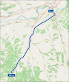 Mappa filovia Alba-Barolo.svg 1,140 × 1,359; 3.06 MB
-
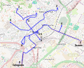
 Alessandria - mappa rete filoviaria.svg 1,094 × 1,412; 4.41 MB
-
 Bergamo mappa rete filoviaria.svg 636 × 515; 907 KB
-
 Mappa filovia di Carrara.svg 1,500 × 1,100; 4.48 MB
-
 Como mappa rete filoviaria.svg 1,045 × 990; 4.46 MB
-
 Desenzano mappa filovia.svg 684 × 520; 2.33 MB
-
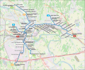
 Mappa filovia Fermo-Porto San Giorgio.png 2,000 × 863; 687 KB
-
 Ferrara mappa rete filoviaria.svg 679 × 663; 2.7 MB
-
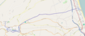
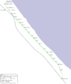
 Mappa filovia Anzio-Nettuno.svg 803 × 553; 1.92 MB
-
 Pavia mappa filovia.svg 622 × 678; 576 KB
-
 FilobusPescara2016.png 2,929 × 3,497; 453 KB
-
 Filobus-sanremo-1.png 620 × 235; 32 KB
-
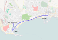
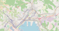
 Sanremo mappa rete filoviaria.jpg 5,725 × 2,875; 4.11 MB
-
 La Spezia mappa rete filoviaria.png 6,601 × 3,486; 3.61 MB
-
 Trapani mappa filovia.svg 758 × 528; 2.05 MB
-
 Verona - mappa progetto rete filoviaria (status 2022).svg 1,480 × 1,200; 8.19 MB


.svg)