Category:Tsushima Island
Jump to navigation
Jump to search
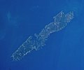
island in Nagasaki, Japan Satellite image of Tsushima Розташування Цусіми в префектурі Нагасакі | |||||
| Upload media | |||||
| Instance of |
| ||||
|---|---|---|---|---|---|
| Located in protected area | |||||
| Location | Tsushima, Nagasaki Prefecture, Japan | ||||
| Located in or next to body of water | |||||
| Has part(s) |
| ||||
| Length |
| ||||
| Highest point |
| ||||
| Population |
| ||||
| Area |
| ||||
| Elevation above sea level |
| ||||
 | |||||

English: Tsushima Island is an island in Nagasaki prefecture, Japan
日本語: 対馬(つしま)は、日本の長崎県の北部、玄界灘にある島である。
Subcategories
This category has the following 6 subcategories, out of 6 total.
Pages in category "Tsushima Island"
This category contains only the following page.
Media in category "Tsushima Island"
The following 10 files are in this category, out of 10 total.
-
 Admiralty Chart No 127 Hirado Seto to Shimonoseki Kaikyo, Published 1961.jpg 16,404 × 11,317; 53.82 MB
-
 Apodemus speciosus tusimaensis in Higashiyama Zoo.jpg 4,896 × 3,672; 11.9 MB
-
 Internal Ocean Waves (ASTER).jpg 758 × 1,208; 175 KB
-
 Manzekisto.jpg 640 × 480; 147 KB
-
 Mongol invasion of Tsushima, ema at Sasuura.png 1,177 × 885; 2.35 MB
-
 The Famous Scenes of the Sixty States 69 Tsushima.jpg 1,046 × 1,578; 300 KB
-
 Tsushima Island ISS034.jpg 3,000 × 2,500; 2.46 MB
-
 Tsushima1WP.jpg 1,261 × 900; 480 KB
-
 Tsushima2Scan4WP.jpg 1,319 × 900; 437 KB
-
 かすまき.png 2,016 × 1,512; 2.99 MB

.jpg)

