Category:Tullynessle and Forbes
Jump to navigation
Jump to search
Scottish parish in Aberdeenshire, Scotland, UK | |||||
| Upload media | |||||
| Instance of | |||||
|---|---|---|---|---|---|
| Named after |
| ||||
| Location |
| ||||
| Population |
| ||||
| Area |
| ||||
 | |||||
Subcategories
This category has the following 2 subcategories, out of 2 total.
T
- Terpersie Castle (5 F)
Media in category "Tullynessle and Forbes"
The following 200 files are in this category, out of 247 total.
(previous page) (next page)-
 A bend in the River Don - geograph.org.uk - 3432981.jpg 1,024 × 697; 249 KB
-
 A farm trailer - geograph.org.uk - 3102588.jpg 2,736 × 3,648; 2.66 MB
-
 A sign by Woodside - geograph.org.uk - 887667.jpg 640 × 480; 92 KB
-
 A97 by Little Wood clearing - geograph.org.uk - 2273206.jpg 1,024 × 768; 257 KB
-
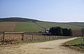
 Access road for Littlewood Park - geograph.org.uk - 2672676.jpg 1,500 × 772; 1.32 MB
-
 Access to Balquharn farm - geograph.org.uk - 887699.jpg 640 × 480; 94 KB
-
 Access to Cairncosh - geograph.org.uk - 887657.jpg 640 × 480; 69 KB
-
 Access to Galla Croft - geograph.org.uk - 887953.jpg 640 × 467; 78 KB
-
 Access to Lethenty - geograph.org.uk - 977508.jpg 640 × 454; 77 KB
-
 Access to Redhouse - geograph.org.uk - 887581.jpg 640 × 480; 66 KB
-
 Access to Whiteside - geograph.org.uk - 887634.jpg 640 × 480; 124 KB
-
 Approach to Cauldhame - geograph.org.uk - 887561.jpg 640 × 450; 65 KB
-

-
 Bales before Millhockie - geograph.org.uk - 2546872.jpg 3,456 × 2,304; 1,006 KB
-
 Balloch View - geograph.org.uk - 978673.jpg 640 × 405; 62 KB
-
 Balquharn - geograph.org.uk - 4712740.jpg 640 × 378; 294 KB
-
 Balquharn farm - geograph.org.uk - 1232084.jpg 640 × 480; 76 KB
-
 Balquharn Farm - geograph.org.uk - 887711.jpg 640 × 480; 37 KB
-
 Barn at Kirkton of Forbes - geograph.org.uk - 1742830.jpg 640 × 427; 250 KB
-
 Bithnie - geograph.org.uk - 1742912.jpg 640 × 427; 234 KB
-
 Bithnie Bridge - geograph.org.uk - 3102553.jpg 3,648 × 2,736; 1.64 MB
-
 Black Bridge - geograph.org.uk - 887631.jpg 640 × 480; 116 KB
-
 Black Bridge - geograph.org.uk - 977534.jpg 640 × 480; 141 KB
-
 Boat Pot, River Don - geograph.org.uk - 4502295.jpg 4,608 × 3,456; 3.45 MB
-
 Bogbraidy Cottage - geograph.org.uk - 1139539.jpg 640 × 421; 62 KB
-
 Boggieshalloch Farm - geograph.org.uk - 2546863.jpg 3,456 × 2,304; 998 KB
-
 Bogieshalloch farm - geograph.org.uk - 1232785.jpg 640 × 412; 64 KB
-
 Bogieshalloch farmhouse - geograph.org.uk - 1232787.jpg 640 × 480; 80 KB
-
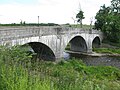
 Bridge at Bridge of Alford - geograph.org.uk - 4855599.jpg 640 × 427; 457 KB
-
 Bridge of Alford - geograph.org.uk - 4855620.jpg 640 × 427; 522 KB
-
 Bridge Of Alford in Bridge Of Alford - geograph.org.uk - 5461893.jpg 640 × 480; 101 KB
-
 Bridge over Esset Burn - geograph.org.uk - 1232145.jpg 640 × 403; 95 KB
-
 Bridge over the Esset Burn - geograph.org.uk - 887729.jpg 640 × 405; 79 KB
-
-
 Burndale cottage - geograph.org.uk - 887722.jpg 640 × 574; 84 KB
-
 Cainndaill How - geograph.org.uk - 887922.jpg 640 × 480; 75 KB
-
 Cairn on Millhockie Hill - geograph.org.uk - 1289617.jpg 640 × 427; 277 KB
-
 Cattle by Strathlunach - geograph.org.uk - 887899.jpg 640 × 480; 94 KB
-
 Clatterin Kist - geograph.org.uk - 859332.jpg 640 × 338; 38 KB
-
 Clearing in Little Wood - geograph.org.uk - 2273201.jpg 969 × 1,172; 649 KB
-
 Clystie Bogs - geograph.org.uk - 859370.jpg 640 × 401; 71 KB
-
 Coldwell - geograph.org.uk - 1289655.jpg 427 × 640; 235 KB
-
 Coldwell and Coldwells Croft - geograph.org.uk - 1289662.jpg 640 × 427; 256 KB
-
 Concrete Straining Post - geograph.org.uk - 1117371.jpg 640 × 480; 71 KB
-
 Correen Quarry - geograph.org.uk - 1172447.jpg 640 × 480; 67 KB
-
 Corrie Cairn Recumbent Stone Circle (1) - geograph.org.uk - 4712711.jpg 640 × 413; 391 KB
-
 Corrie Cairn Recumbent Stone Circle (3) - geograph.org.uk - 4712716.jpg 427 × 640; 433 KB
-
 Cottage near Denburn Lodge - geograph.org.uk - 1232793.jpg 640 × 480; 74 KB
-
 Crop at Kirkton of Forbes - geograph.org.uk - 6361716.jpg 1,600 × 1,131; 558 KB
-
 Crossroads - geograph.org.uk - 977543.jpg 640 × 480; 57 KB
-
 Culhay crossroads - geograph.org.uk - 887911.jpg 640 × 480; 69 KB
-
 Culhay Farm - geograph.org.uk - 1139518.jpg 640 × 427; 81 KB
-
 Denburn Lodge - geograph.org.uk - 1232794.jpg 640 × 480; 98 KB
-
 Down hill Millhill, Montgarrie - geograph.org.uk - 977556.jpg 640 × 466; 83 KB
-
 Down to the Howe - geograph.org.uk - 2546830.jpg 3,456 × 2,304; 1.02 MB
-
 Downstream Esset Burn - geograph.org.uk - 887725.jpg 640 × 480; 110 KB
-
 Downstream River Don - geograph.org.uk - 3102556.jpg 3,648 × 2,736; 2.13 MB
-
 Downstream River Don - geograph.org.uk - 978777.jpg 640 × 480; 90 KB
-
 Drainage work at Whiteside. - geograph.org.uk - 977530.jpg 640 × 480; 69 KB
-
 Druidsfield Standing Stones (1) - geograph.org.uk - 4712751.jpg 460 × 640; 450 KB
-
 Druidsfield Standing Stones (2) - geograph.org.uk - 4712754.jpg 640 × 614; 608 KB
-
 Druidsfield Standing Stones (3) - geograph.org.uk - 4712757.jpg 640 × 427; 502 KB
-
 Druidsfield Standing Stones (4) - geograph.org.uk - 4712758.jpg 640 × 427; 452 KB
-
 Druidsfield Standing Stones (5) - geograph.org.uk - 4712763.jpg 640 × 427; 376 KB
-
 Dunoon House from above - geograph.org.uk - 887915.jpg 640 × 480; 99 KB
-
 Dunoon House from below - geograph.org.uk - 887812.jpg 640 × 480; 75 KB
-
 Dykes - geograph.org.uk - 1289670.jpg 640 × 427; 261 KB
-
 East from Coiliochbhar Hill - geograph.org.uk - 1441674.jpg 640 × 480; 60 KB
-
 East Gate Lodge, Littlewood Park - geograph.org.uk - 6242783.jpg 1,600 × 1,131; 419 KB
-
 East Hillocks - geograph.org.uk - 1232135.jpg 640 × 480; 131 KB
-

-
 Estate road descending from Lord Arthur's Hill - geograph.org.uk - 2672624.jpg 1,500 × 941; 1.14 MB
-

-
 Fairview - geograph.org.uk - 1176289.jpg 640 × 480; 59 KB
-
 Farm building - geograph.org.uk - 887926.jpg 640 × 444; 63 KB
-
 Farmland at Balfour in the Howe of Alford - geograph.org.uk - 5872347.jpg 1,600 × 1,131; 409 KB
-
 Fencing Machine - geograph.org.uk - 4712704.jpg 427 × 640; 588 KB
-
 Fields beneath Suie Hill - geograph.org.uk - 4432068.jpg 800 × 534; 370 KB
-
 Fisherman's rest - geograph.org.uk - 978796.jpg 640 × 480; 131 KB
-
 Fishermen's steps to the River Don - geograph.org.uk - 3102569.jpg 3,648 × 2,736; 2.41 MB
-
 Forbes Arms Hotel - geograph.org.uk - 4855584.jpg 640 × 427; 365 KB
-
 Forbes Arms Hotel sign - geograph.org.uk - 888003.jpg 480 × 640; 92 KB
-
 Forbes Arms Hotel, Bridge of Alford - geograph.org.uk - 5461898.jpg 640 × 480; 88 KB
-
 Forbes Parish Kirk - geograph.org.uk - 1742877.jpg 640 × 427; 252 KB
-
 Forest edge on east side of Coiliochbhar Hill - geograph.org.uk - 2672795.jpg 1,500 × 843; 1.42 MB
-
 Forest Gateway - geograph.org.uk - 1176384.jpg 640 × 480; 87 KB
-
 Forest Road - geograph.org.uk - 2546792.jpg 3,456 × 2,304; 1.02 MB
-
 Forest Road - geograph.org.uk - 2546808.jpg 3,456 × 2,304; 1.13 MB
-
 Fouchie Shank - geograph.org.uk - 2296713.jpg 640 × 480; 90 KB
-
 Gate in field on Lethenty Hill - geograph.org.uk - 1117357.jpg 640 × 480; 90 KB
-
 Gated access to Woodside Cottage - geograph.org.uk - 887673.jpg 640 × 480; 93 KB
-
 Gated-track to Bithnie farm - geograph.org.uk - 3102564.jpg 3,648 × 2,736; 2.49 MB
-
 Gray's Croft - geograph.org.uk - 887544.jpg 640 × 480; 43 KB
-
 Greenhill shelter belt - geograph.org.uk - 977527.jpg 640 × 480; 52 KB
-
 Heading down to the Culhay road - geograph.org.uk - 887903.jpg 640 × 480; 77 KB
-
 Heather on Suie Hill - geograph.org.uk - 1232869.jpg 640 × 480; 81 KB
-
 Hidden Entrance - geograph.org.uk - 5184273.jpg 4,272 × 2,848; 4.59 MB
-
 Holms Hill - geograph.org.uk - 1289658.jpg 640 × 427; 240 KB
-
 Horses in Tullynessle and Forbes - geograph.org.uk - 1289872.jpg 640 × 445; 250 KB
-
 House at Kirkton of Forbes - geograph.org.uk - 1742838.jpg 640 × 427; 230 KB
-
 House near Old Strathlunach - geograph.org.uk - 1139529.jpg 640 × 427; 67 KB
-
 In Correen Hills - geograph.org.uk - 1172462.jpg 640 × 480; 57 KB
-
 Junction for Mucklestown - geograph.org.uk - 977512.jpg 640 × 480; 103 KB
-
 Junction with road to Upper Balfour - geograph.org.uk - 887879.jpg 640 × 480; 104 KB
-
 Kirkton of Forbes - geograph.org.uk - 1742889.jpg 640 × 427; 256 KB
-
 Kirkton of Forbes - geograph.org.uk - 1742901.jpg 640 × 401; 202 KB
-
 Knockhill - geograph.org.uk - 1289864.jpg 640 × 412; 236 KB
-
 Langlands Cottage - geograph.org.uk - 887944.jpg 640 × 440; 94 KB
-
 Larch wood, Coiliochbhar Hill - geograph.org.uk - 3410775.jpg 640 × 360; 126 KB
-
 Larch wood, Coiliochbhar Hill - geograph.org.uk - 3410782.jpg 640 × 360; 128 KB
-
 Lethenty - geograph.org.uk - 977494.jpg 640 × 480; 54 KB
-
 Lethenty Cottage - geograph.org.uk - 887587.jpg 640 × 510; 76 KB
-
 Lethenty Farm - geograph.org.uk - 887584.jpg 640 × 480; 60 KB
-
 Littlewood Park East Lodge - geograph.org.uk - 1742973.jpg 640 × 362; 229 KB
-
 Lochaber by Scotsmill - geograph.org.uk - 1527991.jpg 640 × 480; 69 KB
-
 Logging road, Knockespock Forest - geograph.org.uk - 4432061.jpg 800 × 534; 362 KB
-
 Looking towards Bithnie - geograph.org.uk - 1742853.jpg 427 × 640; 260 KB
-
 Looking towards Millhill - geograph.org.uk - 4712735.jpg 640 × 427; 328 KB
-
 Mad cats^ - geograph.org.uk - 887914.jpg 640 × 480; 96 KB
-
 Manabattock Farm - geograph.org.uk - 1139550.jpg 640 × 427; 84 KB
-
 Manabattock Farm - geograph.org.uk - 2305415.jpg 800 × 518; 106 KB
-
 Manabattock Hill - geograph.org.uk - 1139555.jpg 640 × 427; 70 KB
-
 Metal bridge over the Don at Montgarrie - geograph.org.uk - 2274741.jpg 1,024 × 741; 270 KB
-
 Mill Burn - geograph.org.uk - 1289680.jpg 427 × 640; 264 KB
-
 Millhockie Hill - geograph.org.uk - 1289594.jpg 640 × 427; 290 KB
-
 Millhockie Hill - geograph.org.uk - 1289600.jpg 640 × 427; 272 KB
-
 Millhockie Hill - geograph.org.uk - 1289611.jpg 640 × 427; 265 KB
-
 Millhockie Hill - geograph.org.uk - 1289634.jpg 640 × 427; 255 KB
-
 Montgarrie Bridge - geograph.org.uk - 4712784.jpg 640 × 427; 445 KB
-
 Montgarrie crossroads - geograph.org.uk - 977562.jpg 640 × 417; 75 KB
-
 Montgarrie from the River Don - geograph.org.uk - 4712789.jpg 640 × 427; 466 KB
-
 Moss of Terpersie (1979) - geograph.org.uk - 859357.jpg 640 × 438; 54 KB
-
 Muckle Town - geograph.org.uk - 1289646.jpg 427 × 640; 249 KB
-
 Muckletown-Knockhill junction - geograph.org.uk - 887602.jpg 640 × 418; 36 KB
-
 Nether Balfour - geograph.org.uk - 887860.jpg 640 × 480; 67 KB
-
 Nether Balfour - geograph.org.uk - 978721.jpg 640 × 480; 79 KB
-
 Nether Balfour Cottages - geograph.org.uk - 887888.jpg 640 × 480; 99 KB
-
 New Forestry Track - geograph.org.uk - 1176414.jpg 640 × 480; 89 KB
-
 New House near Millburn - geograph.org.uk - 1289693.jpg 640 × 427; 235 KB
-
 New Mill - geograph.org.uk - 887733.jpg 640 × 490; 84 KB
-
 New mown field ready for baling - geograph.org.uk - 1430103.jpg 640 × 343; 70 KB
-
 Newton of Forbes - geograph.org.uk - 887816.jpg 640 × 480; 39 KB
-
 Newton of Forbes - geograph.org.uk - 887913.jpg 640 × 480; 63 KB
-
 North Bank Croft cottages - geograph.org.uk - 887755.jpg 640 × 473; 52 KB
-
 North Bank Croft cottages - geograph.org.uk - 887937.jpg 640 × 455; 79 KB
-
 North Bank Farm steading - geograph.org.uk - 887759.jpg 640 × 398; 53 KB
-
 North Warrackston Farmhouse - geograph.org.uk - 1162933.jpg 640 × 427; 108 KB
-
 North Warrackston Mill - geograph.org.uk - 1162969.jpg 640 × 427; 101 KB
-
 Old Lethenty Croft - geograph.org.uk - 977516.jpg 425 × 640; 100 KB
-
 Old mill - geograph.org.uk - 977559.jpg 640 × 480; 142 KB
-
 Parkhead - geograph.org.uk - 887618.jpg 503 × 640; 84 KB
-
 Pond by the River Don - geograph.org.uk - 6361711.jpg 1,600 × 1,131; 424 KB
-
 Quarry Corner - geograph.org.uk - 978678.jpg 640 × 394; 58 KB
-
 Quarry on Millhockie Hill - geograph.org.uk - 1289596.jpg 640 × 427; 271 KB
-
 Quiet morning on the River Don - geograph.org.uk - 4177236.jpg 1,600 × 1,059; 360 KB
-
 Redhouse Cottage - geograph.org.uk - 887591.jpg 640 × 585; 57 KB
-
 Redhouse Farm - geograph.org.uk - 887574.jpg 640 × 480; 57 KB
-
 Remains of a Monument^ - geograph.org.uk - 4712777.jpg 427 × 640; 578 KB
-
 Remains of Burnside - geograph.org.uk - 1232780.jpg 640 × 480; 85 KB
-
 Ride, Monach - geograph.org.uk - 4432050.jpg 800 × 534; 405 KB
-
 River Bank Erosion - geograph.org.uk - 4855641.jpg 394 × 640; 482 KB
-
 River Don - geograph.org.uk - 4855634.jpg 640 × 427; 436 KB
-
 River Don at Glenlogie - geograph.org.uk - 6242791.jpg 1,600 × 1,131; 583 KB
-
 River Don at Kirkton of Forbes - geograph.org.uk - 1742843.jpg 427 × 640; 255 KB
-
 River Don at Kirkton of Forbes - geograph.org.uk - 3432971.jpg 800 × 569; 200 KB
-
 River Don at Nether Balfour - geograph.org.uk - 6361720.jpg 1,600 × 1,131; 471 KB
-
 River Don at Slaskie Pot - geograph.org.uk - 3432975.jpg 1,024 × 734; 229 KB
-
 Riverine fields - geograph.org.uk - 977573.jpg 640 × 480; 62 KB
-
 Road from Culhay - geograph.org.uk - 887907.jpg 640 × 480; 76 KB
-
 Road from Scotsmill to Balquharn - geograph.org.uk - 887717.jpg 640 × 441; 73 KB
-
 Road from Upper Balfour - geograph.org.uk - 887868.jpg 640 × 500; 97 KB
-
 Road to A944 - geograph.org.uk - 887882.jpg 640 × 480; 63 KB
-
 Road to Culhay - geograph.org.uk - 887905.jpg 480 × 640; 79 KB
-
 Road to Culhay - geograph.org.uk - 978703.jpg 640 × 480; 64 KB
-
 Road to Montgarrie - geograph.org.uk - 887650.jpg 640 × 480; 74 KB
-
 Road to Montgarrie - geograph.org.uk - 977539.jpg 640 × 486; 70 KB
-
 Road up Suie Hill - geograph.org.uk - 887748.jpg 640 × 512; 63 KB
-
 Road up to North Bank Farm - geograph.org.uk - 887769.jpg 640 × 443; 55 KB
-
 Road westward from Redhouse - geograph.org.uk - 887571.jpg 640 × 523; 38 KB
-
 Roadside - geograph.org.uk - 1232782.jpg 640 × 480; 95 KB
-
 Roadworks on A944 - geograph.org.uk - 1522684.jpg 640 × 428; 49 KB
-
 Round Moss in Knockespock Forest - geograph.org.uk - 1139640.jpg 640 × 427; 91 KB
-
 Ruined building in field south of Bithnie - geograph.org.uk - 2672741.jpg 1,500 × 738; 1.28 MB
-
 Scattered larch on Lord Arthur's Hill - geograph.org.uk - 4809736.jpg 1,024 × 751; 144 KB
-
 Scotsmill - geograph.org.uk - 1232053.jpg 640 × 447; 66 KB
-
 Scotsmill - geograph.org.uk - 887750.jpg 640 × 480; 69 KB
-
 Scotsmill junction for Balquharn - geograph.org.uk - 887745.jpg 640 × 462; 88 KB
-
 Scotsmill steadings - geograph.org.uk - 887740.jpg 640 × 480; 59 KB
-
 Sign for Newton of Forbes - geograph.org.uk - 887813.jpg 640 × 480; 91 KB
-
 Signpost at a crossroads - geograph.org.uk - 887640.jpg 640 × 480; 117 KB
-
 Site of former Syllavethy quarry. - geograph.org.uk - 887992.jpg 640 × 479; 50 KB
-
 Snap^ - geograph.org.uk - 1232777.jpg 640 × 472; 98 KB
-

-
 Snowdrops (Galanthus nivalis) - geograph.org.uk - 4855627.jpg 640 × 427; 459 KB
-
 Snowdrops (Galanthus nivalis) - geograph.org.uk - 4855649.jpg 640 × 427; 443 KB
-
 South Lodge, Littlewood Park (1978) - geograph.org.uk - 856275.jpg 490 × 640; 105 KB
-
 Strathlunach - geograph.org.uk - 887892.jpg 640 × 480; 88 KB
-
 Strathlunach - geograph.org.uk - 887896.jpg 640 × 480; 84 KB
-
 Strathlunach junction - geograph.org.uk - 887960.jpg 640 × 496; 58 KB
-
 Strathlunach Wood - geograph.org.uk - 5872362.jpg 1,600 × 1,131; 424 KB


_-_geograph.org.uk_-_4712711.jpg)
_-_geograph.org.uk_-_4712716.jpg)


_-_geograph.org.uk_-_4712751.jpg)
_-_geograph.org.uk_-_4712754.jpg)
_-_geograph.org.uk_-_4712757.jpg)
_-_geograph.org.uk_-_4712758.jpg)
_-_geograph.org.uk_-_4712763.jpg)


_-_geograph.org.uk_-_859357.jpg)


_-_geograph.org.uk_-_4855627.jpg)
_-_geograph.org.uk_-_4855649.jpg)
_-_geograph.org.uk_-_856275.jpg)


