Category:Tunnels in England
Jump to navigation
Jump to search
Wikimedia category | |||||
| Upload media | |||||
| Instance of | |||||
|---|---|---|---|---|---|
| Category combines topics | |||||
| England | |||||
country in north-west Europe, part of the United Kingdom  someja satełitar in avril      | |||||
| Spoken text audio | |||||
| Pronunciation audio | |||||
| Instance of | |||||
| Name in native language |
| ||||
| Named after | |||||
| Patron saint | |||||
| Location |
| ||||
| Capital | |||||
| Basic form of government |
| ||||
| Official language | |||||
| Anthem |
| ||||
| Currency | |||||
| Head of state |
| ||||
| Head of government |
| ||||
| Highest point | |||||
| Population |
| ||||
| Area |
| ||||
| Replaces |
| ||||
| Different from | |||||
| official website | |||||
 | |||||
Subcategories
This category has the following 9 subcategories, out of 9 total.
Media in category "Tunnels in England"
The following 109 files are in this category, out of 109 total.
-
 Barrel Arch near Chorleywood - geograph.org.uk - 123842.jpg 640 × 480; 340 KB
-
 Bath Spa railway station MMB 21.jpg 2,208 × 1,452; 739 KB
-
 Bath Spa railway station MMB 21C.jpg 1,872 × 1,269; 554 KB
-
 Bay Horse Yard, Skipton - geograph.org.uk - 540287.jpg 640 × 480; 194 KB
-
 Blackwall, East India Dock Tunnel - geograph.org.uk - 790641.jpg 640 × 480; 68 KB
-
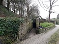
 Brick tunnel leading to Head Dike - geograph.org.uk - 492044.jpg 640 × 480; 140 KB
-
 Bristol MMB «D1 Avon Gorge.jpg 2,400 × 1,600; 2.37 MB
-
 Brook running under Lumb Carr Road - geograph.org.uk - 418044.jpg 640 × 480; 196 KB
-
 Canal tunnel under the B6013 - geograph.org.uk - 1231564.jpg 640 × 479; 179 KB
-
 Chee Tor Tunnels 2 ^ 1 - geograph.org.uk - 2829568.jpg 2,608 × 1,952; 1.63 MB
-
 Completed escalators (5963651750).jpg 300 × 222; 28 KB
-
 Dover Castle entrance to secret tunnels-11782283573.jpg 4,896 × 3,672; 3.14 MB
-

-
 Eastern end of the Severn Tunnel - geograph.org.uk - 573247.jpg 640 × 480; 93 KB
-
 Entrance tunnel to Samphire Hoe - panoramio.jpg 1,444 × 2,048; 1.03 MB
-
-
 Flood tunnel under the A404 - geograph.org.uk - 958234.jpg 640 × 480; 67 KB
-
 FlyUnder - geograph.org.uk - 33950.jpg 640 × 480; 58 KB
-
 Footpath under Railway - geograph.org.uk - 367634.jpg 640 × 480; 82 KB
-
 Footpath under railway - geograph.org.uk - 367637.jpg 480 × 640; 53 KB
-
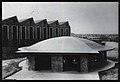
 Fort Southwick 1.jpg 1,200 × 800; 830 KB
-
 Fort Southwick 7.jpg 1,200 × 800; 1,016 KB
-
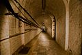 Fort Southwick WW2 Tunnels 1.jpg 1,024 × 683; 102 KB
-
 Fort Southwick WW2 Tunnels 6.jpg 1,024 × 683; 135 KB
-
 Gatwick Airport - geograph.org.uk - 179498.jpg 640 × 431; 95 KB
-
 Henbury Church Tunnel.jpg 2,448 × 3,696; 2.16 MB
-

-
 Jarrow side, entrance building completed (5963651386).jpg 300 × 205; 22 KB
-
 Jarrow site, tunnel entrance (5963650964).jpg 300 × 359; 39 KB
-
 Lichfield City Station - tunnel inside (6668727215).jpg 3,648 × 2,736; 2.46 MB
-

-
 Masonry detail of Bournes tunnel mouth (geograph 2006503).jpg 1,600 × 1,198; 736 KB
-
 Newbold-The Black Path - geograph.org.uk - 554388.jpg 640 × 480; 139 KB
-
 Niton Tunnels 01.jpg 4,128 × 3,096; 7.93 MB
-
 Niton Tunnels 02.jpg 3,096 × 4,128; 5.73 MB
-
 Niton Tunnels 03.jpg 3,096 × 4,128; 3.1 MB
-
 Niton Tunnels 04.jpg 3,096 × 4,128; 4.17 MB
-
 Niton Tunnels 05.jpg 4,128 × 3,096; 6.08 MB
-
 Niton Tunnels 06.jpg 3,096 × 4,128; 5.22 MB
-
 Niton Tunnels 07.jpg 3,096 × 4,128; 5.87 MB
-
 Niton Tunnels 08.jpg 4,128 × 3,096; 7.44 MB
-
 Niton Tunnels 09.jpg 4,128 × 3,096; 7.85 MB
-
 Niton Tunnels 10.jpg 4,128 × 3,096; 5.19 MB
-
 Pedestrian Tunnel, Cosgrove - geograph.org.uk - 531245.jpg 429 × 640; 84 KB
-
 Porthgwarra tunnel cornwall 01.jpg 1,408 × 2,816; 663 KB
-

-
 Selling Tunnel - geograph.org.uk - 534774.jpg 479 × 640; 124 KB
-
 Subway, Great Cambridge Road - geograph.org.uk - 3221969.jpg 640 × 480; 87 KB
-
 Tarka Trail, Landcross tunnel - geograph.org.uk - 71368.jpg 640 × 480; 140 KB
-
 The Needles, tunnel to the searchlight - geograph.org.uk - 1219946.jpg 467 × 622; 108 KB
-
 Tunnel Entrance at the West End of Parkland Walk (02).jpg 4,404 × 3,294; 10.36 MB
-
 Tunnel Entrance, University of Greenwich - geograph.org.uk - 587092.jpg 640 × 480; 122 KB
-

-
 Tunnel under Canal at Kildwick - geograph.org.uk - 682127.jpg 640 × 480; 110 KB
-
 Tunnel under ELR - geograph.org.uk - 378269.jpg 640 × 480; 159 KB
-
 Tunnel under M66 - geograph.org.uk - 1752052.jpg 2,816 × 2,112; 1.77 MB
-

-
 Tunnels at Skipton Wood.jpg 500 × 375; 63 KB
-
 Ventnor Botanic Garden underground tunnel.JPG 4,592 × 3,056; 7.5 MB
-
 Walking the dog, by bike. (43455069744).jpg 6,016 × 4,016; 21.97 MB
-
 Wartime Tunnels at Dover Castle-8447127500.jpg 2,448 × 1,836; 191 KB
-
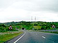
 A1 - M1 Link Motorway access tunnel - geograph.org.uk - 566252.jpg 640 × 421; 107 KB
-
-
 Boring job - geograph.org.uk - 81846.jpg 640 × 431; 101 KB
-
 Braunston-Disused Railway - geograph.org.uk - 702420.jpg 640 × 480; 111 KB
-
 Brea Tunnel - geograph.org.uk - 357108.jpg 640 × 427; 110 KB
-
 Crossing the Road - geograph.org.uk - 297146.jpg 640 × 480; 78 KB
-
 Cycle Track Tunnel - geograph.org.uk - 463134.jpg 476 × 640; 102 KB
-
 Cycleway tunnel under A14 - geograph.org.uk - 479549.jpg 640 × 480; 131 KB
-
 Davis Bridge, Billingham Beck - geograph.org.uk - 86006.jpg 640 × 480; 86 KB
-
 Dunford Bridge - geograph.org.uk - 34367.jpg 640 × 480; 98 KB
-

-
 Foot tunnel beneath railway embankment - geograph.org.uk - 96972.jpg 640 × 480; 108 KB
-
 Foot tunnel, Lake Wood, Uckfield - geograph.org.uk - 467041.jpg 640 × 428; 170 KB
-

-

-
 Footpath tunnel - geograph.org.uk - 244659.jpg 480 × 640; 163 KB
-

-
 Footway tunnel under the A12 - geograph.org.uk - 380980.jpg 640 × 480; 94 KB
-
 Forgotten tunnel - geograph.org.uk - 563743.jpg 640 × 480; 91 KB
-
 Going under the M4 - geograph.org.uk - 255784.jpg 640 × 480; 79 KB
-
 Inside the footpath tunnel - geograph.org.uk - 436440.jpg 640 × 480; 125 KB
-
 Inside the old tunnel - geograph.org.uk - 694299.jpg 640 × 480; 75 KB
-
 Light at the end of the tunnel - geograph.org.uk - 155277.jpg 640 × 480; 394 KB
-
 Manchester Airport Tunnel - geograph.org.uk - 58305.jpg 640 × 480; 59 KB
-
 Mersey Valley Trail tunnels - geograph.org.uk - 311842.jpg 640 × 480; 242 KB
-
 North end of road tunnel on A3066 - geograph.org.uk - 94110.jpg 640 × 480; 258 KB
-
 NW end of footpath tunnel, Northowram - geograph.org.uk - 589650.jpg 475 × 640; 129 KB
-
 Old Tunnel Wharncliffe Woods - geograph.org.uk - 373763.jpg 640 × 480; 152 KB
-
 Rugby - Mill Road - geograph.org.uk - 184682.jpg 640 × 480; 101 KB
-
 Sandstone tunnels - geograph.org.uk - 385672.jpg 640 × 480; 71 KB
-
 Secret Tunnel - geograph.org.uk - 173760.jpg 480 × 640; 166 KB
-

-
 Thrimby Cottages Underpass. - geograph.org.uk - 88864.jpg 640 × 480; 98 KB
-
 Tramway Tunnel - geograph.org.uk - 285993.jpg 640 × 480; 100 KB
-
 Tunnel - geograph.org.uk - 381030.jpg 480 × 640; 122 KB
-
 Tunnel End - geograph.org.uk - 123768.jpg 640 × 480; 129 KB
-
 Tunnel or bridge^ - geograph.org.uk - 685545.jpg 640 × 477; 81 KB
-
 Tunnel Top - geograph.org.uk - 123770.jpg 640 × 480; 121 KB
-
 Tunnel under railway at Steventon - geograph.org.uk - 234508.jpg 640 × 480; 390 KB
-

-

-
 Tunnel under the M4 near Boxford - geograph.org.uk - 74118.jpg 640 × 480; 138 KB
-
 Tunnel Vision near Wyfield Manor - geograph.org.uk - 74122.jpg 640 × 480; 57 KB
-
 Under Southwick Hill (Westbound) - geograph.org.uk - 179566.jpg 640 × 479; 42 KB
-
 Under Southwick Hill - geograph.org.uk - 179558.jpg 640 × 479; 47 KB
-

-
 Water Course bypass Tunnel - geograph.org.uk - 374338.jpg 640 × 480; 96 KB
-
 Water Course Tunnel Outlet - geograph.org.uk - 374038.jpg 640 × 480; 155 KB


.jpg)


.jpg)
.jpg)
.jpg)

.jpg)


.jpg)


.jpg)


_-_geograph.org.uk_-_179566.jpg)


