Category:Turkestan Range
Zur Navigation springen
Zur Suche springen
Gebirgszug  | |||||
| Medium hochladen | |||||
| Ist ein(e) | |||||
|---|---|---|---|---|---|
| Material | |||||
| Ort |
| ||||
| Länge |
| ||||
| Gebirgszug | |||||
| Höchster Punkt |
| ||||
| Höhe über dem Meeresspiegel |
| ||||
 | |||||
Medien in der Kategorie „Turkestan Range“
Folgende 16 Dateien sind in dieser Kategorie, von 16 insgesamt.
-
 Fields of Isfana.JPG 3.648 × 2.736; 1,1 MB
-
 General view, Leilek.JPG 4.320 × 3.240; 3,21 MB
-
 Karavshin.jpg 2.826 × 1.884; 3,48 MB
-
 Man riding a donkey along Qaragʻati Creek.jpg 3.648 × 2.736; 2,15 MB
-
 Mountains located South of Isfana.JPG 3.648 × 2.736; 2,49 MB
-
 Qarag'ati.jpg 3.648 × 2.736; 1,67 MB
-
 Qaragʻati Creek.jpg 3.000 × 4.000; 5,53 MB
-
 Tegirmonlik Creek.jpg 3.672 × 2.065; 2,26 MB
-
 Tergirmonlik Intake Point.jpg 3.920 × 2.204; 3,35 MB
-
 The Ak-Bulak sign.JPG 4.320 × 3.240; 3,56 MB
-
 The Golbo sign.JPG 4.320 × 3.240; 3,46 MB
-
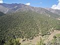
 Turkestan mountains near Deynoo.JPG 3.648 × 2.736; 1,9 MB
-
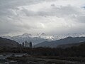
 Turkestan mountains near Kara-Suu.JPG 4.320 × 3.240; 3,17 MB
-
 Turkestan mountains near Leilek.JPG 4.320 × 3.240; 2,76 MB
-
 Turkestan mountains near Ozgurush.jpg 3.648 × 2.736; 2,18 MB
-
 Turkestan mountains, Chuyanchy.JPG 4.320 × 3.240; 2,51 MB


