Category:Turkestan Range
Jump to navigation
Jump to search
mountain range  | |||||
| Upload media | |||||
| Instance of | |||||
|---|---|---|---|---|---|
| Made from material | |||||
| Location |
| ||||
| Length |
| ||||
| Mountain range | |||||
| Highest point |
| ||||
| Elevation above sea level |
| ||||
 | |||||
Media in category "Turkestan Range"
The following 16 files are in this category, out of 16 total.
-
 Fields of Isfana.JPG 3,648 × 2,736; 1.1 MB
-
 General view, Leilek.JPG 4,320 × 3,240; 3.21 MB
-
 Karavshin.jpg 2,826 × 1,884; 3.48 MB
-
 Man riding a donkey along Qaragʻati Creek.jpg 3,648 × 2,736; 2.15 MB
-
 Mountains located South of Isfana.JPG 3,648 × 2,736; 2.49 MB
-
 Qarag'ati.jpg 3,648 × 2,736; 1.67 MB
-
 Qaragʻati Creek.jpg 3,000 × 4,000; 5.53 MB
-
 Tegirmonlik Creek.jpg 3,672 × 2,065; 2.26 MB
-
 Tergirmonlik Intake Point.jpg 3,920 × 2,204; 3.35 MB
-
 The Ak-Bulak sign.JPG 4,320 × 3,240; 3.56 MB
-
 The Golbo sign.JPG 4,320 × 3,240; 3.46 MB
-
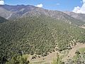
 Turkestan mountains near Deynoo.JPG 3,648 × 2,736; 1.9 MB
-
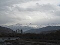
 Turkestan mountains near Kara-Suu.JPG 4,320 × 3,240; 3.17 MB
-
 Turkestan mountains near Leilek.JPG 4,320 × 3,240; 2.76 MB
-
 Turkestan mountains near Ozgurush.jpg 3,648 × 2,736; 2.18 MB
-
 Turkestan mountains, Chuyanchy.JPG 4,320 × 3,240; 2.51 MB


