Category:Twyford and Thorpe
Jump to navigation
Jump to search
civil parish in Leicestershire, UK  | |||||
| Upload media | |||||
| Instance of | |||||
|---|---|---|---|---|---|
| Location | Melton, Leicestershire, East Midlands, England | ||||
 | |||||
Cebuano: Twyford and Thorpe maoy parokya sa Hiniusang Gingharian. Ang Twyford and Thorpe nahimutang sa kondado sa Leicestershire ug apil sa nasod sa Inglatera, sa habagatan-sidlakang bahin sa nasod, km sa amihanan sa ulohang dakbayan London. (→Twyford and Thorpe)
English: Twyford and Thorpe is a civil parish in Leicestershire, England, comprising the villages of Twyford and Thorpe Satchville, and the hamlet of John O' Gaunt. The parish, which is in the Melton district, has a population of 612 at the time of the 2001 census, increasing to 628 at the 2011 census. (→Twyford and Thorpe)
Nederlands: Twyford and Thorpe is een plaats en civil parish in het bestuurlijke gebied Melton, in het Engelse graafschap Leicestershire. (→Twyford and Thorpe)
Svenska: Twyford and Thorpe är en parish i Storbritannien. Den ligger i grevskapet Leicestershire och riksdelen England, i den sydöstra delen av landet, km norr om huvudstaden London. (→Twyford and Thorpe)

Subcategories
This category has the following 3 subcategories, out of 3 total.
J
T
Media in category "Twyford and Thorpe"
The following 126 files are in this category, out of 126 total.
-
 'Public Access Route' on Salters Hill - geograph.org.uk - 5646899.jpg 3,776 × 2,520; 3.77 MB
-

-
 Ashby Road entering Twyford - geograph.org.uk - 6205949.jpg 3,776 × 2,520; 3.28 MB
-
 Ashby Road-Gated Road junction - geograph.org.uk - 2995572.jpg 2,206 × 2,219; 1.77 MB
-
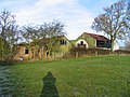 Assortment of farm buildings - geograph.org.uk - 1122326.jpg 640 × 480; 109 KB
-
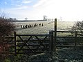 Attentive sheep - geograph.org.uk - 1122332.jpg 640 × 480; 82 KB
-
 B6047 Heading South Towards Market Harborough - geograph.org.uk - 2951494.jpg 2,560 × 1,920; 1.74 MB
-
 Bakers Lane - geograph.org.uk - 2132493.jpg 640 × 524; 125 KB
-
 Bakers Lane at Littlethorpe Farm - geograph.org.uk - 4299570.jpg 1,600 × 1,125; 602 KB
-
 Bridge across a dismantled railway - geograph.org.uk - 2995946.jpg 3,264 × 2,448; 3.95 MB
-
 Bridge on access road to sewage works - geograph.org.uk - 1122341.jpg 640 × 480; 159 KB
-
 Bridge on Burrough Road, Twyford - geograph.org.uk - 5273410.jpg 1,280 × 896; 499 KB
-
 Bums to the wind chaps^ - geograph.org.uk - 2132494.jpg 640 × 428; 70 KB
-
 Burrough Road heading towards Twyford - geograph.org.uk - 4296304.jpg 1,600 × 1,236; 491 KB
-
 Church of St Andrew, Twyford - geograph.org.uk - 6205957.jpg 3,776 × 2,520; 3.17 MB
-
 Corner of a field - geograph.org.uk - 1122328.jpg 640 × 480; 89 KB
-
-
 Driveway to Markham House - geograph.org.uk - 2995580.jpg 3,264 × 2,448; 3 MB
-
 Electricity pylons - geograph.org.uk - 2995336.jpg 1,112 × 1,755; 838 KB
-
 Electricity pylons and crops - geograph.org.uk - 2995298.jpg 1,898 × 1,404; 1.14 MB
-
 Farm buildings at John O' Gaunt - geograph.org.uk - 3298591.jpg 2,894 × 2,145; 911 KB
-
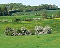 Farmland near Thorpe Satchville - geograph.org.uk - 2995659.jpg 2,036 × 1,624; 1.36 MB
-
 Farmland near Thorpe Satchville - geograph.org.uk - 2995685.jpg 2,255 × 1,770; 1.89 MB
-
 Farmland near Twyford - geograph.org.uk - 2991536.jpg 3,264 × 2,448; 3.93 MB
-
 Farmland near Twyford - geograph.org.uk - 2991538.jpg 2,571 × 1,991; 2.08 MB
-
 Farmland near Twyford - geograph.org.uk - 2991552.jpg 3,264 × 2,448; 3.03 MB
-
 Farmyard at Ivy House Farm, Twyford - geograph.org.uk - 5273424.jpg 1,280 × 861; 257 KB
-
 Field entrance off Klondyke Lane - geograph.org.uk - 6458584.jpg 640 × 464; 72 KB
-

-
 Fields by Gaddesby Brook - geograph.org.uk - 2044578.jpg 640 × 480; 84 KB
-
 Fields by Valley Farm - geograph.org.uk - 2044577.jpg 640 × 480; 74 KB
-
 Footpath on Salter's Hill - geograph.org.uk - 1054059.jpg 640 × 480; 99 KB
-

-

-
 Former railway goods waggon - geograph.org.uk - 5555367.jpg 640 × 482; 100 KB
-
 Former railway goods waggon - geograph.org.uk - 5555368.jpg 640 × 441; 94 KB
-
 Frosty fields - geograph.org.uk - 1122327.jpg 640 × 480; 88 KB
-
 Gaddesby Brook - geograph.org.uk - 4462628.jpg 1,755 × 1,198; 203 KB
-
 Gate along Klondyke Lane - geograph.org.uk - 4299561.jpg 1,600 × 1,176; 602 KB
-
 Gate and markers on the Midshires Way - geograph.org.uk - 5555373.jpg 640 × 496; 123 KB
-
 Gate to Thorpe Satville - geograph.org.uk - 1054053.jpg 640 × 480; 124 KB
-
 Gated Road in Thorpe Satchville - geograph.org.uk - 2995692.jpg 1,657 × 1,660; 1,001 KB
-
 Gated road passes White Lodge - geograph.org.uk - 2995646.jpg 2,384 × 1,544; 1.66 MB
-
 Gated Road to Thorpe Satchville - geograph.org.uk - 2995590.jpg 2,418 × 2,420; 2.71 MB
-
 Gated Road to Thorpe Satchville - geograph.org.uk - 2995601.jpg 3,264 × 2,448; 3.05 MB
-
 Gated Road to Thorpe Satchville - geograph.org.uk - 2995673.jpg 3,264 × 2,448; 3.98 MB
-
 Gates - geograph.org.uk - 1122330.jpg 640 × 426; 98 KB
-
 Gates into a snowy field - geograph.org.uk - 5018228.jpg 640 × 427; 69 KB
-

-

-

-
 Gateway to fields in the snow - geograph.org.uk - 5018222.jpg 640 × 452; 84 KB
-
 Grazing sheep and wind turbine - geograph.org.uk - 4451436.jpg 4,320 × 3,240; 4.17 MB
-
 Heading south on Twyford Road - geograph.org.uk - 2995701.jpg 2,600 × 2,207; 2.25 MB
-
 Hedge and stream - geograph.org.uk - 1122329.jpg 640 × 480; 126 KB
-

-
 Highfield Farm near John O' Gaunt - geograph.org.uk - 3298594.jpg 3,259 × 2,610; 1.44 MB
-
 Hollands Lane leading off Church Lane, Twyford - geograph.org.uk - 6205972.jpg 3,776 × 2,520; 3.12 MB
-
 Horses grazing near Twyford - geograph.org.uk - 2991551.jpg 3,264 × 2,448; 3.21 MB
-
 House at road junction - geograph.org.uk - 4931641.jpg 640 × 488; 86 KB
-
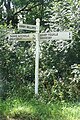
 John O'Gaunt this way - geograph.org.uk - 2044580.jpg 640 × 410; 73 KB
-
 Jubilee bunting on Main Street - geograph.org.uk - 2995717.jpg 3,264 × 2,448; 3.98 MB
-
 Klondyke Lane - geograph.org.uk - 2132481.jpg 640 × 506; 118 KB
-

-

-
 Klondyke Lane crossing the B6047 - geograph.org.uk - 6363529.jpg 3,776 × 2,520; 1.56 MB
-
 Klondyke Lane junction - geograph.org.uk - 2995732.jpg 2,285 × 2,036; 2.44 MB
-

-
 Klondyke Lane towards Park Farm - geograph.org.uk - 2995937.jpg 3,264 × 2,448; 3.69 MB
-

-
-

-

-

-

-
 Leicestershire village scene - geograph.org.uk - 5273430.jpg 1,280 × 837; 199 KB
-
 Lewin's Bridge, Twyford - geograph.org.uk - 5273442.jpg 1,280 × 960; 513 KB
-
 Looking down Station Hill in the direction of Twyford - geograph.org.uk - 6205977.jpg 3,776 × 2,520; 3.19 MB
-
 Main Street in Thorpe Satchville - geograph.org.uk - 4299583.jpg 1,600 × 1,154; 671 KB
-
 Midshires Way heading to Freezeland Lodge - geograph.org.uk - 2991568.jpg 2,361 × 1,730; 1.66 MB
-
 North along the Midshires Way - geograph.org.uk - 2991554.jpg 2,139 × 1,527; 1.5 MB
-
 Old railway cutting - geograph.org.uk - 2995956.jpg 2,007 × 2,287; 1.93 MB
-
 Old Railway cutting - geograph.org.uk - 3349592.jpg 640 × 427; 52 KB
-
 Old Railway cutting in August 2010 - geograph.org.uk - 2000476.jpg 640 × 427; 85 KB
-
 Old Railway Cutting in October 2010 - geograph.org.uk - 2132482.jpg 640 × 428; 65 KB
-
 Old Railway cutting northwards - geograph.org.uk - 3349593.jpg 640 × 472; 52 KB
-
 Over the parapet towards Twyford - geograph.org.uk - 3168558.jpg 1,024 × 748; 924 KB
-
 Over the valley to John O'Gaunt - geograph.org.uk - 3168732.jpg 1,024 × 768; 992 KB
-

-
 Path around Thorpe Satchville - geograph.org.uk - 5236971.jpg 640 × 480; 78 KB
-
 Path around Thorpe Satchville - geograph.org.uk - 5236984.jpg 640 × 480; 98 KB
-
 Path around Thorpe Satchville - geograph.org.uk - 5236987.jpg 480 × 640; 129 KB
-
 Postbox along the Main Street - geograph.org.uk - 2995709.jpg 3,264 × 2,448; 3.62 MB
-
 Postbox on Station Hill - geograph.org.uk - 4296335.jpg 1,600 × 1,168; 650 KB
-
 Road to Grange Farm - geograph.org.uk - 5236986.jpg 640 × 480; 83 KB
-
 Sewage Works - geograph.org.uk - 1122331.jpg 640 × 435; 97 KB
-
 Sheep in Home Field South - geograph.org.uk - 2995354.jpg 1,524 × 1,213; 897 KB
-
 Sheep near a bridge - geograph.org.uk - 2995636.jpg 2,366 × 1,844; 1.55 MB
-
 Sheep near Klondyke Lane - geograph.org.uk - 2995748.jpg 2,919 × 2,353; 2.82 MB
-
 The Midshires Way north of Freezeland Farm - geograph.org.uk - 6210165.jpg 3,776 × 2,520; 3.09 MB
-
 Thimble Hall Road (the B6047) downhill to Twyford - geograph.org.uk - 6208305.jpg 3,776 × 2,520; 3.13 MB
-
 Thimble Hall Road near Twyford - geograph.org.uk - 4159767.jpg 640 × 517; 226 KB
-
 Thimble Hall Road towards Twyford - geograph.org.uk - 3404618.jpg 640 × 456; 46 KB
-
 Thorpe Satchville Road entering Twyford - geograph.org.uk - 6205953.jpg 3,776 × 2,520; 3.83 MB
-
 Thorpe Satchville Road in the snow - geograph.org.uk - 5018223.jpg 640 × 474; 98 KB
-

-
 Three heads - geograph.org.uk - 5273421.jpg 1,280 × 1,280; 518 KB
-
 Towards Gaddesby - geograph.org.uk - 2000477.jpg 640 × 434; 90 KB
-
 Towards Grange Farm - geograph.org.uk - 5236963.jpg 640 × 480; 78 KB
-

-

-
 Track - geograph.org.uk - 2044579.jpg 640 × 480; 113 KB
-
 Track leading to Freezeland Farm - geograph.org.uk - 6210161.jpg 3,776 × 2,520; 3.13 MB
-
 Track on Salter's Hill - geograph.org.uk - 1054060.jpg 640 × 480; 140 KB
-
 Track passing Freezeland Farm - geograph.org.uk - 5555369.jpg 640 × 438; 114 KB
-
 Track past Freezeland Farm northwards - geograph.org.uk - 5555370.jpg 640 × 503; 126 KB
-
 Track to Freezeland Lodge - geograph.org.uk - 2991543.jpg 3,264 × 2,448; 3.69 MB
-
 Track to Freezeland Lodge - geograph.org.uk - 2991546.jpg 3,264 × 2,448; 3.04 MB
-
 Track to sewage works - geograph.org.uk - 1122344.jpg 640 × 480; 99 KB
-
 Turbine at Hall Farm - geograph.org.uk - 5236988.jpg 480 × 640; 76 KB
-
 Twyford Lodge and farmland - geograph.org.uk - 2992950.jpg 2,418 × 2,689; 2.93 MB
-
 Twyford Road towards Thorpe Satchville - geograph.org.uk - 1122343.jpg 640 × 480; 113 KB
-
 Twyford this way - geograph.org.uk - 2044581.jpg 640 × 548; 117 KB
-
 View from old railway embankment - geograph.org.uk - 1122345.jpg 640 × 480; 122 KB
-
 White Lodge near Thorpe Satchville - geograph.org.uk - 2995621.jpg 2,941 × 2,006; 2.56 MB
-
 White Lodge west of Thorpe Satchville - geograph.org.uk - 4299602.jpg 1,600 × 1,146; 407 KB


_downhill_to_Twyford_-_geograph.org.uk_-_6208305.jpg)


