Category:U.S. Route 26 in Nebraska
Jump to navigation
Jump to search
section of U.S. Numberd Highway in Nebraska, United States   _map.svg) | |||||
| Upload media | |||||
| Instance of | |||||
|---|---|---|---|---|---|
| Part of | |||||
| Location | Nebraska | ||||
| Transport network |
| ||||
| Owned by | |||||
| Maintained by | |||||
| Length |
| ||||
 | |||||
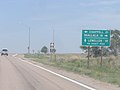
English: Media related to U.S. Route 26 in Nebraska (US 26), a 150.79-mile (242.67 km) section of U.S. Numbered Highway in Nebraska, United States, that connects US 26 in Wyoming with Interstate 80 and Nebraska Highway 61 in Ogallala.
Subcategories
This category has only the following subcategory.
Media in category "U.S. Route 26 in Nebraska"
The following 9 files are in this category, out of 9 total.
-
 Lewellen P6060584.jpg 3,072 × 2,304; 1.07 MB
-
 Scotts Bluff County Road Map.png 2,794 × 1,552; 230 KB
-
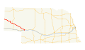 US 26 (NE) map.svg 1,180 × 688; 267 KB
-
 US 26 n RR westbound P7170190.jpg 3,072 × 2,304; 4.84 MB
-
 US 26 Nebraska 1926.svg 1,485 × 1,440; 31 KB
-
 US 26 Nebraska 1963.svg 600 × 600; 17 KB
-
 US 26N Nebraska 1926.svg 1,485 × 1,440; 33 KB
-
 US 26N Nebraska 1948.svg 1,485 × 1,440; 35 KB
-
 Windlass Hill view from summit facing NE.JPG 2,560 × 1,721; 1.72 MB


