Category:U.S. Route 50 Alternate (Nevada)
Jump to navigation
Jump to search
alternate U.S. Numbered Highway in Lyon and Churchill counties in Nevada, United States   _map.svg) | |||||
| Upload media | |||||
| Instance of | |||||
|---|---|---|---|---|---|
| Location |
| ||||
| Transport network | |||||
| Owned by | |||||
| Maintained by | |||||
| Start time |
| ||||
| Length |
| ||||
| Terminus | |||||
| Different from | |||||
 | |||||
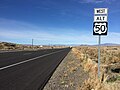
English: Media related to U.S. Route 50 Alternate (Nevada), a 32.371-mile (52.096 km) section of U.S. Numberee Highway alternate route in Lyon and Churchill counties in Nevada, United States, that connects U.S. Route 50 (US 50) and U.S. Route 95 Alternate (US 95 Alt.) in Silver Springs with US 50 (west–northwest of Fallon). The approximate western half of the highway runs connurent with US 95 Alt.
Subcategories
This category has only the following subcategory.
Media in category "U.S. Route 50 Alternate (Nevada)"
The following 8 files are in this category, out of 8 total.
-

-

-
-

-
 Interstate 80, Fernley, Nevada (700872893).jpg 1,280 × 960; 87 KB
-
 Silver Springs, Nevada from North.JPG 3,872 × 2,592; 1.64 MB
-
 US 50 Alt (NV) map.svg 1,475 × 860; 122 KB
-
 US 50 Alt.svg 744 × 1,121; 9 KB
_along_eastbound_Interstate_80_in_Fernley,_Nevada.jpg)
_in_Fernley,_Nevada.jpg)


.jpg)