Category:UB Basel Maps
Jump to navigation
Jump to search
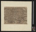
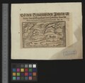
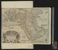
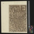
The Basel University Library has - in collaboration with the WiR Micha Rieser - completed the upload of a total of 557 digitized maps, ranging from the 16th until the end of the 18th century and available as .tif files. Most of the uploaded maps are still uncategorized - we would greatly appreciate your help with categorizing them.
Some highlights:
- The oldest available city-map of Paris, created by Olivier Truschet and Germain Hoyau around the year 1550
- The world-map of 1569 by Gerardus Mercator
- The oldest map of the canton Valais (1545), by Sebastian Münster
- The Swiss map (1560) by Aegidius Tschudi
- The oldest known print of the map of the Zürich area by Jos Murer, dated 1568
- The Basel map by Matthäus Merian, 1615 - which got its own exhibition 2015/2016
See also
- our list of projects (in German)
Subcategories
This category has only the following subcategory.
U
- UB Basel Maps Uncategorized (98 F)
Media in category "UB Basel Maps"
The following 200 files are in this category, out of 587 total.
(previous page) (next page)-
Karte des Koenigreichs Württemberg von Gottlob Friedrich Haug, Stuttgart, 1813.jpg 3,702 × 4,745; 7.23 MB
-
Map of Paris by Truschet and Hoyau - Basel University Library.jpg 10,890 × 7,820; 93.39 MB
-
Spinnwetternzunft Basel Matthaeus Merian 1615.jpeg 442 × 512; 269 KB
-
UB Basel Kartenslg Schw E 104.jpg 9,527 × 6,453; 8.22 MB
-
UBBasel Map 1500 Kartenslg Mappe 242-1.tif 8,460 × 4,900, 2 pages; 235.68 MB
-
UBBasel Map 1500-1599 Kartenslg AA 105.tif 9,932 × 7,014, 2 pages; 199.33 MB
-
UBBasel Map 1500-1599 Kartenslg AA 121.tif 12,708 × 8,929, 2 pages; 324.66 MB
-
UBBasel Map 1500-1599 Kartenslg AA 131.tif 6,469 × 6,097, 2 pages; 112.86 MB
-
UBBasel Map 1500-1599 Kartenslg AA 132.tif 6,605 × 6,049, 2 pages; 114.33 MB
-
UBBasel Map 1500-1599 Kartenslg AA 134 Vorderindien.tiff 6,437 × 5,841, 2 pages; 107.59 MB
-
UBBasel Map 1500-1599 Kartenslg AA 135 Belutschistan.tiff 6,573 × 6,113, 2 pages; 114.98 MB
-
UBBasel Map 1500-1599 Kartenslg AA 74.tif 12,062 × 9,700, 2 pages; 334.77 MB
-
UBBasel Map 1500-1599 Kartenslg AA 76.tif 12,062 × 9,700, 2 pages; 334.77 MB
-
UBBasel Map 1500-1599 Kartenslg Schw A 57.tif 11,715 × 9,038, 2 pages; 302.95 MB
-
UBBasel Map 1500-1599 Kartenslg Schw A 58.tif 9,542 × 6,432, 2 pages; 175.62 MB
-
UBBasel Map 1500-1599 Kartenslg Schw Mx 1.tif 8,108 × 3,239, 2 pages; 75.16 MB
-
UBBasel Map 1520 Kartenslg AA 1.tif 12,913 × 8,751, 2 pages; 323.33 MB
-
UBBasel Map 1520 Kartenslg AA 137 Germania.tiff 10,556 × 6,635; 200.41 MB
-
UBBasel Map 1525 Einblatt XVI 19.tif 6,268 × 3,550, 2 pages; 63.69 MB
-
UBBasel Map 1534 Kartenslg AA 128.tif 6,267 × 4,117, 2 pages; 137.34 MB
-
UBBasel Map 1538 Kartenslg AA 123.tif 17,049 × 11,969, 2 pages; 583.84 MB
-
UBBasel Map 1540-1549 Kartenslg Schw Cu 1 Wallis.tiff 9,877 × 4,559, 2 pages; 128.85 MB
-
UBBasel Map 1540-1549 Kartenslg Schw Cu 2 Wallis.tiff 7,719 × 3,641, 2 pages; 80.43 MB
-
UBBasel Map 1542 Kartenslg Mappe 246-10 Alsatia.tiff 12,501 × 8,624, 2 pages; 308.47 MB
-
UBBasel Map 1544 Kartenslg Schw Ml 3 Rauracher Land samt Basel.tiff 14,683 × 6,809, 2 pages; 286.06 MB
-
UBBasel Map 1545 Kartenslg Schw Cu 6.tif 5,028 × 3,704, 5 pages; 266.56 MB
-
UBBasel Map 1546 Kartenslg AA 136.tif 10,659 × 6,667, 2 pages; 203.34 MB
-
UBBasel Map 1546 Kartenslg AA 138 Britanniae insulae.tiff 10,605 × 7,117, 2 pages; 215.96 MB
-
UBBasel Map 1548 Kartenslg Schw A 55 Helvetia.tiff 10,051 × 8,884, 2 pages; 255.49 MB
-
UBBasel Map 1548 Kartenslg Schw A 56 Helvetia.tiff 9,810 × 6,566, 2 pages; 184.31 MB
-
UBBasel Map 1548 Kartenslg Schw A 59.tif 12,848 × 8,621, 2 pages; 316.92 MB
-
UBBasel Map 1548 Kartenslg Schw A 60 Eydgnoschafft.tiff 12,597 × 8,903, 2 pages; 320.89 MB
-
UBBasel Map 1548 Kartenslg Schw B 40 Rauracer.tiff 7,005 × 4,067, 2 pages; 162.47 MB
-
UBBasel Map 1548 Kartenslg Schw B 41 Rauracer.tiff 7,037 × 4,971, 2 pages; 100.1 MB
-
UBBasel Map 1548 VB A2-1-11.tif 11,764 × 8,785, 2 pages; 295.7 MB
-
UBBasel Map 1548-1586 VB A2-1-29 Helvetia.tiff 7,852 × 5,081, 2 pages; 114.17 MB
-
UBBasel Map 1550 Kartenslg Mappe 237-1 Britannische Inseln (cropped).tiff 2,832 × 1,889; 15.33 MB
-
UBBasel Map 1550 Kartenslg Mappe 237-1 Britannische Inseln.tiff 4,234 × 4,113, 2 pages; 49.85 MB
-
UBBasel Map 1550 Kartenslg Schw B 123 von dem Wifelsspurger Goew.tiff 4,777 × 3,828, 2 pages; 52.34 MB
-
UBBasel Map 1552 Kartenslg Mappe 233-100.tif 2,441 × 4,033, 2 pages; 28.19 MB
-
UBBasel Map 1552 Kartenslg Schw A 61 Helvetia.tiff 8,945 × 5,476, 2 pages; 140.16 MB
-
UBBasel Map 1552 Kartenslg Schw A 62 Helvetia.tiff 8,312 × 5,639, 2 pages; 134.13 MB
-
UBBasel Map 1552 Kartenslg Schw Cu 7-1 Valesia.tiff 7,333 × 5,693, 2 pages; 119.46 MB
-
UBBasel Map 1552 Kartenslg Schw Cu 7-2 Valesia.tiff 7,111 × 5,825, 2 pages; 118.53 MB
-
UBBasel Map 1552 Kartenslg Schw Cu 8-1 Valesia.tiff 11,449 × 9,094, 2 pages; 597.43 MB
-
UBBasel Map 1552 Kartenslg Schw Cu 8-2 Valesia.tiff 11,475 × 9,167, 2 pages; 601.78 MB
-
UBBasel Map 1554 Kartenslg Schw A 63 Helvetia.tiff 7,038 × 4,541, 2 pages; 91.46 MB
-
UBBasel Map 1555 VB A2-1-3.tif 12,009 × 8,659, 2 pages; 297.53 MB
-
UBBasel Map 1556 Kartenslg AA 20 Britannia.tiff 8,745 × 12,909, 2 pages; 323 MB
-
UBBasel Map 1556 Kartenslg AA 70 Piamonte.tiff 12,062 × 9,700, 2 pages; 334.77 MB
-
UBBasel Map 1556 Kartenslg AA 86-89 Regni Hungariae.tiff 16,915 × 7,323, 4 pages; 1.08 GB
-
UBBasel Map 1556 Kartenslg Schw A 1a Landtaflen.tiff 4,517 × 7,518, 30 pages; 3.18 GB
-
UBBasel Map 1557 Kartenslg AA 104 Itinera Israelitarum ex Aegypto.tiff 18,738 × 16,090, 2 pages; 862.61 MB
-
UBBasel Map 1557 Kartenslg AA 56a Rei contra Turcas.tiff 10,724 × 9,277, 2 pages; 284.66 MB
-
UBBasel Map 1557 Kartenslg AA 73.tif 12,062 × 9,700, 2 pages; 334.77 MB
-
UBBasel Map 1557 Kartenslg Mappe 96-1a Roma.tiff 16,603 × 11,262, 2 pages; 534.99 MB
-
UBBasel Map 1559 Kartenslg AA 139 Wuertemberg.tiff 5,833 × 8,399, 2 pages; 140.19 MB
-
UBBasel Map 1559 Kartenslg AA 65 Flandria.tiff 12,048 × 9,803, 2 pages; 337.93 MB
-
UBBasel Map 1559 Kartenslg AA 94-94a Asia.tiff 12,632 × 9,434, 2 pages; 534.42 MB
-
UBBasel Map 155u Kartenslg AA 124.tif 12,736 × 8,880, 2 pages; 323.59 MB
-
UBBasel Map 1560 Kartenslg AA 125.tif 12,108 × 10,377, 2 pages; 359.5 MB
-
UBBasel Map 1560-1580 Kartenslg AA 133 Alpenlaender.tiff 6,557 × 6,169, 2 pages; 115.75 MB
-
UBBasel Map 1561 Kartenslg AA 68 Lombarida.tiff 12,062 × 9,700, 2 pages; 334.77 MB
-
UBBasel Map 1561 Kartenslg AA 95-95a Asia.tiff 12,587 × 9,590, 2 pages; 540.18 MB
-
UBBasel Map 1561 Kartenslg AA 96-97 Asia.tiff 8,266 × 12,422, 2 pages; 587.9 MB
-
UBBasel Map 1562 Kartenslg AA 109.tif 12,971 × 8,934, 2 pages; 331.57 MB
-
UBBasel Map 1563 Kartenslg AA 16b Gallia.tiff 10,475 × 9,015, 2 pages; 270.2 MB
-
UBBasel Map 1563 Kartenslg AA 71 Roma.tiff 12,062 × 9,700, 2 pages; 334.77 MB
-
UBBasel Map 1564 Kartenslg AA 101 Candia.tiff 12,995 × 8,786, 2 pages; 326.68 MB
-
UBBasel Map 1564 Kartenslg AA 110-113.tif 14,037 × 9,132, 4 pages; 1.39 GB
-
UBBasel Map 1564 Kartenslg AA 21 Germania.tiff 11,970 × 9,768, 2 pages; 334.54 MB
-
UBBasel Map 1564 Kartenslg AA 6-7 terra.tiff 25,166 × 9,842, 2 pages; 1.37 GB
-
UBBasel Map 1564 Kartenslg AA 84.tif 12,037 × 9,767, 2 pages; 336.38 MB
-
UBBasel Map 1564 Kartenslg Mappe 250-30b Graecia.tiff 12,024 × 7,582, 2 pages; 260.85 MB
-
UBBasel Map 1565 Kartenslg AA 115 Aegyptos.tiff 6,685 × 9,645, 2 pages; 184.5 MB
-
UBBasel Map 1565 Kartenslg AA 116 cropped.tif 6,592 × 4,537; 85.59 MB
-
UBBasel Map 1565 Kartenslg AA 116.tif 13,020 × 8,856, 2 pages; 329.91 MB
-
UBBasel Map 1565 Kartenslg AA 117 Tunisis.tiff 13,056 × 8,952, 2 pages; 334.41 MB
-
UBBasel Map 1565 Kartenslg AA 122.tif 8,968 × 12,847, 2 pages; 329.65 MB
-
UBBasel Map 1565 Kartenslg AA 129.tif 7,217 × 4,221, 2 pages; 87.18 MB
-
UBBasel Map 1565 Kartenslg AA 130.tif 6,565 × 6,169, 2 pages; 115.89 MB
-
UBBasel Map 1565 Kartenslg AA 2 terra.tiff 13,493 × 9,868, 2 pages; 380.97 MB
-
UBBasel Map 1565 Kartenslg AA 72 Ancona.tiff 12,062 × 9,700, 2 pages; 334.77 MB
-
UBBasel Map 1565 Kartenslg AA 78 Melita.tiff 12,062 × 9,700, 2 pages; 334.77 MB
-
UBBasel Map 1565 Kartenslg AA 79 Malte.tiff 12,062 × 9,700, 2 pages; 334.77 MB
-
UBBasel Map 1565 Kartenslg AA 80.tif 12,062 × 9,700, 2 pages; 334.77 MB
-
UBBasel Map 1565 Kartenslg AA 81.tif 12,015 × 9,828, 2 pages; 337.86 MB
-
UBBasel Map 1565 Kartenslg AA 82.tif 5,518 × 3,977; 62.81 MB
-
UBBasel Map 1565 Kartenslg AA 85 Dalmatia Crovatia.tiff 12,019 × 9,767, 2 pages; 335.88 MB
-
UBBasel Map 1566 Kartenslg AA 83.tif 8,925 × 12,946, 2 pages; 330.59 MB
-
UBBasel Map 1566 Kartenslg AA 92 Transilvania.tiff 12,013 × 9,735, 2 pages; 334.61 MB
-
UBBasel Map 1566 Kartenslg Mappe 250-30c Griechenland.tiff 10,198 × 6,937, 2 pages; 202.42 MB
-
UBBasel Map 1566 Kartenslg Mappe 97-40a.tif 11,209 × 7,817, 2 pages; 250.71 MB
-
UBBasel Map 1567 Kartenslg AA 98-99 Asia.tiff 26,155 × 9,112, 2 pages; 1.35 GB
-
UBBasel Map 1567-1567 Kartenslg AA 15.tif 12,012 × 9,844, 2 pages; 338.33 MB
-
UBBasel Map 1568 Kartenslg AA 61 Belgica et al.tiff 11,916 × 9,706, 2 pages; 330.92 MB
-
UBBasel Map 1568 Kartenslg AA 69 territorio Padoano.tiff 12,062 × 9,700, 2 pages; 334.77 MB
-
UBBasel Map 1568 Kartenslg Schw Ca 1.tif 23,302 × 10,289, 2 pages; 1.32 GB
-
UBBasel Map 1569 Kartenslg AA 3-5.tif 26,571 × 6,942, 3 pages; 1.56 GB
-
UBBasel Map 1569 Kartenslg AA 66 Italia.tiff 12,062 × 9,700, 2 pages; 334.77 MB
-
UBBasel Map 1570 Kartenslg AA 102.tif 13,014 × 8,972, 2 pages; 334.08 MB
-
UBBasel Map 1570 Kartenslg AA 18 terra.tiff 11,986 × 9,804, 2 pages; 336.22 MB
-
UBBasel Map 1570 Kartenslg AA 59 Mansfeldia.tiff 12,900 × 8,847, 2 pages; 326.54 MB
-
UBBasel Map 1570 Kartenslg AA 77 Russia.tiff 12,062 × 9,700, 2 pages; 334.77 MB
-
UBBasel Map 1570 Kartenslg AA 91.tif 11,527 × 9,763, 2 pages; 322 MB
-
UBBasel Map 1570 Kartenslg AA 93.tif 12,078 × 9,777, 2 pages; 337.88 MB
-
UBBasel Map 1570-1579 Kartenslg Mappe 250-1.tif 9,733 × 8,454, 2 pages; 235.44 MB
-
UBBasel Map 1570-1590 Kartenslg Mappe 238-45 Hebride Orcade.tiff 4,320 × 1,959, 2 pages; 24.24 MB
-
UBBasel Map 1570-1590 Kartenslg Mappe 238-57b.tif 4,244 × 4,093, 2 pages; 49.72 MB
-
UBBasel Map 1570-1590 VB A2-1-9 Zentralschweiz Berner Oberland.tiff 11,935 × 8,769, 2 pages; 299.45 MB
-
UBBasel Map 1571 Kartenslg AA 118 Romani imperii imago.tiff 9,547 × 6,606, 2 pages; 180.46 MB
-
UBBasel Map 1571 Kartenslg AA 13-14.tif 17,637 × 9,729, 2 pages; 966.71 MB
-
UBBasel Map 1571 Kartenslg AA 19 terra.tiff 12,959 × 8,670, 2 pages; 321.47 MB
-
UBBasel Map 1572 Kartenslg AA 119-120 Peregrinatio filiorum Dei.tiff 28,739 × 8,534, 2 pages; 1.38 GB
-
UBBasel Map 1572 Kartenslg AA 20a Inghiltera (page 1 crop).tiff 2,238 × 1,626; 13.9 MB
-
UBBasel Map 1572 Kartenslg AA 20a Inghiltera.tiff 11,961 × 9,729, 2 pages; 332.95 MB
-
UBBasel Map 1572 Kartenslg AA 8-10 Europa.tiff 27,134 × 9,551, 3 pages; 2.23 GB
-
UBBasel Map 1572 Kartenslg Schw M 3 Helvetia.tiff 11,566 × 9,081, 2 pages; 601.09 MB
-
UBBasel Map 1572 Kartenslg Schw M 3a Helvetia.tiff 10,385 × 6,581, 2 pages; 390.97 MB
-
UBBasel Map 1573 Kartenslg Mappe 238-15.tif 10,013 × 6,904, 2 pages; 396.48 MB
-
UBBasel Map 1573 Kartenslg Schw M 1-2 Eydgnosschafft.tiff 8,110 × 6,942, 4 pages; 648.46 MB
-
UBBasel Map 1576 Kartenslg AA 23 Deutschlandt.tiff 12,022 × 9,812, 2 pages; 337.51 MB
-
UBBasel Map 1576 Kartenslg AA 51 Däs Hailligen Römischen Reichs Fränckischer Krais.tiff 12,669 × 9,215, 2 pages; 668.23 MB
-
UBBasel Map 1576 Kartenslg AA 52 Elsass.tiff 22,739 × 9,876, 2 pages; 642.52 MB
-
UBBasel Map 1577 Kartenslg Schw Ml 2 Basilea.tiff 4,301 × 2,632, 2 pages; 64.77 MB
-
UBBasel Map 1578 Kartenslg AA 11 Europa.tiff 12,251 × 9,841; 344.93 MB
-
UBBasel Map 1578 Kartenslg AA 25 Germania.tiff 12,044 × 9,778, 2 pages; 336.96 MB
-
UBBasel Map 1578 Kartenslg AA 57 Tractus Danubii prima.tiff 11,953 × 9,800, 2 pages; 666.34 MB
-
UBBasel Map 1578 Kartenslg AA 62 Germania.tiff 11,852 × 9,726, 2 pages; 329.82 MB
-
UBBasel Map 1578 Kartenslg AA 64.tif 11,976 × 9,838, 2 pages; 337.11 MB
-
UBBasel Map 1578 Kartenslg AA 90 Grecia.tiff 11,993 × 9,744, 2 pages; 334.36 MB
-
UBBasel Map 1578 Kartenslg Schw A 71 Helvetia Alsatia.tiff 9,685 × 5,141, 2 pages; 142.48 MB
-
UBBasel Map 1578 Kartenslg Schw Cu 4 Valesia.tiff 4,542 × 5,181, 2 pages; 67.35 MB
-
UBBasel Map 1579 Kartenslg Mappe 233-57 Pictonum vicinarum.tiff 9,860 × 7,087, 2 pages; 399.75 MB
-
UBBasel Map 1579 Kartenslg Mappe 240-11c Verona.tiff 9,120 × 6,015, 2 pages; 315.66 MB
-
UBBasel Map 1580 Kartenslg Mappe 234-2 Belgica.tiff 8,965 × 5,928, 2 pages; 305.9 MB
-
UBBasel Map 1580 Kartenslg Schw Ml 4a Basel.tiff 21,519 × 10,440, 3 pages; 856.7 MB
-
UBBasel Map 1580-1589 Kartenslg AA 127 Lago di Geneva.tiff 9,594 × 6,196, 2 pages; 170.1 MB
-
UBBasel Map 1580-1600 Kartenslg Mappe 233-36a Burgundia.tiff 12,379 × 9,851, 2 pages; 348.91 MB
-
UBBasel Map 1580-1600 Kartenslg Mappe 233-36b Burgunida.tiff 5,274 × 4,567, 2 pages; 68.94 MB
-
UBBasel Map 1582 Kartenslg Schw A 66 Helvetia.tiff 13,560 × 10,888, 2 pages; 422.43 MB
-
UBBasel Map 1584 Kartenslg Mappe 240-13 Lombardia.tiff 10,433 × 7,128, 2 pages; 212.79 MB
-
UBBasel Map 1585 Kartenslg Schw B 128a Wiflispurgergou.tiff 10,030 × 6,972, 2 pages; 399.52 MB
-
UBBasel Map 1585 Kartenslg Schw B 26 Argow.tiff 10,011 × 7,113, 2 pages; 406.77 MB
-
UBBasel Map 1585-1658 Kartenslg Schw B 23 Argow.tiff 5,391 × 3,356, 2 pages; 51.78 MB
-
UBBasel Map 1585-1658 Kartenslg Schw B 24 Argow.tiff 4,828 × 3,377, 2 pages; 46.67 MB
-
UBBasel Map 1585-1658 Kartenslg Schw B 25 Argou.tiff 5,825 × 3,413, 2 pages; 56.9 MB
-
UBBasel Map 1586 Kartenslg AA 75 Puteoli.tiff 12,062 × 9,700, 2 pages; 334.77 MB
-
UBBasel Map 1588 Kartenslg Schw A 115 Eydgnoschafft.tiff 4,833 × 3,071, 2 pages; 42.49 MB
-
UBBasel Map 1590-1660 Kartenslg Schw B 20 Argow.tiff 5,501 × 5,417, 2 pages; 85.27 MB
-
UBBasel Map 1590-1660 Kartenslg Schw B 21 Argow.tiff 6,470 × 8,942, 2 pages; 165.54 MB
-
UBBasel Map 1590-1660 Kartenslg Schw B 22 Argow.tiff 3,834 × 2,410, 2 pages; 26.45 MB
-
UBBasel Map 1592 Kartenslg Mappe 252-32.tif 10,991 × 6,865, 2 pages; 215.9 MB
-
UBBasel Map 1592 Kartenslg Mappe 252-32a.tif 10,934 × 6,959, 2 pages; 217.72 MB
-
UBBasel Map 1596 Kartenslg AA 53 Germania.tiff 11,864 × 9,713, 2 pages; 329.71 MB
-
UBBasel Map 1598 Kartenslg Schw A 67 Schweytzerlandt.tiff 7,585 × 5,896, 2 pages; 127.97 MB
-
UBBasel Map 1598 Kartenslg Schw Ml 1 Basel.tiff 7,591 × 5,141, 2 pages; 222.34 MB
-
UBBasel Map 1598 VB A2-1-47 Schweytzerlandt.tiff 7,057 × 5,358, 2 pages; 108.21 MB
-
UBBasel Map 1600 Kartenslg Mappe 97-40c.tif 11,195 × 7,403, 2 pages; 237.14 MB
-
UBBasel Map 1600-1610 Kartenslg Schw A 72 Helvetia.tiff 5,340 × 4,053, 2 pages; 61.95 MB
-
UBBasel Map 1600-1620 Kartenslg Mappe 247-51 Islanda.tiff 4,577 × 3,025, 2 pages; 39.64 MB
-
UBBasel Map 1600-1699 Kartenslg AA 22 Britannia.tiff 9,932 × 7,014, 2 pages; 199.33 MB
-
UBBasel Map 1600-1699 Kartenslg AA 63 Germania.tiff 11,892 × 9,706, 2 pages; 330.26 MB
-
UBBasel Map 1600-1699 Kartenslg Mappe 240-22 Sardinia.tiff 4,239 × 6,867, 2 pages; 83.31 MB
-
UBBasel Map 1600-1699 Kartenslg Mappe 248-48 Insula Kilduyn.tiff 4,791 × 2,667, 2 pages; 36.58 MB
-
UBBasel Map 1600-1699 Kartenslg Mappe 248-50 Nova Zemla.tiff 4,775 × 2,947, 2 pages; 40.28 MB
-
UBBasel Map 1600-1699 Kartenslg Mappe 248-52 Nova Zemla.tiff 4,752 × 2,781, 2 pages; 37.83 MB
-
UBBasel Map 1600-1699 Kartenslg Mappe 248-53 Nova Zemla.tiff 4,592 × 2,750, 2 pages; 36.15 MB
-
UBBasel Map 1600-1699 Kartenslg Mappe 250-37 Candia Creta.tiff 8,492 × 2,785, 2 pages; 67.69 MB
-
UBBasel Map 1600-1699 Kartenslg Mappe 252-88.tif 5,632 × 2,939, 2 pages; 47.38 MB
-
UBBasel Map 1600-1699 Kartenslg Schw B 28a Lucern.tiff 9,854 × 5,509, 2 pages; 155.34 MB
-
UBBasel Map 1600-1699 Kartenslg Schw Ml 8.tif 6,587 × 3,895, 2 pages; 146.81 MB
-
UBBasel Map 1600-1699 VB A2-2-110 Rheinfelden.tiff 4,907 × 3,218, 2 pages; 45.2 MB
-
UBBasel Map 1601 Kartenslg AA 89a-c Graecia.tiff 14,042 × 6,362, 4 pages; 650.09 MB
-
UBBasel Map 1606 Kartenslg Schw B 121 Wiflispurgergow.tiff 6,711 × 4,820, 2 pages; 92.57 MB
-
UBBasel Map 1606 Kartenslg Schw B 122 Wiflispurgergow.tiff 9,936 × 4,881, 2 pages; 138.77 MB
-
UBBasel Map 1606 Kartenslg Schw B 170 Lepontier.tiff 5,332 × 5,405, 2 pages; 82.48 MB
-
UBBasel Map 1606 Kartenslg Schw B 170a Lepontier.tiff 5,530 × 9,896, 2 pages; 156.59 MB
-
UBBasel Map 1606 Kartenslg Schw B 80a Zuerychgow.tiff 5,903 × 5,782, 2 pages; 97.67 MB
-
UBBasel Map 1606 Kartenslg Schw B 80b Zuerychgow.tiff 5,422 × 9,945, 2 pages; 154.29 MB
-
UBBasel Map 1606 Kartenslg Schw B 87 Turgow.tiff 4,564 × 5,369, 2 pages; 70.13 MB
-
UBBasel Map 1606 Kartenslg Schw Cp 1 Rhetia.tiff 6,449 × 5,974, 2 pages; 110.25 MB
-
UBBasel Map 1606 Kartenslg Schw Cp 2 Rhetia.tiff 5,447 × 9,945, 2 pages; 155.01 MB
-
UBBasel Map 1606 Kartenslg Schw Cr 1 Turgow.tiff 5,234 × 9,906, 2 pages; 148.36 MB
-
UBBasel Map 1609-1619 Kartenslg Schw B 128 Wiflispurgergou.tiff 9,778 × 7,196, 2 pages; 399.75 MB
-
UBBasel Map 1614-1628 Kartenslg Schw A 68 Schweytzerlandt.tiff 9,973 × 5,292, 2 pages; 151.02 MB
-
UBBasel Map 1615 Kartenslg Schw Ml 4.tif 13,790 × 9,133, 2 pages; 360.36 MB
-
UBBasel Map 1616 Kartenslg Schw B 124 Wiflispurgergow.tiff 5,185 × 2,382, 2 pages; 35.36 MB
-
UBBasel Map 1616 Kartenslg Schw B 81 Zurichgow.tiff 3,672 × 3,001, 2 pages; 31.55 MB
-
UBBasel Map 1616 Kartenslg Schw Cp 3 Raetiae veteris.tiff 11,878 × 9,035, 2 pages; 307.06 MB
-
UBBasel Map 1616 Kartenslg Schw Cp 4 Raetiae veteris.tiff 9,885 × 5,143, 2 pages; 145.47 MB
-
UBBasel Map 1616 Kartenslg Schw Cp 5 Raetiae veteris.tiff 9,868 × 5,856, 2 pages; 165.35 MB
-
UBBasel Map 1616 Kartenslg Schw Cp 6 Raetiae veteris.tiff 10,052 × 5,904, 2 pages; 169.82 MB
-
UBBasel Map 1616 Kartenslg Schw Cp 7 Raetiae veteris.tiff 9,954 × 5,252, 2 pages; 149.59 MB
-
UBBasel Map 1616 VB A2-3-89-1 Raetiae veteris.tiff 6,577 × 4,830, 2 pages; 90.91 MB
-
UBBasel Map 1616 VB A2-3-89-2 Raetiae veteris.tiff 6,691 × 4,615, 2 pages; 88.37 MB
-
UBBasel Map 1616 VB A2-3-89-3 Raetiae veteris.tiff 6,762 × 4,814, 2 pages; 93.16 MB
-
UBBasel Map 1616 VB A2-3-89-4 Raetiae veteris.tiff 6,672 × 4,810, 2 pages; 91.84 MB
-
UBBasel Map 1620-1740 Kartenslg Mappe 235-65 Rhenolandia Amstelandia.tiff 11,970 × 9,439, 2 pages; 323.28 MB


