Category:USGS Leverett 1928 Posted by CLight
Jump to navigation
Jump to search
Media in category "USGS Leverett 1928 Posted by CLight"
The following 16 files are in this category, out of 16 total.
-
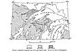 Fig 1 Generalized topographic map of the Lake Superior region.jpg 1,038 × 657; 150 KB
-

-
 Fig 2 map of St Louis River drainage basin.jpg 1,049 × 750; 110 KB
-
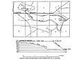 Fig 3 Map and profile of canal of Great Northern Power Co.jpg 1,016 × 738; 82 KB
-
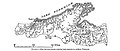 Fig 4 Map showing streams entering Lake Superior in northern Wisconsin.jpg 1,016 × 428; 91 KB
-
 Fig 5 Map of drifts in the northern United States.jpg 1,024 × 1,135; 371 KB
-
 Fig 6 Map showing moraines of Lake Superior lobe.jpg 792 × 739; 103 KB
-
 Fig 7 Map showing drumlins, eskers, and striae in Menominee County.jpg 1,030 × 815; 149 KB
-
 Fig 8 Map showing isobases of the highest beach of glacial Lake Duluth.jpg 1,018 × 835; 133 KB
-
 Fig 9 Map showing isobases of glacial Lake Algonquin.jpg 1,024 × 721; 122 KB
-
 Plate 3 Relief Map of the Lake Superior Region.jpg 1,880 × 1,257; 323 KB
-
 Plate 4 Manitou Falls, on Black River.jpg 1,377 × 1,888; 438 KB
-
 Plate 5 Perch Lake Quadrangle, Mich.jpg 1,234 × 1,588; 321 KB
-
 Plate 6 Houghton Quadrangle, Mich.jpg 1,236 × 1,619; 357 KB
-
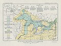 Plate 7 Glacial Lake Algonquin and its Correlatives.jpg 1,410 × 1,075; 284 KB
-
 Plate 8 Nipissing Great Lakes and their Correlatives.jpg 1,457 × 1,056; 245 KB


