Category:US National Archives series: Maps Relating to Military Operations in the Pacific Theater of War
Jump to navigation
Jump to search
Media in category "US National Archives series: Maps Relating to Military Operations in the Pacific Theater of War"
The following 153 files are in this category, out of 153 total.
-
 Abraham, Albert and Allen Islands, Carillon Atoll - NARA - 100359975.jpg 7,736 × 11,678; 3.25 MB
-
 Alton, Alvin & Andrew Islands, Carillon Atoll - NARA - 100359977.jpg 8,292 × 5,892; 3.01 MB
-
 Anthony, Anton & Archibald Islands, Carillon Atoll - NARA - 100359983.jpg 7,892 × 12,113; 3.22 MB
-
 Archie Island, Carillon Atoll - NARA - 100359940.jpg 8,450 × 5,892; 3.64 MB
-
 Arcs of Fire for Casemated Coastal Defense Guns on Iwo Jima - NARA - 100307402.jpg 8,384 × 11,605; 2.73 MB
-
 Arlington Island, Carillon Atoll - NARA - 100359942.jpg 8,393 × 5,884; 3.97 MB
-
 Bennett Island, Carillon Atoll - NARA - 100359944.jpg 8,708 × 12,390; 8.27 MB
-
 Benson Island, Carillon Atoll - NARA - 100359946.jpg 8,454 × 6,600; 7.23 MB
-
 Berlin & Beverly Islands, Carillon Atoll - NARA - 100359948.jpg 7,500 × 12,723; 12.25 MB
-
 Berlin & Beverly Islands, Carillon Atoll - NARA - 100359950.jpg 7,776 × 12,482; 4.18 MB
-
 Blakenship and Burnet Islands, Carillon Atoll - NARA - 100359952.jpg 5,324 × 12,187; 4.36 MB
-
 Burton Island, Carillon Atoll - NARA - 100359959.jpg 6,600 × 8,427; 2.96 MB
-
 Buster & Byron Islands, Carillon Atoll - NARA - 100359961.jpg 5,040 × 6,468; 1.74 MB
-
 Cabras Island, Guam in 1917 (map crop).jpg 2,354 × 1,087; 694 KB
-
 Carillon "Special Map," Sheet No. 12 - NARA - 100359985.jpg 5,976 × 8,598; 1.42 MB
-
 Carillon "Special Map," Sheet No. 16 - NARA - 100359987.jpg 8,238 × 6,364; 2.68 MB
-
 Carillon "Special Map," Sheet No. 26 - NARA - 100359989.jpg 8,304 × 6,276; 1.94 MB
-
 Carillon "Special Map," Sheet No. 28 - NARA - 100359991.jpg 8,233 × 6,272; 1.39 MB
-
 Carillon "Special Map," Sheet No. 29 - NARA - 100359993.jpg 6,052 × 8,584; 1.23 MB
-
 Carillon "Special Map," Sheet No. 3 - NARA - 100360003.jpg 6,704 × 8,794; 2.02 MB
-
 Carillon "Special Map," Sheet No. 30 - NARA - 100359995.jpg 6,048 × 8,736; 1.31 MB
-
 Carillon "Special Map," Sheet No. 31 - NARA - 100359997.jpg 6,104 × 8,568; 1.58 MB
-
 Carillon "Special Map," Sheet No. 32 - NARA - 100359999.jpg 6,068 × 8,644; 1.59 MB
-
 Carillon "Special Map," Sheet No. 33 - NARA - 100360001.jpg 6,028 × 8,625; 1.49 MB
-
 Carillon "Special Map," Sheet No. 8 - NARA - 100360005.jpg 6,176 × 8,640; 1.82 MB
-
 Carillon "Special Map," Sheet No. 8 - NARA - 100360007.jpg 5,868 × 8,639; 1.35 MB
-
 Carillon Atoll - NARA - 100360009.jpg 6,015 × 5,744; 1.18 MB
-
 Carlson Island, Carillon Atoll - NARA - 100359963.jpg 8,420 × 6,600; 6.42 MB
-
 Cecil & Carter Islands, Carillon Atoll - NARA - 100359965.jpg 6,600 × 8,440; 2.76 MB
-
 Central Section- Gugegwe Island - NARA - 100360019.jpg 6,600 × 8,521; 2.42 MB
-
 Central Section- Gugegwe Island - NARA - 100360021.jpg 9,616 × 13,133; 4.06 MB
-
 Chauncey Island, Carillon Atoll - NARA - 100359967.jpg 4,208 × 5,499; 1.33 MB
-
 Chauncey Island, Carillon Atoll - NARA - 100359969.jpg 4,400 × 5,790; 994 KB
-
 D-3 (Enemy) Situation - NARA - 100359954 (page 1).jpg 4,987 × 3,591; 2.81 MB
-
 D-3 (Enemy) Situation - NARA - 100359954 (page 2).jpg 5,057 × 3,657; 1.45 MB
-
 Ebeye Island - NARA - 100359979.jpg 6,600 × 8,507; 6.41 MB
-
 Ebeye Island - NARA - 100359981.jpg 6,600 × 8,512; 4.4 MB
-
 Emidj & Tiniet Islands - NARA - 100359938.jpg 10,196 × 11,609; 9.13 MB
-
 Enubuj Island - NARA - 100360017.jpg 8,740 × 6,738; 3.56 MB
-
 G-2 Situation Map- Kwajalein Atoll, Kwajalein Island - NARA - 100360023.jpg 5,338 × 6,805; 3.55 MB
-
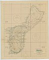
 Guam - NARA - 100359901.jpg 5,149 × 6,557; 5.18 MB
-
 Guam Island- Navigational Information and Anchorages - NARA - 100359898 (page 1).jpg 3,888 × 3,845; 1.86 MB
-
 Guam Island- Navigational Information and Anchorages - NARA - 100359898 (page 2).jpg 3,936 × 3,875; 1.66 MB
-
 Guam Map - NARA - 100359918 (page 1).jpg 9,039 × 7,514; 11.4 MB
-
 Guam Map - NARA - 100359918 (page 2).jpg 8,963 × 7,439; 11.62 MB
-
 Guam Map - NARA - 100359918 (page 3).jpg 8,998 × 7,488; 8.45 MB
-
 Guam Map - NARA - 100359922 (page 1).jpg 8,931 × 7,464; 12 MB
-
 Guam Map - NARA - 100359922 (page 2).jpg 8,943 × 7,424; 9.82 MB
-
 Guam Map - NARA - 100359922 (page 3).jpg 7,634 × 6,496; 8.37 MB
-
 Guam Map - NARA - 100359922 (page 4).jpg 8,845 × 7,426; 11.73 MB
-
 Guam Map - NARA - 100359922 (page 5).jpg 4,441 × 5,660; 3.41 MB
-
 Guam Map - NARA - 100359928 (Orote Peninsula).jpg 4,409 × 4,133; 4.61 MB
-
 Guam Map - NARA - 100359928 (page 1) (cropped).jpg 7,146 × 6,263; 8.05 MB
-
 Guam Map - NARA - 100359928 (page 1).jpg 8,058 × 6,587; 5.37 MB
-
 Guam Map - NARA - 100359928 (page 2) (Apra Harbor crop).jpg 6,624 × 4,943; 7.95 MB
-
 Guam Map - NARA - 100359928 (page 2) (cropped).jpg 7,348 × 7,434; 13.07 MB
-
 Guam Map - NARA - 100359928 (page 2) (Piti crop).jpg 2,551 × 1,256; 938 KB
-
 Guam Map - NARA - 100359928 (page 2) (Sumay).jpg 1,235 × 1,094; 400 KB
-
 Guam Map - NARA - 100359928 (page 2).jpg 8,104 × 7,498; 11.46 MB
-
 Guam Map - NARA - 100359928 (page 3) (cropped).jpg 7,264 × 5,910; 8.64 MB
-
 Guam Map - NARA - 100359928 (page 3).jpg 7,912 × 6,376; 5.98 MB
-
 Guam Map - NARA - 100359928 (page 4) (cropped).jpg 8,224 × 4,247; 9.49 MB
-
 Guam Map - NARA - 100359928 (page 4).jpg 8,958 × 5,280; 8.48 MB
-
 Guam Map - NARA - 100359933 (page 1).jpg 7,703 × 7,561; 10.54 MB
-
 Guam Map - NARA - 100359933 (page 2).jpg 7,587 × 7,472; 10.96 MB
-
 Guam Map - NARA - 100359933 (page 3).jpg 7,520 × 7,487; 12.71 MB
-
 Guam Map - NARA - 100359933 (page 4).jpg 7,566 × 7,488; 11.03 MB
-
 Guam- Disposition of Japanese Forces and Gun Installations - NARA - 100359903.jpg 5,114 × 6,547; 8.54 MB
-
 Guam- Disposition of Japanese Forces and Gun Installations - NARA - 100359905.jpg 5,089 × 6,566; 5.12 MB
-
 Guam- Disposition of Japanese Forces and Gun Installations - NARA - 100359907.jpg 5,162 × 6,532; 6.79 MB
-
 Homer Island, Carillon Atoll - NARA - 100359971.jpg 7,289 × 5,852; 2.22 MB
-
 Invasion of Ie Shima - NARA - 100307404.jpg 6,400 × 5,053; 1.07 MB
-
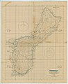 Island of Guam - NARA - 100359893.jpg 8,896 × 10,888; 5.58 MB
-
 Island of Guam - NARA - 100359895 (page 1).jpg 8,920 × 10,926; 5.52 MB
-
 Island of Guam - NARA - 100359895 (page 2).jpg 10,884 × 8,920; 7.54 MB
-
 Island of Guam - NARA - 100359911 (page 1).jpg 11,900 × 7,392; 8.68 MB
-
 Island of Guam - NARA - 100359911 (page 2).jpg 11,863 × 7,992; 13.74 MB
-
 Island of Guam- Agana Bay - NARA - 100359840.jpg 8,539 × 7,080; 9.91 MB
-
 Island of Guam- Agana Bay - Special Air and Gunnery Target Map - NARA - 100359842.jpg 8,734 × 7,344; 11.86 MB
-
 Island of Guam- Agana Bay - Special Air and Gunnery Target Map - NARA - 100359844.jpg 8,333 × 7,010; 9.49 MB
-
 Island of Guam- Agana Bay - Special Air and Gunnery Target Map - NARA - 100359846.jpg 8,263 × 6,979; 15.72 MB
-
 Island of Guam- Agana Bay - Special Air and Gunnery Target Map - NARA - 100359848.jpg 8,865 × 7,283; 17.02 MB
-
 Island of Guam- Agana Bay - Special Air and Gunnery Target Map - NARA - 100359850.jpg 8,999 × 7,272; 18.63 MB
-

-

-
 Island of Guam- Agat Bay - NARA - 100359865.jpg 8,603 × 7,044; 7.91 MB
-
 Island of Guam- Agat Bay - Special Air and Gunnery Target Map - NARA - 100359867.jpg 8,728 × 7,312; 10.97 MB
-
 Island of Guam- Agat Bay - Special Air and Gunnery Target Map - NARA - 100359869.jpg 8,304 × 7,037; 8.38 MB
-
 Island of Guam- Agat Bay - Special Air and Gunnery Target Map - NARA - 100359871.jpg 8,276 × 7,001; 9.01 MB
-
 Island of Guam- Agat Bay - Special Air and Gunnery Target Map - NARA - 100359873.jpg 8,292 × 7,073; 9.32 MB
-
 Island of Guam- Apra Harbor - NARA - 100359828.jpg 8,552 × 7,032; 8.69 MB
-
 Island of Guam- Apra Harbor - Special Air and Gunnery Target Map - NARA - 100359830.jpg 8,695 × 7,329; 14.15 MB
-
 Island of Guam- Apra Harbor - Special Air and Gunnery Target Map - NARA - 100359832.jpg 8,953 × 7,200; 14.43 MB
-
 Island of Guam- Apra Harbor - Special Air and Gunnery Target Map - NARA - 100359834.jpg 8,380 × 7,039; 8.56 MB
-
 Island of Guam- Apra Harbor - Special Air and Gunnery Target Map - NARA - 100359836.jpg 8,272 × 6,936; 14.96 MB
-
 Island of Guam- Apra Harbor - Special Air and Gunnery Target Map - NARA - 100359838.jpg 8,958 × 7,176; 11.37 MB
-
 Island of Guam- Landing Beaches - NARA - 100359914.jpg 9,020 × 10,846; 7.72 MB
-
 Island of Guam- Pacific Ocean (No. 1) - NARA - 100359883.jpg 9,725 × 8,448; 2.75 MB
-
 Island of Guam- Pacific Ocean (No. 2) - NARA - 100359885.jpg 9,756 × 8,520; 2.91 MB
-
 Island of Guam- Pacific Ocean (No. 3) - NARA - 100359887.jpg 9,768 × 8,588; 2.56 MB
-
 Island of Guam- Pacific Ocean (No. 4) - NARA - 100359889.jpg 9,786 × 8,460; 2.93 MB
-
 Island of Guam- Pagat Point - NARA - 100359855.jpg 8,603 × 7,224; 3.51 MB
-
 Island of Guam- Pagat Point - Special Air and Gunnery Target Map - NARA - 100359857.jpg 8,714 × 7,128; 8.42 MB
-
 Island of Guam- Pagat Point - Special Air and Gunnery Target Map - NARA - 100359859.jpg 8,388 × 6,975; 4.48 MB
-
 Island of Guam- Pagat Point - Special Air and Gunnery Target Map - NARA - 100359861.jpg 8,993 × 7,272; 7.01 MB
-
 Island of Guam- Pagat Point - Special Air and Gunnery Target Map - NARA - 100359863.jpg 8,358 × 7,037; 4.24 MB
-
 Island of Guam- Pati Point - NARA - 100359891.jpg 9,638 × 8,396; 5.52 MB
-
 Island of Guam- Port Inarajan - NARA - 100359780.jpg 8,590 × 7,060; 3.79 MB
-
 Island of Guam- Port Inarajan - Special Air and Gunnery Target Map - NARA - 100359782.jpg 8,574 × 7,288; 4.04 MB
-

-

-

-
-
 Island of Guam- Port Merizo - NARA - 100359772.jpg 8,599 × 7,076; 7.16 MB
-
 Island of Guam- Port Merizo - Special Air and Gunnery Target Map - NARA - 100359774.jpg 8,731 × 7,304; 8.29 MB
-
 Island of Guam- Port Merizo - Special Air and Gunnery Target Map - NARA - 100359776.jpg 8,098 × 6,880; 4.26 MB
-
 Island of Guam- Port Merizo - Special Air and Gunnery Target Map - NARA - 100359778.jpg 8,258 × 7,037; 7.89 MB
-

-
 Island of Guam- Ritidian Point - NARA - 100359798.jpg 8,638 × 7,080; 5.17 MB
-
 Island of Guam- Ritidian Point - Special Air and Gunnery Target Map - NARA - 100359800.jpg 8,775 × 7,176; 8.71 MB
-
 Island of Guam- Ritidian Point - Special Air and Gunnery Target Map - NARA - 100359802.jpg 8,203 × 6,864; 7.76 MB
-
 Island of Guam- Ritidian Point - Special Air and Gunnery Target Map - NARA - 100359804.jpg 8,149 × 6,864; 9.78 MB
-

-
 Island of Guam- Santa Rosa - NARA - 100359818.jpg 8,629 × 7,128; 5.82 MB
-
 Island of Guam- Santa Rosa - Special Air and Gunnery Target Map - NARA - 100359820.jpg 8,493 × 7,312; 8.93 MB
-
 Island of Guam- Santa Rosa - Special Air and Gunnery Target Map - NARA - 100359822.jpg 8,416 × 6,938; 7.47 MB
-
 Island of Guam- Santa Rosa - Special Air and Gunnery Target Map - NARA - 100359824.jpg 8,369 × 6,970; 7.64 MB
-
 Island of Guam- Santa Rosa - Special Air and Gunnery Target Map - NARA - 100359826.jpg 8,356 × 6,977; 7.17 MB
-
 Island of Guam- Talofofo Bay - NARA - 100359875.jpg 8,596 × 7,096; 5.1 MB
-
 Island of Guam- Talofofo Bay - Special Air and Gunnery Target Map - NARA - 100359877.jpg 8,729 × 7,200; 3.91 MB
-
 Island of Guam- Talofofo Bay - Special Air and Gunnery Target Map - NARA - 100359879.jpg 8,954 × 7,200; 8.72 MB
-
 Island of Guam- Talofofo Bay - Special Air and Gunnery Target Map - NARA - 100359881.jpg 8,981 × 7,200; 9.31 MB
-
 Island of Guam- Tumon Bay - NARA - 100359810.jpg 8,568 × 7,224; 4.56 MB
-
 Island of Guam- Tumon Bay - Special Air and Gunnery Target Map - NARA - 100359808.jpg 8,620 × 7,224; 8.01 MB
-
 Island of Guam- Tumon Bay - Special Air and Gunnery Target Map - NARA - 100359812.jpg 8,160 × 6,799; 10.11 MB
-
 Island of Guam- Tumon Bay - Special Air and Gunnery Target Map - NARA - 100359814.jpg 8,368 × 7,128; 9.68 MB
-
 Island of Guam- Tumon Bay - Special Air and Gunnery Target Map - NARA - 100359816.jpg 8,243 × 6,988; 6.21 MB
-
 Island of Guam- Uruno Point - NARA - 100359790.jpg 8,701 × 7,364; 3.82 MB
-
 Island of Guam- Uruno Point - Special Air and Gunnery Target Map - NARA - 100359792.jpg 8,496 × 7,245; 7.21 MB
-
 Island of Guam- Uruno Point - Special Air and Gunnery Target Map - NARA - 100359794.jpg 8,210 × 6,951; 4.46 MB
-

-
 Jacob Island, Carillon Atoll - NARA - 100359973.jpg 8,760 × 6,352; 3.67 MB
-
 Kwajalein or Menschikov Atoll - NARA - 100359957.jpg 13,001 × 10,800; 11.06 MB
-
 Map of Western Okinawa Beaches - NARA - 100307410.jpg 10,272 × 13,283; 6.98 MB
-
 Roi & Namur Islands - NARA - 100360025.jpg 8,972 × 7,200; 5.38 MB
-
 South East Portion - Carillon Atoll - NARA - 100360011.jpg 6,011 × 5,744; 1.41 MB
-
 Special Operations Map of Saipan Area - NARA - 7369166.jpg 2,483 × 3,150; 1.15 MB
-
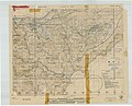
 Summary of 77th Division Operations on Guam - NARA - 100359909.jpg 5,096 × 6,833; 4.42 MB
-
 Taroa Island - NARA - 100360027.jpg 12,695 × 10,608; 13.58 MB
-
 Taroa Island - NARA - 100360029 (page 1).jpg 4,452 × 6,018; 4.92 MB
-
 Taroa Island - NARA - 100360029 (page 2).jpg 4,456 × 5,928; 1.67 MB
-
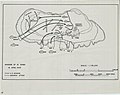
 Thirty Second Army Troop Dispositions - NARA - 100307406.jpg 6,464 × 8,967; 2.08 MB
-
 XXXIV Corps Advance Checked - NARA - 100307408.jpg 14,240 × 6,421; 3.64 MB


.jpg)


_Situation_-_NARA_-_100359954_(page_1).jpg)
_Situation_-_NARA_-_100359954_(page_2).jpg)


.jpg)
.jpg)
.jpg)
.jpg)
.jpg)
.jpg)
.jpg)
.jpg)
.jpg)
.jpg)
.jpg)
_(cropped).jpg)
.jpg)
_(Apra_Harbor_crop).jpg)
_(cropped).jpg)
_(Piti_crop).jpg)
_(Sumay).jpg)
.jpg)
_(cropped).jpg)
.jpg)
_(cropped).jpg)
.jpg)
.jpg)
.jpg)
.jpg)
.jpg)


.jpg)
.jpg)
.jpg)
.jpg)


.jpg)
.jpg)


_-_NARA_-_100359883.jpg)
_-_NARA_-_100359885.jpg)
_-_NARA_-_100359887.jpg)
_-_NARA_-_100359889.jpg)


.jpg)
.jpg)
.jpg)
.jpg)


.jpg)
.jpg)

