Category:US National Archives series: Published Record Set of Maps, ca. 1805 - ca. 1958
Jump to navigation
Jump to search
This series consists of an incomplete set of maps ordered published by the Senate. These maps were often issued as part of Senate Executive Documents and cover a wide variety of subjects. Subjects represented in this series include Congressional land grants, state and international boundaries, geographic discovery, progress of public land surveys, road surveys, and Civil War battlefields. Also included are maps of coastal surveys, various states, the District of Columbia, Liberia, Nicaragua, Panama, South America, and the Philippines.
Media in category "US National Archives series: Published Record Set of Maps, ca. 1805 - ca. 1958"
The following 38 files are in this category, out of 38 total.
-
 26th Congress, 1st Session Map - NARA - 102278663 (page 1).jpg 7,552 × 10,517; 7.97 MB
-
 26th Congress, 1st Session Map - NARA - 102278663 (page 2).jpg 7,386 × 10,419; 9.39 MB
-
 26th Congress, 1st Session Map - NARA - 102278663 (page 3).jpg 7,456 × 10,344; 7.82 MB
-
 26th Congress, 1st Session Map - NARA - 102278663 (page 4).jpg 7,073 × 10,438; 9.04 MB
-
 26th Congress, 1st Session Map - NARA - 102278663 (page 5).jpg 7,473 × 10,389; 11.69 MB
-
 26th Congress, 1st Session Map - NARA - 102278663 (page 6).jpg 7,411 × 10,392; 11.53 MB
-
 26th Congress, 1st Session Map - NARA - 102278663 (page 7).jpg 7,455 × 10,489; 11.85 MB
-
 26th Congress, 1st Session Map - NARA - 102278663 (page 8).jpg 6,983 × 10,378; 9.87 MB
-

-

-

-
-

-
-
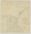
 Diagram of the State of Illinois - NARA - 25464135.jpg 4,896 × 8,030; 2.89 MB
-
 Diagram of the State of Illinois - NARA - 25464141.jpg 3,968 × 6,583; 2.45 MB
-
 Diagram of the State of Illinois - NARA - 25464162.jpg 4,416 × 7,190; 2.57 MB
-
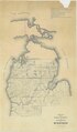
 Map of Colorado Territory - NARA - 23812162.jpg 6,880 × 5,650; 2.68 MB
-
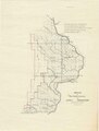
 Map of Indiana - NARA - 25464156.jpg 2,144 × 2,858; 604 KB
-
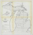
 Map of Michigan - NARA - 25464168.jpg 3,008 × 3,636; 958 KB
-
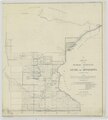
 Map of Minnesota Showing the Extent of the Public Surveys and other detail - NARA - 25464426.jpg 10,816 × 11,140; 10.36 MB
-

-
 Map of the State of Florida Showing the Progress of the Surveys - NARA - 25464174.jpg 8,704 × 8,934; 4.24 MB
-
 Map of the State of Florida Showing the Progress of the Surveys - NARA - 25464183.jpg 8,416 × 9,312; 5.16 MB
-

-
-

-
-

-
-

-
-

-
-

-
-

-
.jpg)
.jpg)
.jpg)
.jpg)
.jpg)
.jpg)
.jpg)
.jpg)
.jpg)
.jpg)
.jpg)


.jpg)
.jpg)
.jpg)
.jpg)
.jpg)
.jpg)
.jpg)