Category:US National Archives series: Railroad Right-of-Way Maps, ca. 1872 - ca. 1875
Jump to navigation
Jump to search
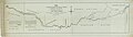
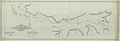
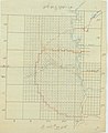
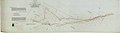
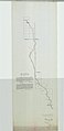
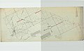
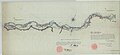
This series consists of manuscript and annotated maps showing the rights-of-way and definite location through public lands for proposed railroad lines and existing railroad lines. These maps show the precise location of the lines and sites in relation to section and township lines. The maps also show prominent land features in unsurveyed areas. Some features shown include towns, rivers, and railroad stations.
Media in category "US National Archives series: Railroad Right-of-Way Maps, ca. 1872 - ca. 1875"
The following 63 files are in this category, out of 63 total.
-
 Alabama and Chattanooga Railroad, plat map - NARA - 102256632.jpg 20,621 × 4,608; 12.15 MB
-
 Alabama and Florida Railroad, from Pensacola to Montgomery - NARA - 102256636.jpg 27,301 × 9,017; 25.25 MB
-

-

-

-

-
 Altantic Pacific Railroad, general survey of the Ft Smith Branch - NARA - 102256236.jpg 21,088 × 5,920; 7.98 MB
-
 Altantic Pacific Railroad, Missouri state line to King Fisher Creek - NARA - 102256240.jpg 18,382 × 8,765; 13.63 MB
-
 Amended general route of the northern branch of the Northern Pacific Railroad - NARA - 102256584.jpg 27,028 × 8,623; 25.72 MB
-
 Atchison, Topeka, and Sata Fe Railroad, from Emporia to Newton - NARA - 102256634.jpg 9,604 × 5,760; 4.68 MB
-
 Atchison, Topeka, and Sata Fe Railroad, from Ft Larned to the Arkansas River - NARA - 102256608.jpg 11,724 × 7,744; 12.72 MB
-
 Atlantic and Pacific Railroad, 11th Land Grant Section - NARA - 102256506.jpg 23,912 × 8,192; 17.39 MB
-
 Atlantic Pacific Railroad through San Bernadino County, California - NARA - 102256234.jpg 6,966 × 5,154; 4.43 MB
-
 Central Pacific Railroad, from the 31st to 74th mile - NARA - 102256283.jpg 40,825 × 6,080; 15.22 MB
-
 Central Pacific Railroad, from the 75th to 94th mile - DPLA - 8b69bf487781062aafaa84fcc340cbd8.jpg 24,619 × 8,192; 10.86 MB
-
 Certification of the plot map of the Dubuque and Pacific Railroad - NARA - 102256412.jpg 2,400 × 3,160; 872 KB
-
 Certification of the plot map of the Dubuque and Pacific Railroad - NARA - 102256414.jpg 2,432 × 3,786; 988 KB
-
 Certification of the plot map of the Illinois Central Railroad - NARA - 102256434.jpg 5,536 × 9,108; 2.87 MB
-
 Chicago and Northwestern Railroad in Wisconsin - NARA - 102256250.jpg 4,704 × 8,743; 5.79 MB
-
 Chicago and Northwestern Railroad, definite location in Wisconsin - NARA - 102256252.jpg 3,520 × 8,136; 2.84 MB
-
-

-

-
 Map of the Gulf and Ship Island Railroad - NARA - 102256360.jpg 5,728 × 11,069; 6.04 MB
-
 Map of the Hastings, Minnesota River, and Red River of the North Railroad - NARA - 102256398.jpg 44,296 × 3,648; 18.08 MB
-
 Map of the Leavenworth, Lawrence, and Galveston Railway - NARA - 102256574.jpg 5,440 × 21,876; 10.81 MB
-
 Map of the original location of the Minneapolis and Cedar Valley Railroad - NARA - 102256536.jpg 5,408 × 34,121; 10.83 MB
-

-
 Map of the Southern Pacific RR between Ochoa and Dragoon Summit - NARA - 84786266.jpg 25,377 × 7,072; 13.55 MB
-
 Map of the Western Division of the Central Pacific Railroad Company - NARA - 84785984.jpg 18,556 × 5,440; 10.37 MB
-
 Map showing 2025 miles of the New Orleans Pacific Railway Company - NARA - 102256542.jpg 30,503 × 7,488; 22.77 MB
-

-

-

-

-

-

-

-
 Montana Railway Company - DPLA - 620c0025f2b9ce0a2fed3684e335e0f3 (page 1).jpg 17,169 × 7,520; 6.96 MB
-
 Montana Railway Company - DPLA - 620c0025f2b9ce0a2fed3684e335e0f3 (page 10).jpg 11,015 × 9,120; 9.77 MB
-
 Montana Railway Company - DPLA - 620c0025f2b9ce0a2fed3684e335e0f3 (page 11).jpg 10,621 × 9,152; 10.15 MB
-
 Montana Railway Company - DPLA - 620c0025f2b9ce0a2fed3684e335e0f3 (page 12).jpg 9,152 × 18,814; 16.28 MB
-
 Montana Railway Company - DPLA - 620c0025f2b9ce0a2fed3684e335e0f3 (page 2).jpg 17,801 × 10,816; 17.98 MB
-
 Montana Railway Company - DPLA - 620c0025f2b9ce0a2fed3684e335e0f3 (page 3).jpg 11,869 × 9,120; 11.26 MB
-
 Montana Railway Company - DPLA - 620c0025f2b9ce0a2fed3684e335e0f3 (page 4).jpg 9,120 × 17,024; 7.74 MB
-
 Montana Railway Company - DPLA - 620c0025f2b9ce0a2fed3684e335e0f3 (page 5).jpg 16,971 × 9,184; 9.07 MB
-
 Montana Railway Company - DPLA - 620c0025f2b9ce0a2fed3684e335e0f3 (page 6).jpg 9,216 × 13,211; 13.13 MB
-
 Montana Railway Company - DPLA - 620c0025f2b9ce0a2fed3684e335e0f3 (page 7).jpg 14,641 × 9,152; 9.16 MB
-
 Montana Railway Company - DPLA - 620c0025f2b9ce0a2fed3684e335e0f3 (page 8).jpg 13,786 × 9,184; 13.64 MB
-
 Montana Railway Company - DPLA - 620c0025f2b9ce0a2fed3684e335e0f3 (page 9).jpg 14,756 × 9,120; 14.56 MB
-

-

-

-

-

-
-

-

-

-

-
 Right of Way of the Southern Pacific Railroad - DPLA - be8aca583ea6fac91844d5d9728b7e8b.jpg 31,543 × 5,472; 12.05 MB
-
 The territory of Montana at the Crow Agency - DPLA - 589f0ab00a1e6be6d88732fb466f1003.jpg 38,480 × 7,776; 23.26 MB
-


.jpg)
.jpg)
.jpg)
.jpg)
.jpg)
.jpg)
.jpg)
.jpg)
.jpg)
.jpg)
.jpg)
.jpg)


