Category:Uiterburen
Jump to navigation
Jump to search
| Object location | | View all coordinates using: OpenStreetMap |
|---|
hamlet in Zuidbroek, the Netherlands   | |||||
| Upload media | |||||
| Instance of | |||||
|---|---|---|---|---|---|
| Location |
| ||||
| Different from | |||||
 | |||||
Subcategories
This category has the following 7 subcategories, out of 7 total.
G
- Gemaal Roode Til (6 F)
R
- Robbedoes (Zuidbroek) (4 F)
U
- Uiterburen 25, Zuidbroek (10 F)
- Uiterburen 45, Zuidbroek (17 F)
- Uiterburen 53, Zuidbroek (7 F)
- Uiterburen 59, Zuidbroek (11 F)
Media in category "Uiterburen"
The following 10 files are in this category, out of 10 total.
-
 Map - NL - Menterwolde - Wijk 00 Zuidbroek - Buurt 01 Uiterburen.svg 375 × 375; 21 KB
-
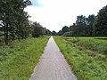 Fietspad op voormalig spoortracé - panoramio.jpg 2,592 × 1,952; 1.68 MB
-
 Nummer 138, hoek Klingenweg, aanzicht - Uiterburen - 20211041 - RCE.jpg 1,200 × 807; 233 KB
-
 Nummer 138, hoek Klingenweg, aanzicht - Uiterburen - 20211042 - RCE.jpg 1,200 × 810; 331 KB
-
 Nummer 27, aanzicht - Uiterburen - 20211037 - RCE.jpg 1,200 × 806; 259 KB
-
 Nummer 27, hek - Uiterburen - 20211038 - RCE.jpg 1,200 × 805; 327 KB
-
 Nummer 27, hek detail - Uiterburen - 20211036 - RCE.jpg 1,200 × 812; 341 KB
-
 Overzicht voorgevel arbeiderswoning - Zuidbroek - 20365241 - RCE.jpg 1,192 × 1,200; 340 KB
-
 Overzicht voorgevel boerderij - Zuidbroek - 20365240 - RCE.jpg 1,195 × 1,200; 285 KB
-
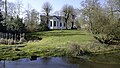 Zuidbroek - Drostenborgh.jpg 4,716 × 2,653; 13.25 MB


