Category:United Kingdom photographs taken on 2003-09-07
Jump to navigation
Jump to search
Countries of Europe: Croatia · Germany · Netherlands‡ · Poland · Portugal‡ · Russia‡ · Spain‡ · Sweden · Switzerland · United Kingdom
‡: partly located in Europe
‡: partly located in Europe
| ← | 7 September 2003 | → | ||
| ← | September 2003 | → | ||

United Kingdom photographs taken on 7 September 2003.
Image files should be categorized here automatically using {{taken on}} template. Direct categorisation is also possible, if automatic is impossible.
Media in category "United Kingdom photographs taken on 2003-09-07"
The following 46 files are in this category, out of 46 total.
-
 A109, Lordship Lane - geograph.org.uk - 293919.jpg 640 × 432; 83 KB
-
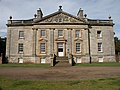 Auchinleck House - geograph.org.uk - 339547.jpg 640 × 480; 81 KB
-
 Avenell Road - geograph.org.uk - 293930.jpg 640 × 416; 99 KB
-
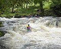 Bala Mill Falls - geograph.org.uk - 1231649.jpg 640 × 512; 100 KB
-
 Bernera Barracks (Wade's Barracks) - geograph.org.uk - 492696.jpg 426 × 640; 105 KB
-
 Blickling Hall from the lake - geograph.org.uk - 887921.jpg 640 × 480; 115 KB
-
 Bruce Castle Park - geograph.org.uk - 293923.jpg 640 × 421; 101 KB
-
 Busta House Hotel - geograph.org.uk - 629898.jpg 640 × 470; 505 KB
-
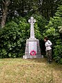 Celtic Cross on Drimnin road - geograph.org.uk - 688307.jpg 480 × 640; 142 KB
-
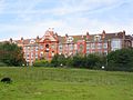 Crossley Hospital East , 1905 - 1961 - geograph.org.uk - 65220.jpg 640 × 480; 81 KB
-

-
 Footbridge from Finsbury Park - geograph.org.uk - 293881.jpg 640 × 417; 106 KB
-

-
 Main Eastern Line at Finsbury Park - geograph.org.uk - 293884.jpg 640 × 436; 87 KB
-
 Minehead Strand - geograph.org.uk - 1763284.jpg 640 × 480; 77 KB
-
 North Road - geograph.org.uk - 234697.jpg 480 × 640; 75 KB
-
 Pavilion in Highgate Wood - geograph.org.uk - 293908.jpg 640 × 412; 99 KB
-
 Pentre Ifan burial chamber - geograph.org.uk - 384085.jpg 640 × 415; 64 KB
-
 Pitfour Castle.jpg 640 × 467; 56 KB
-
 Pond in Balmacara Square - geograph.org.uk - 129401.jpg 640 × 480; 60 KB
-
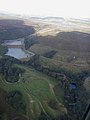
 Reservoir - geograph.org.uk - 697781.jpg 640 × 480; 164 KB
-
 Sign, Highbury Stadium - geograph.org.uk - 293931.jpg 640 × 416; 98 KB
-
 South Parade, Bramhall, SK7 3BH - geograph.org.uk - 722853.jpg 640 × 480; 71 KB
-
 Vaulting at Thornton Abbey - geograph.org.uk - 748249.jpg 640 × 480; 105 KB
-
 View of Muswell Hill - geograph.org.uk - 293913.jpg 640 × 422; 79 KB
-
 Warning Signs in Delamere Forest - geograph.org.uk - 65224.jpg 640 × 480; 96 KB
-
 Windmills from the air - geograph.org.uk - 697671.jpg 640 × 480; 111 KB
-
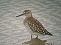 Wood Sandpiper (Tringa glareola) - geograph.org.uk - 1036193.jpg 640 × 480; 74 KB
-
 Ashover - Dale Bank Farm - geograph.org.uk - 609856.jpg 640 × 480; 72 KB
-
 Back in to land - geograph.org.uk - 697772.jpg 640 × 480; 112 KB
-
 Beinn a' Bha'ach Ard - geograph.org.uk - 229334.jpg 640 × 438; 58 KB
-
 Boat and trees in a saltmarsh - geograph.org.uk - 71665.jpg 2,048 × 1,536; 1.73 MB
-
 Boat in a saltmarsh - geograph.org.uk - 71665 (cropped).jpg 1,024 × 1,536; 1.17 MB
-
 Boulder - geograph.org.uk - 229352.jpg 640 × 438; 54 KB
-
 Carn Edward - geograph.org.uk - 394183.jpg 640 × 480; 69 KB
-
 Dean Head Reservoir - geograph.org.uk - 697797.jpg 480 × 640; 33 KB
-
 Deserted Church off Drimnin road - geograph.org.uk - 688254.jpg 640 × 480; 125 KB
-
 Eyemouth Beach - geograph.org.uk - 290767.jpg 640 × 412; 55 KB
-
 Knott End Coastguard Station - geograph.org.uk - 61078.jpg 640 × 480; 124 KB
-
 Loch Benachally - geograph.org.uk - 353475.jpg 640 × 416; 67 KB
-
 Rough Gr ound ,Tom na Dubh Ghlaic - geograph.org.uk - 701285.jpg 640 × 480; 62 KB
-
 Stiffkey Fen - geograph.org.uk - 76137.jpg 640 × 480; 62 KB
-
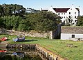
 Thorney mill - geograph.org.uk - 478595.jpg 640 × 427; 75 KB
-
 Tom na Corr Laraich - geograph.org.uk - 688187.jpg 480 × 640; 57 KB
-
 View from Five Flags Car Park - geograph.org.uk - 697664.jpg 640 × 480; 129 KB
-
 View to the East - geograph.org.uk - 697111.jpg 640 × 480; 90 KB


_-_geograph.org.uk_-_492696.jpg)


_-_geograph.org.uk_-_1036193.jpg)


.jpg)


