Category:United Kingdom photographs taken on 2004-07-14
Jump to navigation
Jump to search
Countries of Europe: Azerbaijan‡ · Czech Republic · Denmark · Finland · France‡ · Germany · Greece · Republic of Ireland · Italy · Netherlands‡ · Norway · Poland · Russia‡ · Serbia · Slovakia · Spain‡ · Sweden · Switzerland · United Kingdom
‡: partly located in Europe
‡: partly located in Europe
| ← | 14 July 2004 | → | ||
| ← | July 2004 | → | ||

United Kingdom photographs taken on 14 July 2004.
Image files should be categorized here automatically using {{taken on}} template. Direct categorisation is also possible, if automatic is impossible.
Media in category "United Kingdom photographs taken on 2004-07-14"
The following 53 files are in this category, out of 53 total.
-
 "Yr Etifeddiaeth" - "The Heritage" - geograph.org.uk - 496907.jpg 640 × 557; 156 KB
-
 Aberdeen Beach - geograph.org.uk - 235043.jpg 640 × 410; 54 KB
-
 Alwen Dam - geograph.org.uk - 10488.jpg 640 × 480; 76 KB
-
 Artist at work - geograph.org.uk - 51580.jpg 512 × 429; 79 KB
-
 Bordesley from Butler's Hill.jpg 640 × 480; 285 KB
-
 Bowden Loch - Eildon Wester Hill - geograph.org.uk - 194187.jpg 640 × 480; 76 KB
-
 BULKINGTON Wiltshire - geograph.org.uk - 64651.jpg 640 × 480; 128 KB
-
 Bulls Head, Ilkeston - geograph.org.uk - 16547.jpg 640 × 480; 123 KB
-
 Chestnut Avenue - geograph.org.uk - 234154.jpg 640 × 480; 73 KB
-
 Conservatory, Syon Park - geograph.org.uk - 308331.jpg 640 × 428; 126 KB
-
 Duncryne Hill - geograph.org.uk - 100061.jpg 640 × 480; 113 KB
-
 Dunmallard Hill, Pooley Bridge - geograph.org.uk - 1999.jpg 640 × 480; 44 KB
-
 Falmouth - geograph.org.uk - 17519.jpg 640 × 419; 60 KB
-

-
 Gatehouse, Syon Park - geograph.org.uk - 308329.jpg 480 × 640; 120 KB
-
 Geordies Crag - geograph.org.uk - 1997.jpg 640 × 480; 46 KB
-
 Hillmorton Top Lock - geograph.org.uk - 30107.jpg 640 × 427; 165 KB
-
 Holmpton Road - geograph.org.uk - 234159.jpg 480 × 640; 75 KB
-
 In the valley of the Skyreholme Beck - geograph.org.uk - 965988.jpg 640 × 418; 111 KB
-
 In Trollers Gill - geograph.org.uk - 966021.jpg 640 × 432; 128 KB
-
 KEEVIL, Wiltshire - geograph.org.uk - 65247.jpg 640 × 480; 127 KB
-
 Keyhaven marshes from the Solent Way - geograph.org.uk - 1517.jpg 640 × 480; 30 KB
-
 Loch Lomond Nature Reserve - geograph.org.uk - 100057.jpg 640 × 480; 151 KB
-
 Looking to the lighthouse - geograph.org.uk - 235050.jpg 640 × 410; 36 KB
-
 Manors Station, Newcastle-upon-Tyne.jpg 640 × 480; 133 KB
-
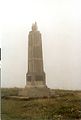 Marconi Monument - geograph.org.uk - 10188.jpg 431 × 640; 47 KB
-
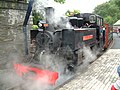 Mountaineer Tan-y-Bwlch 2.JPG 1,600 × 1,200; 819 KB
-
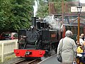 Mountaineer Tan-y-Bwlch.JPG 1,600 × 1,200; 792 KB
-
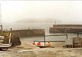 Mullion Cove Harbour - geograph.org.uk - 10189.jpg 640 × 442; 72 KB
-
 New Forest ponies - geograph.org.uk - 1213.jpg 640 × 480; 33 KB
-
 Piccadilly Gardens - geograph.org.uk - 496822.jpg 480 × 640; 100 KB
-
 Poulshot, Wiltshire - geograph.org.uk - 65303.jpg 640 × 480; 113 KB
-
 Skyreholme Beck - geograph.org.uk - 966010.jpg 640 × 417; 95 KB
-
 Skyreholme Beck above Trollers Gill - geograph.org.uk - 966019.jpg 640 × 399; 113 KB
-

-
 Skyreholme Beck, near Parcevall Hall - geograph.org.uk - 965991.jpg 444 × 640; 160 KB
-
 Syon House - geograph.org.uk - 308234.jpg 640 × 375; 80 KB
-
 Syon House with garden - geograph.org.uk - 308232.jpg 464 × 640; 163 KB
-
 The Prom - geograph.org.uk - 235064.jpg 640 × 423; 44 KB
-
 Alwen Reservoir at Sunset - geograph.org.uk - 10489.jpg 640 × 480; 92 KB
-
 Farm shed Westerdale - geograph.org.uk - 105070.jpg 640 × 479; 67 KB
-
 Forest Track to the Alwen Reservoir - geograph.org.uk - 10492.jpg 640 × 480; 110 KB
-
 Glencoe - geograph.org.uk - 13643.jpg 640 × 480; 172 KB
-
 Howtown Pier on Ullswater - geograph.org.uk - 1993.jpg 640 × 480; 57 KB
-
 Iron Canal Bridge - geograph.org.uk - 31597.jpg 600 × 400; 94 KB
-
 Needles in the fog - geograph.org.uk - 84869.jpg 640 × 480; 56 KB
-
 New House Farm Westerdale - geograph.org.uk - 105072.jpg 640 × 479; 84 KB
-
 Side Farm, Section of walk on Ullswater - geograph.org.uk - 1986.jpg 640 × 480; 62 KB
-
 Touch Muir - geograph.org.uk - 9920.jpg 640 × 480; 88 KB
-
 Trap - geograph.org.uk - 9923.jpg 640 × 407; 65 KB
-

-
 View from Carletheran - geograph.org.uk - 9925.jpg 640 × 407; 46 KB
-
 View of Fells from Glenridding - geograph.org.uk - 7301.jpg 640 × 480; 320 KB


