Category:United Kingdom photographs taken on 2005-02-26
Jump to navigation
Jump to search
Countries of Europe: Austria · Finland · France‡ · Germany · Italy · Latvia · Netherlands‡ · Portugal‡ · Romania · Russia‡ · Slovakia · Sweden · Switzerland · Ukraine · United Kingdom
‡: partly located in Europe
‡: partly located in Europe
| ← | 26 February 2005 | → | ||
| ← | February 2005 | → | ||

United Kingdom photographs taken on 26 February 2005.
Image files should be categorized here automatically using {{taken on}} template. Direct categorisation is also possible, if automatic is impossible.
Media in category "United Kingdom photographs taken on 2005-02-26"
The following 43 files are in this category, out of 43 total.
-
 "One of the moss bros fishing" - geograph.org.uk - 38903.jpg 640 × 480; 178 KB
-
 'Buttertubs' - geograph.org.uk - 33515.jpg 640 × 181; 51 KB
-
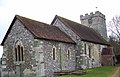
 Alsop en le Dale Church - geograph.org.uk - 205725.jpg 640 × 480; 81 KB
-
 Alternative boating on Treeton Dyke - geograph.org.uk - 435649.jpg 640 × 480; 266 KB
-

-
 Bannau Sir Gaer above Llyn y Fan Fach - geograph.org.uk - 535692.jpg 640 × 480; 85 KB
-
 Between Upper Halling and Holborough - geograph.org.uk - 259.jpg 640 × 480; 59 KB
-
 Cannock Chase - geograph.org.uk - 4824.jpg 640 × 365; 68 KB
-
 Castle Hedingham, Essex - geograph.org.uk - 487863.jpg 480 × 640; 93 KB
-
 Causey Pike - geograph.org.uk - 61765.jpg 640 × 480; 93 KB
-
 Chepstow's "fisherman" in Bank Square - geograph.org.uk - 501292.jpg 640 × 480; 69 KB
-
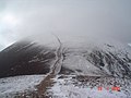
 Climbing Fan Brycheiniog - geograph.org.uk - 535700.jpg 640 × 480; 84 KB
-
 Cottage in the vernacular - geograph.org.uk - 1143028.jpg 640 × 480; 101 KB
-
 Cottage in the vernacular - geograph.org.uk - 1143064.jpg 640 × 480; 83 KB
-
 Duncan Ogg's Hole - geograph.org.uk - 39057.jpg 640 × 480; 134 KB
-
 Guizer Jarl at Norwick Up Helly Aa - geograph.org.uk - 518638.jpg 480 × 640; 65 KB
-
 Leybourne Lakes - geograph.org.uk - 258.jpg 640 × 480; 52 KB
-
-
 M6 Toll Junction T1 - geograph.org.uk - 15371.jpg 610 × 407; 40 KB
-
 Memorial to Plumpton Police Constable - geograph.org.uk - 172463.jpg 640 × 493; 107 KB
-

-
 Picws Du from Llyn y Fan Fach - geograph.org.uk - 535677.jpg 640 × 480; 88 KB
-
 Point to point - geograph.org.uk - 16477.jpg 640 × 480; 76 KB
-
 Ridgegate Reservoir, Macclesfield Forest.jpg 2,048 × 1,536; 1.24 MB
-
 Shell Beach, Tarbert, Kintyre - geograph.org.uk - 53121.jpg 640 × 480; 157 KB
-
 St Andrews Church, Great Durnford - geograph.org.uk - 309634.jpg 640 × 410; 97 KB
-

-
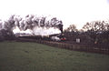 The Lickey Incline - geograph.org.uk - 1152655.jpg 640 × 417; 48 KB
-
 Tissington Hall - geograph.org.uk - 205730.jpg 640 × 480; 98 KB
-
 Trentabank Reservoir, Macclesfield Forest - geograph.org.uk - 44842.jpg 640 × 480; 163 KB
-
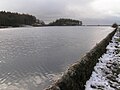
 University Lake - geograph.org.uk - 319453.jpg 640 × 480; 97 KB
-
 Waun Lefrith above Llyn y Fan Fach - geograph.org.uk - 535682.jpg 640 × 480; 116 KB
-
 Casting shadows - geograph.org.uk - 263607.jpg 640 × 480; 71 KB
-
 Cliff and seashore below Golden Cap - geograph.org.uk - 94093.jpg 640 × 480; 153 KB
-
 Footbridge at Dolgellau - geograph.org.uk - 24130.jpg 640 × 481; 77 KB
-
 Kinn. - geograph.org.uk - 61824.jpg 640 × 480; 69 KB
-
 Old poplar plantation, Avon valley, Hanham - geograph.org.uk - 5707.jpg 640 × 480; 131 KB
-
 Parwich Village - geograph.org.uk - 205721.jpg 450 × 600; 52 KB
-
 Rocks in the snow - geograph.org.uk - 263597.jpg 640 × 480; 97 KB
-
 Sail from Scar Crags - geograph.org.uk - 61809.jpg 640 × 480; 75 KB
-
 Spooners Farm, East Chiltington - geograph.org.uk - 108853.jpg 640 × 481; 84 KB
-
 Tree Bark - geograph.org.uk - 118306.jpg 480 × 640; 185 KB
-
 View from Causey Pike. - geograph.org.uk - 155141.jpg 640 × 480; 91 KB


,_Baltasound_-_geograph.org.uk_-_667339.jpg)


