Category:United Kingdom photographs taken on 2006-01-15
Jump to navigation
Jump to search
Countries of Europe: Austria · Belarus · Belgium · Finland · France‡ · Germany · Greece · Italy · Netherlands‡ · Poland · Portugal‡ · Russia‡ · Spain‡ · Switzerland · Ukraine · United Kingdom
‡: partly located in Europe
‡: partly located in Europe
| ← | 15 January 2006 | → | ||
| ← | January 2006 | → | ||

United Kingdom photographs taken on 15 January 2006.
Image files should be categorized here automatically using {{taken on}} template. Direct categorisation is also possible, if automatic is impossible.
Subcategories
This category has only the following subcategory.
Media in category "United Kingdom photographs taken on 2006-01-15"
The following 200 files are in this category, out of 510 total.
(previous page) (next page)-
 'Railway' Bridge over High Peak Trail - geograph.org.uk - 106280.jpg 640 × 480; 113 KB
-
 . Footpath junction in High Wood - geograph.org.uk - 106256.jpg 640 × 480; 220 KB
-
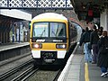 465004 at Beckenham Junction 03.jpg 1,600 × 1,200; 851 KB
-
 465004 at Beckenham Junction 01.jpg 1,600 × 1,200; 888 KB
-
 465004 at Beckenham Junction 02.jpg 1,600 × 1,200; 875 KB
-
 465004 at Beckenham Junction 04.jpg 1,600 × 1,200; 960 KB
-
 465004 at Brixton 01.jpg 1,600 × 1,200; 951 KB
-
 465004 at Brixton 02.jpg 2,672 × 1,096; 894 KB
-
 465004 at Brixton 03.jpg 1,600 × 1,200; 892 KB
-
 A droopy tree, Cholesbury Common - geograph.org.uk - 106853.jpg 480 × 640; 101 KB
-
 A glimpse of sun on a gloomy day - geograph.org.uk - 106058.jpg 640 × 480; 150 KB
-
 A Stone built sheep pen. - geograph.org.uk - 105996.jpg 640 × 480; 80 KB
-
 Abandoned Furniture Van in Venus Wood - geograph.org.uk - 106689.jpg 640 × 480; 213 KB
-
 Aberdaron New Church at Bodernabwy - geograph.org.uk - 106533.jpg 640 × 480; 74 KB
-

-
 Aerial View of Wells Cathedral - geograph.org.uk - 526211.jpg 640 × 427; 85 KB
-
 Aire Valley - geograph.org.uk - 106701.jpg 640 × 480; 116 KB
-
 Airey Houses Prior Mede Harthill - geograph.org.uk - 107039.jpg 640 × 427; 99 KB
-
 All Saints Church Newland Gloucestershire - geograph.org.uk - 107131.jpg 480 × 640; 112 KB
-
 All Saints church, Little Somborne - geograph.org.uk - 107103.jpg 640 × 480; 113 KB
-
 All Saints church, Little Somborne - geograph.org.uk - 107106.jpg 480 × 640; 90 KB
-
 All Saints' Church, Dedworth - geograph.org.uk - 106956.jpg 640 × 480; 85 KB
-
 Ampleforth, St Hilda - geograph.org.uk - 106386.jpg 640 × 426; 61 KB
-
 Ardley nature reserve - geograph.org.uk - 116978.jpg 640 × 480; 140 KB
-
 Ascot Racecourse - geograph.org.uk - 106944.jpg 640 × 480; 90 KB
-
 Ascot Racecourse - geograph.org.uk - 106994.jpg 640 × 480; 77 KB
-
 Asda - geograph.org.uk - 106413.jpg 640 × 480; 39 KB
-
 Aversley Wood - geograph.org.uk - 106155.jpg 400 × 533; 57 KB
-

-
 Banks Fee, Longborough - geograph.org.uk - 106711.jpg 640 × 426; 138 KB
-
 Barling Ness - geograph.org.uk - 119637.jpg 640 × 436; 39 KB
-
 Basingstoke Canal, near Nately - geograph.org.uk - 105975.jpg 640 × 480; 183 KB
-
 Beaufort Square Chepstow Monmouthshire - geograph.org.uk - 107587.jpg 640 × 480; 114 KB
-
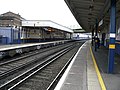
 Beckenham Junction station - looking east.jpg 1,600 × 1,200; 890 KB
-
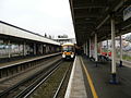
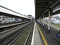
 Beckenham Junction station - Platform 1 - 01.jpg 1,600 × 1,200; 894 KB
-
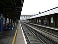 Beckenham Junction station - Platform 2 - 01.jpg 1,600 × 1,200; 877 KB
-
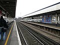 Beckenham Junction station - Platform 2 - 03.jpg 1,600 × 1,200; 876 KB
-
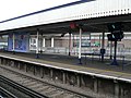
 Beckenham Junction station - Platform 2 - 04.jpg 1,600 × 1,200; 932 KB
-
 Beckenham Junction station - Platforms 2, 3 and 4 - 01.jpg 3,055 × 1,112; 1.11 MB
-
 Beckenham Junction station - Platforms 3 and 4 - 01.jpg 1,600 × 1,200; 878 KB
-
 Benwell's Wood - geograph.org.uk - 106279.jpg 640 × 480; 247 KB
-
 Betchworth Castle (Ruins of) - geograph.org.uk - 106259.jpg 640 × 506; 200 KB
-
 Between Great and Little Kelk - geograph.org.uk - 106621.jpg 640 × 480; 91 KB
-
 Boundary stone, Blackstone Edge - geograph.org.uk - 105937.jpg 683 × 1,024; 224 KB
-
 Holy Trinity Church, Bracknell - geograph.org.uk - 107896.jpg 640 × 480; 89 KB
-
 Bracknell town centre - geograph.org.uk - 106933.jpg 640 × 480; 91 KB
-
 Bridge - geograph.org.uk - 107037.jpg 640 × 479; 76 KB
-
 Brixton railway station 01.jpg 1,600 × 1,200; 959 KB
-
 Brixton railway station 02.jpg 1,600 × 1,200; 885 KB
-
 Broadway Cinema - geograph.org.uk - 106332.jpg 640 × 482; 115 KB
-
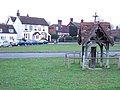 Brockham Green and the Royal Oak - geograph.org.uk - 106276.jpg 640 × 480; 165 KB
-
 Bronze statue on Brixton station.jpg 1,200 × 1,600; 867 KB
-

-
 C69 Stock train at Moorgate 01.jpg 1,600 × 1,200; 861 KB
-
 C69 Stock train at Moorgate 02.jpg 2,259 × 1,160; 834 KB
-
 Cadlan Uchaf Farm near Aberdaron - geograph.org.uk - 106496.jpg 640 × 480; 64 KB
-
 Canada Crescent, North Acton - geograph.org.uk - 109787.jpg 640 × 431; 208 KB
-

-
 Chalfont Lodge nursing home - geograph.org.uk - 106252.jpg 640 × 480; 191 KB
-
 Chalfont Park golf course - geograph.org.uk - 106305.jpg 640 × 480; 270 KB
-
 Chalk Hill - geograph.org.uk - 107111.jpg 640 × 480; 81 KB
-
 Champneys - geograph.org.uk - 106742.jpg 640 × 480; 100 KB
-
 Cheapside - geograph.org.uk - 106949.jpg 640 × 480; 86 KB
-
 Choice of way - geograph.org.uk - 106081.jpg 640 × 480; 91 KB
-
 Christ Church, South Nutfield - geograph.org.uk - 106941.jpg 480 × 640; 51 KB
-
 Christ Church, Virginia Water - geograph.org.uk - 106978.jpg 480 × 640; 75 KB
-
 Clayton Tunnel Northern entrance - geograph.org.uk - 1081681.jpg 640 × 480; 93 KB
-
 Clayton, West Sussex - geograph.org.uk - 1082140.jpg 640 × 480; 72 KB
-
 Colzium - geograph.org.uk - 106513.jpg 640 × 480; 203 KB
-
 Constitution Hill (2354521047).jpg 600 × 800; 60 KB
-
 Contrasting residences in Windsor - geograph.org.uk - 106954.jpg 640 × 480; 87 KB
-
 Corley Cricket Club - geograph.org.uk - 106227.jpg 640 × 427; 141 KB
-
 Corvus monedula - geograph.org.uk - 113607.jpg 640 × 442; 79 KB
-
 Cottages at Anelog, Wales.jpg 640 × 480; 79 KB
-
 Cottages at Staple Hill - geograph.org.uk - 106282.jpg 640 × 480; 65 KB
-
 Cottesmore school - geograph.org.uk - 1564715.jpg 640 × 480; 89 KB
-
 Cunningham Brook, Daisy Hill - geograph.org.uk - 106086.jpg 640 × 480; 156 KB
-
 Daisy Hill Station.jpg 640 × 480; 82 KB
-
 Deergarth How Island - geograph.org.uk - 106053.jpg 640 × 427; 94 KB
-
 Derwent Water - geograph.org.uk - 120715.jpg 640 × 480; 122 KB
-
 Detection loop at Morden Road tram stop.jpg 1,200 × 1,600; 857 KB
-
 Devon Fields - geograph.org.uk - 107129.jpg 640 × 480; 97 KB
-
 Disused Level Crossing - geograph.org.uk - 107014.jpg 640 × 480; 144 KB
-
 Disused Quarry, White Rig - geograph.org.uk - 106493.jpg 480 × 640; 259 KB
-
 Dob Park Bridge, Norwood - geograph.org.uk - 106511.jpg 640 × 480; 166 KB
-
 Dob Park Ford, Norwood, North Yorkshire - geograph.org.uk - 108816.jpg 640 × 480; 152 KB
-
 Donnington Brewery - geograph.org.uk - 106720.jpg 640 × 426; 119 KB
-
 Donnington Manor - geograph.org.uk - 106698.jpg 640 × 426; 135 KB
-
 Driveway to Three Gates House - geograph.org.uk - 108008.jpg 640 × 480; 102 KB
-
 Droitwich Rugby Club - geograph.org.uk - 106568.jpg 640 × 427; 57 KB
-
 Earlish Crofts - geograph.org.uk - 106344.jpg 640 × 480; 51 KB
-
-
 East Burn, Colzium - geograph.org.uk - 106502.jpg 640 × 480; 319 KB
-
 East of Driffield - geograph.org.uk - 106648.jpg 640 × 480; 94 KB
-
 East of Wansford - geograph.org.uk - 106646.jpg 640 × 480; 150 KB
-
 Englemere Pond - geograph.org.uk - 106942.jpg 640 × 480; 89 KB
-

-
 Exe Valley - geograph.org.uk - 107030.jpg 640 × 480; 81 KB
-
 Farm Road to Upper Venn Farm - geograph.org.uk - 106963.jpg 640 × 479; 103 KB
-
 Feeding Troughs, Upper Venn Farm - geograph.org.uk - 106416.jpg 640 × 479; 87 KB
-

-
 Fence - geograph.org.uk - 107058.jpg 640 × 479; 85 KB
-
 Fields and wood at Norwood Edge - geograph.org.uk - 106536.jpg 640 × 480; 122 KB
-
 Footpath Along the River Ure - geograph.org.uk - 114007.jpg 640 × 427; 62 KB
-
 Forgotten Tractor - geograph.org.uk - 107093.jpg 640 × 479; 117 KB
-
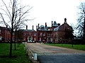
 Former Royal Earlswood Hospital - geograph.org.uk - 106922.jpg 640 × 480; 159 KB
-
 Gate and track - geograph.org.uk - 107054.jpg 640 × 480; 149 KB
-
 Gate and wall, Colzium - geograph.org.uk - 106529.jpg 640 × 480; 316 KB
-
 Gillygooley Primary School - geograph.org.uk - 105999.jpg 640 × 361; 97 KB
-
 Great Kelk.jpg 640 × 480; 95 KB
-
 Greenwood Lee, Widdop Road, Heptonstall - geograph.org.uk - 273187.jpg 640 × 480; 177 KB
-
 H&C Line train at Moorgate 01.jpg 1,600 × 1,200; 854 KB
-
 Hanbury Church - geograph.org.uk - 106572.jpg 427 × 640; 72 KB
-
 Hanbury Hall Lodge - geograph.org.uk - 106571.jpg 640 × 427; 155 KB
-

-
 Hendy Farm near Aberdaron - geograph.org.uk - 106501.jpg 640 × 480; 68 KB
-
 Hesketh Meadow Stables, Dobb Brow - geograph.org.uk - 106055.jpg 640 × 480; 128 KB
-
 High Scrubs, near Ambers Farm - geograph.org.uk - 106770.jpg 480 × 640; 129 KB
-
 Highland Cattle - geograph.org.uk - 106335.jpg 640 × 480; 109 KB
-
 Holl Reservoir Track - geograph.org.uk - 106923.jpg 640 × 480; 150 KB
-
 Houses in Norwood, North Yorkshire - geograph.org.uk - 108830.jpg 640 × 480; 93 KB
-
 Hyde Bridge - geograph.org.uk - 106893.jpg 640 × 479; 127 KB
-
 Griffin Inn Irnham-by-Tim-Heaton.jpg 640 × 480; 65 KB
-
 Irnham-Hall-by-Tim-Heaton.jpg 640 × 480; 62 KB
-
 Johnson's Pond, Windsor Great Park - geograph.org.uk - 106973.jpg 640 × 480; 89 KB
-

-
 Last Ditch Defence - geograph.org.uk - 106409.jpg 640 × 480; 71 KB
-

-
 Leeds185.JPG 640 × 480; 82 KB
-
 Leicester Airport - geograph.org.uk - 106755.jpg 640 × 480; 65 KB
-
 Letchworth Police Station. - geograph.org.uk - 106301.jpg 640 × 482; 124 KB
-
 Letchworth Railway Station - geograph.org.uk - 106313.jpg 640 × 482; 87 KB
-
 Letchworth Town Hall - geograph.org.uk - 106326.jpg 640 × 482; 130 KB
-
 Elim Pentecostal Church - geograph.org.uk - 106210.jpg 640 × 482; 94 KB
-

-

-

-
 Llanfaelrhys Chapel - geograph.org.uk - 106509.jpg 640 × 480; 90 KB
-
 Looking North from Nutfield Station - geograph.org.uk - 106904.jpg 640 × 480; 134 KB
-

-
 Love Lane, Longborough - geograph.org.uk - 106709.jpg 640 × 426; 116 KB
-
 Lowthorpe - Burton Agness Road Junction. - geograph.org.uk - 106623.jpg 640 × 480; 112 KB
-
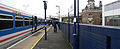
 Lowthorpe railway station.jpg 640 × 480; 130 KB
-
 Lowthwaite and Longlands. - geograph.org.uk - 106023.jpg 640 × 480; 37 KB
-
 Lowthwaite Fell from the footpath. - geograph.org.uk - 105991.jpg 640 × 429; 42 KB
-
 Lowthwaite Fell. - geograph.org.uk - 106019.jpg 640 × 480; 40 KB
-
 LU 1995 Stock at Moorgate.jpg 1,600 × 1,200; 846 KB
-
 LU-edgwarerdSSL-01.jpg 1,600 × 1,200; 828 KB
-
 LU-edgwarerdSSL-02.jpg 1,600 × 1,200; 878 KB
-
 LU-edgwarerdSSL-03.jpg 1,600 × 1,200; 980 KB
-
 LU-moorgate-escalators.jpg 1,600 × 1,200; 888 KB
-
 LU-SWimbledon-escalators.jpg 1,600 × 1,200; 871 KB
-
 Machine Cross - geograph.org.uk - 107077.jpg 640 × 480; 63 KB
-
 Market Drayton Swimming Bath - geograph.org.uk - 593399.jpg 640 × 480; 88 KB
-
 St Martin's, Chavey Down - geograph.org.uk - 106936.jpg 640 × 480; 85 KB
-
 Marwood House Farm - geograph.org.uk - 106140.jpg 640 × 480; 121 KB
-
 May as well be hanged for a sheep... - geograph.org.uk - 106377.jpg 640 × 480; 92 KB
-
 McPuddock - geograph.org.uk - 925894.jpg 640 × 480; 113 KB
-
 Meadow Lea Nursery, Dobbs Weir Road - geograph.org.uk - 106456.jpg 640 × 307; 47 KB
-
 Menwith Hill - Radomes at night - geograph.org.uk - 386041.jpg 640 × 427; 57 KB
-
 Meon Valley Railway Embankment - geograph.org.uk - 105866.jpg 640 × 480; 150 KB
-

-
 Morden Road tram stop - looking east 01.jpg 1,600 × 1,200; 849 KB
-
 Morden Road tram stop - looking east 02.jpg 1,600 × 1,200; 858 KB
-
 Morden Road tram stop - looking west 01.jpg 1,600 × 1,200; 839 KB
-
 Morden Road tram stop - looking west 02.jpg 1,600 × 1,200; 884 KB
-
 Moreton Paddox - geograph.org.uk - 108011.jpg 640 × 480; 58 KB
-
 Mount Lane School - geograph.org.uk - 593411.jpg 480 × 640; 97 KB
-
 Nafferton Pond.jpg 640 × 480; 86 KB
-
 Nafferton.jpg 640 × 480; 122 KB
-
 Natley Brickworks Arm, Basingstoke Canal - geograph.org.uk - 105983.jpg 640 × 480; 146 KB
-
 NE of Wansford - geograph.org.uk - 106641.jpg 640 × 480; 157 KB
-
 Nether Lane Crossing - geograph.org.uk - 106635.jpg 640 × 480; 109 KB
-
 Nether Lane Crossing, Nafferton - geograph.org.uk - 106634.jpg 640 × 480; 97 KB
-

-
 New Ground Bridge, near Tring - geograph.org.uk - 106774.jpg 640 × 480; 135 KB
-
 Newchapel St. James Church - geograph.org.uk - 106040.jpg 640 × 480; 66 KB
-

-
 North Carr Dales Road - geograph.org.uk - 234897.jpg 640 × 480; 165 KB
-
 North Lodge, Moreton Paddox - geograph.org.uk - 106271.jpg 640 × 480; 71 KB
-
 North of Great Kelk - geograph.org.uk - 106618.jpg 640 × 480; 103 KB
-
 Northfields, North Acton - geograph.org.uk - 109781.jpg 640 × 479; 153 KB
-
 NW of Lissett - geograph.org.uk - 106615.jpg 640 × 480; 150 KB
-

-
 Offa's Dyke signpost - geograph.org.uk - 106051.jpg 640 × 480; 72 KB
-
 Old building in Linicro - geograph.org.uk - 106348.jpg 640 × 480; 120 KB
-
 Orchill Court, Gerrards Cross - geograph.org.uk - 106290.jpg 640 × 480; 197 KB
-
 Paunton Court - geograph.org.uk - 107021.jpg 640 × 479; 81 KB
-
 Peat hag and stream, Crow Moss - geograph.org.uk - 106510.jpg 640 × 480; 265 KB
-
 Pedestrian crossing and tram signal at Morden Road.jpg 1,600 × 1,200; 838 KB
-
 Pedestrianised Shopping Street - geograph.org.uk - 106918.jpg 640 × 480; 133 KB
-
 Phone Booth, Post Box and Cottages - geograph.org.uk - 106682.jpg 640 × 480; 135 KB
-
 Pixton Woodlands - geograph.org.uk - 107022.jpg 640 × 480; 106 KB
-
 Plaque, Thirlmere Dam - geograph.org.uk - 106195.jpg 640 × 427; 126 KB
-
 Playground at Thundersley, Essex, England.jpg 640 × 480; 100 KB
-
 Polymer Latex, Stoke Works - geograph.org.uk - 106557.jpg 640 × 427; 101 KB
-
 Potters Lodge - geograph.org.uk - 106636.jpg 640 × 480; 137 KB
-

-
 Railway bridge, Ardley - geograph.org.uk - 116976.jpg 640 × 480; 128 KB
-


_-_geograph.org.uk_-_106259.jpg)


.jpg)


,_West_Cairns_Plantation_-_geograph.org.uk_-_106520.jpg)


