Category:United Kingdom photographs taken on 2007-07-10
Jump to navigation
Jump to search
Countries of Europe: Armenia‡ · Austria · Belgium · Croatia · Czech Republic · Denmark · Finland · France‡ · Germany · Greece · Hungary · Iceland · Republic of Ireland · Italy · Latvia · Netherlands‡ · Norway · Poland · Russia‡ · Serbia · Slovenia · Spain‡ · Sweden · Switzerland · Turkey‡ · Ukraine · United Kingdom
Limited recognition: Kosovo
‡: partly located in Europe
Limited recognition: Kosovo
‡: partly located in Europe
| ← | 10 July 2007 | → | ||
| ← | July 2007 | → | ||

United Kingdom photographs taken on 10 July 2007.
Image files should be categorized here automatically using {{taken on}} template. Direct categorisation is also possible, if automatic is impossible.
Subcategories
This category has the following 3 subcategories, out of 3 total.
L
S
Media in category "United Kingdom photographs taken on 2007-07-10"
The following 200 files are in this category, out of 837 total.
(previous page) (next page)-
 "The Black Horse", Gozzard's Ford - geograph.org.uk - 493168.jpg 640 × 480; 179 KB
-
 'Emstal' loading in Belfast - geograph.org.uk - 491588.jpg 640 × 406; 69 KB
-
 'Ocean Light' in Belfast - geograph.org.uk - 596220.jpg 640 × 360; 44 KB
-
 170206 at Marks Tey Station.jpg 3,648 × 2,736; 4.53 MB
-
 2 Necropolis Road - geograph.org.uk - 490900.jpg 640 × 550; 58 KB
-
 274-276 Cemetery Road - geograph.org.uk - 490906.jpg 640 × 595; 73 KB
-
 66140 Castleton East Junction (1).jpg 640 × 480; 171 KB
-
 A field of cultivated grass - geograph.org.uk - 492588.jpg 640 × 302; 38 KB
-
 A reminder of a lost summer - geograph.org.uk - 490958.jpg 640 × 480; 134 KB
-
 A SARTU crew heading for home - geograph.org.uk - 491671.jpg 640 × 480; 33 KB
-

-
 A Stone Circle - geograph.org.uk - 500258.jpg 640 × 427; 84 KB
-
 A56 towards Rising Bridge - geograph.org.uk - 490973.jpg 640 × 292; 53 KB
-
 Abbey Cottage, Rievaulx - geograph.org.uk - 574501.jpg 640 × 480; 102 KB
-
 Across the Fields at Higher Waterston - geograph.org.uk - 491174.jpg 640 × 480; 122 KB
-
 All Saints Church, Helmsley - Font - geograph.org.uk - 516846.jpg 480 × 640; 63 KB
-
 All Saints Church, Helmsley - geograph.org.uk - 516816.jpg 640 × 360; 109 KB
-

-
 All Saints Church, Helmsley - Lych Gate - geograph.org.uk - 516858.jpg 640 × 480; 125 KB
-

-
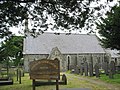
 All Saints Church, Nether Silton - geograph.org.uk - 517116.jpg 640 × 480; 98 KB
-

-
 All Saints Church, Nether Silton - Path - geograph.org.uk - 517087.jpg 640 × 480; 107 KB
-
 Andurn Point - geograph.org.uk - 491230.jpg 640 × 480; 135 KB
-
 Anglers Country Park - geograph.org.uk - 491538.jpg 640 × 480; 73 KB
-
 Anglers Country Park Lake - geograph.org.uk - 491215.jpg 640 × 480; 80 KB
-
 Anglers Country Park Lake - geograph.org.uk - 491224.jpg 640 × 480; 73 KB
-
 Another view of St Johns - geograph.org.uk - 491004.jpg 640 × 483; 73 KB
-
 Anvil Point returns to Belfast - geograph.org.uk - 491583.jpg 640 × 402; 68 KB
-
 Approach to Paddington - geograph.org.uk - 492859.jpg 640 × 480; 135 KB
-
 Arch by the Agricola Tower - geograph.org.uk - 491636.jpg 480 × 640; 105 KB
-
 Archway, Gods House Tower - geograph.org.uk - 495677.jpg 640 × 480; 192 KB
-
 Arney RC Church - geograph.org.uk - 492373.jpg 640 × 479; 50 KB
-
 Assorted Junk - geograph.org.uk - 491336.jpg 640 × 480; 135 KB
-
 Aughrim Townland - geograph.org.uk - 492550.jpg 640 × 479; 73 KB
-
 Back Lane - geograph.org.uk - 491040.jpg 640 × 480; 98 KB
-
 Back of St Johns - geograph.org.uk - 490985.jpg 640 × 402; 65 KB
-
 Barley Fields - geograph.org.uk - 490937.jpg 640 × 480; 95 KB
-
 Barley fields north of Dira Wood - geograph.org.uk - 490907.jpg 640 × 480; 103 KB
-

-
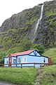
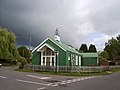 Bartley Tin Church - geograph.org.uk - 490941.jpg 640 × 480; 77 KB
-
 Barton Haven - geograph.org.uk - 491200.jpg 490 × 640; 132 KB
-

-

-
 Belcoo - geograph.org.uk - 492564.jpg 640 × 479; 48 KB
-
 Belcoo - geograph.org.uk - 492569.jpg 640 × 479; 56 KB
-
 Belcoo Railway Station - geograph.org.uk - 492562.jpg 640 × 479; 66 KB
-
 Belfast West Power Station (2) - geograph.org.uk - 491719.jpg 640 × 295; 57 KB
-
 Bellanaleck - geograph.org.uk - 492340.jpg 640 × 479; 68 KB
-
 Bellanaleck, County Fermanagh - geograph.org.uk - 492336.jpg 640 × 479; 48 KB
-
 Bench mark in the Castle Square - geograph.org.uk - 1388976.jpg 480 × 640; 78 KB
-
 Black Beauty meets Duck - geograph.org.uk - 491245.jpg 640 × 480; 91 KB
-
 Blackburn Road Rising Bridge - geograph.org.uk - 490997.jpg 640 × 394; 66 KB
-
 Boundary Wall of Walton Park - geograph.org.uk - 492090.jpg 640 × 480; 102 KB
-
 BPIS Ltd - Cemetery Road - geograph.org.uk - 490921.jpg 640 × 612; 75 KB
-

-
 Former Chapel - Wallis Street - geograph.org.uk - 490912.jpg 640 × 454; 62 KB
-
 Bridge End Station - geograph.org.uk - 491724.jpg 640 × 480; 104 KB
-
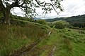
 Bridleway - geograph.org.uk - 490783.jpg 640 × 480; 138 KB
-
 Bridleway in Miterdale - geograph.org.uk - 514301.jpg 640 × 426; 129 KB
-
 Bridleway through oilseed rape field - geograph.org.uk - 492615.jpg 640 × 427; 116 KB
-
 Brown and Muff - Market Street - geograph.org.uk - 490896.jpg 640 × 523; 56 KB
-
 Burnmoor Tarn - geograph.org.uk - 493800.jpg 640 × 426; 95 KB
-
 Bury Road - geograph.org.uk - 491162.jpg 640 × 385; 71 KB
-

-

-
 Cambridge University rugby ground - geograph.org.uk - 557922.jpg 640 × 480; 37 KB
-
 St Luke's Church - geograph.org.uk - 493256.jpg 425 × 639; 255 KB
-
 Canal bridge, High Street, Solihull Lodge - geograph.org.uk - 490877.jpg 640 × 480; 100 KB
-
 Canal bridge, High Street, Solihull Lodge - geograph.org.uk - 490889.jpg 640 × 480; 127 KB
-
 Canal moorings - geograph.org.uk - 495575.jpg 640 × 451; 132 KB
-
 Canal-side gardens in Solihull Lodge - geograph.org.uk - 490810.jpg 640 × 480; 107 KB
-
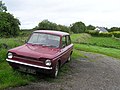 Car at Derryscobe - geograph.org.uk - 492748.jpg 640 × 479; 62 KB
-

-
 Carron Reservoir Dam - geograph.org.uk - 1464062.jpg 640 × 483; 61 KB
-
 Castle Drive from the Castle Ramparts - geograph.org.uk - 493399.jpg 640 × 480; 178 KB
-
 Cattle above Wasdale - geograph.org.uk - 528332.jpg 640 × 426; 96 KB
-
 Cattle at Brithdir Mawr - geograph.org.uk - 492640.jpg 640 × 365; 72 KB
-
 CC Bar - geograph.org.uk - 491195.jpg 640 × 480; 97 KB
-
 Chester Castle Ramparts - geograph.org.uk - 491646.jpg 480 × 640; 69 KB
-
 Chester Castle Ramparts - geograph.org.uk - 492021.jpg 640 × 480; 110 KB
-

-
 Chesterton allotments - geograph.org.uk - 557753.jpg 640 × 480; 54 KB
-
 Christ Church, Skipton, Yorkshire - geograph.org.uk - 497174.jpg 640 × 427; 89 KB
-
 Churchyard Roses - geograph.org.uk - 517123.jpg 640 × 480; 87 KB
-
-

-
 Cleggan Townland - geograph.org.uk - 492534.jpg 640 × 479; 59 KB
-
 Cobden Street Library - geograph.org.uk - 495144.jpg 640 × 427; 83 KB
-
 Cod Beck Reservoir - geograph.org.uk - 517142.jpg 640 × 480; 91 KB
-
 Cold Hiendley Common Lane - geograph.org.uk - 491177.jpg 640 × 475; 127 KB
-
 Cold Hiendley Reservoir Outflow - geograph.org.uk - 491205.jpg 640 × 480; 133 KB
-
 Common mallow (Malva sylvestris) - geograph.org.uk - 496843.jpg 480 × 640; 104 KB
-

-
 Cooper's Plantation - geograph.org.uk - 490772.jpg 640 × 480; 118 KB
-
 Countryside east of Kellinch - geograph.org.uk - 491263.jpg 640 × 480; 91 KB
-
 County Hall from the Castle Ramparts - geograph.org.uk - 491649.jpg 640 × 480; 141 KB
-

-
 Craig-y-fro - geograph.org.uk - 491009.jpg 640 × 480; 119 KB
-
 Cranes of Harland and Wolff - geograph.org.uk - 491573.jpg 640 × 414; 53 KB
-
 Craven Hall. Keighley Road, Skipton - geograph.org.uk - 497170.jpg 640 × 427; 89 KB
-
 Crests on Whorlton Castle - geograph.org.uk - 517555.jpg 640 × 480; 100 KB
-
 Culky Townland - geograph.org.uk - 492327.jpg 640 × 479; 73 KB
-
 Cwm Taf Fechan LNR - geograph.org.uk - 491098.jpg 480 × 640; 132 KB
-
 Dane Bower quarry, disused chimney - geograph.org.uk - 1068409.jpg 640 × 480; 95 KB
-
 De Vere Grand Harbour Hotel, Southampton - geograph.org.uk - 495641.jpg 640 × 480; 232 KB
-
 Debdale Lock - geograph.org.uk - 495501.jpg 640 × 487; 121 KB
-
 Debdale Lock - geograph.org.uk - 495509.jpg 640 × 474; 151 KB
-
 Devil's Brook - geograph.org.uk - 491056.jpg 640 × 480; 95 KB
-
 Diglis Hotel garden - geograph.org.uk - 504447.jpg 640 × 480; 118 KB
-
 Dillington House2.jpg 640 × 472; 113 KB
-
 Dillington Park Lodge - geograph.org.uk - 492446.jpg 640 × 402; 94 KB
-
 Disused quarry track - geograph.org.uk - 491153.jpg 640 × 480; 156 KB
-
 Doctors Surgery Bury Road - geograph.org.uk - 491126.jpg 640 × 437; 72 KB
-
 Door to Stokesley Methodist Church - geograph.org.uk - 517637.jpg 477 × 640; 101 KB
-
 Dorset Farmland - geograph.org.uk - 491967.jpg 640 × 480; 115 KB
-
 Downhill - geograph.org.uk - 1008449.jpg 427 × 640; 79 KB
-
 Dowrich Farm - geograph.org.uk - 490919.jpg 640 × 480; 99 KB
-
 Dragon boat at Worcester - geograph.org.uk - 504442.jpg 640 × 480; 89 KB
-
 Drumawill, Enniskillen - geograph.org.uk - 492317.jpg 640 × 478; 52 KB
-
 Drumkeen Townland - geograph.org.uk - 492324.jpg 640 × 479; 66 KB
-
 Drumsillagh Townland - geograph.org.uk - 492450.jpg 640 × 479; 70 KB
-
 Early Marsh Orchid - geograph.org.uk - 492125.jpg 480 × 640; 70 KB
-
-
 Eastern portal of Cookley Tunnel.jpg 640 × 480; 151 KB
-
 Eglwys Pentir - St Cedol CinW Church - geograph.org.uk - 491851.jpg 640 × 480; 77 KB
-
 Eglwys Sant Cedol Church, Pentir - geograph.org.uk - 491844.jpg 640 × 480; 120 KB
-
 Electrical Pylons - geograph.org.uk - 490745.jpg 640 × 480; 121 KB
-
 Enniskillen - geograph.org.uk - 492780.jpg 640 × 439; 50 KB
-
 Enniskillen - geograph.org.uk - 492783.jpg 640 × 440; 43 KB
-
 Entrance to Haw Park Woods - geograph.org.uk - 491539.jpg 640 × 479; 125 KB
-
 Entrance to Whorlton Castle - geograph.org.uk - 517537.jpg 477 × 640; 96 KB
-
 Ermine Street near Cranwell - geograph.org.uk - 496443.jpg 640 × 480; 99 KB
-
 Ermine Street near Cranwell - geograph.org.uk - 496481.jpg 640 × 427; 82 KB
-
 Factories at Cookley - geograph.org.uk - 495527.jpg 640 × 476; 111 KB
-
 Faithful - Flickr - orangeacid.jpg 2,592 × 3,888; 2.91 MB
-
 Farm road near Crooke Cross - geograph.org.uk - 490931.jpg 640 × 480; 100 KB
-
 Farm track - geograph.org.uk - 490778.jpg 640 × 480; 124 KB
-
 Farmland near Old Somerby - geograph.org.uk - 491468.jpg 640 × 427; 98 KB
-
 Farmland near Welby Lodge Farm - geograph.org.uk - 492662.jpg 640 × 427; 91 KB
-
 Farmland near Welby Lodge Farm - geograph.org.uk - 492663.jpg 640 × 427; 91 KB
-

-
 Felixstowe old station.JPG 2,048 × 1,536; 866 KB
-
 Field of sheep above Nant Crew Bridge - geograph.org.uk - 491018.jpg 640 × 480; 143 KB
-

-
 Fish Farm buildings. - geograph.org.uk - 505761.jpg 640 × 359; 57 KB
-
 Flip Road passing under the A56 - geograph.org.uk - 490966.jpg 640 × 360; 64 KB
-
 Footbridge over River Kent - geograph.org.uk - 504790.jpg 640 × 480; 127 KB
-
 FR ME firebox.JPG 2,400 × 1,600; 1.46 MB
-
 FR TYB ME 2.JPG 1,600 × 2,400; 1.79 MB
-
 FR TYB ME smoke.JPG 2,400 × 1,600; 2.3 MB
-
 FR TYB ME.JPG 1,689 × 1,593; 1,009 KB
-
 FR TYB Palmerston A.JPG 2,400 × 1,600; 2.41 MB
-
 Freemasons Hall, Hunter Street - geograph.org.uk - 493457.jpg 640 × 480; 116 KB
-

-
 Gainsborough Old hall - geograph.org.uk - 495134.jpg 640 × 427; 106 KB
-
 Gate house at Culky - geograph.org.uk - 492326.jpg 640 × 479; 103 KB
-
 Gates at Whorlton Old Church - geograph.org.uk - 517232.jpg 640 × 480; 127 KB
-
 Geraldine Mary Harmsworth Park - geograph.org.uk - 492848.jpg 639 × 480; 143 KB
-
 Geraldine Mary Harmsworth Park - geograph.org.uk - 492856.jpg 480 × 640; 131 KB
-
 Gheluvelt Park - geograph.org.uk - 504433.jpg 640 × 480; 112 KB
-
 Goat Cutting, Beddgelert - geograph.org.uk - 559914.jpg 640 × 480; 96 KB
-
 God's House Tower - geograph.org.uk - 495668.jpg 640 × 480; 136 KB
-
 Gossiping - geograph.org.uk - 516930.jpg 640 × 480; 117 KB
-
 Grassy lane to Brithdir Mawr - geograph.org.uk - 492593.jpg 640 × 335; 44 KB
-
 Grazing 'midst the thistles - geograph.org.uk - 492243.jpg 640 × 388; 74 KB
-
 Great Broughton Methodist Church - geograph.org.uk - 517672.jpg 640 × 480; 70 KB
-
 Great Fen - geograph.org.uk - 491613.jpg 640 × 427; 82 KB
-
 Great Mullein - geograph.org.uk - 491264.jpg 425 × 640; 198 KB
-
 Great Orme - geograph.org.uk - 559932.jpg 640 × 480; 69 KB
-
 Great Orme Cable Car - geograph.org.uk - 559556.jpg 640 × 480; 42 KB
-
 Great Orme Summit - geograph.org.uk - 559928.jpg 640 × 480; 37 KB
-
 Great Orme Tramway - geograph.org.uk - 559568.jpg 640 × 480; 44 KB
-
 Great Orme Tramway midway station - geograph.org.uk - 559550.jpg 640 × 480; 50 KB
-
 Great Orme Tramway top station - geograph.org.uk - 559561.jpg 639 × 479; 55 KB
-
 Greenfield Street - geograph.org.uk - 491141.jpg 640 × 404; 85 KB
-
 Griffin Inn Hud Rake - geograph.org.uk - 491087.jpg 640 × 480; 89 KB
-
 Grimsay Landscape Ruabhal.jpg 640 × 359; 42 KB
-
 Half Complete Office Building - geograph.org.uk - 658885.jpg 640 × 480; 79 KB
-
 Harcamlow Way - geograph.org.uk - 557901.jpg 640 × 480; 51 KB
-
 Haslingden CC - geograph.org.uk - 491198.jpg 640 × 448; 76 KB
-
 Head of Miterdale - geograph.org.uk - 514114.jpg 640 × 426; 117 KB
-
 Headquarters of Charles Edward Stuart - geograph.org.uk - 490780.jpg 640 × 429; 53 KB
-
 Hedgerow near Welby - geograph.org.uk - 491479.jpg 640 × 427; 111 KB
-
 All Saints Church 05.jpg 640 × 480; 99 KB
-
 High Street, Timsbury.jpg 640 × 427; 76 KB
-
 Hill Road Newmillerdam - geograph.org.uk - 492364.jpg 480 × 640; 76 KB
-
 Holy Cross Church, Swainby - Door - geograph.org.uk - 517160.jpg 640 × 480; 115 KB
-
 Holy Cross Church, Swainby - geograph.org.uk - 517158.jpg 640 × 480; 84 KB
-
 Holy Trinity Church, Boltby - Gate - geograph.org.uk - 516873.jpg 640 × 480; 127 KB
-
 Holy Trinity Church, Boltby - geograph.org.uk - 516869.jpg 640 × 480; 87 KB
-

-
 Holy Trinity Church, Boltby - Porch - geograph.org.uk - 516880.jpg 477 × 640; 105 KB
-

-

-
 Holyrood Southampton.jpg 480 × 640; 170 KB
-

-
 Hud Hey Road - geograph.org.uk - 491028.jpg 640 × 311; 80 KB
-
 Humber Bank Flora - geograph.org.uk - 491243.jpg 425 × 640; 197 KB
-
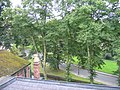
 Hurcott Wood - geograph.org.uk - 495635.jpg 640 × 480; 149 KB


.jpg)


_-_geograph.org.uk_-_491719.jpg)


_-_geograph.org.uk_-_491031.jpg)


_-_geograph.org.uk_-_496843.jpg)


