Category:United Kingdom photographs taken on 2007-10-28
Jump to navigation
Jump to search
| ← | Sunday 28 October 2007 | → | ||
| ← | October 2007 | → | ||

United Kingdom photographs taken on 28 October 2007.
Image files should be categorized here automatically using {{taken on}} template. Direct categorisation is also possible, if automatic is impossible.
Subcategories
This category has only the following subcategory.
Media in category "United Kingdom photographs taken on 2007-10-28"
The following 200 files are in this category, out of 893 total.
(previous page) (next page)-
 "Footpath upgrade." - geograph.org.uk - 613323.jpg 640 × 480; 88 KB
-

-
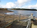 'Low tide' at Kielder Reservoir - geograph.org.uk - 597509.jpg 640 × 480; 84 KB
-
 'S' bend on Church Field Road - geograph.org.uk - 597465.jpg 640 × 438; 97 KB
-
 185127 Castleton East Junction (1).jpg 1,024 × 768; 627 KB
-
 185130 Castleton East Junction (1).jpg 1,024 × 768; 626 KB
-
 A Bracket fungus but cannot identify it. - geograph.org.uk - 598165.jpg 640 × 480; 100 KB
-
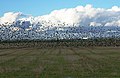
 A gaggle of geese - geograph.org.uk - 597682.jpg 640 × 396; 64 KB
-
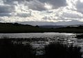 A pool on the Begwyns - geograph.org.uk - 597620.jpg 640 × 450; 56 KB
-
 A road to nowhere... - geograph.org.uk - 597070.jpg 640 × 480; 51 KB
-
 A selection of cranes - geograph.org.uk - 597025.jpg 640 × 425; 57 KB
-
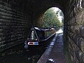 A tight squeeze on the Shropshire Union - geograph.org.uk - 597458.jpg 640 × 480; 252 KB
-
 A85, Milton of Abercairny - geograph.org.uk - 597340.jpg 640 × 480; 112 KB
-
 Access to Soldonmoor Cottage - geograph.org.uk - 602295.jpg 600 × 450; 178 KB
-
 Across the water to Castle Street - geograph.org.uk - 624690.jpg 640 × 480; 71 KB
-
 Ailsa Jane, St Abbs harbour - geograph.org.uk - 597701.jpg 427 × 640; 66 KB
-
 Alley behind Silverburn Centre - geograph.org.uk - 597242.jpg 640 × 480; 52 KB
-
 Allt a' Bharnie - geograph.org.uk - 598033.jpg 480 × 640; 86 KB
-
 Along the causeway (1813854936).jpg 784 × 517; 383 KB
-
 American Football, Wembley (1799000257).jpg 2,560 × 1,920; 364 KB
-
 Approach to South Wonford - geograph.org.uk - 599057.jpg 600 × 450; 145 KB
-
 Around the bend at Cookbury Wick - geograph.org.uk - 597551.jpg 600 × 450; 136 KB
-
 Ashford Bowls Club - geograph.org.uk - 1160056.jpg 640 × 480; 96 KB
-
 Ashford Kent - geograph.org.uk - 1149281.jpg 640 × 480; 102 KB
-
 Ashford Kent Trattoria Romana - geograph.org.uk - 1141427.jpg 480 × 640; 68 KB
-
 Ashford Town Centre - geograph.org.uk - 1039347.jpg 480 × 640; 90 KB
-
 Ashford, Kent - geograph.org.uk - 1149324.jpg 480 × 640; 85 KB
-
 At the cross roads Holsworthy Beacon - geograph.org.uk - 599892.jpg 600 × 450; 145 KB
-
 At Virworthy - geograph.org.uk - 602229.jpg 600 × 450; 160 KB
-
 Auchnafree - geograph.org.uk - 598223.jpg 640 × 480; 77 KB
-
 Auchnafree Millennium Circle - geograph.org.uk - 598211.jpg 640 × 480; 95 KB
-
 Autumn Beech and Larch - geograph.org.uk - 597217.jpg 480 × 640; 154 KB
-

-
 Bakewell Pudding Factory - geograph.org.uk - 597524.jpg 640 × 482; 94 KB
-
 Balcomie Castle - geograph.org.uk - 598107.jpg 640 × 386; 93 KB
-
 Bankmore Street, Belfast - geograph.org.uk - 597138.jpg 640 × 426; 67 KB
-
 Barmouth Harbour Master's Office - geograph.org.uk - 598478.jpg 640 × 480; 98 KB
-
 Beach hut on the Bouldnor shore - geograph.org.uk - 601825.jpg 640 × 477; 121 KB
-
 Beadlet anemones - geograph.org.uk - 620724.jpg 640 × 480; 124 KB
-
 Beech tree on Peebles Golf Course - geograph.org.uk - 597511.jpg 480 × 640; 133 KB
-
 Below Castle Ewen - geograph.org.uk - 596958.jpg 640 × 425; 262 KB
-
 Bend and river bridge - geograph.org.uk - 598125.jpg 600 × 450; 167 KB
-
 Birds of a feather - geograph.org.uk - 613048.jpg 640 × 416; 162 KB
-
 Blue boat - geograph.org.uk - 599015.jpg 640 × 518; 84 KB
-
 Boats laid up for winter - geograph.org.uk - 607572.jpg 640 × 480; 74 KB
-

-
 Bogs on Meall nan Eanchainn - geograph.org.uk - 599661.jpg 640 × 480; 70 KB
-
-
 Boulder with Cairn - geograph.org.uk - 601945.jpg 600 × 480; 67 KB
-
 Bouldnor Bay - geograph.org.uk - 597256.jpg 640 × 470; 83 KB
-
 Bouldnor Cliff - geograph.org.uk - 604690.jpg 640 × 477; 124 KB
-
 Bradford Cathedral 02.jpg 640 × 480; 34 KB
-
 Braid Hills golf course - geograph.org.uk - 596932.jpg 640 × 480; 95 KB
-
 Breakwater in Horn Reach - geograph.org.uk - 601745.jpg 640 × 477; 63 KB
-

-
 Bridge over the River Allen (3) - geograph.org.uk - 948526.jpg 640 × 480; 129 KB
-
 Bridleway to Clayton - geograph.org.uk - 597442.jpg 640 × 480; 87 KB
-
 Bridleway to Tyn-y-byrwydd - geograph.org.uk - 597600.jpg 640 × 480; 127 KB
-
 Broadclyst, Culm valley - geograph.org.uk - 597399.jpg 640 × 427; 173 KB
-
 Brynhwdog Farm - geograph.org.uk - 600310.jpg 640 × 481; 86 KB
-
 Bucklerburn Road - geograph.org.uk - 628502.jpg 620 × 465; 188 KB
-
 Bucklerburn Road - geograph.org.uk - 628514.jpg 470 × 627; 181 KB
-
 Bulldozed road - geograph.org.uk - 600772.jpg 640 × 480; 80 KB
-
 Burn Road, Fixby - geograph.org.uk - 597190.jpg 640 × 480; 99 KB
-
 Burn Road, Lindley - geograph.org.uk - 597233.jpg 640 × 480; 144 KB
-
 Butts, Meall nam Broighleag - geograph.org.uk - 599027.jpg 640 × 480; 59 KB
-
 Byway BS76 - geograph.org.uk - 602282.jpg 640 × 480; 101 KB
-
 Caernarfon Bay from Mount Snowdon - geograph.org.uk - 968707.jpg 640 × 480; 58 KB
-

-
 Cairn, South Slope of Queensberry - geograph.org.uk - 601944.jpg 640 × 427; 63 KB
-
 Capel Burn - geograph.org.uk - 598809.jpg 640 × 427; 81 KB
-
 Capel Burn - geograph.org.uk - 600754.jpg 427 × 640; 64 KB
-
 Captain Street - geograph.org.uk - 597104.jpg 640 × 414; 34 KB
-
 Carreg Thomas - geograph.org.uk - 620723.jpg 640 × 480; 65 KB
-
 Castle Ewen - geograph.org.uk - 596950.jpg 640 × 426; 244 KB
-
 Castle Inn - Bakewell - geograph.org.uk - 597577.jpg 640 × 482; 104 KB
-
 Cathedral Centre - Captain Street - geograph.org.uk - 597106.jpg 640 × 470; 38 KB
-
 Cattle, Tomenbowie - geograph.org.uk - 598196.jpg 640 × 480; 76 KB
-
 Ceunant - geograph.org.uk - 599508.jpg 640 × 481; 85 KB
-
 Chapel at Milton Damerel - geograph.org.uk - 599808.jpg 600 × 450; 169 KB
-
 Chapel at Woodacott Cross - geograph.org.uk - 599041.jpg 600 × 450; 139 KB
-
 Church on Dumbarton Road - geograph.org.uk - 597215.jpg 640 × 480; 89 KB
-
 Clach na Tiompan - geograph.org.uk - 598205.jpg 640 × 480; 91 KB
-
 Cliff formation, north of St Abbs - geograph.org.uk - 599043.jpg 640 × 429; 119 KB
-
 Cliffs at Bluemull - geograph.org.uk - 597182.jpg 640 × 426; 110 KB
-
 Cliffs south of Blue Mull - geograph.org.uk - 597186.jpg 640 × 426; 107 KB
-
 Clifton Marine Parade, Gravesend - geograph.org.uk - 601881.jpg 640 × 480; 59 KB
-
 Clock tower of Clydebank Town Hall - geograph.org.uk - 597221.jpg 480 × 640; 67 KB
-
-

-
 Coastal path near Bouldnor - geograph.org.uk - 601819.jpg 640 × 477; 71 KB
-
 Coastal woodland - geograph.org.uk - 604653.jpg 640 × 477; 134 KB
-
 Coire nan Eanchainn - geograph.org.uk - 599003.jpg 640 × 480; 77 KB
-
 Coire nan Eanchainn - geograph.org.uk - 599656.jpg 640 × 480; 70 KB
-
 Coire Quaich - geograph.org.uk - 599835.jpg 640 × 480; 67 KB
-
 College Gardens, Belfast (part) - geograph.org.uk - 596973.jpg 640 × 426; 76 KB
-
 Conichan - geograph.org.uk - 598177.jpg 640 × 480; 79 KB
-
 Conichan Castle - geograph.org.uk - 598045.jpg 640 × 443; 64 KB
-
 Conichan Castle - geograph.org.uk - 598173.jpg 480 × 640; 92 KB
-
 Contented longhorns on 'The Avenue' - geograph.org.uk - 597502.jpg 640 × 480; 358 KB
-
 Corbett's Bridge - geograph.org.uk - 599592.jpg 640 × 480; 84 KB
-
 Corn Dolly - Bolton Road - geograph.org.uk - 597112.jpg 640 × 467; 32 KB
-
 Cottages at Milton Damerel - geograph.org.uk - 599798.jpg 600 × 450; 165 KB
-
 Cottages at South Wonford - geograph.org.uk - 599055.jpg 600 × 450; 178 KB
-
 Country cottage at Milton Damerel - geograph.org.uk - 599870.jpg 600 × 450; 158 KB
-
 Country road near Berry Farm - geograph.org.uk - 599061.jpg 600 × 450; 172 KB
-
 Cove Wynd, Pittenweem. - geograph.org.uk - 624644.jpg 480 × 640; 82 KB
-
 Crab's eye view from Murlough Beach - geograph.org.uk - 866116.jpg 640 × 494; 92 KB
-
 Craigellachie Bridge - Flickr - M McBey.jpg 2,135 × 1,331; 773 KB
-
 Crane and river, Waldringfield - geograph.org.uk - 939267.jpg 480 × 640; 74 KB
-
 Crane, Ormeau Avenue, Belfast - geograph.org.uk - 597073.jpg 640 × 426; 76 KB
-
 Crepidotus mollis - geograph.org.uk - 596905.jpg 640 × 480; 125 KB
-
 Crossing the void - geograph.org.uk - 776295.jpg 640 × 426; 98 KB
-
 Culter House Road - geograph.org.uk - 628510.jpg 627 × 470; 174 KB
-
 Dalmore Craig - geograph.org.uk - 598059.jpg 640 × 480; 105 KB
-
 Dalriech, Glen Almond - geograph.org.uk - 598783.jpg 640 × 480; 59 KB
-
 Dam, Stuck Chapel Burn - geograph.org.uk - 598807.jpg 640 × 480; 134 KB
-
 Dawlish, Dawlish Warren beach - geograph.org.uk - 597384.jpg 640 × 420; 118 KB
-
 Dawlish, towards Dawlish Warren station - geograph.org.uk - 597383.jpg 640 × 427; 181 KB
-
 Dead tree at Willersley Castle - geograph.org.uk - 597597.jpg 482 × 640; 101 KB
-
 Deer in Guerness Wood - geograph.org.uk - 597838.jpg 591 × 480; 330 KB
-
 Departure from Lymington - geograph.org.uk - 601734.jpg 640 × 477; 68 KB
-
 Derelict glasshouses - geograph.org.uk - 596777.jpg 640 × 543; 183 KB
-
 Detail at Caddonfoot Parish Church - geograph.org.uk - 598142.jpg 591 × 452; 154 KB
-
 Devon Drizzle - geograph.org.uk - 602341.jpg 600 × 450; 178 KB
-
 Devonport House Hotel, Greenwich - geograph.org.uk - 599629.jpg 640 × 480; 96 KB
-
 Diggers on the bridge2 - geograph.org.uk - 607196.jpg 640 × 480; 83 KB
-
 Dismantled railway at Caddonlee - geograph.org.uk - 597534.jpg 640 × 480; 125 KB
-
 Disused quarry (entrance) - geograph.org.uk - 599731.jpg 600 × 450; 155 KB
-
-
 Driveway to Blagdonmoor Wharf - geograph.org.uk - 598135.jpg 600 × 450; 154 KB
-
 Dry Docks - geograph.org.uk - 597027.jpg 640 × 425; 61 KB
-
 Dryburn Moor - geograph.org.uk - 598418.jpg 640 × 480; 107 KB
-
 Duncansby Lighthouse - geograph.org.uk - 664824.jpg 640 × 426; 49 KB
-
 Dunnet Head Lighthouse - geograph.org.uk - 664866.jpg 640 × 426; 56 KB
-
 Earls of Moray Chapel - geograph.org.uk - 599097.jpg 640 × 480; 83 KB
-
 Earth Work - geograph.org.uk - 598123.jpg 640 × 426; 41 KB
-
 Elie beach - geograph.org.uk - 624508.jpg 640 × 480; 62 KB
-
 Elie Lighthouse - geograph.org.uk - 624539.jpg 640 × 480; 62 KB
-
 Elie Ness lighthouse. - geograph.org.uk - 624534.jpg 640 × 480; 69 KB
-
 Elie seafront - geograph.org.uk - 624503.jpg 640 × 480; 70 KB
-
 Elm Terrace, The Green, Wallsend - geograph.org.uk - 596992.jpg 640 × 425; 83 KB
-
 Entrance to Lamerton Farm - geograph.org.uk - 598131.jpg 600 × 450; 185 KB
-
 Entrance to Northfield House, St Abbs - geograph.org.uk - 597914.jpg 427 × 640; 83 KB
-
 Entrance to Park Crescent - geograph.org.uk - 598974.jpg 640 × 480; 67 KB
-
 Entrance to Rhiw Goch Farm - geograph.org.uk - 599401.jpg 640 × 480; 77 KB
-
 Entrance to Vaglefield Farm - geograph.org.uk - 598150.jpg 600 × 450; 159 KB
-
 Exeter - on Exeter St Davids station - geograph.org.uk - 597388.jpg 640 × 427; 182 KB
-

-
 Fallen leaves - geograph.org.uk - 596888.jpg 640 × 480; 112 KB
-
 Falls of Keltie - geograph.org.uk - 597674.jpg 428 × 640; 133 KB
-

-
 Farm Building - geograph.org.uk - 658414.jpg 640 × 480; 89 KB
-
 Farm Track - geograph.org.uk - 602168.jpg 640 × 480; 51 KB
-
 Farmland at Tain - geograph.org.uk - 597397.jpg 640 × 480; 43 KB
-

-
 Fere Mere, Monyash - geograph.org.uk - 599620.jpg 640 × 480; 106 KB
-
 Fergushill manse.JPG 2,288 × 1,712; 1.31 MB
-
 Field access lane - geograph.org.uk - 599040.jpg 600 × 450; 151 KB
-
 Fields along side Weston Jones Mill - geograph.org.uk - 597403.jpg 640 × 480; 106 KB
-
 Fields at Meadowhead - geograph.org.uk - 597004.jpg 640 × 480; 89 KB
-

-
 Fields, Conichan - geograph.org.uk - 598166.jpg 640 × 480; 126 KB
-
 Fife Coast Path near Newark Castle - geograph.org.uk - 624561.jpg 640 × 480; 80 KB
-
 Fire station, Belfast - geograph.org.uk - 597117.jpg 640 × 383; 52 KB
-
 Fisherman's bridge, Salachy, Glen Oykel - geograph.org.uk - 597520.jpg 640 × 480; 136 KB
-
 Fishing shed, St Abbs harbour - geograph.org.uk - 599008.jpg 640 × 484; 119 KB
-
 Fleet Moss - geograph.org.uk - 597852.jpg 640 × 161; 106 KB
-
 Footbridge over the Braid Burn - geograph.org.uk - 596896.jpg 640 × 480; 154 KB
-
 Footbridge over the River Tweed - geograph.org.uk - 598130.jpg 640 × 480; 118 KB
-

-
 Foreshore and windmill, St Monans - geograph.org.uk - 624607.jpg 640 × 480; 82 KB
-

-

-
-
 Four and a half bar gate - geograph.org.uk - 599060.jpg 600 × 450; 179 KB
-
 Four structures at South Wonford - geograph.org.uk - 599049.jpg 600 × 450; 143 KB
-
 Barn at Wilmingham dairy farm - geograph.org.uk - 600962.jpg 640 × 477; 62 KB
-
 Barn at Wilmingham dairy farm - geograph.org.uk - 600966.jpg 640 × 477; 74 KB
-
 Cottage near Freshwater Causeway - geograph.org.uk - 600905.jpg 640 × 477; 67 KB
-
 Cottage near Freshwater Causeway - geograph.org.uk - 600910.jpg 640 × 477; 63 KB
-
 Front of funfair, Felixstowe - geograph.org.uk - 1048300.jpg 640 × 480; 75 KB
-
 Fumitory flowers - geograph.org.uk - 596944.jpg 640 × 480; 135 KB
-
 Fungi in Earl's Croome churchyard - geograph.org.uk - 598421.jpg 640 × 426; 105 KB
-

-
 Gardenmore Presbyterian Church, Larne - geograph.org.uk - 597904.jpg 640 × 573; 58 KB
-
 Gargoyle, Queen's University, Belfast - geograph.org.uk - 596899.jpg 640 × 426; 88 KB
-
 Gate 5, TT Electronics, Northfleet - geograph.org.uk - 601893.jpg 640 × 480; 92 KB
-
 Gate and Bridge on Sud Moor - geograph.org.uk - 602175.jpg 480 × 640; 53 KB
-
 Gatehouse, Haddon Hall - geograph.org.uk - 599675.jpg 640 × 480; 108 KB
-

-
 Ginger Sheep, Mitchellslacks - geograph.org.uk - 601946.jpg 640 × 396; 70 KB
-
 Glen Almond from Lechrea Hill - geograph.org.uk - 601505.jpg 640 × 480; 60 KB
-
 Glog Farm - geograph.org.uk - 599524.jpg 640 × 481; 141 KB
-
 Golf course maintenance depot - geograph.org.uk - 608871.jpg 640 × 461; 72 KB
-
 Golf course, Glen Almond - geograph.org.uk - 598665.jpg 640 × 480; 71 KB
-
 GoringGap.jpg 640 × 480; 66 KB
-
 Greenwich Park - geograph.org.uk - 599606.jpg 640 × 480; 150 KB
-
 Greystoke Gill - geograph.org.uk - 598798.jpg 600 × 450; 97 KB
-
 Grimescar Foot, Fixby - geograph.org.uk - 597204.jpg 640 × 471; 83 KB


.jpg)
.jpg)


.jpg)
.jpg)


_-_geograph.org.uk_-_948526.jpg)


_-_geograph.org.uk_-_596973.jpg)


_-_geograph.org.uk_-_599731.jpg)


