Category:United Kingdom photographs taken on 2008-06-24
Jump to navigation
Jump to search

Subcategories
This category has only the following subcategory.
Media in category "United Kingdom photographs taken on 2008-06-24"
The following 200 files are in this category, out of 890 total.
(previous page) (next page)-

-

-

-
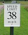 38 mph (60 kph) speed limit sign - geograph.org.uk - 859388.jpg 505 × 640; 243 KB
-
 A house on Trandy Lane, Laxton - geograph.org.uk - 859233.jpg 640 × 480; 242 KB
-
 A lone piper in Abbey Square - geograph.org.uk - 858067.jpg 640 × 480; 237 KB
-
 A nice house in Laxton - geograph.org.uk - 858671.jpg 640 × 508; 210 KB
-
 A peaty col - geograph.org.uk - 861601.jpg 640 × 480; 77 KB
-
 A view east into Berkshire, near Lambourn - geograph.org.uk - 858606.jpg 640 × 480; 116 KB
-

-
-

-
 A87 in Glen Varragill - geograph.org.uk - 858171.jpg 640 × 480; 106 KB
-

-
 Abbey Road Studios 2008-06-24.jpg 3,712 × 2,088; 2.36 MB
-
 Aberdeen streetscene - geograph.org.uk - 918154.jpg 640 × 426; 68 KB
-
 Access Avenue from Carleton Biggin - geograph.org.uk - 867240.jpg 640 × 480; 88 KB
-
 Access Lane to Tewit Cote - geograph.org.uk - 865465.jpg 640 × 480; 78 KB
-
 Access to Freemen's Great Common - geograph.org.uk - 859099.jpg 640 × 427; 88 KB
-
 Acha Mor - geograph.org.uk - 865953.jpg 640 × 480; 68 KB
-
 Across Argill to Cragg House - geograph.org.uk - 858426.jpg 640 × 480; 52 KB
-
 Across the Allt Coire Bhearnaist - geograph.org.uk - 861578.jpg 640 × 480; 75 KB
-
 Aire View - geograph.org.uk - 858727.jpg 640 × 480; 89 KB
-
 All in a day's work - geograph.org.uk - 858989.jpg 640 × 480; 293 KB
-
 Alleyway in Lothersdale - geograph.org.uk - 865389.jpg 640 × 480; 94 KB
-
 Allt a' Chlair - geograph.org.uk - 860590.jpg 640 × 480; 80 KB
-
 Allt a' Ghlinne Mhòir - geograph.org.uk - 861793.jpg 640 × 480; 65 KB
-
 Allt Connie - geograph.org.uk - 861021.jpg 480 × 640; 114 KB
-
 Allt Connie - geograph.org.uk - 861031.jpg 640 × 480; 86 KB
-
 Allt Connie - geograph.org.uk - 864494.jpg 480 × 640; 89 KB
-
 Allt Connie - geograph.org.uk - 864500.jpg 640 × 480; 87 KB
-
 Allt Connie - geograph.org.uk - 864504.jpg 640 × 480; 65 KB
-
 Allt Cristie Mòr - geograph.org.uk - 865035.jpg 640 × 480; 70 KB
-
 Allt Cristie Mòr - geograph.org.uk - 865042.jpg 640 × 480; 81 KB
-
 Allt Fèith Làir - geograph.org.uk - 861757.jpg 640 × 480; 66 KB
-
 Allt Reidh a' Bhathaich - geograph.org.uk - 858203.jpg 640 × 480; 96 KB
-
 Almondbury Liberal Bowling Club - geograph.org.uk - 859574.jpg 640 × 480; 59 KB
-
 Almost there - geograph.org.uk - 867581.jpg 480 × 640; 73 KB
-
 Alongside the Leen - geograph.org.uk - 858946.jpg 640 × 426; 111 KB
-
 Altogether now - geograph.org.uk - 867586.jpg 480 × 640; 160 KB
-
-
 Churchyard, St Marks Church, Ampfield - geograph.org.uk - 860503.jpg 640 × 480; 127 KB
-
 Coast Redwood (Sequoia sempervierns) - geograph.org.uk - 860535.jpg 480 × 640; 82 KB
-

-

-
 Another view of Stapleton church - geograph.org.uk - 858979.jpg 640 × 480; 248 KB
-
 Approaching Surgill Beck - geograph.org.uk - 864983.jpg 640 × 480; 83 KB
-
 Approaching Throstle Nest - geograph.org.uk - 867289.jpg 640 × 480; 68 KB
-
 Arch, Craster Harbour - geograph.org.uk - 1594195.jpg 640 × 427; 67 KB
-
 Architectural detail, St Marks Church - geograph.org.uk - 860482.jpg 480 × 640; 95 KB
-
 Architectural detail, St Marks Church - geograph.org.uk - 860496.jpg 640 × 480; 99 KB
-
 Argill Beck - geograph.org.uk - 858791.jpg 640 × 480; 141 KB
-
 Argill with static caravans - geograph.org.uk - 858477.jpg 640 × 480; 93 KB
-
 Ascending Ramshaw - geograph.org.uk - 867236.jpg 640 × 480; 80 KB
-
 Ashville College - Yew Tree Lane - geograph.org.uk - 859305.jpg 640 × 480; 258 KB
-
 The church of St Calixtus - geograph.org.uk - 858992.jpg 640 × 480; 239 KB
-
 Baildon - geograph.org.uk - 959915.jpg 480 × 640; 73 KB
-
 Baker's Mill pond - geograph.org.uk - 859933.jpg 427 × 640; 92 KB
-
 Baker's Mill, Great Cornard - geograph.org.uk - 859937.jpg 427 × 640; 78 KB
-
-
 Ballingdon Bridge, Sudbury - geograph.org.uk - 859149.jpg 640 × 427; 94 KB
-
 Ballingdon Bridge, Sudbury - geograph.org.uk - 859159.jpg 427 × 640; 78 KB
-
 Ballingdon Bridge, Sudbury - geograph.org.uk - 859166.jpg 640 × 427; 95 KB
-
 Barn and hayfield - geograph.org.uk - 859438.jpg 640 × 342; 54 KB
-
 Barn Door,Thorpe Fold, Almondbury - geograph.org.uk - 859522.jpg 640 × 480; 140 KB
-
 Barton Court - Yew Tree Lane - geograph.org.uk - 859308.jpg 640 × 480; 226 KB
-
 Basford Library - geograph.org.uk - 859010.jpg 640 × 412; 78 KB
-
 Bean field, near Draycot Foliat - geograph.org.uk - 859443.jpg 640 × 480; 174 KB
-
 Beck - Main Street, Pannal - geograph.org.uk - 859235.jpg 640 × 577; 386 KB
-
 Beck - Main Street, Pannal - geograph.org.uk - 859236.jpg 640 × 554; 346 KB
-
 Beck beside Main Street, Cononley - geograph.org.uk - 858674.jpg 640 × 480; 130 KB
-
 Bedford Bridge, Glen Tilt - geograph.org.uk - 1121201.jpg 640 × 480; 123 KB
-
 Beeches Farm, Faxfleet - geograph.org.uk - 860450.jpg 640 × 456; 233 KB
-
 Beef in green pasture - geograph.org.uk - 859437.jpg 640 × 329; 51 KB
-
 Bellasize Drain, west of Blacktoft - geograph.org.uk - 860401.jpg 640 × 322; 162 KB
-
 Belmont longhouse - geograph.org.uk - 858451.jpg 640 × 426; 107 KB
-
 Below Burnt Hill - geograph.org.uk - 866563.jpg 640 × 480; 91 KB
-
 Below Sròn Coire na Creige - geograph.org.uk - 862025.jpg 640 × 480; 88 KB
-
 Belsize Square, NW3 - geograph.org.uk - 881968.jpg 640 × 480; 87 KB
-
-
 Bendybus - geograph.org.uk - 858104.jpg 640 × 426; 81 KB
-
 Beulah Street - geograph.org.uk - 859393.jpg 640 × 480; 222 KB
-
 Birchwoods above the Dee - geograph.org.uk - 860586.jpg 640 × 462; 108 KB
-
 Bird Hide - geograph.org.uk - 858019.jpg 640 × 480; 81 KB
-
 Birks Lane, Almondbury - geograph.org.uk - 859458.jpg 640 × 480; 110 KB
-
 Birks Lane,Almondbury - geograph.org.uk - 859457.jpg 640 × 480; 105 KB
-
 Birks Mill, Almondbury - geograph.org.uk - 859494.jpg 640 × 480; 148 KB
-
 Birling Manor, Birling Gap - geograph.org.uk - 860399.jpg 640 × 486; 105 KB
-
 Black Lion Hotel, Long Melford - geograph.org.uk - 859085.jpg 640 × 427; 74 KB
-
 Blacktoft to Broomfleet - geograph.org.uk - 860423.jpg 640 × 480; 260 KB
-
 Blind bend in Whitehouse Lane - geograph.org.uk - 859441.jpg 640 × 480; 113 KB
-
 Bloodvein moth (Timandra comae) - geograph.org.uk - 858049.jpg 640 × 480; 152 KB
-
 Boat hire kiosk - geograph.org.uk - 865266.jpg 640 × 461; 76 KB
-
 Boating pool, Sudbury - geograph.org.uk - 859127.jpg 640 × 427; 101 KB
-
 Bog behind Meall Chrombaig - geograph.org.uk - 861759.jpg 640 × 480; 74 KB
-
 Bokerley Junction - geograph.org.uk - 857626.jpg 640 × 444; 72 KB
-
 Boscastle - Flickr - exfordy.jpg 2,592 × 3,888; 6.26 MB
-
-
 Bounding ridge of Coire Bhearnaist - geograph.org.uk - 865069.jpg 640 × 480; 66 KB
-
 Braes Road from Portree Forest - geograph.org.uk - 858156.jpg 640 × 480; 145 KB
-

-
 Bridge LEH1-40 - Station Road, Pannal - geograph.org.uk - 859231.jpg 640 × 441; 219 KB
-

-
 Bridge over Pugneys Drain - geograph.org.uk - 857947.jpg 640 × 480; 75 KB
-
 Bridge over the Duror - geograph.org.uk - 861025.jpg 640 × 428; 134 KB
-
 Bridge, Inverey - geograph.org.uk - 861018.jpg 640 × 480; 106 KB
-
 Bridgewater Canal Runcorn - geograph.org.uk - 1238698.jpg 640 × 480; 96 KB
-
 Bridgnorth Angling Society fishing spot - geograph.org.uk - 858998.jpg 640 × 480; 388 KB
-
 Bridlepath to Thorney Gale - geograph.org.uk - 858755.jpg 640 × 480; 70 KB
-
 Bridleway from the nature reserve - geograph.org.uk - 858366.jpg 640 × 427; 73 KB
-
 Bridleway north - geograph.org.uk - 859426.jpg 640 × 480; 158 KB
-
 Bridleway south - geograph.org.uk - 859430.jpg 640 × 480; 173 KB
-
 Brinklow Way - Yew Tree Lane - geograph.org.uk - 859304.jpg 640 × 403; 176 KB
-
 Broad beans, near Draycot Foliat - geograph.org.uk - 859445.jpg 640 × 480; 100 KB
-
 Brookly Bay - geograph.org.uk - 857914.jpg 640 × 549; 102 KB
-
 Brookly Stream - geograph.org.uk - 857909.jpg 640 × 526; 145 KB
-
 Broomfleet Signal Box - geograph.org.uk - 880945.jpg 640 × 427; 157 KB
-
 Brow Top Farm - geograph.org.uk - 859544.jpg 640 × 479; 88 KB
-
 Bruffs and Beck Plantation - geograph.org.uk - 870079.jpg 640 × 480; 60 KB
-
 Bures Church - south porch - geograph.org.uk - 860282.jpg 427 × 640; 120 KB
-
 Bures High Street - geograph.org.uk - 860343.jpg 640 × 427; 79 KB
-
 Bures High Street - geograph.org.uk - 860347.jpg 640 × 427; 77 KB
-
 Burn Bridge Road - geograph.org.uk - 859259.jpg 640 × 528; 289 KB
-
 Burnt heather, Sròn Coire na Creige - geograph.org.uk - 861807.jpg 640 × 480; 75 KB
-
 Butcher's delivery, Braemar - geograph.org.uk - 860559.jpg 640 × 480; 62 KB
-
 Bypass blues - geograph.org.uk - 857723.jpg 640 × 480; 92 KB
-
 Byway, Fognam Down, near Lambourn - geograph.org.uk - 858735.jpg 640 × 480; 171 KB
-
 Caochan nam Fiadh - geograph.org.uk - 1121156.jpg 640 × 480; 115 KB
-
 Carn a' Bhutha - geograph.org.uk - 861605.jpg 636 × 423; 65 KB
-
 Carn Bhac - geograph.org.uk - 1117712.jpg 640 × 480; 65 KB
-
 Carn Bhac - geograph.org.uk - 865058.jpg 640 × 480; 75 KB
-
 Carn Damhaireach ridge of Carn Bhac - geograph.org.uk - 865063.jpg 640 × 480; 65 KB
-
 Carn Dearg and Allt Fèith Làir - geograph.org.uk - 1119769.jpg 640 × 480; 87 KB
-
 Carn na Moine - geograph.org.uk - 865047.jpg 640 × 480; 58 KB
-
 Carr Head Lane - geograph.org.uk - 862689.jpg 640 × 480; 84 KB
-
 Castle Street, Warkworth - geograph.org.uk - 1680198.jpg 853 × 1,280; 405 KB
-
 Catford Ram, Catford, SE6 (2610915977).jpg 1,280 × 960; 276 KB
-
 Cathcart House - corner of Raglan Street - geograph.org.uk - 859386.jpg 480 × 640; 241 KB
-
 Cathedral (2616013666).jpg 1,071 × 1,600; 181 KB
-
 Cathedral (2616013836).jpg 1,600 × 1,071; 201 KB
-
 Cathedral Tower (2615188003).jpg 1,600 × 1,071; 184 KB
-
 Cathedral Tower (2615190943).jpg 1,071 × 1,600; 253 KB
-
 Cathedral Tower (2616014018).jpg 1,071 × 1,600; 264 KB
-
 Cathedral Tower (2616014232).jpg 1,071 × 1,600; 245 KB
-
 Cathedral Tower (2616014366).jpg 1,600 × 1,071; 178 KB
-
 Cathedral Tower (2616014488).jpg 1,071 × 1,600; 184 KB
-
 Cathedral Tower (2616019288).jpg 1,071 × 1,600; 195 KB
-

-
 Cattle crossing - geograph.org.uk - 859129.jpg 640 × 427; 91 KB
-
 Chancery Cottage - geograph.org.uk - 859415.jpg 640 × 480; 114 KB
-
 Changing styles - geograph.org.uk - 858091.jpg 640 × 426; 44 KB
-
 Chanonry finery - geograph.org.uk - 858118.jpg 640 × 426; 122 KB
-
 Chapel Wood, Ampfield - geograph.org.uk - 860510.jpg 640 × 480; 125 KB
-
 Chelmsford Road - geograph.org.uk - 860278.jpg 640 × 480; 102 KB
-
 Chelmsley Wood Asda Frame Work - geograph.org.uk - 900714.jpg 640 × 480; 121 KB
-
 Chester Mystery Plays banner 2008 - geograph.org.uk - 858697.jpg 640 × 480; 258 KB
-
 Chocolateshopinlonon.JPG 2,304 × 1,728; 775 KB
-
 Church Street - geograph.org.uk - 860370.jpg 640 × 480; 91 KB
-
 Cinder Hill Lane - geograph.org.uk - 862717.jpg 640 × 480; 67 KB
-
 Cintra House - detail - geograph.org.uk - 858004.jpg 640 × 480; 52 KB
-
 Cintra House, Hills Road - geograph.org.uk - 857992.jpg 640 × 480; 73 KB
-
 Clashmore Woods at Astle - geograph.org.uk - 858195.jpg 640 × 480; 98 KB
-
 Clearing near Pipers Wait - geograph.org.uk - 862531.jpg 640 × 480; 115 KB
-
 Clearing near Pipers Wait - geograph.org.uk - 862537.jpg 640 × 427; 100 KB
-
 Climbing Tow Top Lane - geograph.org.uk - 865394.jpg 640 × 480; 103 KB
-
 Clinton Arms - geograph.org.uk - 860261.jpg 640 × 480; 72 KB
-
 Cnoc Mor - geograph.org.uk - 857378.jpg 640 × 480; 144 KB
-
 Coire Bhearnaist - geograph.org.uk - 861588.jpg 640 × 480; 61 KB
-

-

-
 Common Spotted Orchid - geograph.org.uk - 870011.jpg 480 × 640; 99 KB
-
 Community pride - geograph.org.uk - 858761.jpg 640 × 426; 141 KB
-
 Community Pride II - geograph.org.uk - 863465.jpg 640 × 426; 121 KB
-
 Concrete water tower - geograph.org.uk - 858047.jpg 480 × 640; 72 KB
-

-
 Connie Glen - geograph.org.uk - 864483.jpg 640 × 480; 69 KB
-
 Cononley Post Office - geograph.org.uk - 858694.jpg 640 × 480; 104 KB
-
 Cooling off - geograph.org.uk - 859131.jpg 640 × 427; 79 KB
-
 Corfe Castle - geograph.org.uk - 864982.jpg 640 × 480; 81 KB
-
 Cornard Mere - geograph.org.uk - 859971.jpg 640 × 427; 90 KB
-
 Cornard Mere information board - geograph.org.uk - 859966.jpg 640 × 427; 150 KB
-

-
 Cotness Clough.jpg 640 × 480; 247 KB
-

-
 Cottage at Steelworks Corner - geograph.org.uk - 860705.jpg 640 × 375; 82 KB
-
 Cottages in Bures - geograph.org.uk - 859984.jpg 640 × 427; 102 KB
-
 Cotton-grass on Saxa Vord - geograph.org.uk - 858794.jpg 640 × 435; 65 KB
-
 Council flats - geograph.org.uk - 858705.jpg 640 × 426; 90 KB
-
 Country Lane - geograph.org.uk - 857889.jpg 640 × 480; 155 KB
-
 Craster Harbour Panorama - geograph.org.uk - 1540589.jpg 640 × 390; 52 KB
-
 Creag na h-Iolair - geograph.org.uk - 1119739.jpg 640 × 480; 88 KB
-

-

-

-
 Cross Hills Road, Cononley - geograph.org.uk - 858716.jpg 640 × 480; 105 KB
-
 Cullompton, a Fore Street view - geograph.org.uk - 858629.jpg 640 × 427; 159 KB
-

-

-

-

_postbox,_Fellows_Road_-_Merton_Rise,_NW3_-_geograph.org.uk_-_881975.jpg)
_postbox,_Lancaster_Drive_-_Belsize_Square,_NW3_-_geograph.org.uk_-_881962.jpg)

_speed_limit_sign_-_geograph.org.uk_-_859388.jpg)


_-_geograph.org.uk_-_860535.jpg)
_-_geograph.org.uk_-_860521.jpg)
,_St_Marks_Churchyard_-_geograph.org.uk_-_860527.jpg)


_-_geograph.org.uk_-_858049.jpg)


.jpg)

.jpg)
.jpg)
.jpg)
.jpg)
.jpg)
.jpg)
.jpg)
.jpg)
.jpg)


_-_geograph.org.uk_-_858813.jpg)


.jpg)


