Category:United Kingdom photographs taken on 2009-04-16
Jump to navigation
Jump to search
Countries of Europe: Austria · Belgium · Czech Republic · Denmark · France‡ · Germany · Greece · Hungary · Iceland · Italy · Netherlands‡ · Poland · Portugal‡ · Russia‡ · Serbia · Slovakia · Spain‡ · Sweden · Switzerland · Turkey‡ · Ukraine · United Kingdom
‡: partly located in Europe
‡: partly located in Europe
| ← | 16 April 2009 | → | ||
| ← | April 2009 | → | ||

United Kingdom photographs taken on 16 April 2009.
Image files should be categorized here automatically using {{taken on}} template. Direct categorisation is also possible, if automatic is impossible.
Subcategories
This category has the following 2 subcategories, out of 2 total.
Media in category "United Kingdom photographs taken on 2009-04-16"
The following 200 files are in this category, out of 923 total.
(previous page) (next page)-
 (1919) Purple Thorn (Selenia tetralunaria) (3450104092).jpg 1,500 × 1,004; 1.43 MB
-
 (looking towards) Dunfermline Abbey, Dunfermline.jpg 2,448 × 3,264; 3.12 MB
-
 Crowcombe Heathfield railway station MMB 02.jpg 1,461 × 1,996; 1.25 MB
-
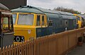 Williton railway station MMB 05 D7017.jpg 2,319 × 1,498; 1.42 MB
-
 31454 South Wingfield (3447117467).jpg 2,717 × 2,684; 1.93 MB
-
 66579 South Wingfield (3447985084).jpg 2,803 × 3,287; 6.34 MB
-
 A gap in the hedge - geograph.org.uk - 1255017.jpg 640 × 480; 127 KB
-
 A narrow track - geograph.org.uk - 1255049.jpg 450 × 640; 156 KB
-
 A panoramic view of Churchill. - geograph.org.uk - 1254514.jpg 640 × 480; 69 KB
-
 A panoramic view of Dow Crag - geograph.org.uk - 1261625.jpg 640 × 199; 30 KB
-

-
 A rural lane - geograph.org.uk - 1254946.jpg 620 × 541; 120 KB
-
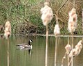 A solitary Canada goose - geograph.org.uk - 1255002.jpg 630 × 498; 101 KB
-
 A steam engine outside Whitby Station - geograph.org.uk - 1260676.jpg 640 × 407; 341 KB
-

-
 A view of the River Blackadder - geograph.org.uk - 1254563.jpg 640 × 480; 104 KB
-
 A5 near Crevenagh, Omagh - geograph.org.uk - 1256301.jpg 640 × 479; 68 KB
-
 A5 near Doogary - geograph.org.uk - 1256299.jpg 640 × 479; 58 KB
-
 A886, Ardachuple - geograph.org.uk - 1256520.jpg 640 × 480; 105 KB
-
 A886, descent to Colintraive - geograph.org.uk - 1255963.jpg 640 × 480; 145 KB
-
 Aberthaw Cement Works WALES - panoramio.jpg 2,048 × 1,536; 745 KB
-
 Abhainn Shira from Victoria Bridge - geograph.org.uk - 1267263.jpg 640 × 480; 79 KB
-

-
 Agricultural building at Mill Farm - geograph.org.uk - 1254953.jpg 518 × 630; 153 KB
-
 Albert Road, Beeston - geograph.org.uk - 1282929.jpg 640 × 436; 93 KB
-
 Alfred Salter Playground, Druid St - geograph.org.uk - 1271588.jpg 640 × 430; 94 KB
-
 Alive and dead, Donhead st Andrew - geograph.org.uk - 1255430.jpg 640 × 480; 155 KB
-
 All Bar One, Butler's Wharf - geograph.org.uk - 1271441.jpg 640 × 430; 77 KB
-
 All Souls, Langham Place - geograph.org.uk - 1269843.jpg 430 × 640; 42 KB
-
 Allt Glachavoil tributary - geograph.org.uk - 1255918.jpg 640 × 480; 122 KB
-
 Allt Glachnavoil - geograph.org.uk - 1255952.jpg 640 × 480; 166 KB
-

-
-

-
-

-
 An Dubh-loch - geograph.org.uk - 1275506.jpg 480 × 640; 80 KB
-
 An embedded leaflet dispenser - geograph.org.uk - 1254615.jpg 480 × 640; 123 KB
-

-

-
 Anthocharis cardamines - geograph.org.uk - 1254584.jpg 640 × 480; 62 KB
-
 Appleby Hill - geograph.org.uk - 1264419.jpg 640 × 480; 229 KB
-
 Approaching Colintraive - geograph.org.uk - 1255969.jpg 640 × 480; 121 KB
-
 Approaching Penair School - geograph.org.uk - 1254561.jpg 480 × 640; 83 KB
-

-
 Approaching Whitwell Road - geograph.org.uk - 1254813.jpg 640 × 480; 137 KB
-
 April in Bath - geograph.org.uk - 1740123.jpg 4,287 × 2,703; 2.76 MB
-
 Arlington Court and beyond. - geograph.org.uk - 1254486.jpg 640 × 427; 47 KB
-
 Arnold Estate, Tanner St, Bermondsey - geograph.org.uk - 1271558.jpg 640 × 430; 74 KB
-
 Arthur's Mission, Snowsfield - geograph.org.uk - 1271681.jpg 640 × 430; 98 KB
-
 Augher Townland - geograph.org.uk - 1256211.jpg 640 × 479; 76 KB
-

-
 Ballo Reservoir and West Lomond - geograph.org.uk - 1731317.jpg 1,600 × 1,200; 383 KB
-
 Bannister Street - geograph.org.uk - 1259058.jpg 640 × 480; 70 KB
-
 Barnham St Bridge off Crucifix - geograph.org.uk - 1271654.jpg 640 × 430; 76 KB
-
 Barns at Lower Tregurra - geograph.org.uk - 1254628.jpg 640 × 480; 94 KB
-
 Barton Grange Garden Centre, Brock - geograph.org.uk - 1259102.jpg 640 × 480; 55 KB
-
 National Cycle Route 1 - geograph.org.uk - 1256745.jpg 640 × 480; 87 KB
-
 New Development on Falkland Way - geograph.org.uk - 1256727.jpg 640 × 409; 68 KB
-
 Bath Square, Portsmouth, Hampshire - geograph.org.uk - 1257633.jpg 640 × 427; 62 KB
-
 Bath Square, Portsmouth, Hampshire - geograph.org.uk - 1257637.jpg 640 × 480; 66 KB
-
 Beach and sea loch. - geograph.org.uk - 1307590.jpg 640 × 480; 70 KB
-
 Bed of the River Tyne at low tide - geograph.org.uk - 1268204.jpg 640 × 480; 101 KB
-

-
 Beesley's Garden Centre, Ravenstone 1 - geograph.org.uk - 1265520.jpg 640 × 481; 203 KB
-
 Beesley's Garden Centre, Ravenstone 2 - geograph.org.uk - 1265523.jpg 640 × 480; 231 KB
-
 Beesley's Garden Centre, Ravenstone 3 - geograph.org.uk - 1265532.jpg 640 × 480; 187 KB
-
 Beinn Bhreac - geograph.org.uk - 1255222.jpg 640 × 480; 106 KB
-
 Beinn Bhreac, South top - geograph.org.uk - 1255216.jpg 640 × 362; 86 KB
-
 Beltany Road - geograph.org.uk - 1256206.jpg 640 × 479; 80 KB
-
 Beltany Townland - geograph.org.uk - 1256027.jpg 640 × 479; 67 KB
-
 Beltany Townland - geograph.org.uk - 1256030.jpg 640 × 479; 76 KB
-
 Beltany Townland - geograph.org.uk - 1256065.jpg 640 × 479; 73 KB
-
 Beltany Townland - geograph.org.uk - 1256068.jpg 640 × 479; 81 KB
-
 Beltany Townland - geograph.org.uk - 1256072.jpg 640 × 479; 77 KB
-
 Beltany Townland - geograph.org.uk - 1256074.jpg 640 × 479; 62 KB
-
 Beltany Townland - geograph.org.uk - 1256181.jpg 640 × 479; 90 KB
-
 Beltany Townland - geograph.org.uk - 1256202.jpg 640 × 479; 74 KB
-
 Beltany Townland - geograph.org.uk - 1256205.jpg 640 × 479; 73 KB
-
 Beltany Townland - geograph.org.uk - 1256230.jpg 640 × 479; 55 KB
-
 Bermondsey St Tunnel - geograph.org.uk - 1271662.jpg 640 × 430; 94 KB
-
 Bishops Lydeard railway station MMB 02.jpg 2,220 × 1,477; 1.33 MB
-
 Bishops Lydeard railway station MMB 04.jpg 2,400 × 1,600; 1.26 MB
-
-
 Blower's Brook - geograph.org.uk - 1265514.jpg 480 × 640; 231 KB
-
 Blue on Blue - geograph.org.uk - 1257031.jpg 640 × 480; 64 KB
-
 Boardwalks, at Stover Country Park - geograph.org.uk - 1254565.jpg 640 × 480; 113 KB
-
 Boats Moored in Camber Dock - geograph.org.uk - 1256109.jpg 640 × 361; 59 KB
-
 Boats Moored in Camber Dock - geograph.org.uk - 1256117.jpg 640 × 480; 65 KB
-

-
 Bog and tarn - geograph.org.uk - 1255294.jpg 640 × 426; 58 KB
-
 Bog, Meallan Riabhach - geograph.org.uk - 1255200.jpg 640 × 480; 113 KB
-
 Borough Market, Cathedral St - geograph.org.uk - 1270942.jpg 640 × 430; 79 KB
-
 High Street, Boston (geograph 3779634).jpg 418 × 640; 96 KB
-
 Botallack Manor Farm - geograph.org.uk - 1268233.jpg 640 × 480; 90 KB
-
 Boucher Crescent - geograph.org.uk - 1258439.jpg 640 × 480; 69 KB
-
 Boucher Shopping Park - geograph.org.uk - 1258398.jpg 640 × 480; 79 KB
-
 Boucher Shopping Park 2 - geograph.org.uk - 1258404.jpg 640 × 480; 74 KB
-
 Boucher Shopping Park 3 - geograph.org.uk - 1258411.jpg 640 × 480; 77 KB
-
 Boucher Shopping Park 4 - geograph.org.uk - 1258418.jpg 640 × 480; 66 KB
-
 Boundary Brook - geograph.org.uk - 1254891.jpg 640 × 427; 113 KB
-

-
 Bridge by Whitwell - geograph.org.uk - 1255058.jpg 480 × 640; 135 KB
-
 Bridge Hewick Pump - geograph.org.uk - 1254552.jpg 640 × 427; 69 KB
-
-
 Bridge over stream - geograph.org.uk - 1255055.jpg 556 × 620; 179 KB
-
 Bridge over the River Aisne (Eyn) - geograph.org.uk - 1254881.jpg 640 × 480; 120 KB
-
 Bridge under the M42 - geograph.org.uk - 1264353.jpg 640 × 480; 183 KB
-
 Bridleway to Ffynnon Cemetery - geograph.org.uk - 1255730.jpg 640 × 480; 173 KB
-
 Bridleway to nowhere - geograph.org.uk - 1265492.jpg 640 × 480; 240 KB
-
 Bridleway towards Tisbury - geograph.org.uk - 1255416.jpg 640 × 481; 104 KB
-
 Broad Street, Portsmouth - geograph.org.uk - 1257616.jpg 640 × 480; 70 KB
-
 Broadcasting House, Langham Place - geograph.org.uk - 1269847.jpg 430 × 640; 52 KB
-
 Burn descending Beinn Bhreac - geograph.org.uk - 1255235.jpg 640 × 480; 129 KB
-
 Burn draining Cruach an Lochain - geograph.org.uk - 1255887.jpg 480 × 640; 110 KB
-

-

-

-
 Butler's Wharf - geograph.org.uk - 1271435.jpg 640 × 430; 83 KB
-
 Butler's Wharf Pier and Tower Bridge - geograph.org.uk - 1271428.jpg 640 × 430; 78 KB
-

-
 Cadgwith - geograph.org.uk - 1263658.jpg 640 × 425; 79 KB
-
 Caldra Farm - geograph.org.uk - 1254654.jpg 640 × 480; 80 KB
-
 Camber Dock - geograph.org.uk - 1256105.jpg 640 × 480; 64 KB
-
 Camber Dock, Portsmouth - geograph.org.uk - 1257591.jpg 640 × 480; 53 KB
-
 Camber Dock, Portsmouth - geograph.org.uk - 1258280.jpg 640 × 480; 70 KB
-
 Camera over M42 in Warwickshire - geograph.org.uk - 1264365.jpg 640 × 480; 183 KB
-
 Camouflaged sheds - geograph.org.uk - 1256246.jpg 640 × 480; 77 KB
-
 Campsite at Thorny Cliff - geograph.org.uk - 1263369.jpg 640 × 425; 55 KB
-
 Canalside, Gunwharf Quays - geograph.org.uk - 1258325.jpg 640 × 480; 74 KB
-

-
 Carn Perfedd - geograph.org.uk - 1257103.jpg 640 × 480; 132 KB
-
 Carn Trellwyd and Carn Penberi - geograph.org.uk - 1256508.jpg 640 × 480; 124 KB
-
 Carnedd Lleithr - geograph.org.uk - 1257129.jpg 640 × 480; 113 KB
-
 Carrick Luz - geograph.org.uk - 1263341.jpg 640 × 425; 75 KB
-
 Cattle in the mist, Birdingbury - geograph.org.uk - 1254513.jpg 640 × 456; 90 KB
-
 Cattle, Colintraive - geograph.org.uk - 1446887.jpg 640 × 480; 109 KB
-
 Celandine near Banbridge - geograph.org.uk - 1255267.jpg 606 × 388; 125 KB
-
 Cemetery and Bridleway entrance - geograph.org.uk - 1255747.jpg 640 × 480; 97 KB
-
 Cemetery at Junction of A650 and A651 - geograph.org.uk - 1254604.jpg 640 × 480; 108 KB
-
 Chapel, Torquay Cemetery - geograph.org.uk - 1265258.jpg 640 × 479; 98 KB
-
 Chee Tor - geograph.org.uk - 1258352.jpg 640 × 480; 50 KB
-
 Cherry blossom at Sizergh Castle - geograph.org.uk - 1285378.jpg 640 × 480; 95 KB
-
 Christ The Consoler - geograph.org.uk - 1255497.jpg 640 × 480; 75 KB
-
 Church Road, Wrockwardine Wood, Telford - geograph.org.uk - 1257853.jpg 640 × 453; 197 KB
-
 Church Road, Wrockwardine Wood, Telford - geograph.org.uk - 1257858.jpg 640 × 366; 156 KB
-
 Church, Jamaica Rd - geograph.org.uk - 1271538.jpg 640 × 430; 79 KB
-
 Churchyard Well - geograph.org.uk - 1255211.jpg 480 × 640; 133 KB
-

-
 City Hall, SE1 - geograph.org.uk - 1271143.jpg 640 × 430; 57 KB
-

-
 Cityscape in Old Portsmouth - geograph.org.uk - 1256389.jpg 640 × 480; 76 KB
-
 Claremore Road - geograph.org.uk - 1256142.jpg 640 × 479; 102 KB
-
 Claremore Road - geograph.org.uk - 1256179.jpg 640 × 479; 74 KB
-
 Claremore Road - Newtownsaville Road - geograph.org.uk - 1256170.jpg 640 × 479; 62 KB
-
 Claremore Road, Beltany - geograph.org.uk - 1256190.jpg 640 × 479; 91 KB
-
 Claremore Road, Beltany - geograph.org.uk - 1256191.jpg 640 × 479; 86 KB
-
 Cleopatra's Needle - geograph.org.uk - 1623690.jpg 604 × 640; 107 KB
-

-

-
 Clifton Street - geograph.org.uk - 1259033.jpg 640 × 480; 71 KB
-
 Clink Prison Museum, Clink St - geograph.org.uk - 1270881.jpg 640 × 430; 58 KB
-
 Clontafleece Road - geograph.org.uk - 1255187.jpg 640 × 426; 61 KB
-
 Cnoc Breamanach - geograph.org.uk - 1255936.jpg 640 × 480; 103 KB
-
 Cnoc na Carraige - geograph.org.uk - 1255947.jpg 640 × 480; 131 KB
-
 Cnoc nan Cuilean - geograph.org.uk - 1270065.jpg 640 × 480; 96 KB
-
 Coast looking to Wembury - panoramio.jpg 3,072 × 2,304; 3.03 MB
-
 Coastline north of Cadgwith - geograph.org.uk - 1263643.jpg 640 × 425; 95 KB
-
 Colintraive Community Hall - geograph.org.uk - 1255103.jpg 640 × 480; 79 KB
-
 Concrete farm track - geograph.org.uk - 1264390.jpg 640 × 480; 232 KB
-
 Converted barns by Mill Farm - geograph.org.uk - 1254913.jpg 640 × 480; 103 KB
-
 Converted Warehouses, Wolseley St - geograph.org.uk - 1271525.jpg 640 × 430; 101 KB
-
 Cormore Road, Beltany - geograph.org.uk - 1256014.jpg 640 × 479; 83 KB
-
 Cormore Road, Beltany - geograph.org.uk - 1256024.jpg 640 × 479; 92 KB
-
 Cornwell Cottages, Hornchurch - geograph.org.uk - 1254847.jpg 640 × 406; 83 KB
-
 Cors Caron close to the Afon Teifi - geograph.org.uk - 1254667.jpg 640 × 480; 94 KB
-

-
 Cottages at Ramsnest Common - geograph.org.uk - 1255727.jpg 640 × 360; 56 KB
-
 Cottages at Treleddyd-fawr - geograph.org.uk - 1256090.jpg 640 × 464; 101 KB
-
 Cottages, Clifton Street - geograph.org.uk - 1259047.jpg 640 × 480; 64 KB
-

-

-

-
 Row of cottages in Beauchamp Lane - geograph.org.uk - 1254930.jpg 640 × 427; 84 KB
-
 St James The Apostle church - geograph.org.uk - 1254922.jpg 640 × 427; 100 KB
-
-
 St James' churchyard - geograph.org.uk - 1254914.jpg 640 × 427; 126 KB
-
 Crags and woods, Kinlochruel - geograph.org.uk - 1255986.jpg 640 × 480; 119 KB
-
 Creag nam Fitheach - geograph.org.uk - 1255893.jpg 640 × 480; 87 KB
-

-
 Creagan Beag - geograph.org.uk - 1255203.jpg 640 × 480; 152 KB
-
 Crevenagh, Omagh - geograph.org.uk - 1256304.jpg 640 × 479; 64 KB
-
-
 Cross-marked slab - geograph.org.uk - 1254688.jpg 489 × 640; 97 KB
-
 Crosscroads at Mount Pleasant - geograph.org.uk - 1254592.jpg 640 × 480; 60 KB
-
 Crow Park - geograph.org.uk - 1706156.jpg 1,600 × 1,200; 640 KB
-
 Crow Park - geograph.org.uk - 1706174.jpg 1,024 × 768; 220 KB
-
 Crow Park - geograph.org.uk - 1706264.jpg 1,024 × 768; 294 KB
-
 Cruach an Lochain - geograph.org.uk - 1255872.jpg 640 × 480; 100 KB
-
 Cruise Boat on the River Thames - geograph.org.uk - 1269936.jpg 640 × 430; 59 KB
_Purple_Thorn_(Selenia_tetralunaria)_(3450104092).jpg)
_Dunfermline_Abbey,_Dunfermline.jpg)


.jpg)
.jpg)


.jpg)


_-_geograph.org.uk_-_1254881.jpg)


