Category:United Kingdom photographs taken on 2009-07-31
Jump to navigation
Jump to search
Countries of Europe: Albania · Austria · Belgium · Bulgaria · Croatia · Czech Republic · Finland · France‡ · Germany · Greece · Hungary · Republic of Ireland · Italy · Latvia · Lithuania · Netherlands‡ · North Macedonia · Norway · Poland · Portugal‡ · Romania · Russia‡ · Serbia · Spain‡ · Sweden · Switzerland · Turkey‡ · Ukraine · United Kingdom
‡: partly located in Europe
‡: partly located in Europe
| ← | 31 July 2009 | → | ||
| ← | July 2009 | → | ||

United Kingdom photographs taken on 31 July 2009.
Image files should be categorized here automatically using {{taken on}} template. Direct categorisation is also possible, if automatic is impossible.
Subcategories
This category has the following 2 subcategories, out of 2 total.
L
Media in category "United Kingdom photographs taken on 2009-07-31"
The following 200 files are in this category, out of 1,100 total.
(previous page) (next page)-
 'The Boathouse' - geograph.org.uk - 1422986.jpg 640 × 480; 90 KB
-
 'The Haven', Stretton on Dunsmore - geograph.org.uk - 1422709.jpg 640 × 464; 101 KB
-
 Greater Western Franchise Bidders.jpg 3,000 × 2,000; 2.61 MB
-
 822m top from An Staonaig - geograph.org.uk - 1424925.jpg 640 × 480; 78 KB
-
 A dying breed (the village Post Office) - geograph.org.uk - 1441617.jpg 640 × 426; 286 KB
-
 A prospect of Rothbury - geograph.org.uk - 1425893.jpg 640 × 480; 103 KB
-
 A rather worn down groyne. - geograph.org.uk - 1571025.jpg 640 × 433; 324 KB
-
 A Victorian postbox in Treworthal - geograph.org.uk - 1423057.jpg 480 × 640; 115 KB
-
 A379 Chillington - geograph.org.uk - 1582669.jpg 640 × 480; 63 KB
-
 A379 heading to Frogmore - geograph.org.uk - 1582654.jpg 640 × 480; 79 KB
-
 A423 south of Princthorpe - geograph.org.uk - 1422674.jpg 640 × 426; 79 KB
-
 A49 at Moston Park - geograph.org.uk - 1441609.jpg 640 × 426; 308 KB
-
 A53 lay-by at Hodnet, Shropshire England.jpg 640 × 426; 302 KB
-
 A911, Arnot - geograph.org.uk - 1623476.jpg 640 × 480; 83 KB
-
 A911, Strathendry - geograph.org.uk - 1623440.jpg 640 × 480; 91 KB
-
 A912 - geograph.org.uk - 1619743.jpg 640 × 480; 86 KB
-
 A914, Muirhead - geograph.org.uk - 1623218.jpg 640 × 480; 70 KB
-
 A92 - geograph.org.uk - 1623223.jpg 640 × 480; 72 KB
-
 A92 - geograph.org.uk - 1623226.jpg 640 × 480; 73 KB
-
 Abandoned cottage near West Raw Farm - geograph.org.uk - 1427205.jpg 640 × 480; 115 KB
-
 Abbey Gardens, Bury St Edmunds - geograph.org.uk - 1425735.jpg 640 × 418; 97 KB
-
 Abbey Green junction - geograph.org.uk - 1440456.jpg 640 × 426; 345 KB
-
 Access to Wood Lane Farm - geograph.org.uk - 1441703.jpg 640 × 426; 325 KB
-
 Afon Gwynant and road bridge - geograph.org.uk - 1426830.jpg 640 × 425; 105 KB
-
 Aglais io - geograph.org.uk - 1426137.jpg 408 × 640; 79 KB
-
 And a baa-baa there. Here a baa, there a baa ... - panoramio.jpg 1,587 × 1,743; 376 KB
-
 And on his farm he had some sheep. Ee-i-ee-i-o. - panoramio.jpg 1,028 × 1,030; 207 KB
-

-

-
-
 Arable land, Auchmuir Bridge - geograph.org.uk - 1623468.jpg 640 × 480; 60 KB
-
 Arable land, Easter Cash - geograph.org.uk - 1619735.jpg 640 × 480; 75 KB
-
 Arable land, Falklandwood - geograph.org.uk - 1622008.jpg 640 × 480; 102 KB
-
 Arc central square from Debenhams - geograph.org.uk - 1460254.jpg 640 × 481; 67 KB
-
 Arlington Mill in Bibury - geograph.org.uk - 1440332.jpg 640 × 427; 78 KB
-
 Arlington Row cottages in Bibury - geograph.org.uk - 1440317.jpg 640 × 427; 120 KB
-
 Arlington Row cottages in Bibury - geograph.org.uk - 1440321.jpg 640 × 427; 69 KB
-
 Arlington Row cottages in Bibury - geograph.org.uk - 1440324.jpg 640 × 427; 100 KB
-
 Artwork in Bank Street - geograph.org.uk - 1425546.jpg 640 × 460; 111 KB
-
 Auchmuir Braes Plantation - geograph.org.uk - 1623451.jpg 640 × 480; 90 KB
-

-
 B587 at Spring Wood - geograph.org.uk - 1431985.jpg 640 × 494; 63 KB
-
 B936 - geograph.org.uk - 1621104.jpg 640 × 480; 92 KB
-
 B936, Falkland - geograph.org.uk - 1622011.jpg 640 × 480; 135 KB
-
 Bank House Farm, Etton - geograph.org.uk - 1422317.jpg 640 × 480; 77 KB
-
 Bantons Lane - geograph.org.uk - 1429222.jpg 640 × 480; 85 KB
-
 Barley crop at White Leys - geograph.org.uk - 1431958.jpg 640 × 480; 100 KB
-
 Barley crop at Woodside Farm - geograph.org.uk - 1429501.jpg 640 × 480; 94 KB
-
 Barley field near White Leys - geograph.org.uk - 1431871.jpg 480 × 640; 92 KB
-
 Barley, Easter Cash - geograph.org.uk - 1619740.jpg 640 × 480; 89 KB
-
 Barley, Strathendry - geograph.org.uk - 1623431.jpg 640 × 488; 97 KB
-
 Barley, Wester Gospetry - geograph.org.uk - 1422292.jpg 640 × 480; 90 KB
-
 Barley, Woodmill - geograph.org.uk - 1621094.jpg 640 × 480; 73 KB
-
 Barton on Sea golf course - geograph.org.uk - 1427053.jpg 640 × 427; 95 KB
-
 Pyronia tithonus - geograph.org.uk - 1422586.jpg 640 × 458; 104 KB
-
 Bath - Le terme - panoramio.jpg 3,872 × 2,592; 1.45 MB
-
 Bath - Le terme romane - panoramio.jpg 3,754 × 2,513; 1.11 MB
-
 Beach huts, Milford on Sea - geograph.org.uk - 1430877.jpg 640 × 427; 105 KB
-
 Beacon Cliff - geograph.org.uk - 1427101.jpg 427 × 640; 113 KB
-
 Bean crop - geograph.org.uk - 1620808.jpg 640 × 480; 103 KB
-
 Bear right for NCR 45 - geograph.org.uk - 1441640.jpg 640 × 426; 292 KB
-
 Beck Road, Isleham - geograph.org.uk - 1425804.jpg 427 × 640; 93 KB
-
 Becton Bunny chine - geograph.org.uk - 1427061.jpg 640 × 427; 95 KB
-
-
 Bedminster railway station MMB 10 67005.jpg 1,444 × 2,279; 976 KB
-
 Bedminster railway station MMB 11 67005.jpg 2,239 × 1,474; 1.07 MB
-
 Below Yr Arddu - geograph.org.uk - 1437779.jpg 640 × 427; 197 KB
-
 Below Yr Arddu - geograph.org.uk - 1437781.jpg 640 × 426; 223 KB
-

-
 Bench mark on Near Intake Barn - geograph.org.uk - 1452871.jpg 640 × 480; 221 KB
-
 Bibury Court Hotel - geograph.org.uk - 1440335.jpg 640 × 407; 82 KB
-
 Bibury Trout Farm - geograph.org.uk - 1440334.jpg 640 × 427; 97 KB
-
 Big Law from Greenbrough Hill - geograph.org.uk - 1424305.jpg 6,820 × 3,206; 2.64 MB
-
 Bishop Burton Road, Cherry Burton - geograph.org.uk - 1422041.jpg 640 × 480; 91 KB
-
 Bishop's Walk Shopping Centre - geograph.org.uk - 1429756.jpg 640 × 409; 85 KB
-
 Black Jack Street in Cirencester - geograph.org.uk - 1429776.jpg 640 × 427; 59 KB
-
 Blooms Garden Centre near Swindon - geograph.org.uk - 1422717.jpg 640 × 480; 68 KB
-
 Blooms Garden Centre near Swindon - geograph.org.uk - 1422838.jpg 640 × 427; 64 KB
-
 Blooms Garden Centre near Swindon - geograph.org.uk - 1422840.jpg 640 × 427; 82 KB
-

-
-
 Bowers Cottage in West Harting - geograph.org.uk - 1424670.jpg 640 × 360; 60 KB
-
 Bracken and oaks at Castramont Wood - geograph.org.uk - 1423193.jpg 640 × 480; 144 KB
-
 Bridge End Barn and the Arcow Quarry - geograph.org.uk - 1452790.jpg 640 × 480; 150 KB
-
 Bridge over the burn at Laghead - geograph.org.uk - 1422479.jpg 640 × 480; 68 KB
-
 Bridge over the Dee at Kirkcudbright - geograph.org.uk - 1423823.jpg 640 × 480; 41 KB
-
 Bridleway at East Ilsley - geograph.org.uk - 1656990.jpg 640 × 480; 83 KB
-
 Bridleway on Booker Down - geograph.org.uk - 1424604.jpg 360 × 640; 74 KB
-
 Bristol Temple Meads railway station MMB 24 67005.jpg 2,332 × 1,512; 1.59 MB
-
 Bristol Temple Meads railway station MMB 25 67005 67025.jpg 2,400 × 1,600; 1.75 MB
-
 British Rail Class 150 at Ebbw Vale Parkway railway station.JPG 3,264 × 2,448; 3.12 MB
-
 Broadstone Lane - geograph.org.uk - 1431548.jpg 480 × 640; 74 KB
-
 Broch and ruined cottage, Achlochan - geograph.org.uk - 1500188.jpg 640 × 480; 86 KB
-

-
 Building in South Harting - geograph.org.uk - 1424582.jpg 640 × 360; 74 KB
-
 Bull Ring, Much Wenlock - geograph.org.uk - 1652327.jpg 640 × 480; 129 KB
-
 Bullocks grazing near Ticknall - geograph.org.uk - 1429221.jpg 640 × 459; 74 KB
-
 Burgedin Farm - geograph.org.uk - 1421755.jpg 640 × 480; 69 KB
-
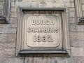 Burgh Chambers - geograph.org.uk - 1425601.jpg 640 × 480; 85 KB
-
 Burgh Chambers - geograph.org.uk - 1425615.jpg 480 × 640; 83 KB
-
 Bust Scott Geograph-1422431-by-Keith-Edkins.jpg 480 × 640; 104 KB
-

-
 Bygot Wood - geograph.org.uk - 1422144.jpg 640 × 480; 67 KB
-
 California, Strathmiglo - geograph.org.uk - 1619713.jpg 640 × 480; 100 KB
-
 Calke Abbey Stables - 3 - geograph.org.uk - 1427984.jpg 640 × 480; 77 KB
-

-
 Capital, Great Malvern station - geograph.org.uk - 1427499.jpg 493 × 640; 284 KB
-
 Capital, Great Malvern station - geograph.org.uk - 1427503.jpg 584 × 640; 357 KB
-
 Capital, Great Malvern station - geograph.org.uk - 1427515.jpg 540 × 640; 354 KB
-
 Car park and pavilion, Hawk Hill - geograph.org.uk - 1623391.jpg 640 × 480; 74 KB
-
 Car park of the Helwith Bridge Inn - geograph.org.uk - 1445845.jpg 640 × 480; 109 KB
-
 Carleton Mill - panoramio.jpg 1,551 × 1,609; 382 KB
-
 Carpenter's Down Wood - geograph.org.uk - 1422084.jpg 640 × 480; 104 KB
-
 Carstramon and Rusko Castle - geograph.org.uk - 1423904.jpg 640 × 480; 108 KB
-
 Carstramon Wood - a SWT Reserve - geograph.org.uk - 1429061.jpg 640 × 480; 138 KB
-
 Castle Bank and High Street - geograph.org.uk - 1423800.jpg 640 × 480; 67 KB
-
 Castramont Wood - geograph.org.uk - 1423911.jpg 640 × 480; 133 KB
-
 Cattery and cottage - geograph.org.uk - 1440490.jpg 640 × 426; 307 KB
-
 Cattle and horses at Isleham - geograph.org.uk - 1426066.jpg 640 × 427; 99 KB
-
 Cattle crossing - geograph.org.uk - 1440466.jpg 640 × 426; 351 KB
-
 Central Methodist Church, Brighouse - geograph.org.uk - 1425840.jpg 640 × 480; 66 KB
-
 Cereal crop - geograph.org.uk - 1441605.jpg 640 × 426; 341 KB
-
 Chamberlain's Doorway - geograph.org.uk - 1425629.jpg 640 × 480; 91 KB
-
 Chapel at Darliston - geograph.org.uk - 1441661.jpg 640 × 426; 291 KB
-
 Chapel-en-le-Frith - Eccles Pike Cross - geograph.org.uk - 1424862.jpg 640 × 480; 119 KB
-

-

-
-
 Chelsea College of Art and Design - geograph.org.uk - 1449638.jpg 640 × 480; 100 KB
-
 Cherry Burton Pond - geograph.org.uk - 1422066.jpg 640 × 480; 116 KB
-

-
 Church Road - geograph.org.uk - 1582954.jpg 640 × 480; 64 KB
-
 Churchgate House, Bury St Edmunds - geograph.org.uk - 1425783.jpg 640 × 434; 79 KB
-
 Churchtown lancashire - panoramio (1).jpg 990 × 743; 258 KB
-
 Churchtown lancashire - panoramio (2).jpg 990 × 743; 352 KB
-
 Churchtown lancashire - panoramio.jpg 990 × 743; 306 KB
-
 Churchyard gates, Much Wenlock - geograph.org.uk - 1652339.jpg 640 × 480; 130 KB
-
 Clem Atlee Court - geograph.org.uk - 1428469.jpg 640 × 440; 87 KB
-
 Cliff-top path, Hordle Cliff - geograph.org.uk - 1430889.jpg 640 × 427; 104 KB
-
 Cloisters at Laycock Abbey - geograph.org.uk - 1427064.jpg 640 × 480; 83 KB
-
 Coastline east of Barton on Sea - geograph.org.uk - 1427079.jpg 640 × 427; 92 KB
-
 Coleridge Cross - geograph.org.uk - 1583059.jpg 640 × 480; 96 KB
-
 Colin Rose Geograph-1422283-by-Keith-Edkins.jpg 480 × 640; 52 KB
-
 Concrete pillar in the cliffs - geograph.org.uk - 1427070.jpg 640 × 480; 137 KB
-
 Corner of Long Lane and Moor Head Lane - geograph.org.uk - 1452156.jpg 640 × 480; 174 KB
-
 Cotswold cottages - geograph.org.uk - 1422331.jpg 640 × 428; 82 KB
-
 Cottages at Willingham Green - geograph.org.uk - 1432714.jpg 640 × 480; 66 KB
-
 Cottages by Arlington Row in Bibury - geograph.org.uk - 1440323.jpg 640 × 427; 117 KB
-
 Cottages by Arlington Row in Bibury - geograph.org.uk - 1440325.jpg 640 × 427; 99 KB
-
 Country lane and speeding car - geograph.org.uk - 1441700.jpg 640 × 426; 308 KB
-
 Cow Lane in South Harting - geograph.org.uk - 1424702.jpg 640 × 360; 71 KB
-
 Craghead - geograph.org.uk - 1426984.jpg 640 × 480; 100 KB
-
 Creeting St Peter village sign - geograph.org.uk - 1422093.jpg 445 × 640; 142 KB
-
 Cribs Hope from the Heatherhope valley - geograph.org.uk - 1423020.jpg 640 × 480; 152 KB
-
 Cromwell Road - geograph.org.uk - 1448775.jpg 640 × 480; 98 KB
-

-
 Crossroads at Vagg, north of Yeovil - geograph.org.uk - 1429863.jpg 640 × 480; 108 KB
-
 Cuckoo Pint berries in Bibury - geograph.org.uk - 1440328.jpg 640 × 493; 80 KB
-
 Culreoch from the Castramont Burn - geograph.org.uk - 1422506.jpg 640 × 480; 90 KB
-
 Cup and ring markings on Lordenshaw Hill - geograph.org.uk - 1427002.jpg 480 × 640; 115 KB
-
 Cutting silage at Feorlig - geograph.org.uk - 1422623.jpg 640 × 480; 82 KB
-
 Damaged bench mark alongside Long Lane - geograph.org.uk - 1453657.jpg 640 × 480; 220 KB
-
-
 Deer Bridge - geograph.org.uk - 1582968.jpg 640 × 480; 105 KB
-
 Demolition Experience - geograph.org.uk - 1425680.jpg 640 × 480; 77 KB
-
-
 Descent near Llyn Llagi - geograph.org.uk - 1438446.jpg 640 × 425; 172 KB
-
 Design Geograph-1422444-by-Keith-Edkins.jpg 480 × 640; 118 KB
-
 Dingerein Castle - geograph.org.uk - 1423042.jpg 640 × 480; 53 KB
-
 Dismantled railway near Birdingbury (2) - geograph.org.uk - 1422699.jpg 543 × 640; 139 KB
-
 Disused entrance to RAF Mildenhall - geograph.org.uk - 1425797.jpg 640 × 427; 85 KB
-
 Disused trackbed at Nyewood - geograph.org.uk - 1424555.jpg 360 × 640; 96 KB
-
 Diversion of burn - geograph.org.uk - 1424884.jpg 640 × 480; 123 KB
-
 Doorway, Malvern station - geograph.org.uk - 1427486.jpg 608 × 640; 367 KB
-
 Dramatic clouds over Long lane - geograph.org.uk - 1448908.jpg 640 × 480; 136 KB
-
 Drayton Road, Hodnet - geograph.org.uk - 1441690.jpg 640 × 426; 334 KB
-
 Duke of York - geograph.org.uk - 1535064.jpg 640 × 482; 72 KB
-
 Dunshalt Post Office - geograph.org.uk - 1620871.jpg 640 × 480; 71 KB
-
 Eagle Hotel and old cinema - geograph.org.uk - 1535060.jpg 640 × 397; 63 KB
-
 Earl Stonham village hall - geograph.org.uk - 1421960.jpg 640 × 468; 110 KB
-
 Easter Upper Urquhart - geograph.org.uk - 1422335.jpg 640 × 480; 53 KB
-
 Eastmill Bridge - geograph.org.uk - 1619723.jpg 640 × 480; 130 KB
-
 Ebury Street - geograph.org.uk - 1452493.jpg 640 × 480; 80 KB
-
 Ebury Street - geograph.org.uk - 1452503.jpg 503 × 640; 81 KB
-
 Edinburgh, Perth and Dundee Railway - geograph.org.uk - 1622326.jpg 640 × 480; 68 KB
-
 Edinburgh, Perth and Dundee Railway - geograph.org.uk - 1622338.jpg 640 × 483; 128 KB
-
 Edward VII letterbox at Helwith Bridge - geograph.org.uk - 1445839.jpg 480 × 640; 182 KB
-
 Electricity pylon beside footpath - geograph.org.uk - 1422634.jpg 513 × 640; 100 KB
-
 Electricity pylon in stubble field - geograph.org.uk - 1422647.jpg 640 × 480; 103 KB
-
 Emerging onto Barton Common - geograph.org.uk - 1427042.jpg 427 × 640; 115 KB
-
 End of Main Street, Dunshalt - geograph.org.uk - 1620831.jpg 640 × 480; 76 KB
-
 English-Scottish Border - geograph.org.uk - 1448471.jpg 427 × 640; 74 KB
-
 Entrance road to St Brides - geograph.org.uk - 1430765.jpg 640 × 480; 80 KB
-
 Entrance to Bygot House Farm - geograph.org.uk - 1422165.jpg 640 × 480; 112 KB
-
 Entrance to Cherry Burton Golf Club - geograph.org.uk - 1422088.jpg 640 × 480; 86 KB
-
 Entrance to Dunkenhill Farm - geograph.org.uk - 1422457.jpg 640 × 480; 82 KB
-
 Entrance to Etton Fields Farm - geograph.org.uk - 1422349.jpg 640 × 480; 81 KB
-
 Entrance to High Farm, Etton - geograph.org.uk - 1422325.jpg 640 × 480; 66 KB
-
 Entrance to Langham Mansions - geograph.org.uk - 1422735.jpg 640 × 480; 104 KB
-
 Entrance to Leicester Lodge - geograph.org.uk - 1422082.jpg 640 × 480; 100 KB


_-_geograph.org.uk_-_1441617.jpg)


_-_geograph.org.uk_-_1427167.jpg)


.jpg)
.jpg)


_-_geograph.org.uk_-_1422699.jpg)


