Category:United Kingdom photographs taken on 2009-10-10
Jump to navigation
Jump to search
| ← | Saturday 10 October 2009 | → | ||
| ← | October 2009 | → | ||

United Kingdom photographs taken on 10 October 2009.
Image files should be categorized here automatically using {{taken on}} template. Direct categorisation is also possible, if automatic is impossible.
Subcategories
This category has the following 2 subcategories, out of 2 total.
Media in category "United Kingdom photographs taken on 2009-10-10"
The following 200 files are in this category, out of 1,529 total.
(previous page) (next page)-
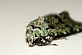
 (2245) Green-brindled Crescent (Allophyes oxyacanthae) (3996971127).jpg 1,200 × 803; 919 KB
-
 (2245) Green-brindled Crescent (Allophyes oxyacanthae) (3997205489).jpg 1,500 × 1,004; 1.24 MB
-
 (2245) Green-brindled Crescent (Allophyes oxyacanthae) (3997731280).jpg 1,200 × 803; 746 KB
-
 (2245) Green-brindled Crescent (Allophyes oxyacanthae) (3997732502).jpg 1,500 × 1,004; 1.31 MB
-
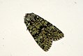
 (2247) Merveille du Jour (Dichonia aprilina) (3996969617).jpg 1,500 × 1,004; 1.19 MB
-
 (2247) Merveille du Jour (Dichonia aprilina) (3996970147).jpg 1,500 × 1,004; 930 KB
-
 (2263) Red-line Quaker (Agrochola lota) (3997204799).jpg 1,500 × 1,004; 1.35 MB
-
 -2009-10-10 Steps down to Beeston Regis beach from the Caravan Park, Beeston Regis..JPG 2,560 × 1,920; 1.2 MB
-

-
 57601 WCRC diesel locomotive Shiela British Rail Class 56 Carlisle 10 Oct 2009 pic 1.jpg 2,736 × 3,648; 2.5 MB
-
 57601 WCRC diesel locomotive Shiela British Rail Class 56 Carlisle 10 Oct 2009 pic 2.jpg 3,648 × 2,736; 3.27 MB
-
 57601 WCRC diesel locomotive Shiela British Rail Class 56 Carlisle 10 Oct 2009 pic 3.jpg 3,648 × 2,736; 3.53 MB
-
 66117 EWS Class 66 diesel locomotive Carlisle 10 Oct 2009.jpg 3,648 × 2,736; 4.44 MB
-
 A burn through the woods - geograph.org.uk - 1528483.jpg 480 × 640; 106 KB
-
 A conversation with Oscar Wilde - geograph.org.uk - 1528648.jpg 640 × 480; 135 KB
-
 A couple of retail units entering Leigh - geograph.org.uk - 1537632.jpg 640 × 430; 124 KB
-
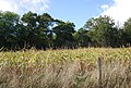 A field of Maize near Home Covert Wood - geograph.org.uk - 1535295.jpg 640 × 430; 180 KB
-

-

-
 A stretched limo, Omagh - geograph.org.uk - 1531785.jpg 640 × 479; 68 KB
-

-
 A1 Loco Tornado - geograph.org.uk - 1529329.jpg 640 × 427; 93 KB
-

-
-
 A299 Thanet Way Dual Carriageway - geograph.org.uk - 1533026.jpg 640 × 427; 59 KB
-
 A361 leavin Lechlade - geograph.org.uk - 1555774.jpg 640 × 427; 66 KB
-
 A361 through Lechlade (1) - geograph.org.uk - 1555751.jpg 640 × 427; 68 KB
-
 A361 through Lechlade (2) - geograph.org.uk - 1555760.jpg 640 × 427; 41 KB
-
 A49 heading north from Woofferton - geograph.org.uk - 1535625.jpg 640 × 397; 63 KB
-
 A684 into Sedbergh - geograph.org.uk - 1528498.jpg 640 × 480; 99 KB
-
 A691, Durham to Consett - geograph.org.uk - 1537646.jpg 640 × 436; 56 KB
-
 Abbey Road, Torquay - geograph.org.uk - 1535968.jpg 480 × 640; 93 KB
-
 Abbotsbury, old goods shed - geograph.org.uk - 1528765.jpg 640 × 480; 86 KB
-
 Above Scalderskew - geograph.org.uk - 1534342.jpg 640 × 480; 46 KB
-
 Achnahanat - geograph.org.uk - 1529080.jpg 640 × 480; 72 KB
-
 Addition to the Children's Library -2 (3998635985).jpg 3,184 × 3,002; 2.33 MB
-
 Addition to the Children's Library -3 (3998643013).jpg 2,882 × 2,161; 1.99 MB
-
 Afon Elan above Glanhirin farm bridge - geograph.org.uk - 1528718.jpg 640 × 480; 140 KB
-
 Afon Elan below Glanhirin farm bridge - geograph.org.uk - 1528699.jpg 640 × 439; 101 KB
-
 Albert St - geograph.org.uk - 1531468.jpg 640 × 430; 138 KB
-

-
 Alden Road - geograph.org.uk - 1529738.jpg 640 × 480; 101 KB
-
 Allt a' Chuilinn - geograph.org.uk - 1535713.jpg 640 × 480; 82 KB
-
 Almshouses, Leigh - geograph.org.uk - 1537767.jpg 640 × 380; 84 KB
-
 Alpine Inn - geograph.org.uk - 1535953.jpg 640 × 480; 60 KB
-
 Alston Station - geograph.org.uk - 1533588.jpg 640 × 449; 139 KB
-
 Aluminium bridge - geograph.org.uk - 1540090.jpg 640 × 480; 80 KB
-
 An offally good butcher^ - geograph.org.uk - 1551049.jpg 480 × 640; 72 KB
-

-

-
 Angel of the North - geograph.org.uk - 1554137.jpg 640 × 480; 35 KB
-
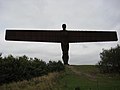 Angel of the North - geograph.org.uk - 1554144.jpg 640 × 480; 40 KB
-
 Animal Crossing under disused Railway - geograph.org.uk - 1532664.jpg 640 × 480; 108 KB
-

-
 Another use for hay - geograph.org.uk - 1528691.jpg 640 × 480; 93 KB
-
 Approach to Finkley Down farm - geograph.org.uk - 1802094.jpg 640 × 480; 78 KB
-
 Approach to Finkley Down Farm - geograph.org.uk - 1802182.jpg 640 × 480; 105 KB
-
 Approaching a stile - geograph.org.uk - 1535749.jpg 640 × 430; 145 KB
-
 Approaching Highworth - geograph.org.uk - 1555796.jpg 640 × 427; 56 KB
-

-
 Ash Hill Court, Torquay - geograph.org.uk - 1535702.jpg 506 × 640; 46 KB
-
 Ashford Roofscape - geograph.org.uk - 1528833.jpg 640 × 427; 86 KB
-
 Ashpit Plantation - geograph.org.uk - 1535373.jpg 640 × 430; 115 KB
-

-
 Autumn fungi at Allen Banks - geograph.org.uk - 1535693.jpg 640 × 480; 62 KB
-
 Autumn fungi at Allen Banks - geograph.org.uk - 1535694.jpg 640 × 480; 88 KB
-
 Autumn in London (4023048785).jpg 4,752 × 3,168; 4.12 MB
-
 Autumn in London (4023085747).jpg 4,752 × 3,168; 4.74 MB
-
 Autumn in London (4023089785).jpg 4,752 × 3,168; 4.24 MB
-
 Autumn in London (4023117861).jpg 4,752 × 3,168; 6.64 MB
-
 Autumn in London (4023137761).jpg 3,168 × 4,752; 5.7 MB
-
 Autumn in London (4023176167).jpg 4,752 × 3,168; 4.57 MB
-
 Autumn in London (4023181601).jpg 4,752 × 3,168; 4.19 MB
-
 Autumn in London (4023186627).jpg 4,752 × 3,168; 7.47 MB
-
 Autumn in London (4023205905).jpg 3,168 × 4,752; 7.44 MB
-
 Autumn in London (4023209981).jpg 4,752 × 3,168; 6.75 MB
-
 Autumn in London (4023812514).jpg 4,752 × 3,168; 5 MB
-
 Autumn in London (4023856978).jpg 4,752 × 3,168; 5.38 MB
-
 Autumn in London (4023880302).jpg 4,752 × 3,168; 5.41 MB
-
 Autumn in London (4023884286).jpg 3,168 × 4,752; 6.71 MB
-
 Autumn in London (4023887830).jpg 3,168 × 4,752; 4.24 MB
-
 Autumn in London (4023891918).jpg 3,168 × 4,752; 6.12 MB
-
 Autumn in London (4023906642).jpg 4,752 × 3,168; 6.38 MB
-
 Autumn in London (4023916732).jpg 4,752 × 3,168; 4.51 MB
-
 Autumn in London (4023922388).jpg 4,752 × 3,168; 7.99 MB
-
 Autumn in London (4023926552).jpg 4,752 × 3,168; 6.7 MB
-
 Autumn in London (4023931706).jpg 4,752 × 3,168; 7.01 MB
-
 Autumn in London (4023937832).jpg 4,752 × 3,168; 5.25 MB
-
 Autumn in London (4023946784).jpg 4,752 × 3,168; 3.5 MB
-
 Autumn in London (4023953058).jpg 4,752 × 3,168; 4.21 MB
-
 Autumn in London (4023956708).jpg 4,752 × 3,168; 7.47 MB
-
 Autumn in London (4023958820).jpg 4,752 × 3,168; 4.98 MB
-
 Autumn in London (4026541737).jpg 4,752 × 3,168; 5.34 MB
-
 Autumn in London (4026543875).jpg 4,752 × 3,168; 5.41 MB
-
 Autumn in London (4026548809).jpg 3,168 × 4,752; 4.6 MB
-
 Autumn in London (4026564815).jpg 4,752 × 3,168; 5.28 MB
-
 Autumn in London (4027299238).jpg 4,752 × 3,168; 5.24 MB
-
 Autumn in London (4027300870).jpg 4,752 × 3,168; 4.92 MB
-
 Autumn in London (4027304466).jpg 4,752 × 3,168; 5.13 MB
-
 Autumn in London (4027306208).jpg 4,752 × 3,168; 4.9 MB
-
 Autumn in London (4027308830).jpg 4,752 × 3,168; 6.02 MB
-
 Autumn in London (4027310980).jpg 3,168 × 4,752; 5.92 MB
-
 Autumn in London (4027314258).jpg 4,752 × 3,168; 7.93 MB
-
 Autumn in London (4027316216).jpg 4,752 × 3,168; 5.37 MB
-
 Autumn in London (4027319360).jpg 4,752 × 3,168; 4.01 MB
-
 Autumn in London (4027320918).jpg 4,752 × 3,168; 5.77 MB
-
 Autumn in London (4027321664).jpg 4,496 × 2,792; 2.71 MB
-
 Autumn in London (4027323808).jpg 4,752 × 3,168; 5.76 MB
-

-
 Autumnal Woodland - geograph.org.uk - 1529727.jpg 640 × 480; 96 KB
-
 B2027 coming into Leigh - geograph.org.uk - 1537517.jpg 640 × 430; 164 KB
-
 B2027, entering Leigh - geograph.org.uk - 1537519.jpg 640 × 440; 153 KB
-
 B3355 at Thicket Mead, Midsomer Norton - geograph.org.uk - 1531242.jpg 640 × 522; 130 KB
-
 Back Mead - geograph.org.uk - 1530090.jpg 480 × 640; 126 KB
-
 Banc y Defaid - geograph.org.uk - 1528739.jpg 640 × 480; 138 KB
-
 Banner within St Paul's, Elsted - geograph.org.uk - 1532153.jpg 480 × 640; 51 KB
-
 Barn beside the B4000 - geograph.org.uk - 1560062.jpg 640 × 427; 43 KB
-
 Barn beside the road - geograph.org.uk - 1561378.jpg 640 × 427; 67 KB
-
 Barn Lane near Corse - geograph.org.uk - 1528289.jpg 640 × 426; 53 KB
-
 Barn on Snargate Lane - geograph.org.uk - 1528814.jpg 640 × 427; 77 KB
-
 Barn, Home Farm, Nizels Lane - geograph.org.uk - 1535921.jpg 640 × 290; 61 KB
-
 Barns at Worsall Farm - geograph.org.uk - 1561371.jpg 640 × 427; 64 KB
-
 Barns, Leigh Park Farm - geograph.org.uk - 1537270.jpg 640 × 430; 140 KB
-
 Barns, Leigh Park Farm - geograph.org.uk - 1537303.jpg 640 × 396; 98 KB
-
 Base of Raven Crag - geograph.org.uk - 1535682.jpg 640 × 480; 164 KB
-
 BATA in Russell's old yard - geograph.org.uk - 1530558.jpg 640 × 479; 111 KB
-
 Bealach nan Corp - geograph.org.uk - 1529281.jpg 640 × 480; 90 KB
-
 Beech and Maple at the Vyne - geograph.org.uk - 1774229.jpg 800 × 600; 224 KB
-
 Beech St - geograph.org.uk - 1531452.jpg 640 × 430; 125 KB
-
 Beechwood Park in Autumn - geograph.org.uk - 1552930.jpg 640 × 480; 142 KB
-
 Beechwood Presbyterian Church - geograph.org.uk - 1552923.jpg 640 × 480; 86 KB
-
 Bend in Nizels Lane at Mansers - geograph.org.uk - 1536083.jpg 640 × 430; 182 KB
-
 Bend in the path north of Philpots Lane - geograph.org.uk - 1535909.jpg 640 × 430; 194 KB
-
 Bend in the road - geograph.org.uk - 1557518.jpg 640 × 427; 123 KB
-
 Bennover Road - geograph.org.uk - 1540423.jpg 640 × 426; 74 KB
-
 Between Two Crops - geograph.org.uk - 1535284.jpg 640 × 426; 119 KB
-
 Beulah Rd - geograph.org.uk - 1531385.jpg 640 × 430; 129 KB
-
 Bindown just before sunset - geograph.org.uk - 1530829.jpg 640 × 419; 47 KB
-

-
 Birchgrove Wood - geograph.org.uk - 1532349.jpg 640 × 480; 126 KB
-
 Bird feeders at Martin Mere - geograph.org.uk - 1602528.jpg 640 × 427; 125 KB
-
 Black Combe Beck - geograph.org.uk - 1529476.jpg 640 × 480; 52 KB
-
 Black Mountains, Wales nice view.jpg 2,592 × 1,944; 1.11 MB
-
 Blacka Plantation near Hathersage Road - geograph.org.uk - 1529025.jpg 640 × 480; 145 KB
-
 Bleng Bridge - geograph.org.uk - 1531197.jpg 480 × 640; 118 KB
-
 Blocked byway - geograph.org.uk - 1528338.jpg 640 × 480; 293 KB
-
 Blowhole at Porthcothan - geograph.org.uk - 1529168.jpg 472 × 640; 107 KB
-
 Blu Cargo, Torquay - geograph.org.uk - 1536624.jpg 640 × 480; 81 KB
-

-

-

-
 Boat at Inveraray - geograph.org.uk - 1546540.jpg 640 × 428; 38 KB
-
 Boathouse, Hall Place Park, Leigh - geograph.org.uk - 1537610.jpg 640 × 350; 88 KB
-
 Bordanoost, Haroldswick - geograph.org.uk - 1528258.jpg 640 × 426; 53 KB
-
 Boston manor house stairs 3087.jpg 1,760 × 3,260; 3.67 MB
-
 Boston manor house stairs 3087alt.jpg 2,602 × 3,906; 7.07 MB
-
 Boston manor newel posts 3084.jpg 2,530 × 3,135; 4.8 MB
-
 Boswarva - geograph.org.uk - 1528990.jpg 640 × 427; 88 KB
-
 Boulder Field at Wintours Leap - geograph.org.uk - 1736484.jpg 1,024 × 768; 285 KB
-
 Boulder, Beinn a' Chabhair - geograph.org.uk - 1537237.jpg 640 × 480; 81 KB
-
 Boundary Wall at Southwell Minster - geograph.org.uk - 1533611.jpg 640 × 480; 117 KB
-
-
 Bourne Place Barn, Nizels Lane - geograph.org.uk - 1535999.jpg 640 × 430; 149 KB
-
 Bourne Place Meadow, Nizels Lane - geograph.org.uk - 1536048.jpg 640 × 430; 125 KB
-
 Brampton House, Scabharbour Rd - geograph.org.uk - 1536557.jpg 640 × 430; 174 KB
-
 Bridge at Helebridge - geograph.org.uk - 1535032.jpg 640 × 426; 121 KB
-
 Bridge over River Carron - geograph.org.uk - 1528533.jpg 640 × 480; 68 KB
-
 Bridge over the River Oykel - geograph.org.uk - 1528427.jpg 640 × 480; 92 KB
-
 Bridgnorth shed - geograph.org.uk - 1540417.jpg 640 × 427; 131 KB
-
 Bridlepath to Hebblethwaite Hall - geograph.org.uk - 1528466.jpg 640 × 480; 134 KB
-

-

-
 Bridleway, to Dartmeet - geograph.org.uk - 1531306.jpg 640 × 480; 121 KB
-
 British Rail Mk1 99125 Jessica West Coast Railway Company Carlisle 10 Oct 2009.jpg 3,648 × 2,736; 2.54 MB
-
 British Rail Mk1 99128 West Coast Railway Company Carlisle 10 Oct 2009.jpg 3,648 × 2,736; 2.58 MB
-

-
 Broken Glass on the Byway - geograph.org.uk - 1528333.jpg 640 × 598; 344 KB
-
 Brook, below Skir Hill - geograph.org.uk - 1529938.jpg 480 × 640; 138 KB
-
 BT Exchange - geograph.org.uk - 1607479.jpg 640 × 480; 60 KB
-
 Bungalow near Bourne Place, Nizels lane - geograph.org.uk - 1536066.jpg 640 × 430; 142 KB
-

-
 Bus stop on Qua fen - geograph.org.uk - 1539968.jpg 640 × 480; 95 KB
-
 Bus Stop, Leigh - geograph.org.uk - 1537777.jpg 640 × 430; 137 KB
-
 Buscot Wick - geograph.org.uk - 1561410.jpg 640 × 427; 49 KB
-
 Business premises - geograph.org.uk - 1802179.jpg 640 × 480; 81 KB
-
 Butt Lane - geograph.org.uk - 1528354.jpg 640 × 480; 170 KB
-
 By the East Looe River - geograph.org.uk - 1538724.jpg 640 × 390; 74 KB
-
 Byway to Butt Lane - geograph.org.uk - 1528321.jpg 640 × 480; 283 KB
-
 Calverley House, Calverley Rd - geograph.org.uk - 1532199.jpg 640 × 430; 158 KB
-
 Calverley House, Calverley Rd - geograph.org.uk - 1532205.jpg 640 × 430; 122 KB
-

-
 Calverley Rd - geograph.org.uk - 1532267.jpg 640 × 430; 156 KB
-
 Calverley St - geograph.org.uk - 1532222.jpg 640 × 430; 118 KB
-
 Cambridge Regional College - geograph.org.uk - 1528303.jpg 640 × 480; 161 KB
-
 Cambridge St - geograph.org.uk - 1533442.jpg 640 × 430; 128 KB
-
 Camden Hill and Prospect Rd junction - geograph.org.uk - 1533481.jpg 640 × 430; 128 KB
-
 Camden Rd - geograph.org.uk - 1532214.jpg 640 × 430; 130 KB
-
 Camden Road Car Park - geograph.org.uk - 1531449.jpg 640 × 430; 149 KB
-
 Canavan clock, Lurgan - geograph.org.uk - 1528585.jpg 640 × 428; 87 KB
-
 Canavan Clocks, Lurgam - geograph.org.uk - 1528615.jpg 640 × 383; 97 KB
_Green-brindled_Crescent_(Allophyes_oxyacanthae)_(3996971127).jpg)
_Green-brindled_Crescent_(Allophyes_oxyacanthae)_(3997205489).jpg)
_Green-brindled_Crescent_(Allophyes_oxyacanthae)_(3997731280).jpg)
_Green-brindled_Crescent_(Allophyes_oxyacanthae)_(3997732502).jpg)
_Merveille_du_Jour_(Dichonia_aprilina)_(3996969617).jpg)
_Merveille_du_Jour_(Dichonia_aprilina)_(3996970147).jpg)
_Red-line_Quaker_(Agrochola_lota)_(3997204799).jpg)


_-_geograph.org.uk_-_1555751.jpg)
_-_geograph.org.uk_-_1555760.jpg)


.jpg)
.jpg)


.jpg)
.jpg)
.jpg)
.jpg)
.jpg)
.jpg)
.jpg)
.jpg)
.jpg)
.jpg)
.jpg)
.jpg)
.jpg)
.jpg)
.jpg)
.jpg)
.jpg)
.jpg)
.jpg)
.jpg)
.jpg)
.jpg)
.jpg)
.jpg)
.jpg)
.jpg)
.jpg)
.jpg)
.jpg)
.jpg)
.jpg)
.jpg)
.jpg)
.jpg)
.jpg)
.jpg)
.jpg)
.jpg)
.jpg)
.jpg)
.jpg)
.jpg)


