Category:United Kingdom photographs taken on 2009-11-22
Jump to navigation
Jump to search
Countries of Europe: Austria · Belarus · Belgium · Bosnia and Herzegovina · Croatia · Czech Republic · Denmark · Estonia · Finland · France‡ · Germany · Greece · Hungary · Republic of Ireland · Italy · Latvia · Malta · Netherlands‡ · Norway · Poland · Portugal‡ · Romania · Russia‡ · Slovakia · Spain‡ · Sweden · Switzerland · Turkey‡ · Ukraine · United Kingdom
‡: partly located in Europe
‡: partly located in Europe
| ← | 22 November 2009 | → | ||
| ← | November 2009 | → | ||

United Kingdom photographs taken on 22 November 2009.
Image files should be categorized here automatically using {{taken on}} template. Direct categorisation is also possible, if automatic is impossible.
Subcategories
This category has the following 2 subcategories, out of 2 total.
Media in category "United Kingdom photographs taken on 2009-11-22"
The following 200 files are in this category, out of 815 total.
(previous page) (next page)-
-
 "The Parson's Nose", Hillsborough - geograph.org.uk - 1591225.jpg 640 × 621; 86 KB
-
 "The Shopper" by Bill Scott - geograph.org.uk - 1602648.jpg 401 × 640; 73 KB
-
 "Weir ahead" sign, Lisburn - geograph.org.uk - 1591945.jpg 640 × 372; 86 KB
-
 "Welcome to Derrytrasna" - geograph.org.uk - 1591594.jpg 640 × 480; 98 KB
-
 'The Craigavon Effect', Balteagh - geograph.org.uk - 1591404.jpg 640 × 480; 112 KB
-
 1 and 2 Holly Villas - geograph.org.uk - 1593606.jpg 640 × 427; 57 KB
-

-
 A clear felled area south of Whitefolds - geograph.org.uk - 1591775.jpg 640 × 480; 115 KB
-
 A gate on the forest track - geograph.org.uk - 1593069.jpg 640 × 480; 108 KB
-
-
 A Green Lung - geograph.org.uk - 1593611.jpg 480 × 640; 119 KB
-
 A lovely day for a walk in the forest - geograph.org.uk - 1591488.jpg 640 × 481; 241 KB
-

-
 A scenic bus ride along B3157 - geograph.org.uk - 1886653.jpg 2,048 × 1,536; 651 KB
-

-
 A small trackside pool in the forest - geograph.org.uk - 1591443.jpg 640 × 480; 102 KB
-

-

-
 A229 Hawkhurst Road at Hartley Hill - geograph.org.uk - 1596126.jpg 640 × 427; 80 KB
-
 A505 Weston Hills Tunnel - geograph.org.uk - 1771232.jpg 640 × 480; 47 KB
-
 A6 - geograph.org.uk - 1593303.jpg 640 × 480; 59 KB
-
 AA Sign, Ramsbury - geograph.org.uk - 1650141.jpg 481 × 640; 144 KB
-
 Across Loch Garten - geograph.org.uk - 1592626.jpg 640 × 480; 90 KB
-
 Aghacommon Embankment Bridge - geograph.org.uk - 1591442.jpg 640 × 480; 95 KB
-
 All clear for Barrow-in-Furness - geograph.org.uk - 1598065.jpg 640 × 426; 56 KB
-
 All Saints' Church, Edingthorpe - geograph.org.uk - 2142557.jpg 1,600 × 1,061; 417 KB
-
 Ancient Beech Tree in Burnt Bank Wood - geograph.org.uk - 1593423.jpg 427 × 640; 124 KB
-
 Ancient Track in Burnt Bank Wood - geograph.org.uk - 1593432.jpg 427 × 640; 130 KB
-
 Anglers on Harley Fishing Lake - geograph.org.uk - 1596147.jpg 640 × 427; 88 KB
-

-
 Approaching Charlestown - geograph.org.uk - 1591683.jpg 640 × 480; 101 KB
-
 Approaching the Speech House car park - geograph.org.uk - 1607564.jpg 640 × 427; 147 KB
-
 Arch from the field - geograph.org.uk - 1595330.jpg 640 × 427; 91 KB
-
 Ashmount Gardens, Lisburn - geograph.org.uk - 1591926.jpg 640 × 360; 74 KB
-
 At the end of the prom - geograph.org.uk - 1593453.jpg 640 × 375; 45 KB
-
 Autumn in Stamford Park - geograph.org.uk - 1594298.jpg 640 × 480; 210 KB
-
 Back to the train - geograph.org.uk - 1595233.jpg 640 × 480; 99 KB
-
 Backing in the bay - geograph.org.uk - 1595206.jpg 640 × 480; 81 KB
-
 Bad Junction - geograph.org.uk - 1594603.jpg 640 × 480; 61 KB
-
 Badger's Oast House - geograph.org.uk - 1596088.jpg 640 × 427; 46 KB
-
 Bag in the breeze near Axford - geograph.org.uk - 1635400.jpg 640 × 480; 137 KB
-
 Balder Railway Viaduct - geograph.org.uk - 1593233.jpg 640 × 480; 89 KB
-
 Ballyhanedin Road - geograph.org.uk - 1610470.jpg 240 × 180; 17 KB
-
 Ballynacor Lane, Derrymacash - geograph.org.uk - 1591504.jpg 640 × 480; 92 KB
-
 Bannfoot Ferry (East) - geograph.org.uk - 1591648.jpg 640 × 480; 94 KB
-
 Bannfoot Road approaching the ferry - geograph.org.uk - 1591632.jpg 640 × 480; 114 KB
-

-
 Barton Road, Torquay - geograph.org.uk - 1595525.jpg 640 × 501; 59 KB
-
 Battersea Post Office - geograph.org.uk - 1590984.jpg 640 × 480; 83 KB
-
 Baywatch - geograph.org.uk - 1592672.jpg 640 × 480; 79 KB
-
 Beech Tree Leaves in Burnt Bank Wood - geograph.org.uk - 1593429.jpg 427 × 640; 117 KB
-
 Beggar's Oak - geograph.org.uk - 1596090.jpg 427 × 640; 93 KB
-
 Benches at Whitehouse - geograph.org.uk - 1592648.jpg 640 × 480; 69 KB
-
 Bend on High Weald Landscape Trail - geograph.org.uk - 1595937.jpg 640 × 427; 87 KB
-
-
 Blackroot Pool, Sutton Park - geograph.org.uk - 1591289.jpg 640 × 480; 104 KB
-
 Blue Boar Lane, Rochester - geograph.org.uk - 1627717.jpg 640 × 427; 57 KB
-
-
 Boars Head - geograph.org.uk - 1593312.jpg 640 × 480; 56 KB
-

-
 Boundary Fence on the Scawd Law Col - geograph.org.uk - 1592961.jpg 640 × 480; 82 KB
-
 Boundary stone on A142 at Ely - geograph.org.uk - 1619989.jpg 458 × 640; 165 KB
-
 Bowling Green - geograph.org.uk - 1594288.jpg 640 × 480; 122 KB
-
 Brake on the wheel - geograph.org.uk - 1595222.jpg 640 × 480; 75 KB
-
 Bray's Lane, Ely - geograph.org.uk - 1767067.jpg 800 × 600; 154 KB
-
 Bridge 28a, Lancaster Canal - geograph.org.uk - 1591905.jpg 640 × 480; 67 KB
-
 Bridge 29 Lancaster Canal - geograph.org.uk - 1592111.jpg 640 × 480; 80 KB
-
 Bridge 30 Lancaster canal - geograph.org.uk - 1593298.jpg 640 × 480; 101 KB
-
 Bridge 31 , Lancaster Canal - geograph.org.uk - 1591892.jpg 640 × 480; 79 KB
-
 Bridge 32 , Lancaster Canal - geograph.org.uk - 1591203.jpg 640 × 480; 103 KB
-
 Bridge 33 Lancaster Canal - geograph.org.uk - 1591202.jpg 640 × 480; 85 KB
-
-
 Bridge Near Thirties Farm - geograph.org.uk - 1591730.jpg 640 × 480; 52 KB
-
 Bridge over River Tay - geograph.org.uk - 1591758.jpg 480 × 640; 53 KB
-
 Bridge over the Nant Gwyddior - geograph.org.uk - 1591437.jpg 640 × 480; 152 KB
-
 Bridleway Bridge - geograph.org.uk - 1595975.jpg 640 × 427; 92 KB
-
 Bridleway enters Bedgebury Forest - geograph.org.uk - 1595994.jpg 640 × 427; 110 KB
-

-

-
 Bridleway near Axford - geograph.org.uk - 1635387.jpg 640 × 480; 196 KB
-
 Bridleway near Sugar Loaf Hill - geograph.org.uk - 1595981.jpg 640 × 427; 87 KB
-
 Bridleway near Sugar Loaf Hill - geograph.org.uk - 1596015.jpg 640 × 427; 92 KB
-
 Bridleway near Witcha Copse - geograph.org.uk - 1650275.jpg 640 × 480; 139 KB
-
 Bridleway to Furnace Farm - geograph.org.uk - 1595972.jpg 640 × 427; 97 KB
-
 Bridleway to Sugar Loaf Hill - geograph.org.uk - 1596013.jpg 640 × 427; 93 KB
-
 Bridleway to Three Chimneys Farm - geograph.org.uk - 1596007.jpg 640 × 427; 92 KB
-

-
 Bridleway, Axford - geograph.org.uk - 1593007.jpg 640 × 480; 136 KB
-
 Bridleway, Axford - geograph.org.uk - 1635225.jpg 479 × 640; 183 KB
-
 Bridleway, Lambourn Woodland - geograph.org.uk - 1651930.jpg 640 × 480; 165 KB
-
 Bridleway, Lambourn Woodlands - geograph.org.uk - 1652146.jpg 640 × 481; 216 KB
-

-
 Buildings at the Centre of St Columb - geograph.org.uk - 1591851.jpg 426 × 640; 94 KB
-

-
 Burn above Auchinellan - geograph.org.uk - 1591731.jpg 640 × 480; 96 KB
-
 Burnt Bank Wood River - geograph.org.uk - 1592378.jpg 427 × 640; 133 KB
-
 Bus shelter, Axford - geograph.org.uk - 1635239.jpg 480 × 640; 136 KB
-
 By Home Farm, Haccombe - geograph.org.uk - 1595575.jpg 640 × 480; 74 KB
-
 Byway to Badger's Oak - geograph.org.uk - 1596115.jpg 640 × 427; 127 KB
-
 Byway to Badger's Oak - geograph.org.uk - 1596122.jpg 640 × 427; 101 KB
-
 Byway to Hartley (2) - geograph.org.uk - 1596112.jpg 640 × 427; 110 KB
-
 Byway to Hartley - geograph.org.uk - 1596108.jpg 640 × 427; 80 KB
-
 Byway to Trenley Lane - geograph.org.uk - 1596078.jpg 640 × 427; 108 KB
-
 Byway, Ellisfield - geograph.org.uk - 1593138.jpg 480 × 640; 158 KB
-
 Byway, Upper Lambourn - geograph.org.uk - 1658039.jpg 640 × 480; 185 KB
-
 Canada Geese - geograph.org.uk - 1593295.jpg 640 × 480; 52 KB
-
 Canford Heath, bungalows - geograph.org.uk - 1591244.jpg 640 × 480; 53 KB
-
 Captain Cook, in festive mode - geograph.org.uk - 1593529.jpg 480 × 640; 35 KB
-

-
 Caravans at Doe Park - geograph.org.uk - 1593206.jpg 640 × 480; 83 KB
-
 Carbet Road, Tamnificarbet - geograph.org.uk - 1591356.jpg 640 × 480; 99 KB
-
 Cartmel Grange Nursing Home - geograph.org.uk - 1598050.jpg 640 × 426; 62 KB
-
 Cathedral close, Ely - geograph.org.uk - 1767007.jpg 800 × 600; 110 KB
-
 Cattle, Stocks Lane - geograph.org.uk - 1635405.jpg 640 × 480; 130 KB
-
 Cattle, Whittonditch - geograph.org.uk - 1650232.jpg 640 × 480; 130 KB
-
 Cattle, Whittonditch - geograph.org.uk - 1650258.jpg 640 × 480; 141 KB
-
 Caution runners crossing - geograph.org.uk - 1607540.jpg 640 × 426; 198 KB
-

-
 Chaffinch Close, Broadstone - geograph.org.uk - 1591414.jpg 640 × 504; 79 KB
-
 Chalk Lane - geograph.org.uk - 1593527.jpg 640 × 427; 111 KB
-
 Charlestown village - geograph.org.uk - 1591675.jpg 640 × 480; 106 KB
-
 Chequer Tree Farmhouse - geograph.org.uk - 1593576.jpg 640 × 427; 87 KB
-
 Cherry Hill Park, and the Ely Porta - geograph.org.uk - 1767150.jpg 800 × 600; 278 KB
-
 Cherry Hill Park, Ely - geograph.org.uk - 1767116.jpg 800 × 600; 276 KB
-
 Cherry Hill Park, Ely - geograph.org.uk - 1767122.jpg 800 × 600; 224 KB
-
 Cherry Hill Park, Ely - geograph.org.uk - 1767132.jpg 800 × 550; 159 KB
-
 Cherry Hill Park, Ely - geograph.org.uk - 1767140.jpg 800 × 536; 171 KB
-
-
 Church Lane, Ely - geograph.org.uk - 1766549.jpg 800 × 679; 155 KB
-
-
 Churchyard, St Andrew's Church - geograph.org.uk - 1662171.jpg 640 × 480; 175 KB
-
 Clapper bridge - geograph.org.uk - 1591707.jpg 640 × 480; 97 KB
-
 Claytons Close, Methley - geograph.org.uk - 1592146.jpg 640 × 480; 88 KB
-
 Cliff Rescue Practice near Ballyaurgan - geograph.org.uk - 1591762.jpg 640 × 427; 327 KB
-
 Close up of Red Route Cycling Notice - geograph.org.uk - 1596053.jpg 427 × 640; 61 KB
-
 Clown Fish (4125498003).jpg 1,026 × 642; 383 KB
-
 Cold Harbour, the Silent Woman - geograph.org.uk - 1591270.jpg 640 × 480; 78 KB
-
 Commercial woodland - geograph.org.uk - 1607260.jpg 640 × 426; 186 KB
-
 Conifer Plantation in Burnt Bank Wood - geograph.org.uk - 1593441.jpg 427 × 640; 122 KB
-
 Coombe Lane - geograph.org.uk - 1591575.jpg 640 × 480; 70 KB
-
 Coppice work in Angley Wood - geograph.org.uk - 1593498.jpg 640 × 427; 117 KB
-

-
 Cordon Hill - geograph.org.uk - 1592732.jpg 640 × 359; 96 KB
-
 Corstorphine Hill Tower - geograph.org.uk - 1592855.jpg 427 × 640; 106 KB
-
 Corstorphine Hill Tower - geograph.org.uk - 1592867.jpg 427 × 640; 110 KB
-
 Crab apples (4125499571).jpg 1,968 × 1,734; 1.54 MB
-
 Cranbrook Car Park - geograph.org.uk - 1592184.jpg 640 × 427; 67 KB
-

-
 Cranbrook Masonic Hall - geograph.org.uk - 1596127.jpg 640 × 427; 43 KB
-
 Cranbrook Union Windmill - geograph.org.uk - 1592187.jpg 640 × 427; 45 KB
-
 Crazy Golf - geograph.org.uk - 1594272.jpg 640 × 480; 171 KB
-

-
 Crested Tit at Glenmore shop - geograph.org.uk - 1597887.jpg 640 × 480; 196 KB
-
 Cross Keys Hotel Kippen - geograph.org.uk - 1591509.jpg 640 × 480; 58 KB
-
 Cross, Aldbourne - geograph.org.uk - 1635434.jpg 479 × 640; 150 KB
-
 Cumbria in the arch - geograph.org.uk - 1595371.jpg 426 × 640; 89 KB
-
 Cumbria in the bay - geograph.org.uk - 1595324.jpg 640 × 480; 71 KB
-
 Cwm Ganol - geograph.org.uk - 1593044.jpg 640 × 480; 79 KB
-
 Cycleway through the forest - geograph.org.uk - 1607071.jpg 426 × 640; 232 KB
-
 Damp Grassland - geograph.org.uk - 1591732.jpg 640 × 426; 96 KB
-

-
 Deep in the forest - geograph.org.uk - 1606971.jpg 640 × 428; 205 KB
-
 Dentist's sign, Hillsborough - geograph.org.uk - 1591235.jpg 640 × 525; 73 KB
-

-
 Derryadd Telephone Exchange - geograph.org.uk - 1591582.jpg 640 × 480; 97 KB
-
 Derryadd village - geograph.org.uk - 1591524.jpg 640 × 480; 90 KB
-
 Derryinver Townland - geograph.org.uk - 1591696.jpg 640 × 480; 81 KB
-
 Detail on Corstorphine Hill Tower - geograph.org.uk - 1592860.jpg 640 × 427; 90 KB
-
 Disused (and boggy) quarry - geograph.org.uk - 1593075.jpg 640 × 480; 101 KB
-
 Disused quarry beside the forest track - geograph.org.uk - 1591403.jpg 640 × 480; 166 KB
-
 Disused quarry in Esgair y Llyn - geograph.org.uk - 1593049.jpg 640 × 480; 112 KB
-
 Disused quarry in the forest - geograph.org.uk - 1593026.jpg 640 × 480; 145 KB
-

-
 Division on Maypole Lane - geograph.org.uk - 1593619.jpg 640 × 427; 88 KB
-
 Double stiles through Robins Wood - geograph.org.uk - 1596142.jpg 640 × 427; 106 KB
-

-
 Down the forest track - geograph.org.uk - 1593014.jpg 640 × 480; 99 KB
-
 Down the forest-side track - geograph.org.uk - 1593005.jpg 640 × 480; 103 KB
-
 Drain, Lisburn - geograph.org.uk - 1591922.jpg 583 × 376; 85 KB
-
 Drumnagoon Road, Tamnificarbet - geograph.org.uk - 1591360.jpg 640 × 480; 130 KB
-
 Drybrook Road station - geograph.org.uk - 1607028.jpg 640 × 427; 180 KB
-
 Duck Pond - geograph.org.uk - 1593296.jpg 640 × 437; 44 KB
-
 Ducks entrering the Great Ouse, Ely - geograph.org.uk - 1767095.jpg 800 × 600; 209 KB
-
 Dumpy Tree Frog (4153393909).jpg 640 × 480; 122 KB
-

-

-
 Earth star (1) - geograph.org.uk - 1590979.jpg 502 × 640; 84 KB
-
 Earth star (2) - geograph.org.uk - 1591007.jpg 640 × 480; 79 KB
-
 East Gate Street from the East Gate - geograph.org.uk - 1591288.jpg 640 × 516; 74 KB
-
 East Stoke, Holme Lane - geograph.org.uk - 1591419.jpg 480 × 640; 119 KB
-
 Edge of Pitmedden Forest - geograph.org.uk - 1594341.jpg 640 × 480; 112 KB
-
 Edge of the woodland - geograph.org.uk - 1607280.jpg 640 × 427; 237 KB
-
 Eeriness in the trees - geograph.org.uk - 1606956.jpg 640 × 427; 218 KB
-
 Ely Cathedral - geograph.org.uk - 1766558.jpg 600 × 800; 169 KB
-
 Ely Cathedral - geograph.org.uk - 1766562.jpg 800 × 600; 171 KB
-
 Ely Cathedral - geograph.org.uk - 1767011.jpg 800 × 600; 156 KB
-
 Ely Cathedral - geograph.org.uk - 1771144.jpg 600 × 800; 162 KB
-
 Ely Cathedral - geograph.org.uk - 1771147.jpg 800 × 601; 134 KB
-
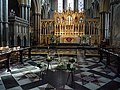 Ely Cathedral - geograph.org.uk - 1771203.jpg 800 × 600; 163 KB


_-_geograph.org.uk_-_1591648.jpg)


_-_geograph.org.uk_-_1596112.jpg)


.jpg)


.jpg)


_quarry_-_geograph.org.uk_-_1593075.jpg)


.jpg)


_-_geograph.org.uk_-_1590979.jpg)
_-_geograph.org.uk_-_1591007.jpg)


