Category:United Kingdom photographs taken on 2018-04-01
Jump to navigation
Jump to search
Countries of Europe: Austria · Belgium · Denmark · Estonia · Finland · France‡ · Georgia‡ · Germany · Greece · Hungary · Italy · Latvia · Malta · Monaco · Netherlands‡ · Norway · Poland · Portugal‡ · Romania · Russia‡ · Serbia · Slovakia · Spain‡ · Sweden · Switzerland · Turkey‡ · Ukraine · United Kingdom
‡: partly located in Europe
‡: partly located in Europe
| ← | 1 April 2018 | → | ||
| ← | April 2018 | → | ||

United Kingdom photographs taken on 1 April 2018.
Image files should be categorized here automatically using {{taken on}} template. Direct categorisation is also possible, if automatic is impossible.
Subcategories
This category has the following 3 subcategories, out of 3 total.
C
S
Media in category "United Kingdom photographs taken on 2018-04-01"
The following 141 files are in this category, out of 141 total.
-
 -2018-04-01 Dead Harbour Dolphin (Phocoena phocoena) East Beach, Cromer.jpg 1,600 × 1,051; 393 KB
-
 2018 at Portsmouth and Southsea - bridge over Commercial Road.JPG 1,366 × 910; 575 KB
-
 2018 at Portsmouth and Southsea - entrance canopy detail.JPG 1,024 × 1,366; 626 KB
-
 2018 at Portsmouth and Southsea - facade.JPG 1,366 × 820; 496 KB
-
 2018 at Portsmouth and Southsea - old booking hall.JPG 1,024 × 1,366; 415 KB
-
 2018 at Portsmouth and Southsea - on the concourse looking north.JPG 1,366 × 910; 611 KB
-
 2018 at Portsmouth and Southsea - on the concourse looking south.JPG 1,366 × 910; 557 KB
-
 2018 at Portsmouth and Southsea - platform 2.JPG 1,366 × 910; 448 KB
-
 2018 at Portsmouth and Southsea - platforms 3 and 4.JPG 1,366 × 910; 573 KB
-
 2018 at Portsmouth and Southsea - terminal platform canopy.JPG 1,366 × 910; 531 KB
-
 2018 at Portsmouth and Southsea - under the viaduct.JPG 1,366 × 910; 503 KB
-
 2018 at Portsmouth and Southsea - viaduct approach (450004).JPG 1,366 × 910; 745 KB
-
 2018-04-01 Biffa dumpster bin, Daventry.JPG 5,152 × 3,864; 5.2 MB
-
 2018-04-01 Indian On The Cliff, Brook Street, Cromer.JPG 5,152 × 3,864; 4.63 MB
-
 All Saints church - western arch (geograph 5728110).jpg 1,024 × 768; 239 KB
-
 All Saints church from the north-west (geograph 5728103).jpg 1,024 × 768; 171 KB
-
 Beeston Castle - Outer Gatehouse.jpg 5,113 × 3,351; 5.91 MB
-
 Blossom alongside Station Road, Tadcaster (geograph 5729980).jpg 1,024 × 768; 248 KB
-
 Bowling greens, St Josephs Street, Tadcaster (geograph 5729993).jpg 1,024 × 768; 87 KB
-
 Centre Lane entrance to John Smiths Brewery (geograph 5729927).jpg 1,024 × 768; 164 KB
-
 Close-up of the inscription (OpenBenches 5067).jpg 3,024 × 4,032; 7.57 MB
-
 Close-up of the inscription (OpenBenches 5068).jpg 4,032 × 3,024; 3.6 MB
-
 Close-up of the inscription (OpenBenches 5070).jpg 4,032 × 3,024; 1.63 MB
-
 Close-up of the inscription (OpenBenches 5070-1).jpg 4,032 × 3,024; 1.75 MB
-
 Close-up of the inscription (OpenBenches 5075).jpg 3,840 × 2,160; 2.45 MB
-
 Close-up of the inscription (OpenBenches 5079).jpg 3,840 × 2,160; 2.68 MB
-
 Close-up of the inscription (OpenBenches 5080).jpg 3,840 × 2,160; 2.68 MB
-
 Close-up of the inscription (OpenBenches 5081).jpg 3,840 × 2,160; 2.5 MB
-
 Close-up of the inscription (OpenBenches 5082).jpg 3,840 × 2,160; 2.8 MB
-
 Close-up of the inscription (OpenBenches 5083).jpg 3,840 × 2,160; 2.4 MB
-
 Close-up of the inscription (OpenBenches 5084).jpg 3,840 × 2,160; 2.92 MB
-
 Close-up of the inscription (OpenBenches 5085).jpg 3,840 × 2,160; 2.66 MB
-
 Close-up of the inscription (OpenBenches 5086).jpg 3,840 × 2,160; 2.76 MB
-
 Close-up of the inscription (OpenBenches 5087).jpg 3,840 × 2,160; 2.64 MB
-
 Close-up of the inscription (OpenBenches 5091).jpg 3,264 × 2,448; 1.94 MB
-
 Close-up of the inscription (OpenBenches 5092).jpg 3,264 × 2,448; 1.84 MB
-
 Close-up of the inscription (OpenBenches 5093).jpg 3,264 × 2,448; 2.14 MB
-
 Close-up of the inscription (OpenBenches 5096).jpg 3,024 × 4,032; 3.78 MB
-
 Close-up of the inscription (OpenBenches 5117).jpg 3,082 × 2,311; 2.39 MB
-
 Close-up of the inscription (OpenBenches 5143).jpg 4,032 × 3,024; 1.92 MB
-
 Close-up of the inscription (OpenBenches 5144).jpg 3,343 × 2,507; 2.44 MB
-
 Close-up of the inscription (OpenBenches 5145).jpg 4,032 × 3,024; 4.83 MB
-
 Coastliner crossing the Wharfe Bridge in Tadcaster (geograph 5729832).jpg 1,024 × 768; 252 KB
-
 Cycle Sense, High Street, Tadcaster (geograph 5730014).jpg 1,024 × 768; 148 KB
-
 Cycle Sense, Westgate, Tadcaster (geograph 5729957).jpg 1,024 × 768; 141 KB
-
 Datchet Station (geograph 5726682).jpg 4,017 × 2,681; 1.06 MB
-
 Dinefwr castle at sunrise.jpg 3,992 × 2,242; 1.96 MB
-
 Easter cross in Tadcaster (geograph 5729939).jpg 768 × 1,024; 163 KB
-
 Eclectic architecture, Westgate, Tadcaster (geograph 5729948).jpg 1,024 × 768; 151 KB
-
 Emerald House - geograph.org.uk - 5922056.jpg 1,024 × 681; 116 KB
-
 Environment Agency - geograph.org.uk - 5922054.jpg 1,024 × 681; 103 KB
-
 Fenners- no play on the first day (geograph 5723150).jpg 1,024 × 768; 1,005 KB
-
 Flood defences in Tadcaster (geograph 5730027).jpg 1,024 × 768; 220 KB
-
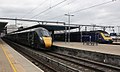
 Fratton - GWR 158957 arriving from Bath Spa.JPG 1,366 × 910; 645 KB
-
 Fratton - SWR 444001 (Stagecoach livery) up train.JPG 1,366 × 820; 355 KB
-
 Fratton - SWR 450026 and GWR 158957.JPG 1,366 × 910; 645 KB
-
 Fratton TCD - SWR 150890.JPG 1,366 × 820; 465 KB
-
 Fratton TCD - SWR 450120, 450555 and 450012.JPG 1,366 × 910; 549 KB
-
 Hawker House - geograph.org.uk - 5922058.jpg 1,024 × 681; 127 KB
-
 Hoist at the Old Brewery, Tadcaster (geograph 5729911).jpg 768 × 1,024; 132 KB
-
 Holyrood Chapel, Newburgh.jpg 1,920 × 2,560; 1.06 MB
-
 Holyrood Chapel.jpg 1,920 × 2,560; 1.12 MB
-
 Howden Arms, High Street, Tadcaster (geograph 5730009).jpg 1,024 × 768; 139 KB
-
 Ian Turners Carpets, Station Road, Tadcaster (geograph 5729973).jpg 1,024 × 768; 132 KB
-
 Ibrox Stadium (geograph 5756318).jpg 640 × 321; 87 KB
-
 Inside the mens toilets at Ruswarp (geograph 5732863).jpg 6,000 × 4,000; 7.36 MB
-
 Inveraray Pier with puffer "Vital Spark".jpg 3,872 × 2,592; 3.18 MB
-
 Long shot of the bench (OpenBenches 5068-1).jpg 4,032 × 3,024; 4.17 MB
-
 Long shot of the bench (OpenBenches 5069).jpg 4,032 × 3,024; 4.02 MB
-
 Long shot of the bench (OpenBenches 5070-2).jpg 4,032 × 3,024; 3.82 MB
-
 Long shot of the bench (OpenBenches 5075-1).jpg 3,840 × 2,160; 3.9 MB
-
 Long shot of the bench (OpenBenches 5096-1).jpg 4,032 × 3,024; 4.12 MB
-
 Long shot of the bench (OpenBenches 5117-1).jpg 4,032 × 3,024; 5.91 MB
-
 Long shot of the bench (OpenBenches 5143-1).jpg 4,032 × 3,024; 3.86 MB
-
 Long shot of the bench (OpenBenches 5144-1).jpg 4,032 × 3,024; 5.36 MB
-
 Long shot of the bench (OpenBenches 5145-1).jpg 4,032 × 3,024; 5.75 MB
-
 Looking downstream from the Wharfe Bridge in Tadcaster (geograph 5729845).jpg 1,024 × 768; 148 KB
-
 Looking upstream from the Wharfe Bridge in Tadcaster (geograph 5729847).jpg 1,024 × 768; 126 KB
-
 Luscinia View, Reading - geograph.org.uk - 5922061.jpg 1,024 × 681; 120 KB
-
 Manor Farm Youth Centre, Tadcaster (geograph 5730007).jpg 1,024 × 768; 113 KB
-
 Methodist Church, High Street, Tadcaster (geograph 5730012).jpg 1,024 × 768; 135 KB
-
 MV Catriona at Lochranza april 1st 2018.jpg 2,592 × 1,944; 1.72 MB
-
 New Street, Old Brewery (geograph 5729904).jpg 768 × 1,024; 131 KB
-
 Orthotrichum pulchellum.jpg 2,044 × 1,077; 748 KB
-
 Police Scotland radio communications centre (geograph 5755621).jpg 640 × 480; 104 KB
-
 Portsmouth and Southsea - Southern 377150 down service.JPG 1,366 × 910; 493 KB
-
 Portsmouth and Southsea - SWR 444009 (SWT livery).JPG 1,366 × 910; 524 KB
-
 Portsmouth and Southsea - SWR 450004+450012 (Stagecoach livery).JPG 1,366 × 910; 517 KB
-
 Portsmouth and Southsea - SWR 450085 and 450544 in carriage sidings.JPG 1,366 × 910; 417 KB
-
 Portsmouth and Southsea - SWR 450543 and 450547 in carriage sidings.JPG 1,366 × 910; 585 KB
-
 Reading - GWR 165103 and 165106 on North Downs services.JPG 1,366 × 910; 508 KB
-
 Reading - GWR 800008+800022 and 43176.JPG 1,366 × 820; 421 KB
-
 Royal Mail depot, Westfield Crescent, Tadcaster (geograph 5729975).jpg 1,024 × 768; 153 KB
-
 Ruins of Ankerwyke Priory.jpg 6,000 × 4,000; 13.91 MB
-
 Shops on Bridge Street, Tadcaster (geograph 5729851).jpg 1,024 × 768; 156 KB
-
 Shops with archway, High Street, Tadcaster (geograph 5730023).jpg 1,024 × 768; 160 KB
-
 Sign for the Angel and White Horse (geograph 5729867).jpg 768 × 1,024; 146 KB
-
 Southampton - GWR 158960 going to Bath Spa.JPG 1,366 × 910; 606 KB
-
 Southampton - SWR 158884 (SWT livery) Salisbury train.JPG 1,366 × 910; 399 KB
-
 Southampton - SWR 444013 (Stagecoach livery) Poole train.JPG 1,366 × 910; 830 KB
-
 Southampton - SWR 450111 and 450567.JPG 1,366 × 820; 543 KB
-
 Southampton - SWR 450111 in the up goods loop.JPG 1,366 × 820; 726 KB
-
 Southampton Central - SWR 158887 Salisbury service.JPG 1,366 × 820; 450 KB
-
 Southampton Central - SWR 450017 and 158887.JPG 1,366 × 1,024; 573 KB
-
 Spa Well Info Board at Spittal (geograph 5726172).jpg 2,048 × 1,536; 1.59 MB
-
 St Josephs church, Tadcaster (geograph 5729986).jpg 1,024 × 768; 120 KB
-
 St Josephs parish hall, Tadcaster (geograph 5729988).jpg 1,024 × 768; 134 KB
-

-
 St Marys church, Tadcaster (geograph 5729949).jpg 1,024 × 768; 163 KB
-
 St Marys churchyard, Tadcaster (geograph 5729952).jpg 1,024 × 768; 176 KB
-
 Statue of Joseph and Jesus (geograph 5730031).jpg 1,024 × 768; 79 KB
-
 Tadcaster Community Swimming Pool (geograph 5729971).jpg 1,024 × 768; 117 KB
-
 Tadcaster Social Club, Westgate (geograph 5729961).jpg 1,024 × 748; 191 KB
-
 Tadcaster- the two breweries (geograph 5729932).jpg 1,024 × 768; 93 KB
-
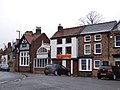
 The Angel and White Horse. Bridge Street, Tadcaster (geograph 5729862).jpg 1,024 × 768; 141 KB
-
 The Ark, Kirkgate, Tadcaster (geograph 5729946).jpg 1,024 × 768; 151 KB
-
 The Cavern Wall of Fame (geograph 5730332).jpg 4,032 × 3,024; 3.29 MB
-
 The Coach and Horses,Commercial Street, Tadcaster (geograph 5729822).jpg 1,024 × 768; 103 KB
-
 The former Britannia Inn, Tadcaster (geograph 5729828).jpg 1,024 × 768; 162 KB
-
 The Old Brewery, Tadcaster (geograph 5729906).jpg 1,024 × 768; 130 KB
-
 The Old Post Office, Station Road, Tadcaster (geograph 5729965).jpg 1,024 × 768; 138 KB
-
 The Old Sunday Sshool, Westgate, Tadcaster (geograph 5729954).jpg 1,024 × 768; 102 KB
-
 The Old Sunday Sshool, Westgate, Tadcaster - detail (geograph 5729955).jpg 1,024 × 768; 143 KB
-
 The Range - geograph.org.uk - 5922043.jpg 1,024 × 681; 107 KB
-
 The Range - geograph.org.uk - 5922045.jpg 1,024 × 681; 112 KB
-
 The Riley-Smith Hall, Station Road, Tadcaster (geograph 5729968).jpg 1,024 × 768; 136 KB
-
 The site of the Saxon church in Pontefract (geograph 5728131).jpg 1,024 × 768; 170 KB
-
 View from the bench (OpenBenches 5068-2).jpg 4,032 × 3,024; 2.75 MB
-
 View from the bench (OpenBenches 5069-1).jpg 4,032 × 3,024; 3.68 MB
-
 View from the bench (OpenBenches 5070-3).jpg 4,032 × 3,024; 2.42 MB
-
 View from the bench (OpenBenches 5075-2).jpg 3,840 × 2,160; 4.7 MB
-
 View from the bench (OpenBenches 5079-1).jpg 3,840 × 2,160; 2.56 MB
-
 View from the bench (OpenBenches 5081-1).jpg 3,840 × 2,160; 2.52 MB
-
 View from the bench (OpenBenches 5117-2).jpg 4,032 × 3,024; 4.31 MB
-
 View from the bench (OpenBenches 5143-2).jpg 4,032 × 3,024; 2.08 MB
-
 View from the bench (OpenBenches 5144-2).jpg 4,032 × 3,024; 2.95 MB
-
 View from the bench (OpenBenches 5145-2).jpg 4,032 × 3,024; 4.32 MB
-
 War memorial, Westgate, Tadcaster (geograph 5729960).jpg 768 × 1,024; 145 KB
-
 Westbury - fGWR 43186 and 43023.JPG 1,366 × 820; 374 KB
-
 Westbury - GWR 166210 ecs for Frome service.JPG 1,366 × 910; 464 KB
-
 Wharfe Bridge in Tadcaster, repaired (geograph 5729839).jpg 1,024 × 768; 134 KB
_East_Beach,_Cromer.jpg)


.JPG)


.jpg)
.jpg)

.jpg)
.jpg)
.jpg)
.jpg)
.jpg)
.jpg)
.jpg)
.jpg)
.jpg)
.jpg)
.jpg)
.jpg)
.jpg)
.jpg)
.jpg)
.jpg)
.jpg)
.jpg)
.jpg)
.jpg)
.jpg)
.jpg)
.jpg)
.jpg)
.jpg)
.jpg)
.jpg)
.jpg)
.jpg)

.jpg)
.jpg)


.jpg)
.jpg)

_up_train.JPG)


.jpg)


.jpg)
.jpg)
.jpg)
.jpg)

.jpg)
.jpg)
.jpg)
.jpg)
.jpg)
.jpg)
.jpg)
.jpg)
.jpg)
.jpg)
.jpg)

.jpg)
.jpg)

.jpg)

.jpg)

.JPG)
.JPG)


.jpg)

.jpg)
.jpg)
.jpg)

_Salisbury_train.JPG)
_Poole_train.JPG)


.jpg)
.jpg)
.jpg)
.jpg)
.jpg)
.jpg)
.jpg)
.jpg)
.jpg)
.jpg)
.jpg)
.jpg)
.jpg)
.jpg)
.jpg)
.jpg)
.jpg)
.jpg)
.jpg)


.jpg)
.jpg)
.jpg)
.jpg)
.jpg)
.jpg)
.jpg)
.jpg)
.jpg)
.jpg)
.jpg)
.jpg)
.jpg)


.jpg)