Category:United Kingdom photographs taken on 2020-04-13
Jump to navigation
Jump to search
| ← | Monday 13 April 2020 | → | ||
| ← | April 2020 | → | ||

United Kingdom photographs taken on 13 April 2020.
Image files should be categorized here automatically using {{taken on}} template. Direct categorisation is also possible, if automatic is impossible.
Media in category "United Kingdom photographs taken on 2020-04-13"
The following 67 files are in this category, out of 67 total.
-
 63 - 65, Mount Ephraim - geograph.org.uk - 6513197.jpg 1,024 × 685; 138 KB
-
 Abandoned public footpath, Styal Road, Moss Nook, Manchester.jpg 3,120 × 4,160; 6.09 MB
-
 Acer negundo 62069114.jpg 1,024 × 683; 180 KB
-
 Beware of Frogs^ Bishop's Down Park Rd - geograph.org.uk - 6513133.jpg 1,024 × 684; 278 KB
-
 Bishop's Down Park Rd - geograph.org.uk - 6513156.jpg 1,024 × 685; 240 KB
-
 Bishop's Down Park Rd - geograph.org.uk - 6513159.jpg 1,024 × 684; 297 KB
-
 Bishop's Down Park Rd - geograph.org.uk - 6513160.jpg 1,024 × 684; 305 KB
-
 Bishop's Down Park Rd - geograph.org.uk - 6513161.jpg 1,024 × 684; 296 KB
-
 Bricked in cave, Tunbridge Wells Common - geograph.org.uk - 6513192.jpg 1,024 × 684; 310 KB
-
 Brown Horse, Coley.jpg 3,290 × 4,606; 11.72 MB
-
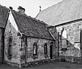
 Burnbank Parish Church front.jpg 2,784 × 4,703; 3.19 MB
-
 Burnbank Parish Church side.jpg 4,377 × 3,670; 4.58 MB
-
 Cannon Hoare Memorial - geograph.org.uk - 6513206.jpg 1,024 × 684; 182 KB
-
 Cherry Blossom, Styal Road, Moss Nook, Manchester.jpg 3,120 × 4,160; 5.05 MB
-
 Church of St John - geograph.org.uk - 6513209.jpg 685 × 1,024; 154 KB
-
 Church of St Paul - geograph.org.uk - 6513179.jpg 1,024 × 684; 296 KB
-
 Craigtoun Hospital.jpg 640 × 480; 197 KB
-
 Culverden Down - geograph.org.uk - 6513117.jpg 1,024 × 685; 220 KB
-
 Culverden Down - geograph.org.uk - 6513131.jpg 1,024 × 684; 234 KB
-
 Culverden Down becomes Molyneux Park - geograph.org.uk - 6513132.jpg 1,024 × 684; 205 KB
-
 Culverden Down, Culverden Park junction - geograph.org.uk - 6513105.jpg 1,024 × 684; 214 KB
-
 Culverden Stadium Entrance - geograph.org.uk - 6513104.jpg 1,024 × 675; 234 KB
-
 Dicranum scoparium 66834080.jpg 2,048 × 1,536; 2.32 MB
-
 Duke of York.jpg 3,648 × 2,432; 5.62 MB
-
 Elephant Rock, Toad Rocks - geograph.org.uk - 6513177.jpg 1,024 × 684; 314 KB
-
 End of the road, Bishop's Down Park Rd - geograph.org.uk - 6513157.jpg 1,024 × 684; 256 KB
-
 Entrance to Nevill Park - geograph.org.uk - 6513180.jpg 1,024 × 684; 288 KB
-
 Exidia glandulosa 66922323.jpg 2,048 × 1,536; 1.49 MB
-
 Exidia glandulosa 66922335.jpg 2,048 × 1,536; 1.53 MB
-
 Footbridge over the A555, Manchester..jpg 4,160 × 3,120; 3.24 MB
-
 Footpath, Still Green - geograph.org.uk - 6513167.jpg 1,024 × 684; 316 KB
-

-
 Gate Posts, Culverden Down - geograph.org.uk - 6513108.jpg 1,024 × 684; 253 KB
-
 Gate, Bishop's Down Park Rd - geograph.org.uk - 6513163.jpg 1,024 × 684; 246 KB
-
 Gates to Bennet Memorial School - geograph.org.uk - 6513109.jpg 1,024 × 684; 221 KB
-
 Harmony St - geograph.org.uk - 6513170.jpg 978 × 1,024; 279 KB
-
 Hungershall Park - geograph.org.uk - 6513184.jpg 1,024 × 684; 195 KB
-
 Huntleys Park - geograph.org.uk - 6513113.jpg 1,024 × 684; 147 KB
-
 Konak (Closed) - geograph.org.uk - 6513200.jpg 1,024 × 684; 159 KB
-
 Lecidella elaeochroma 66914624.jpg 2,048 × 1,365; 1.07 MB
-
 Lecidella elaeochroma 66914645.jpg 1,365 × 2,048; 1.02 MB
-
 Leeds Bradford Airport April 2020.jpg 1,948 × 1,096; 283 KB
-
 Nevill Park - geograph.org.uk - 6513183.jpg 1,024 × 684; 258 KB
-
 Nevill Park - geograph.org.uk - 6513185.jpg 1,024 × 684; 258 KB
-
 North Lodge, Nevill Park - geograph.org.uk - 6513181.jpg 1,024 × 685; 173 KB
-
 Old footbridge crossing the Styal railway line. Moss Nook, Manchester..jpg 3,120 × 4,160; 5.67 MB
-
 Old White Beare, Norwood Green.jpg 2,685 × 2,685; 4.94 MB
-
 Outwood Farm, Heald Green.jpg 4,160 × 3,120; 3.94 MB
-
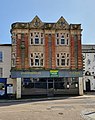 Penzance - 27B Market Place.jpg 2,390 × 3,028; 1.72 MB
-
 Placards opposite the entrance to Pinderfields Hospital (geograph 6442255).jpg 1,820 × 1,366; 610 KB
-
 Pumping Station, Denny Bottom - geograph.org.uk - 6513166.jpg 1,024 × 684; 318 KB
-
 Reynolds Lane - geograph.org.uk - 6513100.jpg 1,024 × 685; 183 KB
-
 Rusthall Common - geograph.org.uk - 6513178.jpg 1,024 × 684; 246 KB
-
 South Lodge, Nevill Park - geograph.org.uk - 6513186.jpg 1,024 × 684; 241 KB
-
 Stereum hirsutum 66907241.jpg 2,048 × 1,365; 630 KB
-
 The Old Racecourse, Tunbridge Wells Common - geograph.org.uk - 6513188.jpg 1,024 × 684; 244 KB
-
 The Skinners' School - geograph.org.uk - 6513099.jpg 1,024 × 685; 149 KB
-
 The Trading Post - geograph.org.uk - 6513101.jpg 1,024 × 848; 168 KB
-
 Toad Rock - geograph.org.uk - 6513174.jpg 1,024 × 684; 257 KB
-
 Toad Rock Retreat - geograph.org.uk - 6513171.jpg 1,024 × 684; 200 KB
-
 Toad Rocks - geograph.org.uk - 6513176.jpg 1,024 × 684; 271 KB
-
 Wellington Rocks - geograph.org.uk - 6513194.jpg 1,024 × 684; 247 KB
-
 White Horse, Lightcliffe.jpg 2,516 × 2,516; 4.45 MB
-
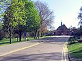 Whitgift School; view from main entrance April 2020.jpg 2,554 × 1,913; 1.63 MB
-
 William St - geograph.org.uk - 6513102.jpg 1,024 × 668; 131 KB
-
 Woodside Rd - geograph.org.uk - 6513169.jpg 1,024 × 685; 165 KB
-
 Zygiella x-notata 66820066.jpg 2,048 × 1,365; 1.13 MB


_-_geograph.org.uk_-_6513200.jpg)


.jpg)


